Down the Cassiar, Westy troubles and Whistler Canada Cup

 
Boya Lake Provincial Park.

Boya Lake Provincial Park.

Boya Lake Provincial Park, Northern BC.

Boya Lake Provincial Park, Northern BC.

Full moon rising over the Stewart-Cassiar Highway.

Full moon rising over the Stewart-Cassiar Highway.

Aïsha keeping us entertained on long drives with her ukulele songs.

Aïsha keeping us entertained on long drives with her ukulele songs.

Leaving Burns Lake pulling our broken Westy on a U-Haul platform, still unsure where we will be able to get it fixed and even less when…

Leaving Burns Lake pulling our broken Westy on a U-Haul platform, still unsure where we will be able to get it fixed and even less when…

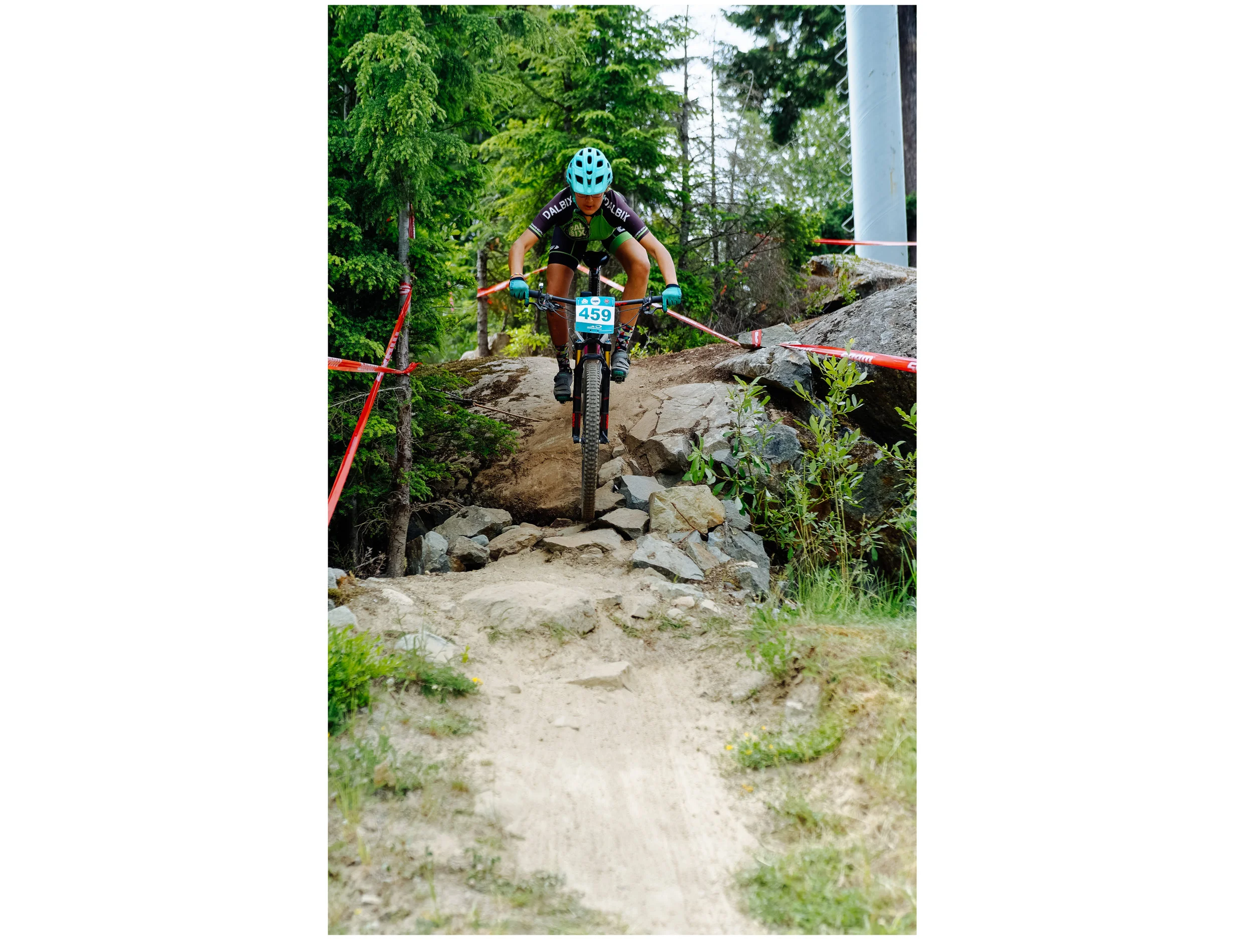
Mathilde showing great form on a steep line during the Whistler Canada Cup.

Mathilde showing great form on a steep line during the Whistler Canada Cup.

Mathilde, proud to finish that tough race!

Mathilde, proud to finish that tough race!

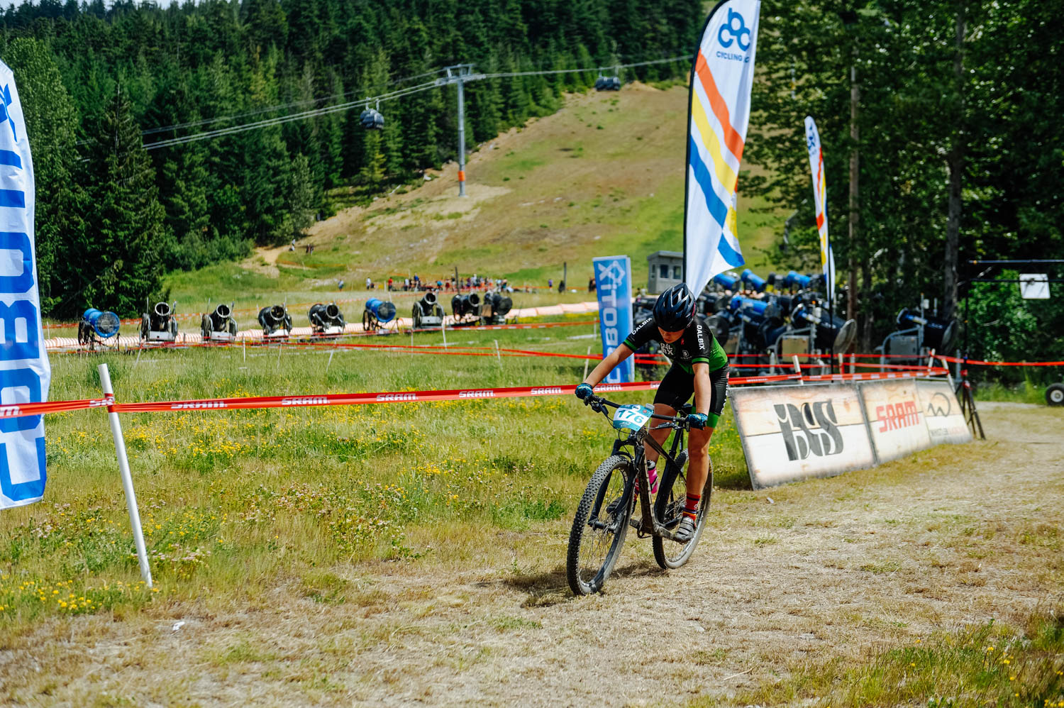
Aïsha at the beginning of the race.

Aïsha at the beginning of the race.

Mara feeling tired.

Mara feeling tired.

Mara on the left and Aïsha on the right.

Mara on the left and Aïsha on the right.

Mara

Mara

Mara dug deep to finish that race.

Mara dug deep to finish that race.

Teammate Zachary Brunelle taking one of the technical A line on the course.

Teammate Zachary Brunelle taking one of the technical A line on the course.

Mathilde in 3rd place!

Mathilde in 3rd place!

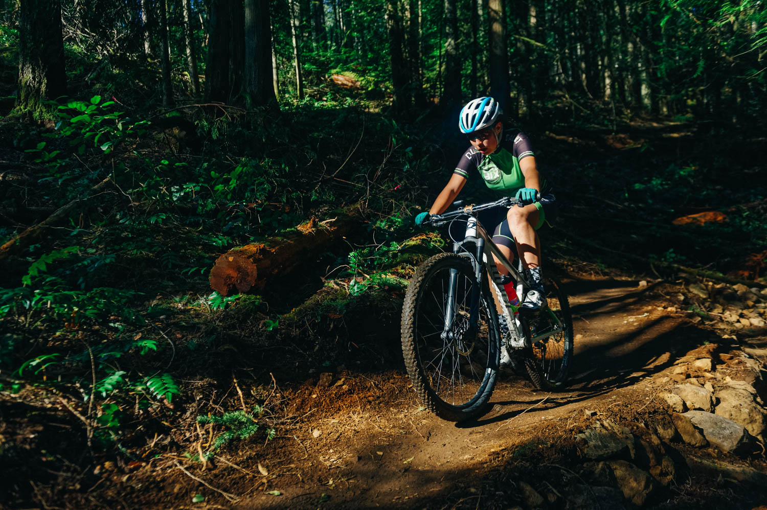
The Whistler Canada Cup course was the most technical race the girls had ever done. On top of that, there was 240 m of climbing PER lap. Some sections of the course were only a few days old and very loose. The whole course was incredibly dusty. Aïsha crashed during the preride; she was in pain during the race and had lost her confidence, so she decided to opt out after one lap to avoid another crash and save herself for next weekend Canada Cup in Canmore. Mathilde coughed all night (and kept everybody awake) and was feeling miserable on the morning of the race (we all brought back a nasty virus from Whitehorse). She freaked out a bit after the first big climb when she stopped and felt like she was choking, but thankfully, coach Dan Sams @terraridersyukon was right there and talked her through it and she kept on going. She finished her race and grabbed the 3rd place. She was super proud to have finished such a tough course in her physical condition. After a sleepless night, too much preriding the day before and still healing from her nasty crash at Baie St-Paul, Mara was able to hang on to 4th place. Quite a feat in her condition! The field of Expert Women U17 was very strong with a few BC riders who are super strong technically. It was a good experience and the girls know what they need to work on for next year!

We were super proud of the girls’ Yukon teammates from U Kon Echelon who came all the way down here to race, not expecting such a tough course, but did it nonetheless! Way to go, friends!

And the girls now have Instagram accounts: @aisha.roldan, @mara.roldan.mtb @mathilde.roldan
Go give them a follow if you want!


The Hammerfest race and a visit from Grand-Père

 
The Hammerfest race was a really fun event. The course was long for the expert, but Mara had a great race, finishing 2nd in the U19 field. Aïsha is still struggling with some back issues and a vertebrae pinched during her warm up, forcing her to sto…

The Hammerfest race was a really fun event. The course was long for the expert, but Mara had a great race, finishing 2nd in the U19 field. Aïsha is still struggling with some back issues and a vertebrae pinched during her warm up, forcing her to stop the race after one lap since she has lost sensations in both her legs.

Mathilde had a great race and placed first in her field!

Mathilde had a great race and placed first in her field!

My dad took the train across Canada and came to spend a week in Victoria.

My dad took the train across Canada and came to spend a week in Victoria.

He taught me to shuck oysters.

He taught me to shuck oysters.

My dad and I took a road trip to Port Renfrew. We stopped at French Beach Provincial Park along the way.

My dad and I took a road trip to Port Renfrew. We stopped at French Beach Provincial Park along the way.

IMG_7031.jpg

There is so much to explore on the Island and we will not see it all in the month or so we are here. I’m glad I got to see a part of it with my dad while he was here with us!


First week in Victoria, BC, and the Hartland Island Cup

 
IMG_6527.jpg
Pre-riding the Hartland Island Cup course. Quite a change from the AZ courses!

Pre-riding the Hartland Island Cup course. Quite a change from the AZ courses!

Checking out the lines.

Checking out the lines.

Practice, practice, practice!

Practice, practice, practice!

There is still snow on the ground. It’s very unusual in Victoria!

There is still snow on the ground. It’s very unusual in Victoria!

The view from our beautiful campground - Pedder Bay RV Resort and Marina.

The view from our beautiful campground - Pedder Bay RV Resort and Marina.

IMG_6583.jpg
Look at that water!

Look at that water!

The girls were pretty excited and nervous to race the first Island Cup of the season (it’s their first time here). Mara had a great start and was keeping up with the strong girls until she got a flat, Aisha’s and Mathilde’s timing chips got mixed up…

The girls were pretty excited and nervous to race the first Island Cup of the season (it’s their first time here). Mara had a great start and was keeping up with the strong girls until she got a flat, Aisha’s and Mathilde’s timing chips got mixed up, so they didn’t have their results, which wasn’t acknowledge before podiums (Aïsha was waiting for her turn on the podium and someone else got called because of the mixed results, even if she really was third…). They all acted with such maturity and positive attitudes, it was very heartwarming to see. Mathilde said she had her worst race ever (they rode a lot this week and their legs were shut), but that she had fun and was proud of herself. All in all, a success! And this community is simply amazing.


_CFO7547_DxO.jpg
_CFO7555_DxO.jpg
Mathilde and I when on a paddling date. It was so beautiful, seals were playing hide and seek around our kayak, a trumpeter swan landed beside us and a bald eagle took flight nearby. We could even see the snowy peaks of Olympic National Park in the …

Mathilde and I when on a paddling date. It was so beautiful, seals were playing hide and seek around our kayak, a trumpeter swan landed beside us and a bald eagle took flight nearby. We could even see the snowy peaks of Olympic National Park in the US in front of us.

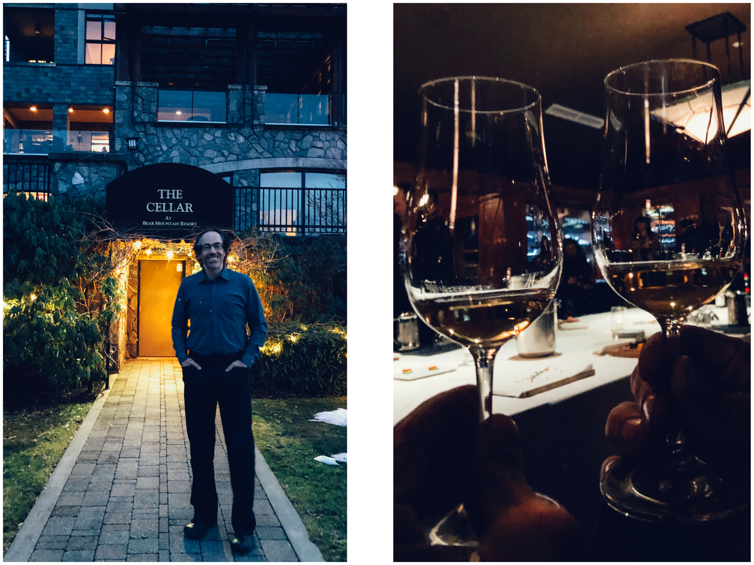
JF and are celebrating our 20th anniversary (well, as you know, we’re not married, but that’s 20 years from our official dating date) and it is my birthday in a few weeks as well, so he treated us to a guided tasting flight in the cellar of Bear Mou…

JF and are celebrating our 20th anniversary (well, as you know, we’re not married, but that’s 20 years from our official dating date) and it is my birthday in a few weeks as well, so he treated us to a guided tasting flight in the cellar of Bear Mountain Resort. Every Friday, there is a different theme and this week was Italy. How perfect! The sommelier led our group down to this incredible room with a huge table covered with canapés prepared with local cheeses and charcuteries, and guided us through a tasting of 8 different wines. When they brought out the lobster cakes, I looked at JF with big round eyes and asked: How much was this thing? He said: well it said from 40$ per person… So we laughed imagining cameras looking down on us to see how much food we ate from the decadent spread and charging accordingly! It turned out to be just a little over that and I kept bugging him that it was because he went for the prosciutto 3 times!
It was so fun to be with him in such a different setting. It really felt like we had traded life with another couple for an evening, in a weird but cool way.


Romping around the Bay Area without breaking the bank

Carmel-by-the-sea

Carmel-by-the-sea

Riding in Fort Ord.

Riding in Fort Ord.

 
D1529D3C-5AC0-4633-BD86-1AF51B0A69F4.jpeg
Delicious Humphry Slocombe ice cream in Oakland.

Delicious Humphry Slocombe ice cream in Oakland.

Tartine Bakery

Tartine Bakery

Beautiful San Francisco houses on Valencia Ave in the Mission District.

Beautiful San Francisco houses on Valencia Ave in the Mission District.

IMG_6082.jpg

Our first year on the road, 6 years ago, we did cities, museums, paying activities and organized campgrounds most of the time. We quickly realized that it wasn’t sustainable for our limited budget… Fast forward to now, we very rarely pay for campgrounds, only do free activities and go to the restaurant once every two months. However, we couldn’t pass on San Francisco. We had spent 10 days here in 2015 and our dear friends who had been living in the Mission District for decades showed us around to many cool spots. I reached out to Liza for her suggestions for ways to explore SF, Berkeley and Oakland on the cheap.

 
valencia.jpg
 

There are good spots to spend the night for free on iOverlander around Berkeley, but with all the bikes we have on the Westy, we decided to go for a campground this time (Anthony Chabot Regional Park). That is one of the downside of our current set-up… So with that expanse, we knew we had to be even more thrifty.

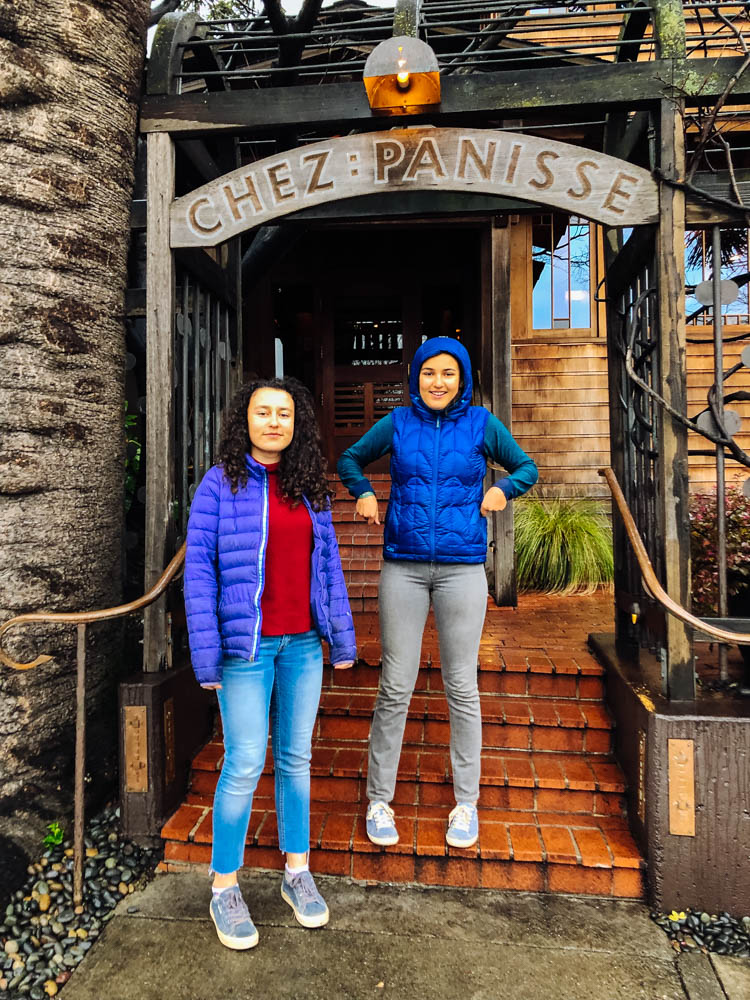
In Berkeley, we went to check out the amazing grocery Berkeley Bowl and had fun looking at all the cool produce, we checked out a few bookstores (Pegasus was great) and thrift shops on Telegraph Ave, and drooled over the menu of Chez Panisse and the Cheeseboard. If you want a quick meal on a budget, check out the food court right by the Imperial Tea Room, they have amazing sushis to go.

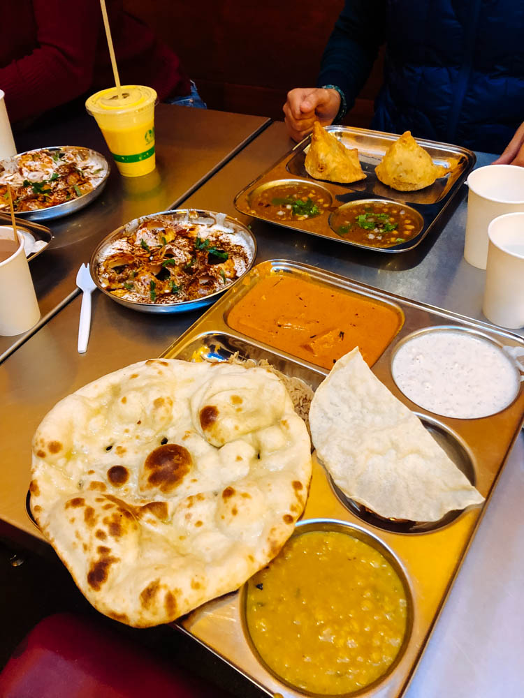
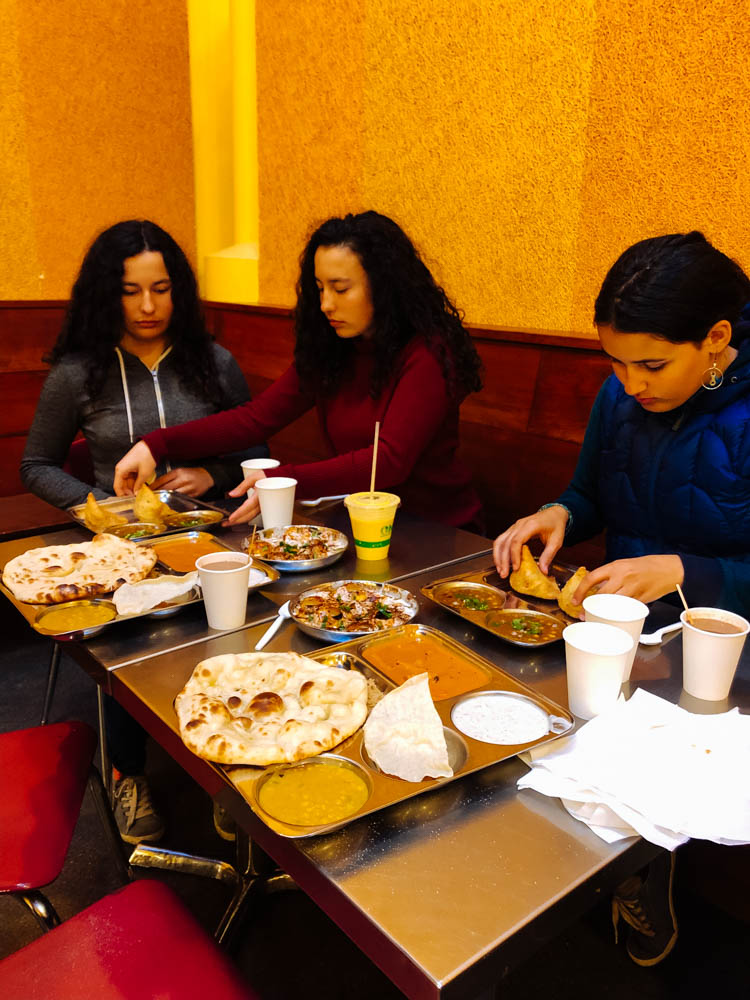
We went to have an early dinner at Vik’s chaat to beat the crowds. Chaat is Indian street food (and it doesn’t mean you eat it in the street here… it’s a big open area behind an indian grocery store). It’s very decently priced (not cheap, nothing is cheap here, but their weekday specials are the best deals, we got 2 of those to share and a few sides) and we discovered new-to-us food (do not skip the cholle bhature if you go!). We then bought what we needed at the store to make a delicious saag paneer at home the next day (for a little over 20$) and some more Indian fare.

We ended the night walking the streets of Oakland and tasting the ice cream at Humpry Slocombe (get their Blue Bottle vietnamese coffee flavor).

Another fun outing would have been to go to Ranch 99 in Richmond (about 20 minutes North of Berkeley, depending on trafic). It’s an asian mall with lots of cool things to see and eat - I hear the dim sums are great. I also really wanted to tour the St. George Spirits distillery in Alameda, but the tours were only on the weekends and children under 21 are not allowed on the premises. There is also Faction Brewing that sounds like a great place to enjoy a beer on an open deck (dogs and children allowed) and watch the city from across the water.


In San Francisco, we went straight to the Mission District to find a spot to park since it was Thursday and we walked around on Guerrero. The Mission was once a multicultural neighborhood of artists and intellectuals and is now an enclave for the privileged… It is still a beautiful place to visit, but it is also a pretty sad reality. Only white college-educated professionals with double income can *maybe* afford it… There are tent and tarp cities on many street corners (and even more in Berkeley and Oakland)...

We went into chez Panisse (one of the best bakeries) and quickly got out when we saw the prices (as tempting as their offers were, we cannot fork out 5,50 US$ for a pain au chocolat - that’s almost 8$ CAN - or 6$ for a *short* baguette!). We checked out Bi-Rite Market around the corner, but the prices were also too high for our budget (they sold the Chez Panisse Country loaf for 11$...) and went to their Creamery across the street instead where we shared a large size bowl (4 flavors) for 7,50$ (always share! That’s the best way to sample the good food on a budget).

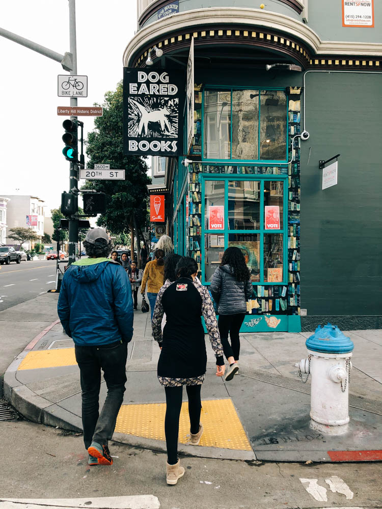
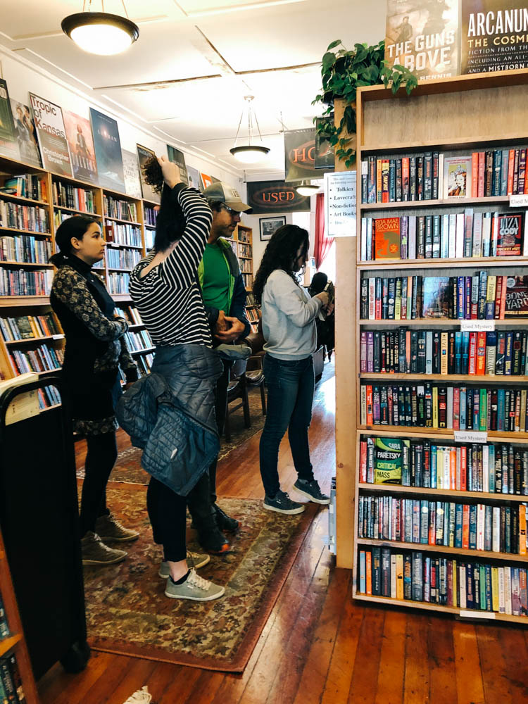
We checked out some cool stores on Valencia, a used and new Scifi and mystery bookstore (Bordelands book), a really beautiful store selling *nomad tools* (mostly amazing journals, charging stations and cute slippers...), JF and I had a coffee at Rituals (the beans a very pricey, so we didn’t buy any…), I went to drool over all the Italian goodies (and Amari!!) at Lucca Ravioli Company (and only left with a jar of passata, I’m such a good girl). We then went to Buffalo exchange - a thrift store - where we found amazing deals. The girls really needed puffy coats and wind breakers and we left with a brand new looking REI insulated vest (19$), a Montbell 800 coat (22$) and a Nike windbreaker (12$).

We thrift about  85 % of our clothes (the 15$ is mostly bike shorts, sneakers and bike shoes). We are by no mean an example of anything… Heck, we still forget our cloth grocery bags way too often. When we lived in the farm, we were much greener in many ways, but I'm pretty sure our ecological footprint was still bigger there than on the road… Anyways, I’m very aware that the #vanlife is simply a new iteration of privilege, so I’m not gonna play holier than thou. We just thrift a lot, it’s good for the planet and good for the budget.

We had an early dinner of burmese food that was delicious. Again, we shared 5 dishes (2 were appetizers) that were simply amazing. If you go to Burma Love, do not miss their Platha & Dip, Nan Pia Dok and Rainbow salad (people rave about their tea leaf salad, but we were not crazy about it). The calamari melt was amazing but too greasy for my taste (my family loved it!).

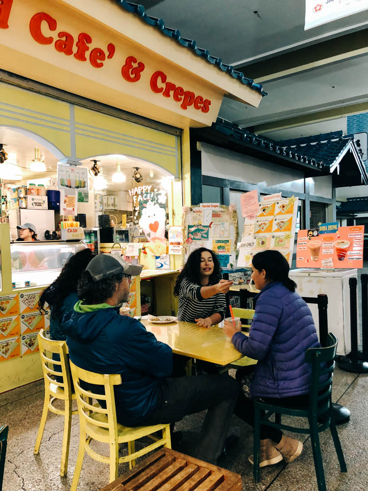
We then headed to Japantown for desert! Japantown is a cool indoor mall (sprawling on both sides of Webster street over 6 blocks - we parked at the Safeway for free parking and got a few things from there). We had read about an ice cream and crepe shop (Belly Good café and crêpe) that made cute little animal face deserts and Mara really wanted one, so she did and we shared a few taro bubble teas (super reasonable prices). We had planned to sample the ramen at Marafuku, but we were not hungry anymore and everything was closing down.

Walking around, we could witness the Japanese "kawaii" phenomenon. Kawaii in Japanese translates roughly as "cuteness", and is a big part of the Japanese popular culture. Kawaii encompasses all the ultra "cute" creatures of Hello Kitty, Pikachu and the numberless anime characters, not to mention all the accessories with big-eyed, baby animals, pink hearts… So if you know Mara, you know she was all over that

One of the coolest spots in SF to see or photograph the Golden Gate Bridge is Crissy Field that you get to by driving through the Presidio (which also has some museums). Crissy Field is on the water and there is a narrow beach right there where you are so close to best close up view of the bridge. There is free parking and the beach is off leash dog friendly- it is just gorgeous. Also if you like fresh clams and oysters, the best place is Swan Oyster Depot- tiny place south one long counter and there is a line down the street to get a seat at the counter- usually an hour wait, but so worth it. Just fresh shucked clams and oysters, clam chowder, big hunks of sourdough bread and cold beer and wine! Also go for a stroll in the Golden Gate Park and drive by the Conservatory of flowers, one of the most beautiful building in SF, and head to the Huntington Falls and Stow Lake and ride the Carousel and visit the Arts Studio, where you can see stained glass artists and jewelers at work. There is a great used book library not too far on Clements called the Green apple books. Go see the Diego Riviera mural at the SF Art institute. You can roam the halls and look at studios. Don’t miss Burma superstar (lots of vegan and vegetarian option, the Rainbow salad was AMAZING). Check out Mission Dolores, it is the first Spanish Mission was created in 1791. It is San Francisco's oldest standing building. There are lots of amazing murals initiated by the Chicano Art Mural Movement of the 1970s and inspired by the traditional Mexican paintings made famous by Diego Riviera. Some of the more significant mural installations are located on Balmy Alley and Clarion Alley. In North Beach district, you can go to Lombard street (the world’s steepest and more crooked street in the world) and check out City Light Bookstore where Jack Kerouac and his friends used to meet for literature and poetry readings. Go to Caffe Trieste, known as the beatnik hangout of the '50s. Their home-roasted coffee is impeccable.

So that is to say: cities are never cheap, but there are ways to make then budget-friendly. Ask the locals you know (in person or online), focus on ethnic food (forget the pretty restaurants, go for the hole-in-the-wall places full of locals, Yelp is your friend). Spend time walking the isles of international markets and buy stuff to cook at home (or in your bus). Share to taste a little of everything.

Also note that our girls often offer to pay if they want something special. We don’t do allowances, but our girls have money from gifts and work they did. They are very reasonable (it’s not always been that way for all 3). They know that our lifestyle doesn’t allow us to splurge (and are very aware of our budget situation since Stout got sick), they also have a clear sense of what they need vs. want (and very little space to put it, be it clothes or books or else), so they choose wisely. And that helps.

Faria Beach, Solvang and the Firestone Walker Brewery

 
_CFO7347_DxO.jpg
The view from beautiful site 7 at Faria Beach County Park.

The view from beautiful site 7 at Faria Beach County Park.

The moon is setting as the sun is rising. A truly magical moment to wake up to (seen from bed and photo taken without even exiting the bus).

The moon is setting as the sun is rising. A truly magical moment to wake up to (seen from bed and photo taken without even exiting the bus).

_CFO7390_DxO.jpg
Faria Beach

Faria Beach

When the locals walk the beach in their puffy coats and surf in their 6 mm wetsuit, Yukon kids be like:

When the locals walk the beach in their puffy coats and surf in their 6 mm wetsuit, Yukon kids be like:

This big guy made it to the beach! What no celebratory burger for me?

This big guy made it to the beach! What no celebratory burger for me?

Cheers!

Cheers!

_CFO7307_DxO.jpg
_CFO7331_DxO.jpg
Watching the sun set over the ocean from home.

Watching the sun set over the ocean from home.

There are many places to camp along the Pacific Coast Highway. Most are overpriced, crowded and noisy. This one is no exception, but if you are lucky enough to reserve site 7, you have a little slice of paradise to yourself (for $36, no services). Be advised that it requires some maneuvering to back into the site (to have your door facing the ocean), especially if the nearby sites are occupied, but it is well worth it. Dogs are allowed to be off leash on the beach.

 
I expected Solvang, the self-proclaimed Danish capital of the USA, to be pretty kitsch, but honestly, old-world Danish architecture and Danish pastries (try the folded crêpe at Mortensen’s) make up for the cheap looking souvenir boutiques and 3 (yes…

I expected Solvang, the self-proclaimed Danish capital of the USA, to be pretty kitsch, but honestly, old-world Danish architecture and Danish pastries (try the folded crêpe at Mortensen’s) make up for the cheap looking souvenir boutiques and 3 (yes, 3!) windmills.

 
We were there on a Tuesday and were impressed by their small but good and affordable Farmer's market. It made this cute little town even more likeable. Our favorite store was the old bookshop where they have the Hans Christian Anderson Museum.

We were there on a Tuesday and were impressed by their small but good and affordable Farmer's market. It made this cute little town even more likeable. Our favorite store was the old bookshop where they have the Hans Christian Anderson Museum.

B4ACE967-F02C-4B02-849A-F5E853565D63.jpeg
 
 
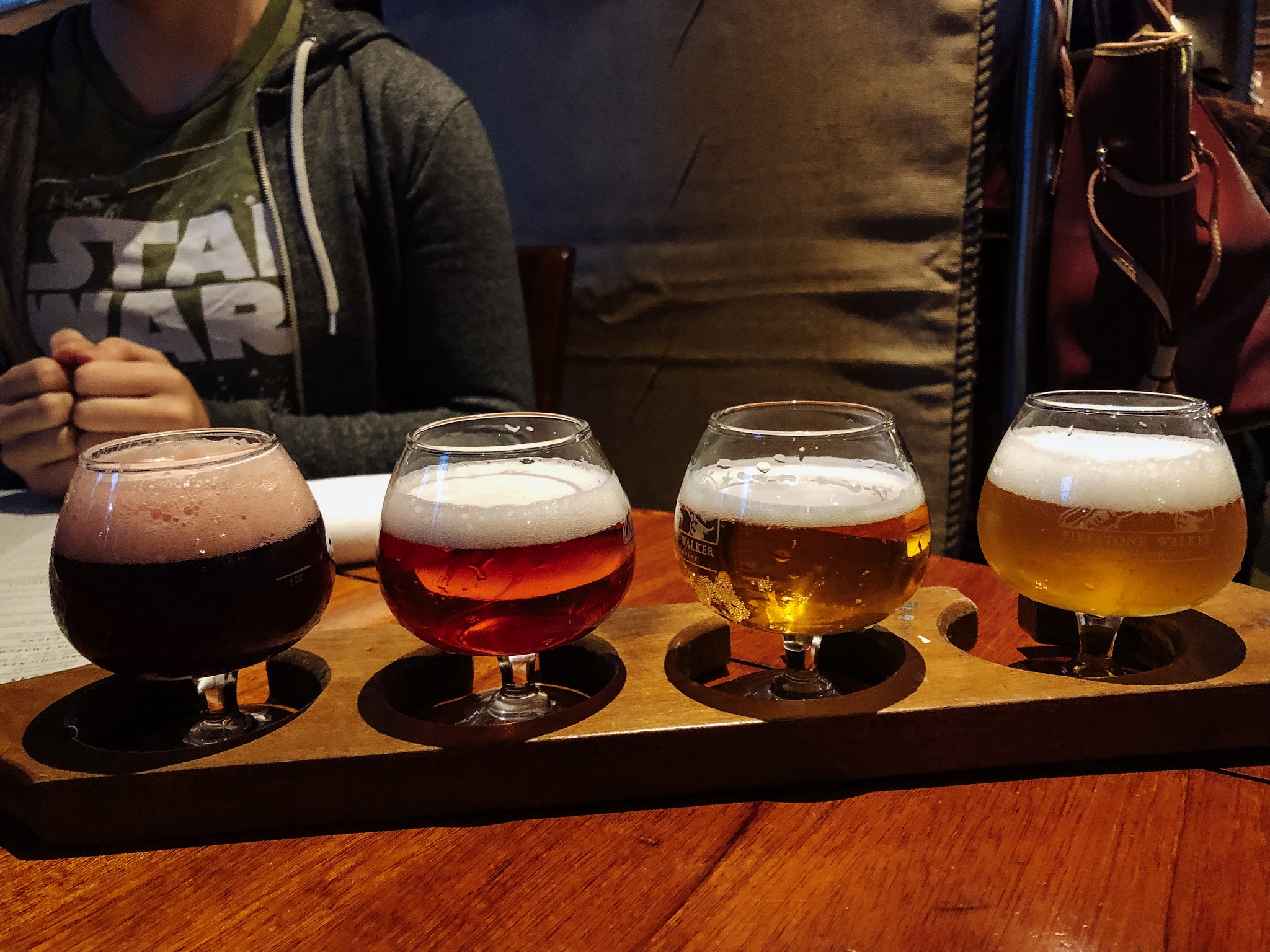
After an afternoon touring Solvang, go have dinner and beer in the next town over, Buellton, home to the famous Firestone Walker Brewery. They specialize in sour beers and have delicious food on offer (the fig and pig pizza with an arugula extra, an…

After an afternoon touring Solvang, go have dinner and beer in the next town over, Buellton, home to the famous Firestone Walker Brewery. They specialize in sour beers and have delicious food on offer (the fig and pig pizza with an arugula extra, and their fried chicken sandwich with sriracha aioli and jalapeno slaw + homemade fries were truly amazing).


As for beer, I really loved their Capt Franc, a beer-wine hybrid at 9.8% produced with Cabernet Franc grapes from the area and aged for 12 months in French Oak with 12 different atypical yeasts. Plenty of barnyard funk with a gueze-like quality. I a…

As for beer, I really loved their Capt Franc, a beer-wine hybrid at 9.8% produced with Cabernet Franc grapes from the area and aged for 12 months in French Oak with 12 different atypical yeasts. Plenty of barnyard funk with a gueze-like quality. I also really wanted to try their Krieky Bones, but they were out.

Death Valley National Park

Zabriskie Point is the Delicate Arch of Death Valley National Park and people gather there at sunset. Being only 15 minutes away from the main Furnace Creek area by car, it is undeniably one of the most popular spots. It is only a 0,1 mile hike up a…

Zabriskie Point is the Delicate Arch of Death Valley National Park and people gather there at sunset. Being only 15 minutes away from the main Furnace Creek area by car, it is undeniably one of the most popular spots. It is only a 0,1 mile hike up a steep paved path to the viewpoint. Bring warm clothes if it is cold, it can get crazy windy there.

Zabriskie Point was named after Christian Zabriskie who was the general manager of the Pacific Coast Borax Company, which was huge in Death Valley during the borax mining days. The view has been featured in many pop culture references as well, with …

Zabriskie Point was named after Christian Zabriskie who was the general manager of the Pacific Coast Borax Company, which was huge in Death Valley during the borax mining days. The view has been featured in many pop culture references as well, with the most notable being the Joshua Tree album cover for the band U2.

Most people know that Badwater Basin in Death Valley National Park is the lowest point in North America (282 ft below sea level), but there's something even more fascinating about that place. When rainstorms flood the valley bottom like it did in th…

Most people know that Badwater Basin in Death Valley National Park is the lowest point in North America (282 ft below sea level), but there's something even more fascinating about that place. When rainstorms flood the valley bottom like it did in the last few weeks, the salt expanse is covered with a thin sheet of standing water. Each newly-formed lake does not last long, because the 1.9 inches of average rainfall is overwhelmed by a 150-inch annual evaporation rate. This means that even a 12-foot-deep, 30-mile-long lake would dry up in a single year!!! How crazy is that?

From the parking lot, you can see the sea level sign that is located 280 feet above you on the adjacent mountain. It really puts in perspective how low you are when you see it compared to the mountain.

From the parking lot, you can see the sea level sign that is located 280 feet above you on the adjacent mountain. It really puts in perspective how low you are when you see it compared to the mountain.

Look at those cool salt crystals! You can even taste them!

Look at those cool salt crystals! You can even taste them!

As soon as you enter the walk out on the platform you are immediately greeted with a huge lake of what looks like snow. This water is so high is salt content that almost nothing can actually live there. The salt flat itself is 5 miles long. Badwater…

As soon as you enter the walk out on the platform you are immediately greeted with a huge lake of what looks like snow. This water is so high is salt content that almost nothing can actually live there. The salt flat itself is 5 miles long. Badwater Basin is a truly unique place to stop. You don’t need a lot of time here, but it is worth checking out. Also note that it is very often windy there.

Golden Canyon is one of the many sites where different parts of the original Star Wars movies were filmed. It is the most popular hike in all of Death Valley National Park and is a little over 3 miles round trip, depending on where you stop. The par…

Golden Canyon is one of the many sites where different parts of the original Star Wars movies were filmed. It is the most popular hike in all of Death Valley National Park and is a little over 3 miles round trip, depending on where you stop. The parking lot is about 10 minutes South of Furnace Creek.

It has gaping canyons, massive boulders, waves of plantless terrain and even a large red rock called the Red Cathedral at the end. You can totally picture a few stormtroopers appearing around a boulder. You can see some of the reconstructed scenes v…

It has gaping canyons, massive boulders, waves of plantless terrain and even a large red rock called the Red Cathedral at the end. You can totally picture a few stormtroopers appearing around a boulder. You can see some of the reconstructed scenes vs the original scene here.

Approaching the Red Cathedral (in the back).

Approaching the Red Cathedral (in the back).

After leaving Death Valley from the south west road, we decided to stop to visit another geologically interesting place near Searles Lakes. When you visit Trona Pinnacles, you cannot help but feel like you are on the moon or on another planet. The u…

After leaving Death Valley from the south west road, we decided to stop to visit another geologically interesting place near Searles Lakes. When you visit Trona Pinnacles, you cannot help but feel like you are on the moon or on another planet. The unusual landscape is made up of more than 500 spires, some as high as 140 feet, rising from the bed of the Searles Dry Lake basin. The pinnacles vary in size and shape from short and wide to tall and thin, and are composed primarily of calcium carbonate (tufa), like those found in Mono Lake. The pinnacles were formed underwater from 10,000 to 100,000 years ago when Searles Lake was one of a chain of interconnected Pleistocene lakes stretching from Mono Lake to Death Valley.

The Trona Pinnacles are not in Death Valley, they are truly in the middle of nowhere, about 25 minutes east of Ridgecrest, and are one of those places that have to be seen to be believed. Like the Alabama Hills, it is hard to do justice to the sheer…

The Trona Pinnacles are not in Death Valley, they are truly in the middle of nowhere, about 25 minutes east of Ridgecrest, and are one of those places that have to be seen to be believed. Like the Alabama Hills, it is hard to do justice to the sheer beauty of these massive rock structures that jot a landscape that is almost entirely barren and flat.

The Pinnacles are recognizable in more than a dozen movies. Over thirty film projects a year are shot among the tufa pinnacles, including backdrops for car commercials and sci-fi movies and television series such as Battlestar Galactica, Star Trek V: The Final Frontier, Disney's Dinosaur, The Gate II, Lost in Space, Planet of the Apes, and more recently the movie Holes.

There is a short half mile hiking trail, but you can drive around easily in a 4 x 4 vehicle to see the formations. They were more impressive from afar in my opinion. There are designated camping spots and the area is very well defined with rocks to …

There is a short half mile hiking trail, but you can drive around easily in a 4 x 4 vehicle to see the formations. They were more impressive from afar in my opinion. There are designated camping spots and the area is very well defined with rocks to prevent driving over the fragile areas. Please set up camp only where there is already a fire ring outside of the rock-fenced areas. There was no usable cell signal there.

We have decided to camp at Texas Spring Campground, since it is the cheapest and the more beautiful. There are no services and a no generator rule. There is a dump, water and toilet on site. Note that for 5$ per person (during the week, $10 on weekends), you can access the hotel warm fed spring pool and showers. The pool was just too cold - 85 F - to be comfortable when we were there (it was cold and windy that night). Note that you only need one card ($5) to enter the pool and shower area and that there is no lifeguard or staff on duty there, so decide accordingly ;)

There are more hikes and sights to see in Death Valley, but some were closed when we were there since the recent rains had washed out the roads or there were closures due to construction. We wanted to hike Mosaic Canyon, check out Scotty’s Castle and bike Titus Canyon, but couldn’t.

We passed on the Mesquite sand dunes since we had just been at the Kelso dunes in the Mojave desert (that are bigger and more impressive) and the Racetrack (those moving rocks that have left tracks behind them) since it is located at the end of rough dirt road and is an adventure in itself.

*Be advised that exiting Death Valley through the west (road from Stovepipe Wells to Panamint Springs) requires driving a very long twisty downhill section that could be hard on your brakes if you tow a trailer or drive a motorhome. We separated the Westy from the bus for the long climb and descent and it still was a bit nerve-wracking, glad we have a brake retarder on the bus. A friends’ brakes caught on fire there. Be warned and drive slow.

Interesting facts about Death Valley:

Death Valley National Park is the largest national park in the Lower 48 at a whopping more than 3.4 million acres.

The highest recorded temperature in the world was recorded in Death Valley’s Furnace Creek at 134 Fahrenheit in July, 1913. For almost one hundred years, a false recording made in Libya overshadowed Furnace Creek’s claim to fame. In 2012, however, the record went back to Death Valley after it was concluded that the Libyan recording was made in error.

Death Valley is only 76 miles from the highest point in the country, Mt. Whitney, which tops out at an elevation of 14,505 feet. In other words, the lowest and highest points in the contiguous U.S. are less than 100 miles apart!

There is every year an ultramarathon in Death Valley called the Badwater 135, which links these two points! The race organizers description goes like this : Covering 135 miles (217 km) non-stop from Death Valley to Mt. Whitney, CA, the Badwater 135 is the most demanding and extreme running race offered anywhere on the planet. The start line is at Badwater Basin, Death Valley, which marks the lowest elevation in North America at 280’ (85m) below sea level. The race finishes at Whitney Portal at 8,300’ (2530m), which is the trailhead to the Mt. Whitney summit, the highest point in the contiguous United States. The Badwater 135 course covers three mountain ranges for a total of 14,600’ (4450m) of cumulative vertical ascent and 6,100’ (1859 m) of cumulative descent.

From this blog.


The Mojave National Preserve

_CFO7010_DxO.jpg
_CFO7013_DxO.jpg
Pencil cholla in front of a big Joshua Tree.

Pencil cholla in front of a big Joshua Tree.

_CFO6985_DxO.jpg
Great campspot among the Joshua Trees.

Great campspot among the Joshua Trees.

_CFO7044_DxO-2.jpg
The Mojave desert is the driest desert in North America, receiving less than 2 inches of rain a year. One of the most significant dunes in North America, the Kelso Dunes stick out like a sore thumb in the landscape of the Mojave.

The Mojave desert is the driest desert in North America, receiving less than 2 inches of rain a year. One of the most significant dunes in North America, the Kelso Dunes stick out like a sore thumb in the landscape of the Mojave.

_CFO7057_DxO.jpg
It is a pretty challenging hike in the sand, but they are known as the singing dunes, a phenomenon you can experience if you slide down slowly, generating a low-frequency rumble that can be both felt and heard. Watch this YouTube video if like me, y…

It is a pretty challenging hike in the sand, but they are known as the singing dunes, a phenomenon you can experience if you slide down slowly, generating a low-frequency rumble that can be both felt and heard. Watch this YouTube video if like me, you have a hard time picturing what it can sounds like. We went to explore them, but didn’t have the courage (or the time) to climb all the way up.

F8B664CB-F722-4A51-8081-2F2F679C7C77.jpeg
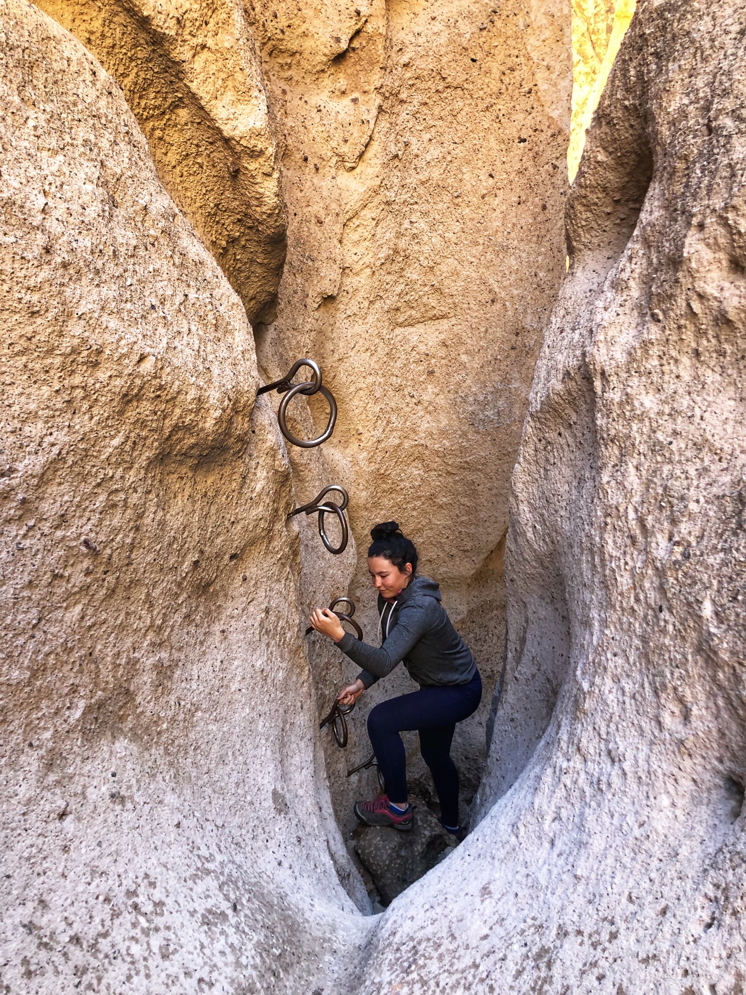
Our favorite place was the Rings Trail; it’s one of the best 2 miles hikes you can do. We decided to go down the rings and back up at the end of Banshee canyon to experience the rings again, since the rest of the trail is more traditional hiking thr…

Our favorite place was the Rings Trail; it’s one of the best 2 miles hikes you can do. We decided to go down the rings and back up at the end of Banshee canyon to experience the rings again, since the rest of the trail is more traditional hiking through the desert.

Banshee Canyon

Banshee Canyon

826D5AB1-6FFC-4434-8857-98C43391DE93.jpeg
The Kelso Depot is quite the unusual Visitor Center. I wrote its story below.

The Kelso Depot is quite the unusual Visitor Center. I wrote its story below.

The Kelso Depot’s beautiful Spanish Colonial revival style architecture.

The Kelso Depot’s beautiful Spanish Colonial revival style architecture.

If you are just driving through the Mojave desert, you might think it is a big expanse of desolate land; but once you take some time to explore its remote corners, you realize it’s a pretty special place with singing sand dunes, lava tubes, cinder cones, abandoned mines and the highest concentration of Joshua Trees in the world. (Near the cross on the Teutonia peak trail, you will find the largest Joshua Tree forest in the world. Most people assume it is in Joshua Tree National Park, but it is actually here in Mojave National Preserve.)

While you are there, take a look at the Cima Dome. Most people would probably go past it if they didn’t know it was special but once you notice it, it is pretty crazy. It looks like the land is being viewed through a fisheye lens (from this site, lots of great info on the area).

We decided to stay at the Hole in the Wall campground since it is located right next to the Rings Trail and since it is one of the only places in the park where we knew we would have decent connexion for work. This campground is 12 bucks a night, first come first served and has water. It is a great spot to stay at and has amazing surrounding mountains and views.

You can camp at most spots in Mojave National Preserve as long as they have fire pits set up. This allows you to be able to camp in some amazing places. Just be sure to respect the environment if you chose a spot like this. Know that the connexion is very spotty in the Preserve and that most place won’t have signal strong enough to allow you to work.

There is no gas and no food in the park, and many of the backroads are washboards and only accessible by 4 x 4.

The story of the Kelso Depot

The first depot was built in 1905, when the Union Pacific wanted a foothold on the West Coast, but the actual building was built in 1924 and included a conductor’s room, telegraph office, baggage room, dormitory rooms for staff, boarding rooms for railroad crewmen, a billiard room, library and locker room.

Originally, the restaurant and telegraph office each had three shifts, operating around the clock. This continued through the boom years of the 1940s, when Kaiser’s Vulcan mine caused Kelso’s population to grow to nearly 2,000. The closing of the mine coupled with diesel engines replacing steam resulted in the UP moving jobs and families out of Kelso. In 1985 the UP decided to close the Kelso Depot entirely.

Believing that the now empty building would become “a target for vandalism, unauthorized entrance, and a legal liability,” the UP Division Superintendent made plans to raze the building. Local residents and others across the region heard about the proposed demolition and began to publicize the building’s plight.

They organized into the Kelso Depot Fund and set about saving the building. While they were able to stop the demolition, the costs of restoration grew too expensive for the group and they turned to local politicians and the federal government for assistance. Members of Congress from the area went to work, and by 1992, the BLM had the title to the building. Renovation of the Kelso Depot began in 2002. The building reopened to the public as the new visitor center for Mojave National Preserve in October, 2005.


Homolovi State Park and Petrified Forest National Park, AZ

It is so incredible that the archeologists that work at the Homolovi State Park research center allow visitors to wander through the site and find artefacts (it is obviously illegal to take anything).

It is so incredible that the archeologists that work at the Homolovi State Park research center allow visitors to wander through the site and find artefacts (it is obviously illegal to take anything).

It is quite the feeling to find all sorts of pottery pieces created by the Hopis that are over 800 years old.

It is quite the feeling to find all sorts of pottery pieces created by the Hopis that are over 800 years old.

As we exclaimed at every find we did, we could picture the women who cooked in these pottery containers…

As we exclaimed at every find we did, we could picture the women who cooked in these pottery containers…

Between the 1200s to the late 1300s, there was over 1,200 rooms on this land. Standing on these grounds, you can still feel the village buzzing with life. What a privilege to be there.

Between the 1200s to the late 1300s, there was over 1,200 rooms on this land. Standing on these grounds, you can still feel the village buzzing with life. What a privilege to be there.

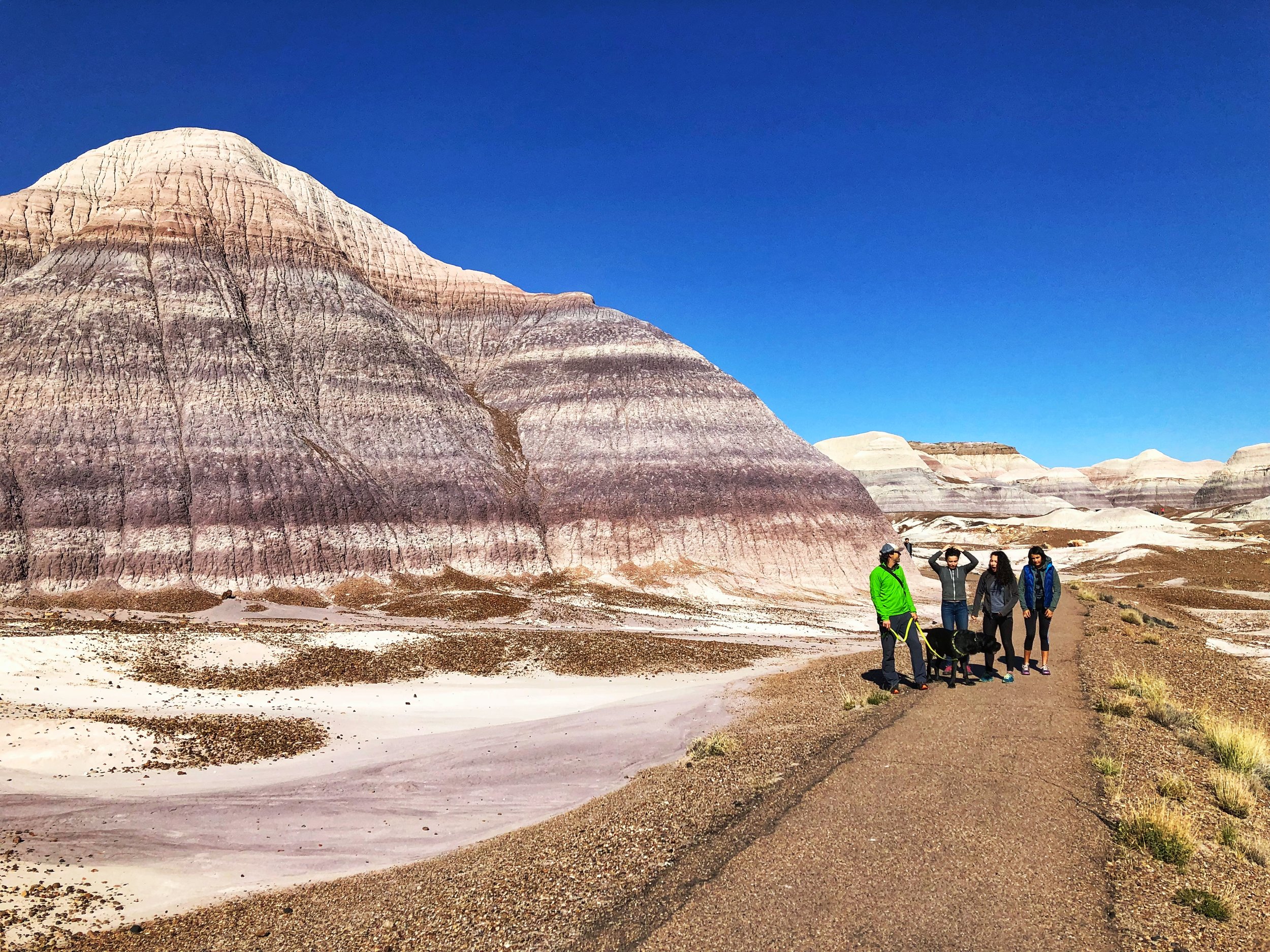
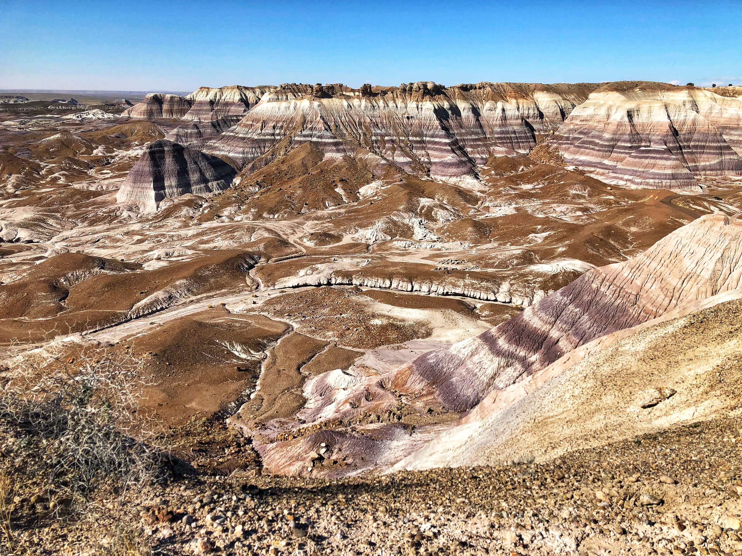
Petrified wood is pretty cool the first time you see it, but a bit less exciting on the third or fourth time… We went to Petrified Forest National Park mostly to see the Painted desert, those colorful layered hills you see in the background. It’s too bad there are not longer hikes in the park. I would have loved to get lost in that unique landscape.


The next day, we went to visit the Petrified Forest National Park. This is the painted desert part. Just gorgeous.

The next day, we went to visit the Petrified Forest National Park. This is the painted desert part. Just gorgeous.

Blue Hill Mesa.

Blue Hill Mesa.

At the bottom of Blue Hill Mesa (short hike).

At the bottom of Blue Hill Mesa (short hike).

A3E2546E-DFDC-49D1-84DE-9C88A95C1155.jpeg
033C5B35-1C66-40D2-A54E-898F0708F42B.jpeg
AEADBF58-9289-4AE4-B375-310F6F1C8D82.jpeg
Petrified wood.

Petrified wood.

642F194A-7A9C-42DC-9071-E5AA629EC6FC.jpeg

I've spent many hours in nature lately, in silence, on my bike, meditating on the part of me that is afraid of not offering my girls a more normal teenage life full of activities and peers on a daily basis. What if we stick to the fact that our family culture is to live on the road, away from a busy calendar? How do I know what is best for them at this stage of their lives? I can listen to their desires (which ebb and flow and change with their hormonal cycle...) or I can simply hold the bar, as I did all those previous years and say: this is our family, this is what we do. I will make sure you get a great online education and a high school diploma while living on the road. I wonder if we have become a generation of parents who cater too much to their children's desires. If I struggle with this transition, if living in a house for 4 years, needing a second income and vehicle, yearning to be out in nature in my bus, to have more quality time with them does not feel right... is it still the right thing to do for them? I don't know. I truly don't know.
My friend @reneetougas wrote a beautiful series on her blog on homeschooling the high school years. She asks an important question:
"Perhaps in the same way that schooling parents ask homeschoolers - how do you manage to be with your kids all day? Which for me is incomprehensible to answer since my reverse question is how can you stand to not be?" I still cringe when I hear parents cheer because school is about to finally resume after spring break. I mean, I get it, being surrounded by young children all day is hard work and wanting some alone time is totally human. But I feel like we don’t know how to be together anymore. We find it intimidating. Here, take my phone. And draining. Yes, you can go on Netflix. 
Why is that? Can’t we just have a good time together? Have meaningful conversations? Have we become so busy that we need to schedule fun times and laughter fits?

You know, we did not wake up one morning and saw that all the stars had aligned, that all the conditions had come together and decided not to send our girls to school. It is rather the opposite. We decided to not send them to school, then we invented the circumstances that made that possible.

Crested Butte, Fruita and Moab

CD2268CD-5818-4E5E-80C1-CD3181134594.jpeg

We were very excited to check out Crested Butte, but we knew it was rather late in the season… I had taken notes from Pedaladventure’s great post on that fun adventure town, but we ended up just exploring it on foot and Westfalia instead of riding the trails (already covered in snow).

6CCBC963-DECA-4438-9530-54F67C9A75AB.jpeg

We boondocked here a few nights, near Almont.

F6D720DC-996F-4824-8B56-96BEA5B7029D.jpeg

And woke up to this!

27B0E040-D580-403F-A415-5EF9F4175711.jpeg

It was beautiful… but a bit cold for camping.

Desperate for some good riding, we headed to Fruita where we had been in the Spring, but had only explored one sector (18 Road). This time, we checked them all and loved them (here’s another post by Pedaladventure on Fruita if you want more info).

Desperate for some good riding, we headed to Fruita where we had been in the Spring, but had only explored one sector (18 Road). This time, we checked them all and loved them (here’s another post by Pedaladventure on Fruita if you want more info).

C062432D-1935-43BC-9109-A7745A4A4966.jpeg

In Fruita, we rode some great trails in the Kokopelli trail system.

025E8C3A-F1D8-4122-A98F-1982D3FB8802.jpeg

Then, we went to explore the Rabbit Valley area, still technically in Fruita, but closer to the Utah border.

85DDD4B8-D450-470C-96B1-AD45BF77DAE1.jpeg

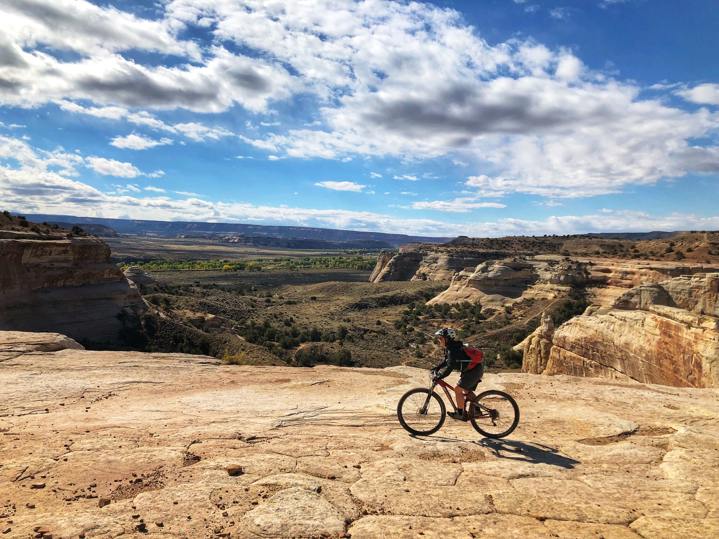
And rode this amazing trail all around the rim you see down there (called Western Rim).

A85F9FF2-5395-471E-9985-C04FE1CB7CDC.jpeg

It’s now in my top 3 trails.

CB0C152A-67C6-4B96-864B-1F9E1967E4F9.jpeg
3116ACF9-02DA-4E30-8C5B-06EC6B5A558A.jpeg
1E78D6E1-8416-4586-8AE0-0D8E0B41D6AC.jpeg
2C17648D-C8A1-4277-80A5-CD72D2EB200B.jpeg

You can see the Colorado River down there.

90A9905F-87F4-4F18-A205-717D5D9C14C4.jpeg

We also rode a few trails on 18 road (still Fruita) for Mathilde’s birthday (we love PBR, Joe’s Ridge and Mojo).

8AFC31CB-389F-40BA-A375-695DCFA9C452.jpeg
That’s Joe’s Ridge. Simply amazing.

That’s Joe’s Ridge. Simply amazing.

And of course, we went to Moab (I wrote so much about Moab, just do a search in the location bar and you’ll find plenty). We had a chance to connect with friends there since it is that time of year where many of us converge to this area. Photo by Ch…

And of course, we went to Moab (I wrote so much about Moab, just do a search in the location bar and you’ll find plenty). We had a chance to connect with friends there since it is that time of year where many of us converge to this area.
Photo by Ching from Live Small Ride Free

JF and Mathilde on Ramblin Photo by Ching from Live Small Ride Free

JF and Mathilde on Ramblin
Photo by Ching from Live Small Ride Free

Me on Chisholm Photo by Ching from Live Small Ride Free

Me on Chisholm
Photo by Ching from Live Small Ride Free

Mara on Big Mesa Photo by Ching from Live Small Ride Free

Mara on Big Mesa
Photo by Ching from Live Small Ride Free

Our group on Big Mesa. Photo by Ching from Live Small Ride Free

Our group on Big Mesa.
Photo by Ching from Live Small Ride Free

As I’ve shared here before, one of our girls wants to go to school, have external academic and biking motivation, deadlines, a schedule, to be graded… She is an organizer that thrives on structure. She makes lists, plans and wants to know what’s coming. Her Christmas gifts are ready weeks in advance.... You get the idea...

I was hoping that providing as much structure as possible with a Google calendar and online classes with clear external deadlines, timed tests and grades would satisfy her… But she says she’s done with life on the road. She wants stability. A totally normal desire. We knew it would very likely come, but still hoped it might not. Of course, it is out of the question to leave her with friends or family and keep travelling. It's not an option for us. We travel to have more time together.

A few people have asked us why we would settle down if one child wants to settle down and another one wants to keep traveling. Why would we put more importance on the desire to settle down than on the one to keep on traveling? Is is because it is what is expected or more *normal*? Teenagers need a group of peers, need space from their parents, etc. Of course, their life on the road provides plenty of that with bike teams and races, tons of friends of all ages we meet along the road, lots of time alone either in the bus while the others are gone riding or time alone on rides, daily texting with friends, etc… but it’s not the same as being in one fixed location.

So, this is our work right now: finding out what is fear of not offering a normal teenagehood to our girls and what is sticking to our family values and the needs of the other members of the family?

Some might philosophically say that kids will be angry at their parents nonetheless, that they will turn out fine anyways, that we adapt to anything… and there is truth to that of course, but these are key years in one’s life and I don’t want to rob them of these important years. We have a huge decision on our hands...

Another very important aspect of this decision is my mental health. I’ve talked about it here before. I take meds all year round and use my light therapy glasses everyday of the fall and winter EVEN on the road during Arizona winters. I need to be active outside in the sun almost everyday to keep anxiety and depression at bay. The first winter I spent in the south in my entire life was a game changer: I realized I could feel good all year, have energy and drive to do things and not wake up with an elephant on my solar plexus and struggle to get out of bed. I was 35. And I never looked back. Since then, I spent one winter in Quebec and it was really hard. You’ll tell me winter is hard on you too, but when you suffer from SAD, it’s a different level of hard. I don’t ever want to go through this again. Especially not when my girls are going through a major transition like entering high school.

So yes, this is a big factor and a top priority. It might sound egocentric, but if I’m sick, nothing is going to work. So yes, we could veto another 3 years on the road and tell our daughter that we will make sure she has high quality online classes and that she can settle down in 3 years when she goes to University. But that doesn’t feel right to force her into that life against her will… but then, settling down means forcing her sister into a life she doesn’t want either… And that’s where we will have to make a hard decision.

It’s no secret that we are not excited about settling down (we don't even know WHERE we would settle down at this point, but it would very likely be in Canada). Settling down means finding a home base and furnishing it (we have a big dog and finding a furnished rental is very unlikely). We don’t own anything anymore. Settling down IS a big deal. This bus is the home in which I lived the longest in all my life. I don't want to sell it. Same for the Westy. But in the North, these are not winter vehicles and need to be put in storage when not in use… And problems show up… Which also means that we'll need a car (or two) and another job to pay for it all…

So, it’s not a matter of simply *trying it for a year*. If we settle down, it will likely be at least for the next 4 years (or until our youngest is done with high school)... because we won’t turn things around again. Especially since the daughter who wants to settle down wants to do it because she is done leaving friends behind.

A part of me wants to believe that we can turn this into an adventure… If we find an interesting school in a new location where we can live in the bus for part of the year (and maybe an AirBnB for the few colder winter months…), that maybe could work. But the other part of me is like: are you crazy? No friends or family around in such a tough transition. No way!

And I dream of Europe...

I’m sure many of you wonder why I share all this personal stuff here. There are a few reasons. First, this is how I think. By sharing ideas and listening to feedback. It helps me frame my ideas and make sense of it all. Also, and above all, I feel like there are not many families on the road with teenagers and I know I wanted to hear their stories when my girls were smaller, so that’s mainly why I share mine here. It’s the same reason why I started blogging 10 years ago: to connect with likeminded people who questioned the mainstream path. There is less and less of us on that path when the children turn into teenagers and I feel like we need to hear the voices of these parents, their worries, their reflexions and yes, their fears… Because as much as we exude confidence, when you make a choice that is outside the norm, the fears are always there in the back of your mind, nagging. But you turn away from them and look at your teenagers and see that so far, you have done a decent job and that maybe you know the path… against all odds.

I have so much to say about this different life we live together that I am writing a book right now. If you feel encline, let me know in the comments what you would like to find in that book.

Great Sand Dunes National Park and Preserve

Can you spot the sand dunes at the base of the Sangre de Cristo Mountains?

Can you spot the sand dunes at the base of the Sangre de Cristo Mountains?

_CFO6412_DxO.jpg
_CFO6416_DxO.jpg
_CFO6420_DxO.jpg
_CFO6429_DxO.jpg
_CFO6428_DxO.jpg

These huge dunes look totally out of place at the edge of the snow-covered Rocky Mountains. Located in south central Colorado (about 2.5 hours from Colorado Springs and nearly four hours from Denver, they lie at the foot of the Sangre de Cristo Mountains. They are the tallest sand dunes in North America.

There are no official trails into the dunes and because of the soft, ever-shifting sand, possibilities for exploration are limitless. It is permitted to walk anywhere, and one popular target is the top of the tallest dune, which conveniently is only half a mile from the edge. Still, the journey takes up to one hour and it is often a case of one step up, half a step down. It is easier to walk along sand ridges, rather than up the side of the dunes. The surface temperature of the sand can rise to over 140 F in the summer, much too hot for barefoot walking, and very hard on your dog’s paws (bring booties). Note that this is one of the rare National Parks where dogs are allowed on hiking trails. It is written everywhere that you need to keep your dog ON LEASH. I know the dunes feel like a sandbox of epic proportions, but please respect that rule so we can keep coming here with our pups (most people had their dogs off leash…).

It is often windy on the dunes (it was when we were there) and it was not a pleasant experience. Wear long pants and non-mesh shoes (or walk barefoot if the sand is cool enough), a windbreaker and buff and tight-fitting hat, as well as sunglasses if you plan to hike the dunes on a windy day. It will make your journey much more fun.


You can also rent sand board or sand sleds to play on the dunes just outside the park (regular sleds or snowboards don’t work well on dry sand). Another amazing feature of the Great Sand Dunes is Medano Creek - a small stream fed by melting snow that is only about ten miles long and flows most strongly during spring and early summer. It starts in the Sangre de Cristo mountains, runs along the east edge of the dunes and disappears below ground in the valley.


It is also a great area for stargazing and there are often ranger-led astronomy programs in the park. A really unique experience would be to camp overnight in the dunes (when weather is calm and clear to avoid blowing sand or dangerous thunderstorms with lightning). You can pitch your tent anywhere in the dune field that lies outside the day-use area. You'll have a minimum hike of 1.5 miles over the dunes, but will experience a unique overnight setting. Don’t forget that hauling your gear up slippery sand dunes is quite the workout.

There is a limit of 6 people per party, and limit of 20 parties in the dune field per night; permits are first-come, first-served (gas stoves only; no campfires). Dogs are not permitted in the dunes backcountry.


Though not inside Great Sand Dunes National Park & Preserve, Zapata Falls is a terrific little hike (0.8 miles) during a visit to the area and a fun place to cool off from the hot sun in the summer since you have to walk in the water to get there.


There are a few options for camping in the area. The Piñon Flats Campground is run by the National Park Service, with 44 sites that are first-come, first-served and 44 that visitors can reserve in advance.

For those traveling in 4WD vehicles, there are 21 campsites along Medano Pass Road within the park that are free and available on a first-come, first-served basis.

Outside the park, there is the San Luis Wilderness area, which was a state park until last year, where you can camp FOR FREE WITH 30/50 AMP power, sheltered picnic tables and fire ring in a gorgeous setting. Too good to be true? That’s what we thought, but we had a hard time leaving.


Mary Jane Canyon and some Moab updates

Driving on Ranch rd/BLM 98 to get to Mary Jane Canyon. What a view!

Driving on Ranch rd/BLM 98 to get to Mary Jane Canyon. What a view!

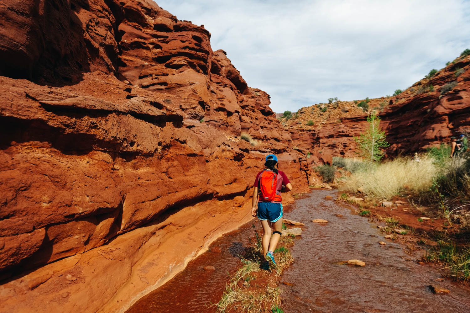
After about 5 minutes of walking on the trail, you have to get your feet wet!

After about 5 minutes of walking on the trail, you have to get your feet wet!

And it just gets better.

And it just gets better.

The sandstone is so red it's almost purple and when you walk in the water, it looks like there is blood around your feet.

The sandstone is so red it's almost purple and when you walk in the water, it looks like there is blood around your feet.

_CFO4563_DxO.jpg
Finally found a quiet camping spot about 25 minutes out of Moab. With a gorgeous view of the Fiery Furnace.

Finally found a quiet camping spot about 25 minutes out of Moab. With a gorgeous view of the Fiery Furnace.

Silence. Finally. After days of constant OHV noise.

Silence. Finally. After days of constant OHV noise.

If you type Moab on the Home page search bar of the blog, you'll see a ridiculous number of posts pop up. We just love Moab and have been coming here every year for the last 5 years. The more helpful post for bike trails and general info that I wrote is this one and this one contains more photos or trails (all the info is still good, except that the coffee at Bike Fiend was NOT good this year, stick to Moab Coffee Roasters and the good cheap laudromat by the Village Market and Chili Pepper Bike shop is not a Domino Pizza and you are left with very few options for laundry... We ended up going to Moab Laundry (that we call the Gringo Laundromat, because it's pack full with travelers and it's ridiculously cheap and the driers take forever to dry... buuut, it's right by the City Market AND Gearhead (where you can fill your jugs with delicious spring water for free), so we can kill 3 birds with one stone.

Coming here every year for a while also means that we have seen the effects of more and more people camping on the public lands and that every year, we camp a little further away... Last year, we stayed on Dalton Wells Road since Willow Springs Road was packed and this year, after spending a few very noisy days on Dalton Wells with people riding and racing their OHV all day long in front of our bus, we moved further out of town.

There has been lots of discussions on Instagram lately among the vanlifers about the repercussions of sharing the exact coordinates of these free campsites (and other beautiful locations). Many of us feel directly responsible for drawing crowds there (and some of us truly are... I know I am for at least a few spots I first reviewed on Campendium). It’s a complex issue and many of us stand on the fence here. We’re not a select little group who should be the only ones to have access to this information. HOWEVER, as Kerri McHale (@asolojourner) says: “There’s surely enough info already out there to get anyone’s feet wet; even if every single one of us stopped geotagging today. (…) This land is open to everyone, and everyone’s free to explore it. We’re not putting up “no trespassing” signs; were just not putting up neon arrows to the road here”.

Of course, I will keep sharing these special spots with people I know. And I will keep sharing them here on the blog. I receive lots of messages from friends and acquaintances (and readers!) planning trips and never refuse them a piece of advice. However, I know these people and know they will not trash them. These places are our second homes, our refuges, as Kerri McHale says. She continues: It’s not good for everyone to crowd onto one pinpoint on a map—it changes the land, even when people *aren’t* trashing it. I’ve talked to many locals lately, who see places they’ve come back to for decades overrun and trashed. I once thought, “I don’t have that many followers…how could I really be affecting this?” But that’s kind of like saying, “I’ll just drop this one coke can on the ground. No one comes around here anyway,” isn’t it?

So if you have read this far, let me share with you here one of Moab's best kept secret: Mary Jane Canyon. When the crowds are invading Arches and Canyonlands National Parks (and Corona Arch trail too now...), there are a few hidden gems that you will likely only have to share with a few other hikers if you are willing to drive a few extra miles (or 20). Last year, I told you about the Fisher Towers (still our favorite hike in the area!) and this year, we discovered Mary Jane Canyon. Unfortunately, we didn't get to go all the way to the end where the true gem is: a beautiful 30 feet high split waterfall INSIDE the slot canyon because we ran out of light. It is a long hike (9 miles/14 km round trip) mostly IN the water, so plan accordingly. It is however perfect on a hot day when the crowds are all at Grandstaff Canyon (aka Morning Glory, aka Negro Bill Canyon) to get their feet wet. Some people have reported being able to keep their feet dry by rock hopping, but it'll be a lot of work (and you'll likely slip and get wet or injure yourself). You CAN be in the water 90% of the time, but you will likely have to be walking in it at least 50% if you follow the trail that meanders in and out of the creek. We don't have Keens, so we simply used our regular sneakers with wool hiking socks and it was perfect. JF did it in his Chaco sandals and said it was not ideal because the sole became abrasive under his feet after a while. If you have weak ankles, brink hiking poles. The water was pretty shallow when we did it at the beginning of April (mostly ankle deep, some spots mid-calf) and cold but not freezing. We called the BLM field office in Moab beforehand since it had rained a few days prior, but they said they do not monitor the water level there, so I guess it is not as likely to get flash floods there. The water level does vary during the year and it is usually dry at the end of the summer.
Once you reach the trail head, make sure you take the right trail. The more obvious one is for Professor/Sylvester Creek, which is NOT where you are going. The trail to Mary Jane Canyon is just across the parking lot by a no camping sign. The best info I found about it is on this blog (with photos of the trail head). The canyon walls get higher as you hike further into the canyon, and eventually will reach upwards of 100 ft. I also read that there are several side canyons that allow for exploring tighter slot canyons.


Exploring Utah's Canyons part 4: San Rafael Reef

_CFO4433_DxO.jpg
lhc.jpg
_CFO4465_DxO.jpg
Little Wild Horse Canyon is so sinuous, you feel like water walking through it.

Little Wild Horse Canyon is so sinuous, you feel like water walking through it.

Mathilde is always ready to rest. Ahem.

Mathilde is always ready to rest. Ahem.

_CFO4469_DxO.jpg
So, so gorgeous!

So, so gorgeous!

Canyons have been described as sensuous and feminine, womb-like in opposition to mountains and spires or hoodoos. You see, something unique happen when you stand in the belly of the earth. You want to run your fingers along the round walls, like a p…

Canyons have been described as sensuous and feminine, womb-like in opposition to mountains and spires or hoodoos. You see, something unique happen when you stand in the belly of the earth. You want to run your fingers along the round walls, like a pregnant belly or a breast. You want to linger, to drift… you don't want to get out of that embrace, to reemerge  and reenter the world beyond that womb.

lhc6.jpg

In their book Utah Canyon Country, Kathy and Craig Copeland warn the hikers pretty clearly about Bell & Little Wild Horse canyons: The circuit linking the two canyons is a merry-go-round of enthusiastic hikers: kids sprinting away from their ambling parents, young couples lugging babies in backpacks, seniors cautiously shrouded head-to-toe in sun-barrier clothing, experienced trekkers sheepish about participating in such a carnival yet enjoying it too. (…) Hiking here is like joining a hikers’ pride parade. It’s an act of solidarity with your comrades: the people raising hikers-to-be. Not convinced? Then come here simply to marvel at the bizarre beauty of the San Rafael Reef. These canyons are so extraordinary they’ll command your attention while the party swirls on without you.

Little Wild Horse Canyon (2-4 miles round trip to simply explore the first section of LWH Canyon or 9 miles to do the loop hike with Bell Canyon, easy, dog-friendly but lots of people, VERY HEAVY traffic):

There were over 60 vehicles in the parking lot when we arrived at 3 pm on a Monday afternoon (granted, it was during Spring Break, but still!). We decided to go find a camping spot on Little Wild Horse BLM just a few minutes from there and waited for the crowd to leave. We started our hike in the canyon at 6 pm and had the place pretty much to ourselves. It was AMAZING. We hike pretty fast, but we were able to see a lot of Little Wild Horse Canyon and return by 8 pm. It is undeniably the most beautiful slot canyon we have seen when taking in consideration the minimal approach and how easy it is to hike it (no technical challenge at all).

Most people simply walk a few miles into Little Wild Horse Canyon and turn around (like we did), but you can also do it in a loop starting with Bell Canyon and returning through Little Wild Horse Canyon. I believe it would be doable the other way around too (but you might want to double check that in case there are obstacles) in order to avoid the crowd if you start very early from LWH canyon.


Our beautiful (and very windy) campsite on Little Wild Horse BLM.

Our beautiful (and very windy) campsite on Little Wild Horse BLM.


To also check in the same area:

Crack Canyon (7 miles round trip, easy with a few obstacles requiring some gymnastic efforts, dogs allowed, but has to be pretty athletic, moderate to low traffic)

Chute Canyon (4.5 miles round trip, easy, dogs allowed, moderate to low traffic)

I'm not going to keep you from paying $15 to go into Goblin Valley State park and spend an hour (or less) climbing on goblin-like rock formations (why on earth do they allow people to climb on such fragile formations, I don't know...), but if you do and you have bikes, go explore a much less crowded area of the park with really nice easy bike trails and ride The Dark Side of the Moon to get very close to the San Rafael Swell.

Recommended books:

Map (note that there is no cell signal in most of these places, so you'll likely need a paper map) : Canyons of the Escalante

Hiking Grand Staircase-Escalante & the Glen Canyon Region: A Guide To 59 Of The Best Hiking Adventures In Southern Utah

Hiking from Here to Wow: Utah Canyon Country

Hiking the Escalante

Exploring Utah's Canyons part 2: Hole-in-the-Rock Road

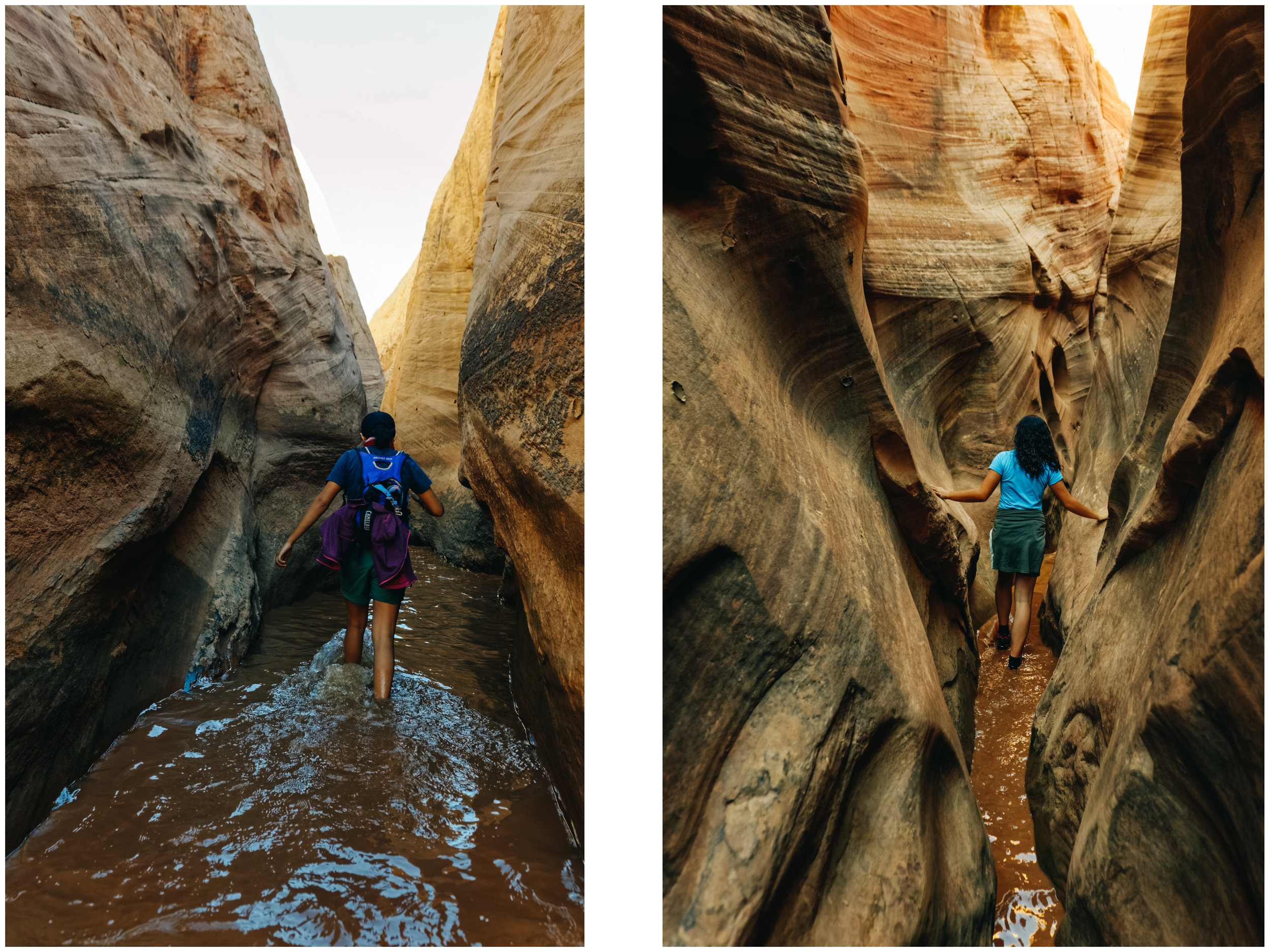
Approach hike to Big Horn Canyon

Approach hike to Big Horn Canyon

The incredible colors and texture in Big Horn Canyon.

The incredible colors and texture in Big Horn Canyon.

Feeling like we are in another world, alone in Big Horn Canyon.

Feeling like we are in another world, alone in Big Horn Canyon.

Playing in a shallow section of Big Horn Canyon.

Playing in a shallow section of Big Horn Canyon.

Hole-in-the-Rock Road has the biggest concentration of slot canyons in Utah. It is 57 miles one-way and 4 x 4 is strongly recommended for the last 7 miles. There was LOTS of wash board on this route when we were there and driving it in our van wasn't fun. We decided NOT to drive the 50 something mile required to get to some of the canyons we wanted to explore and stuck to the canyons located on the first 15 miles of the road for that reason.

There are no route markers on most canyon trails (sometimes a cairn here and there). You need a map and some navigation skills.

As the Copelands put it in their book: Hiking, particularly when routefinding rather than heedlessly following a trail, reboots our connection with nature. It requires us to engage directly. And canyon country is the ideal place to venture into trail-less terrain.

These places invite exploration, but if you want to veer off the path, you should stay on the cattle trails to avoid destroying the fragile desert crust. Do not add cairns, do not write with mud on the canyon walls, keep your voice down (and teach this to your kids). Enthusiasm is beautiful, but this is not an amusement park. Be respectful of others who are likely to look for a more contemplative experience.

Big Horn canyon (5 miles round trip, easy, dog-friendly, moderate traffic): Big Horn Canyon is an interesting tributary of Harris Wash in a rarely explored part of the Grand Staircase-Escalante National Monument. It was our best *discovery*. The wide range of colors, textures and formations took our breath away. The canyon deepens quickly, eventually reaching a depth of 400 feet, and forms slot-like channels of varying narrowness mixed with wider, flat sections. It has two forks and all could be seen in five hours though adjacent parts of Harris Wash, and especially some of its nearby side canyons, are also worth visiting.

Squeezing through an unnamed side canyon we discovered while hiking in Big Horn Canyon. It led to a beautiful cathedral-like area.

Squeezing through an unnamed side canyon we discovered while hiking in Big Horn Canyon. It led to a beautiful cathedral-like area.

JF using his elbows to slowly get down this steep section of the side canyon.

JF using his elbows to slowly get down this steep section of the side canyon.

We have a tradition to pick a birthday hike (or ride). I had picked Little Death Hollow, but it was closed since a cow was stuck in it and someone else had been charged by an aggressive cow… So back to the drawing board we went and decided to check out Zebra Canyon.

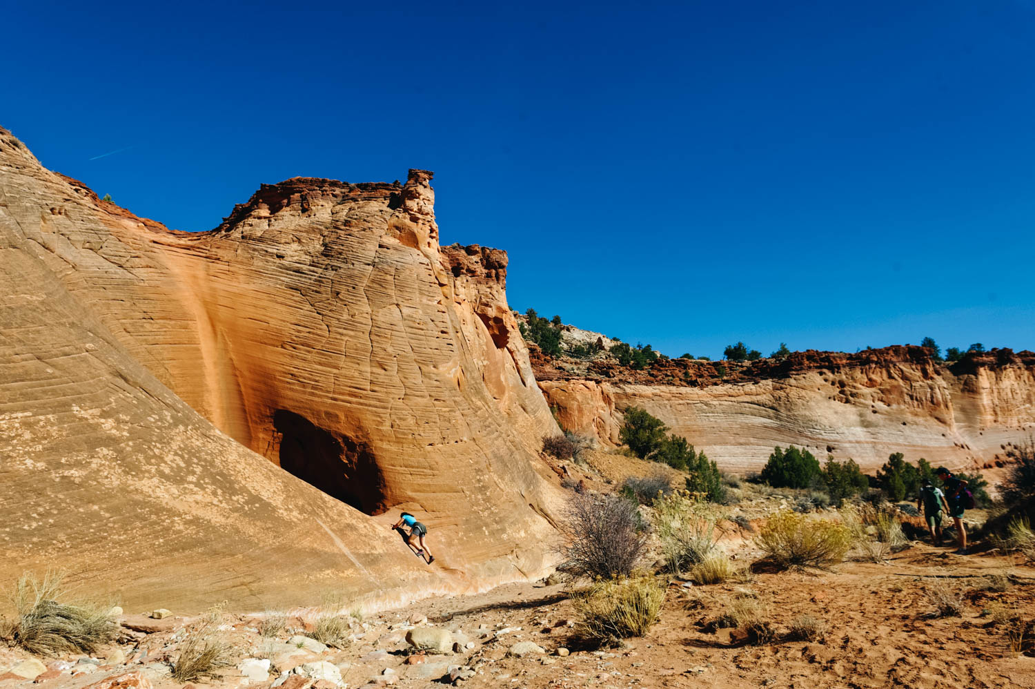
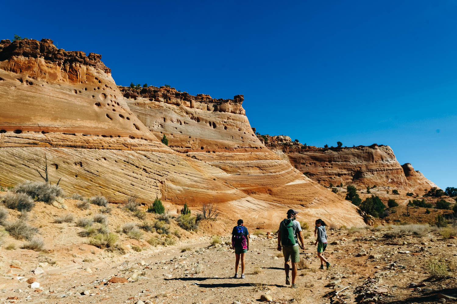
Zebra slot canyon (5 miles round trip, easy to get there/moderate, some stemming required in the canyon, canyon is not dog-friendly, high to moderate traffic): This is a very short slot canyon (200 m) that require some wiggling and stemming to get through. It often contains water and quicksand. When we did it, there was two 50 feet-long sections of mid-calf freezing cold water. The slot canyon is reached after a 2 miles beautiful approach walk down to Harris Wash. There are not route markers here and it can be confusing for many. Make sure you have a map.

The birthday hike crew

The birthday hike crew

Canyons invite exploration

Canyons invite exploration

Walking in the wash to get to Zebra Canyon.

Walking in the wash to get to Zebra Canyon.

Getting closer.

Getting closer.

There was two 50 feet-long sections of mid-calf freezing cold water. I got feet cramps that were so bad I could not stand for a minute.

There was two 50 feet-long sections of mid-calf freezing cold water. I got feet cramps that were so bad I could not stand for a minute.

Mara-give-me-a-challenge Roldan

Mara-give-me-a-challenge Roldan

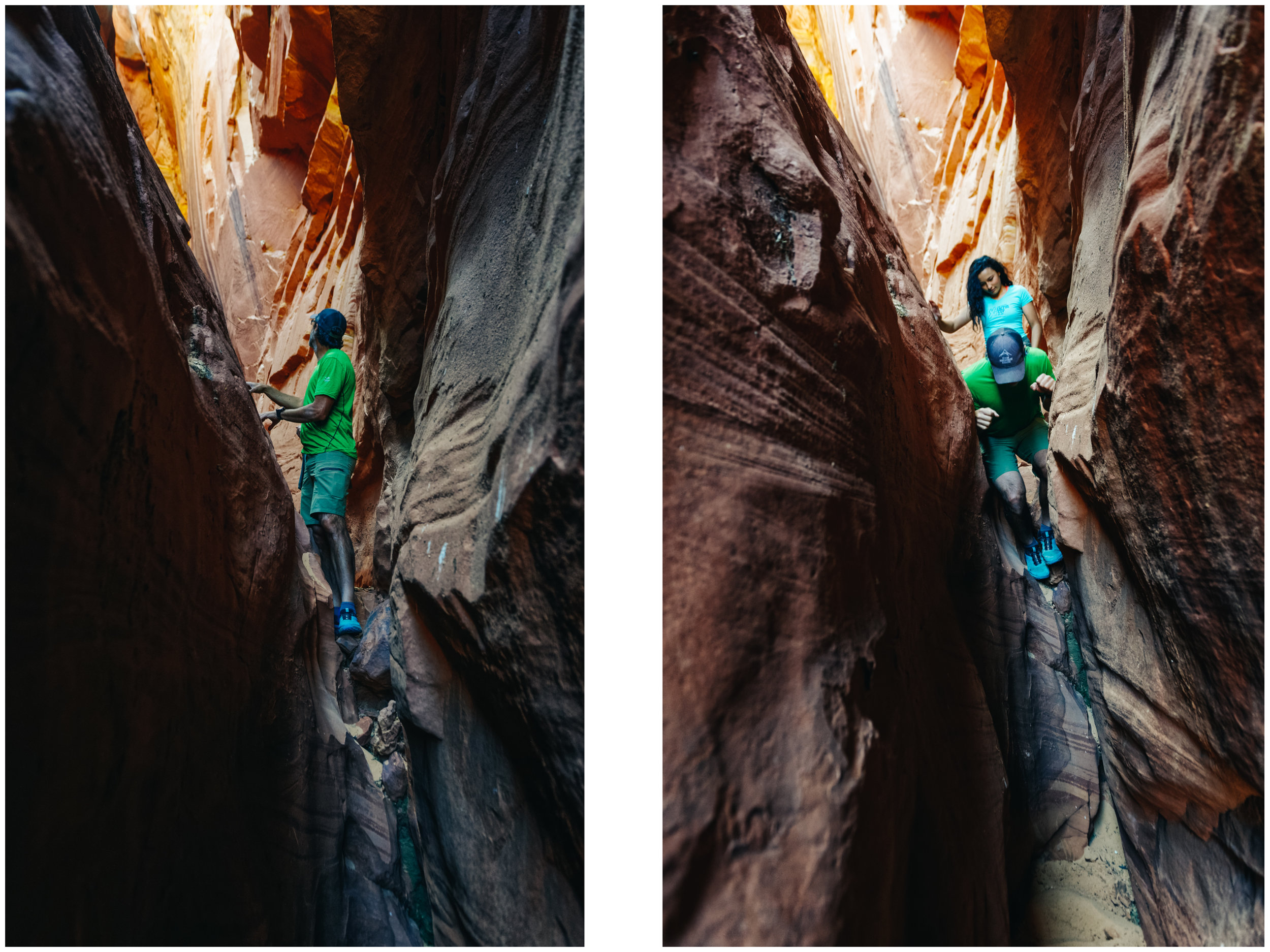
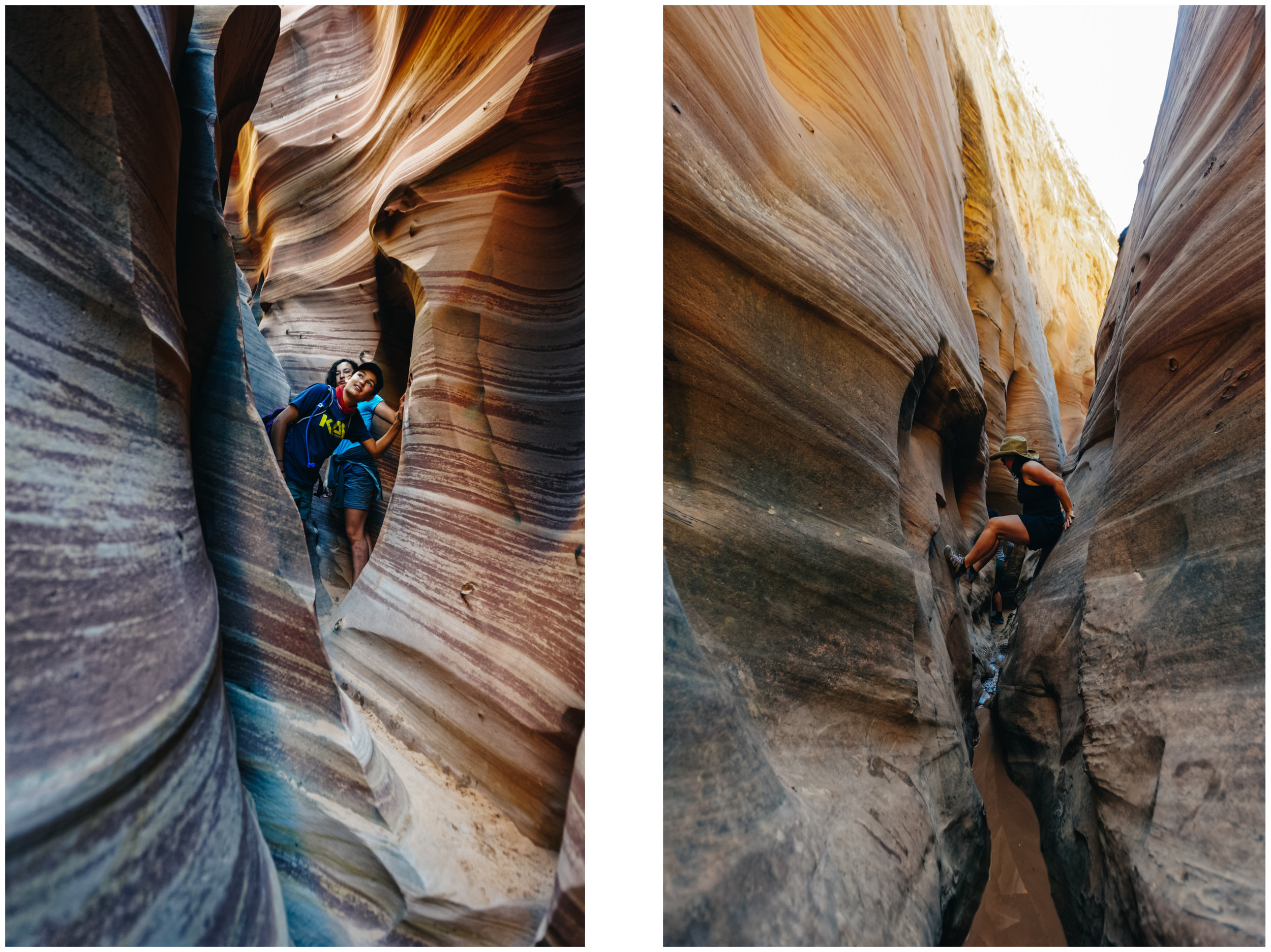
Being tall is not always a good thing when exploring slot canyons.

Being tall is not always a good thing when exploring slot canyons.

Left: int the narrowest and most beautiful part of Zebra Canyon. Right: JF helps Mara down a steep section.

Left: int the narrowest and most beautiful part of Zebra Canyon. Right: JF helps Mara down a steep section.

Right: looking at a bird's nest in an alcove. Right: me, stemming to avoid a section of freezing water.

Right: looking at a bird's nest in an alcove. Right: me, stemming to avoid a section of freezing water.

_CFO4507.jpg

In many of these canyons, you will see Moqui Marbles. They are sandstone balls cemented by a hard shell of iron oxide minerals. They tumble from the pale, cream-colored navajo sandstone beds, when wind and water wash away the softer rock. The children of the Indian tribe who lived there were known to play with these stones, particularly the smaller stones, and used them like children today use marbles, hence the name Moqui Marbles.

The curious rocks have inspired fantastical tales of fairies, meteorites and dinosaur eggs, but their origin is fairly mundane. Water flowing through sedimentary rock leaves behind minerals that glue together masses of sand, mud or other particles.
Collecting them is prohibited. Please be respectful.

In my research online, I actually discovered that some people are selling them on eBay as shaman stones having special powers. I’m pretty sure this is bad Karma...

To also check in the same area:

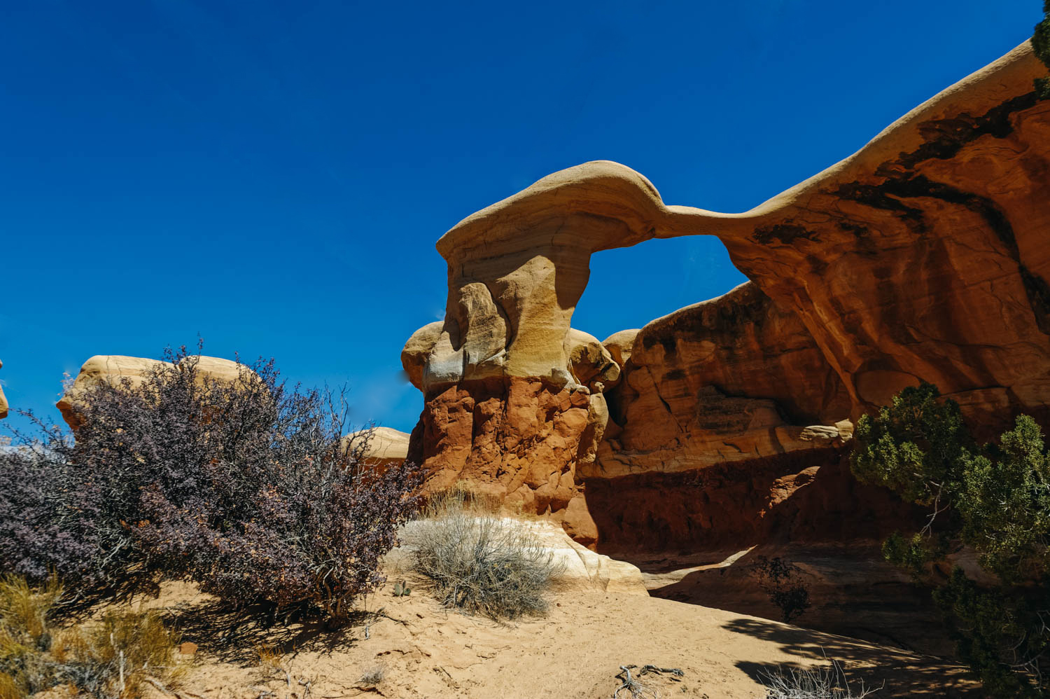
Devil’s Garden Hoodoos (stroll around, up to a few miles, perfect natural playground for kids, a few arches and funky hoodoos, 12 miles from Highway 12 on Hole-in-the-Rock road).

Devil's Garden Hoodoos (on Hole-in-the-Rock Road, not to be confused with Arches NP Devil's Garden).

Devil's Garden Hoodoos (on Hole-in-the-Rock Road, not to be confused with Arches NP Devil's Garden).

Metate Arch at Devil's Garden Hoodoos.

Metate Arch at Devil's Garden Hoodoos.

Mara standing on an arch at Devil's Garden. This is an amazing natural playground. You have to stop there if you have kids.

Mara standing on an arch at Devil's Garden. This is an amazing natural playground. You have to stop there if you have kids.

Peekaboo and Spooky Canyons (4.8 miles round trip, moderate, not dog-friendly, heavy traffic): These are undeniably the most visited canyons on Hole-in-the-Rock Road and for good reasons. The approach is short and the experience is unique. However, you might have to wait in line to enter through Peekaboo… it’s that crazy busy. People usually hike up Peekaboo and down Spooky (DO NOT ATTEMPT THIS HIKE IF YOU ARE IN ANY WAY OVERWEIGHT, these canyons are so narrow that people got stuck). Spooky will force even the most slender lanky types to carry their packs over their heads, turn sideways and wiggle through. There are a few chokestones and short drops. If you are #ho shapeshifter, you can also attempt Brimstone Canyon located at the same trailhead (darker and more obstacles, great to check you immunity to claustrophobia). We hiked these almost six years ago with the girls and it was quite the adventure (read the whole story here!)

Neon Canyon and the Golden Cathedral (9.2 miles round trip), moderate, dog-friendly, moderate traffic)

Note that there are many more very interesting canyons to explore on Hole-in-the-Rock Road (Davis Gulch, Llewelyn Gulch, Reflexion Canyon, Willow Gulch, Fortymile Gulch, Egypt 3, Spencer), but many require a 50 mile drive on that often very wash boardy road (it was in very rough shape when we were there).

We camped at this BLM while exploring this area. 


Recommended books:

Map (note that there is no cell signal in most of these places, so you'll likely need a paper map) : Canyons of the Escalante

Hiking Grand Staircase-Escalante & the Glen Canyon Region: A Guide To 59 Of The Best Hiking Adventures In Southern Utah

Hiking from Here to Wow: Utah Canyon Country

Hiking the Escalante

Exploring Utah's Canyons part 1: Skutumpah Road + Lower Calf Creek Falls

Willis Creek

Willis Creek

Willis Creek overarching walls

Willis Creek overarching walls

Wavy walls inside Willis Creek Canyon

Wavy walls inside Willis Creek Canyon

willis4.jpg

When we started traveling around the US 6 years ago, Zion and Bryce National Parks were the new Grand Canyon. Crowds were filling every trail and people that had never hiked in their life showed up on Angel’s Landing trail wearing flip flops and carrying a tiny 250 ml bottle of water they had just bought at the lodge. Now, mainly thanks to social media, Utah’s slot canyons seem to be the new Zion. Whereas we had enjoyed Peekaboo and Spooky Canyons with only a few other adventurous parties 6 years ago, the Escalante Visitor Center ranger told us to stay away from it because there were line-ups of people trying to get in and out. And many of them were not serious hikers, even less slot-canyon savvy.

We knew that Willis Creek slot canyon and Lower Calf Creek Falls would be busy, but we didn’t expect to have people literally crawl under us inside Zebra Canyon (I wish I was joking). It was just ridiculous. Granted it was Spring Break, but we never expected it to be THAT busy.

One of our best experience was at Big Horn Canyon, where we started early and had the place mostly to ourselves until we were on our return. It was also quite special since we *discovered* one of the side slot canyon and ventured inside it not knowing what we would find. It ended in a gorgeous cathedral-like cave. The experience is just not the same at all. Of course, nobody likes busy places, but a crowded slot canyon is just not fun. And can border on dangerous.

Mostly, people are not aware of canyon etiquette. They are loud (and their voice reverberates on the canyon walls and don’t give people space to enjoy the spectacular sections of a canyon. Don’t be these guys. This is not a race, this is an experience. Many are there to have a contemplative experience and don’t feel like chatting. Canyons invite silence and respect.

Here are short description of every canyon we visited (note that there are many more and in other areas of Utah too). These are all accessible from Route 12. To simplify things I have separated them in 4 different posts.

More info can be obtained online or at the Escalante Visitor Center for directions. ALWAYS stop at the nearest visitor center to get information about the state of the trail and the risks of flash floods.

When hiking Willis Creek, we camped on this BLM.

It is easy to get good pictures in Willis creek: the narrow sections are not very long allowing ample light to come in.

It is easy to get good pictures in Willis creek: the narrow sections are not very long allowing ample light to come in.

Willis Creek is very dog-friendly.

Willis Creek is very dog-friendly.

_CFO3982_DxO.jpg

From Cannonville (Skutumpah Rd):

Willis Creek (4.8 miles round trip, easy, very dog-friendly, high traffic): Many slot canyons are accessible only after a 2-3 miles hike in a usually pretty sandy wash (in full sun), but Willis Creek is an exception, which explains why it is so popular. In some books it is describes as the best bang for your buck experience, and I guess it is true if you are in a rush or you want an easy mostly flat hike with no obstacles to climb. However, unless you go very, very early or late in the day, expect to be with a crowd. From the parking lot, the trail quickly drops into the canyon, within 5 minutes, you will see sculpted Navajo sandstone walls rise on both sides. You will go into many sections of slot canyon that alternate with short sections of wash. This explains why it is easy to get good pictures in Willis creek: the narrow sections are not very long allowing ample light to come in. It is a 20 minutes drive down unpaved Skutumpah Road (from Cannonville, on Hwy 12). It is not big-rig accessible (you can leave your rig for the day at the Cannonville Visitor Center or at a nearby BLM).

To also check in the same area:

Lick Wash Canyon (8-mile round trip, easy, dog friendly, moderate traffic). We did it almost 6 years ago and didn't find it particularly interesting.

Hike to Lower Calf Creek Falls

Hike to Lower Calf Creek Falls

Hike to Lower Calf Creek Falls

Hike to Lower Calf Creek Falls

Right on Route 12, between Escalante and Boulder:

Lower Calf Creek falls (6 miles round trip, easy, very dog-friendly, high traffic): Note that this is not a slot canyon, but a hike that leads you along high sandstone walls (with a few petroglyphs) to a beautiful waterfall. The hike in itself is beautiful from the start. It is a great hike to do if slots canyons are vulnerable to flash floods. There are some sandy sections and some ups and downs. In warm weather, people swim in the pool at the bottom of the fall.

Lower Calf Creek Falls.

Lower Calf Creek Falls.

Prescott, AZ

Exploring the Granite Dells.

Exploring the Granite Dells.

_CFO1775_DxO.jpg
Willow Lake seen from the Granite Dells.

Willow Lake seen from the Granite Dells.

_CFO1782_DxO-2.jpg
_CFO1786_DxO.jpg
Riding the Sundog Trail. Photo by Jason Liske.

Riding the Sundog Trail. Photo by Jason Liske.

Photo by Jason Liske.

Photo by Jason Liske.

Photo by Jason Liske.

Photo by Jason Liske.

Photo by Jason Liske.

Photo by Jason Liske.

Watson Lake. Photo by Jason Liske.

Watson Lake. Photo by Jason Liske.

Our campsite at White Spar Campground and the trails nearby.

Our campsite at White Spar Campground and the trails nearby.

Cold Brew Negroni. Recipe on my Instagram account. So good!

Cold Brew Negroni. Recipe on my Instagram account. So good!

The weather was unusually warm in Prescott for this time of year, so that meant we could comfortably camp (0 degrees nights and nice warm days) and most of the bike trails were rideable. Our original plan was to go on a BLM camping spot on Thumb Butte Mountain, but there was snow and mud on the steep climb to get there, so we turned around and went to White Spar Campground. For $10/night, you get a big asphalted lot with a picnic table and fire rink and access to a bathroom. There is no water on site at this time of year, but it’s easy to go dump and fill at Affinity RV for free. AND there are lots of bike trails that start right from the campground (Twist and Shout, Apple Blossom, Goldwater Lake). We rode a lot during our stay here and checked out many different areas. The number of bike trails here is just incredible! I think the favorite was Badger Mountain and Sundog and we also liked the new trails at Spence Basin (Tunnel Vision), but there were many more that we liked. Prescott has over 250 miles of beautiful trails. The Trailfork app is the best app to use for this area, as well as the PMBA website for trail conditions.

On the other side of town, there are two reservoir lakes (Watson Lake and Willow Lake) surrounded by the Granite Dells, a landscape reminescent of the Alabama Hills (where you can ride some pretty technical trails), and completely different from the area where we were camped.


McDowell Meltdown 2018

Our set-up for the race near the Competitive Loop (4 Peaks).

Our set-up for the race near the Competitive Loop (4 Peaks).

Jason leading the pack of Intermediate Single Speeders.

Jason leading the pack of Intermediate Single Speeders.

Antonio after his first lap.

Antonio after his first lap.

Diedra at the start (women intermediate 40-49)

Diedra at the start (women intermediate 40-49)

Mara on her first lap.

Mara on her first lap.

Ben closing the gap!

Ben closing the gap!

Mara at the finish!

Mara at the finish!

Mara came in third (over 14 girls) in her category (13-14 yo girls)!!

Mara came in third (over 14 girls) in her category (13-14 yo girls)!!

Last year, the McDowell Meltdown was JF and Mara's first ever bike race. You might remember that they had registered just for fun. This year, they came in a little more prepared (but not super well-trained since they both got a nasty bug over the holidays). They still did great and had a good time. 

Some of you have asked why Aisha and Mathilde did not do the race. The answer is that they simply didn't feel like it. They might or might not ride the other races in a few weeks. Our girls are free to choose, of course! As for me, I'm not interested in racing (nor am I in racing shape!).

We had never stayed at the McDowell Mountain Regional Park campground (we rarely pay for campsites), but this was well-worth it since they could pre-ride the course during the week and because there are also tons of trails that you can ride right from your campsite. We explored some trails, but there are still lots we haven't had a chance to ride. There are all types of trails, from wide sandy washes to steep rocky trails.

The sites are huge and well-spaced, they all have power and water ($30), but make sure you reserve in advance online because they fill-up pretty quickly at this time of year. If the campground is full, there is an overflow where you can stay for $20/night with no services, but access to showers and dump station.

Ending the year in the Strongholds

_CFO0527_DxO.jpg
cochise2.jpg
_CFO0549_DxO.jpg
_CFO0554_DxO.jpg
_CFO0556_DxO.jpg
_CFO0564_DxO.jpg
_CFO0567_DxO.jpg
_CFO0597_DxO-2.jpg
_CFO0602_DxO.jpg
_CFO0601_DxO.jpg
_CFO0607_DxO.jpg
_CFO0632_DxO.jpg
_CFO0622_DxO.jpg
_CFO0711_DxO.jpg
_CFO0687_DxO.jpg
cochise.jpg
_CFO0709_DxO.jpg
_CFO0634_DxO.jpg
_CFO0642_DxO.jpg
_CFO0643_DxO-2.jpg

Don't you just love it when you are with people with whom everything is so easy and simple and fun? I've said it before and I'll say it again: these guys feel like family! We spent a wonderful laid back weekend with them in the Dragoon Mountains, also called Cochise Strongholds. I've written on the blog about this place a few times already, so if you want more practical info about the camping or rock climbing, just search the blog with the hashtag cochise. 

We just love this place. There is an incredible sense of peace in these mountains. I love watching every sunrise and sunsets from the top and see how the orange light plays with the dry grass. Some people have compared it to some areas in Australia and even the African Savannah. I cannot help but think about Cochise and his troops who hid in those mountains for 2 years...

P.S. There is a pretty cool story about that van… We bought it from a gut that had imported it from California in 2000, used it, crossed Canada in it with our big St. Bernard to move to the Yukon, and sold it in 2005 to our friends Antonio and Pascale when I was expecting Mathilde (we camped in it with the twins in the Yukon, BC and Alaska – the first time they were only 2 months old!). Antonio and Pascale were moving to San Diego for Pascale’s postgraduate study, so the van was going back to its original home. Many years later, while he was working on the van, Antonio came across the manufactured date… which happened to be on his exact birthday. Not only the same year and the same month, but the same day too! How cool is that! So Tony the van, turned 40 on the same day as Antonio! And they are both off to many more adventures!

San Felipe, Baja California, Mexico

_CFO9731_DxO.jpg
That beach was so nice and clean. The only downside were the stray dogs. Traveling to Mexico with an non-neutered dog might not have been our best move... a tad bit stressful.

That beach was so nice and clean. The only downside were the stray dogs. Traveling to Mexico with an non-neutered dog might not have been our best move... a tad bit stressful.

_CFO9741_DxO.jpg
We loved seeing our girls navigate a new culture and be so open and so eager to discover new things.

We loved seeing our girls navigate a new culture and be so open and so eager to discover new things.

That place was great, and by that I mean that (one of) the shower had good pressure and hot water (without any risk of getting an electric shock from naked wires), there is TP in the (clean) bathroom, our palapa's second floor is solid enough to hol…

That place was great, and by that I mean that (one of) the shower had good pressure and hot water (without any risk of getting an electric shock from naked wires), there is TP in the (clean) bathroom, our palapa's second floor is solid enough to hold the 5 of us. If you've never camped outside the US or Canada, you might find this place pretty run down and trashy. Hey, we have water and electricity on our beachfront site for 25 USD per night and are walking distance from town. That is 5 stars in my Mexican camping book!

Full moon rising over the Sea of Cortez. 5 million stars!

Full moon rising over the Sea of Cortez. 5 million stars!

Cooking under our palapa.

Cooking under our palapa.

Sunrise over the Sea of Cortez.

Sunrise over the Sea of Cortez.

_CFO9791_DxO.jpg
_CFO9794_DxO.jpg
_CFO9798_DxO.jpg
We went to visit the Valle de Los Gigantes, where the world’s biggest cactuses live. These cactuses are called the Mexican Giant Cardon. Some of these live more than 2000 years and measure over 20 meters! It was a pretty special experience to walk a…

We went to visit the Valle de Los Gigantes, where the world’s biggest cactuses live. These cactuses are called the Mexican Giant Cardon. Some of these live more than 2000 years and measure over 20 meters! It was a pretty special experience to walk among these true giants. If you ever go, make sure to stop for a chat with Miguel who will warm your heart with his stories and his big Mexican smile.  

_CFO9830-2_DxO.jpg
_CFO9837_DxO.jpg
_CFO9860_DxO.jpg
After visiting the Valle de Los Gigantes, we drove another hour south to the little village of Puertecitos where a friend told us about some hot springs. The village entrance was a pretty sad sight of slums and old trailers. The place was empty. I g…

After visiting the Valle de Los Gigantes, we drove another hour south to the little village of Puertecitos where a friend told us about some hot springs. The village entrance was a pretty sad sight of slums and old trailers. The place was empty. I guess that most people living there are fishermen who were gone during the day. When we finally found someone to ask about the hot springs, we found out it was only accessible at low tide, 4-5 hours later, which would have meant driving the hour and a half back to our campsite in the dark, so we turned around. 

Some areas are as sad as the road side faded shrines in some of the steep curves along ruta 5. 2008 hit hard here. There are so many abandoned  buildings in different states of construction, big colourful gates announcing resorts that only exis…

Some areas are as sad as the road side faded shrines in some of the steep curves along ruta 5. 2008 hit hard here. There are so many abandoned  buildings in different states of construction, big colourful gates announcing resorts that only existed in the minds of overly enthusiastic builders. So many makeshift shelters and a few expat gated communities sprinkled here and there for good measure. 

_CFO9870_DxO.jpg
San Felipe was pretty much what we expected (minus the crazy wind that blew pretty much all day long for 4 days straight and forced is to wear all the clothes we had brought one on top of each other). It's laid back and perfect for a week off. Howev…

San Felipe was pretty much what we expected (minus the crazy wind that blew pretty much all day long for 4 days straight and forced is to wear all the clothes we had brought one on top of each other). It's laid back and perfect for a week off. However, there's just so much sitting on the beach, reading in a hammock, playing cards and eating tacos I can do before going crazy (well, maybe not the taco part). 

For a bunch of antsy pants like us, there isn't much to do. No trails to hike or bike (a campground neighbor went for a run and got bitten by stray dogs), no waves to surf, no wall to climb. We walked to town a few times a day, but ended up stuck in…

For a bunch of antsy pants like us, there isn't much to do. No trails to hike or bike (a campground neighbor went for a run and got bitten by stray dogs), no waves to surf, no wall to climb. We walked to town a few times a day, but ended up stuck in the Westy because of the wind for many hours a day. 

My head is full of the pictures I didn't take. The harsh living realities of so many people, the trash everywhere, the striking contrasts between the expat houses and the locals’. It's always disturbing, and I hope I never become insensitive to it. As soon as we crossed into Mexicali, we were in a different world. The honking, the smells, the poverty, people selling stuff at every intersection, from tortillas and neon cotton candy to airplane models and cheap copycat go-pro cameras, Mexicans sellers got you covered. You need an alternator? Ramon is selling some from the back of his pick-up. Dreaming of a fuzzy leopard stirring wheel covers? That guy is coming to your car window with his selection. Guys would show up at our campsite, invariably presenting us with the same fare someone else offered us a few hours priors: *almost gratis* bracelets and hammocks. The weathered down musicians coming to our tables at night in the restaurants, dragging their old amplifiers behind them (everything has to be loud in Mexico, especially the music!)...

As we drove back to the border through the desolate suburbs of Mexicali, I was reminded of a conversation a friend had a long time ago with a Buddhist monk. She was telling him that her brother was dying of cancer while she was living a happy healthy life and how unfair this was. After a few minutes of silence, the monk simply looked at her with his wise eyes and said: Who said it would be fair?

We were dealt a pretty awesome hand while many are struggling pretty hard to get enough food to eat for their family. Life isn’t fair, indeed and traveling is quite humbling.


The Grand Canyon or hiking across one of the Seven Wonders of the World for his 40th birthday

Hike to Ooh Aah Point with friends.

Hike to Ooh Aah Point with friends.

_CFO9301_DxO.jpg
_CFO9308_DxO.jpg
_CFO9312_DxO.jpg
_CFO9329_DxO.jpg
JF showing Antonio where the Rim-to-Rim-to-Rim will take him the next day.

JF showing Antonio where the Rim-to-Rim-to-Rim will take him the next day.

Looking down into the Canyon from Ooh Aah Point.

Looking down into the Canyon from Ooh Aah Point.

One of the many morbidly obese squirrel...

One of the many morbidly obese squirrel...

_CFO9330_DxO.jpg
_CFO9328_DxO.jpg
_CFO9294_DxO.jpg
It was pretty smoky in the canyon, which made it a bit more challenging to breathe.

It was pretty smoky in the canyon, which made it a bit more challenging to breathe.

Waiting for JF and Martin to emerge from the big hole after their incredible Rim-to-Rim-to-Rim feat.

Waiting for JF and Martin to emerge from the big hole after their incredible Rim-to-Rim-to-Rim feat.

Just a tiny part of the many switchbacks Martin and JF hiked on their 74 km long day.

Just a tiny part of the many switchbacks Martin and JF hiked on their 74 km long day.

The champions!

The champions!

More and more, Aisha and Mara sleep in the tent or the Westy so they have their little corner.

More and more, Aisha and Mara sleep in the tent or the Westy so they have their little corner.

Our beautiful campsite in the National Forest near the South Entrance of the Grand Canyon.

Our beautiful campsite in the National Forest near the South Entrance of the Grand Canyon.

Life at camp with the boys.

Life at camp with the boys.

We had visited the Grand Canyon 5 years ago with the girls and it was still one of the highlights of our first year on the road, mostly because of our memorable hike into the canyon in the dark to watch the sunrise from Ooh Aah Point

Last year, JF had decided that he wanted to run/hike the Rim-to-Rim-to-Rim for his 40th birthday, that is from the South Rim to the North Rim and back, a 74 km feat with a crazy elevation change of 3,368 m. It was quite a challenge! I was glad his cousin Martin was joining him. Our friends Antonio and Pascale (and the boys!) came all the way from Tucson to spend the weekend with us. It was really cool to see the boys reaction to seeing the Grand Canyon for the first time. We had a beautiful day of hiking with them to Ooh Aah Point and many beautiful discussions as usual.

On the Sunday, Martin and JF left camp at 4:30 am and had only told us that they estimated it would take them between 12 to 16 hours to complete their adventure. So, the girls and I arrived at the Canyon Rim as the sun was disappearing. Lots of people were still coming up from the Bright Angel Trail before darkness fell. A worried friend was calling a name down into the canyon, the shuttle buses were packed with day trippers going back to their cars and hotels. Quickly, night fell and we could barely see down into the canyon, the bright half-moon illuminating only a few sections of the trail. Two rangers walked down with flashlights and came back 25 minutes later with an exhausted man. The girls and I got our hopes up every time we saw two headlamps down below on the trail, we tried to listen for familiar voices, knowing quite well that after 73 km, it was very likely that the boys didn’t have the energy to talk anymore. We were almost alone at the trailhead now, an eerie feeling in a place so busy during the day. A woman waiting for her friends sat nearby and started playing the flute. We sat in silence with the warm wind on our faces, listening to her melodious complaint.

We waited some more, danced and did jumping jacks in the moon shadow to stay warm, talked about fear and the ball that settled in our stomachs as time went by. After 3 hours of waiting, we finally heard from them (they had a pocket of connexion in the canyon). They were exhausted, but OK, and only 3.5 km away. We jumped in relief and joy and craziness took over as the building anxiety dissolved. It was hard to keep quiet but we wanted to surprise them! Finally, we saw one headlamp and a familiar shape. The girls were sure it was JF, but I couldn’t recognize his gait… and well, there was only one headlamp… it couldn’t be them… But as he neared the last switchback, we could see clearly that it was an exhausted JF, leaning on his poles as he painfully climbed the last stretch. The girls ran down the trail, screaming their joy and congratulations. We had never seen JF that exhausted! Martin was right behind (he had lost his headlamp). They had spent 15 and a half hours in the Canyon going from the South Rim to the North Rim and back (74 km). What an accomplishment! They both agreed that the last 20 km were too much before falling into bed, without dinner or celebratory beer.

Sawtooth Canyon, aka New Jack City, CA

Our beautiful free campsite! If you zoom in, you can see Mara climbing on the right most crag, in line with the top of the picnic table roof.

Our beautiful free campsite! If you zoom in, you can see Mara climbing on the right most crag, in line with the top of the picnic table roof.

She's free soloing now. We're cool with that. Just kidding, mom.

She's free soloing now. We're cool with that. Just kidding, mom.

The Valentine Wall, where we saw 2 tarantulas...

The Valentine Wall, where we saw 2 tarantulas...

Cat on Love Potion 9 (5.7) trying not to get blown away on that arete. We arrived at New Jack City on a Thursday night, which meant we only had Friday to climb before the weekend crowd got here. It was a crazy windy day (35 miles per hour constant w…

Cat on Love Potion 9 (5.7) trying not to get blown away on that arete. We arrived at New Jack City on a Thursday night, which meant we only had Friday to climb before the weekend crowd got here. It was a crazy windy day (35 miles per hour constant wind gust crazy), but we still climbed in a super fun gully right behind our campsite (Valentine Wall).

Mara on Cupid's Fever (5.8)

Mara on Cupid's Fever (5.8)

Mara on My Bloody Valentine (5.10 a) on the Valentine Wall.

Mara on My Bloody Valentine (5.10 a) on the Valentine Wall.

Stout wondering what the heck his human is doing up a rock wall.

Stout wondering what the heck his human is doing up a rock wall.

Mathilde on Jack be Nimble (5.8)

Mathilde on Jack be Nimble (5.8)

The twins on The Boy Scout Wall.

The twins on The Boy Scout Wall.

Mara leading Green Eggs and Ham (5.7)

Mara leading Green Eggs and Ham (5.7)

_CFO9136_DxO.jpg
Mathilde on top of Jack be Nimble (5.8), on the Boy Scout Wall.

Mathilde on top of Jack be Nimble (5.8), on the Boy Scout Wall.

Climbing on the Welcome Wall, right by our campsite.

Climbing on the Welcome Wall, right by our campsite.

We spent most of our days in our climbing harnesses, taking turns on the routes, just shouting next when a climber was done. The bus door would open and another eager climber would spill out, pausing what he was doing. We translated and cooked in our harnesses. We were a funny sight, but it was wonderful to have so many great routes right by the bus. This place is so great! These perfect campsites are available for free (Sawtooth Canyon Campground: GPS 34.6703, -116.984)

The surrounding landscape is breathtaking. Most campsites are very private. There are 16 sites, and the campground is opened all year round. Each site has a picnic table, grill and fire pit. There are vault toilets. No potable water or dump station available on site. If you come from Barstow (25 minute drive), you can fill your water tank with potable water at the Flying J gas station. There is a big Vons grocery store there too. You must pack out your garbage as there is no trash can at the campground.

You will have to drive around to find the best spots for signal. Site 2 had great Verizon signal. The sites just behind the rocks don’t have signal, but the ones further at the back seemed to have good signal too. It can get very windy, very quickly, so don’t leave awnings out or things outside that could fly away. The only downside of this place is that there is a lot of broken glass everywhere (watch out for your dogs’ paws). We also encountered two tarantulas during our stay. The site is used by boy scouts association on weekends, so we were happy to be further from the crowd (who sets up at the far end where there is a group campsite area).

There are tons of amazing rock climbing routes right behind the sites, so be aware that you might have climbers in your backyard (or on your site) if you chose a site by climbing routes (look for bolts on the walls). Site 2 is just by the Valentine Wall and the Welcome Wall and we climbed all the routes on these two walls. We then moved on to the Boy scout Wall (near the group campsite area) on warmer day (it’s in the shade all day). There are many more walls to explore and we will be back when the weather is cooler.