Crystal Geyser


The Crystal Geyser is located just south of Green River, Utah, along the east bank of the Green River. The geyser as it appears today was created by an oil exploration well drilled in 1935. 

Crystal Geyser is different from most geysers like those in Yellowstone National Park since it is not created by geothermal activity but rather by carbon dioxide. 

The water that comes out of the hole is cool to the touch since there isn't any geothermal activity involved.

This geyser erupts due to the same process that causes soda pop to shoot out of the can when you hold your finger over the lid and shake it. Although technically not a true geyser, the cold-water eruptions look so much like hot-water geysers that they are referred to as “soda pop geysers”.

When the geyser erupts the water cascades down a terrace of colorful orange travertine limestone, that varies in hues of white to almost brown, and into the river. 

When it first formed, the geyser would shoot 80 feet into the air in 15-minute intervals and 150 feet into the air every nine hours. Over the years, however, the eruptions have decreased in height and frequency.

These days, the Crystal Geyser eruptions times are a little more unpredictable and only reach heights ranging anywhere from 2 to 10 feet, due to the blockage in the well. The reason why it’s erupting now after years of dormancy is believed to be the result of Utah’s historically cold winter in 2022.

We lucked out as the geyser was active as we pulled in at sunset.

The geyser is said to erupt at least once every day but there isn't a pattern or timeline to go by. Eruptions have lasted from a few minutes to 45+ minutes. 

You will likely question your choice of this campsite as you drive through the desolate, lunar like landscape on a washboard road. But at the end you find this nice area along the green river with a geyser. It’s really scenic among the red rock.

We were surprised to find 3 more rigs there on a Sunday night in November, but the fact that this type of geyser is very rare will make it enough to attract visitors.


Furniture Draw Canyon and Buckhorn Draw road


This short, flat trail leads you through tall canyon washes. It is not technical at all and includes a few narrow sections. It’s great for all ability levels and shows the area’s beauty in less than four miles.

This canyon is totally kid and pet-friendly. Much of the wash is pretty wide and full of scree. Unlike many other canyons, it’s easy to find and easy to navigate. If you’re used to more  technical slotting, this will be rather underwhelming, but it’s still a beautiful canyon.

The rock formation is very similar to Little Wild Horse Canyon since they are both part of the San Rafael Swell. Furniture Draw is shorter and much less popular (although less stunning).

The whole area totally blew our minds. The Buckhorn Draw road reminded us a bit of the Burr Trail. It is stunningly scenic.

5 km down the road from Furniture Draw, you can see some really well-maintained pictographs and petroglyphs. There are also dinosaur tracks nearby.

The Buckhorn Draw Pictograph panel.

There are tons of gorgeous campsites along the canyon walls of Buckhorn Draw road, but they are $15 per night and the signal is not as good as at The Wedge.


The Wedge and Good Water Rim trail


The Wedge, also called The Little Grand Canyon, is located in Eastern Utah and despite its amazing beauty is relatively unknown. It is on BLM land, 20 miles east of Castle Dale and about three hours from Salt Lake City. 

It’s so special to camp (for free!) right on the rim of this spectacular canyon. We were afraid it was going to be crowded but there was almost no one there. The area is so large that we could not see any other campers from our spot. 

The Good Water Rim bike trail starts and ends here.
It’s a 21,5 mile loop.

This unique trail is a singletrack that parallels the contours of ‘The Wedge’ in the San Rafael Swell. If you do only choose to do a portion of the Good Water Rim Trail, I recommend to ride the west side where the views are more impressive.

The trail hugs the rim most of the way. The views are simply incredible.

Note that the wedge campgrounds are divided into two separate areas. Sites 1-7 fork left as you drive in (we picked site 7B which was huge). These sites generally do not have access to the stunning rim views that most people are after. 
Even though you are not really on the "Little Grand Canyon", Site 1 is gorgeous and remote. It's at the end of the road and has a nice view since it is "perched" on a little outcropping.

View from the East trailhead Overlook. We were completely alone for miles.

I’m sure it gets busier during the shoulder season when the weather is perfect, but I wouldn’t want to be here in the summer as there is no shade. It was pretty cold at night in November, but the days were perfect (for us northerners, at least) to hike and bike. Hey, there’s a reason it’s called the off-season and we had the place to ourselves!

Little Grand Canyon Overlook with the San Rafael River a the bottom.

What we discovered is that the most amazing sites right on the rim are directly AFTER site 9. These are not official BLM spots, but as long as you stay in the boundaries and camp on a designated site that has a fire ring, it is OK.

People with small children or pets might not want to camp on the ledge as there is obviously no fencing whatsoever.

One of the many amazing campsites along the canyon. If you sleepwalk, don’t camp here!

Many spots have been closed off and there is lots of cryptobiotic soil, so stay off and watch your step.

There is no water and no garbage cans, but there are very clean pit toilets at the trailheads and overlooks.

The dirt road is well graded all the way to the campsites. You won’t need a high clearance vehicle to get to them.

It’s pretty high (6,200 feet), so the nights are cold.


Crested Butte, Fruita and Moab

CD2268CD-5818-4E5E-80C1-CD3181134594.jpeg

We were very excited to check out Crested Butte, but we knew it was rather late in the season… I had taken notes from Pedaladventure’s great post on that fun adventure town, but we ended up just exploring it on foot and Westfalia instead of riding the trails (already covered in snow).

6CCBC963-DECA-4438-9530-54F67C9A75AB.jpeg

We boondocked here a few nights, near Almont.

F6D720DC-996F-4824-8B56-96BEA5B7029D.jpeg

And woke up to this!

27B0E040-D580-403F-A415-5EF9F4175711.jpeg

It was beautiful… but a bit cold for camping.

Desperate for some good riding, we headed to Fruita where we had been in the Spring, but had only explored one sector (18 Road). This time, we checked them all and loved them (here’s another post by Pedaladventure on Fruita if you want more info).

Desperate for some good riding, we headed to Fruita where we had been in the Spring, but had only explored one sector (18 Road). This time, we checked them all and loved them (here’s another post by Pedaladventure on Fruita if you want more info).

C062432D-1935-43BC-9109-A7745A4A4966.jpeg

In Fruita, we rode some great trails in the Kokopelli trail system.

025E8C3A-F1D8-4122-A98F-1982D3FB8802.jpeg

Then, we went to explore the Rabbit Valley area, still technically in Fruita, but closer to the Utah border.

85DDD4B8-D450-470C-96B1-AD45BF77DAE1.jpeg

And rode this amazing trail all around the rim you see down there (called Western Rim).

A85F9FF2-5395-471E-9985-C04FE1CB7CDC.jpeg

It’s now in my top 3 trails.

CB0C152A-67C6-4B96-864B-1F9E1967E4F9.jpeg
3116ACF9-02DA-4E30-8C5B-06EC6B5A558A.jpeg
1E78D6E1-8416-4586-8AE0-0D8E0B41D6AC.jpeg
2C17648D-C8A1-4277-80A5-CD72D2EB200B.jpeg

You can see the Colorado River down there.

90A9905F-87F4-4F18-A205-717D5D9C14C4.jpeg

We also rode a few trails on 18 road (still Fruita) for Mathilde’s birthday (we love PBR, Joe’s Ridge and Mojo).

8AFC31CB-389F-40BA-A375-695DCFA9C452.jpeg
That’s Joe’s Ridge. Simply amazing.

That’s Joe’s Ridge. Simply amazing.

And of course, we went to Moab (I wrote so much about Moab, just do a search in the location bar and you’ll find plenty). We had a chance to connect with friends there since it is that time of year where many of us converge to this area. Photo by Ch…

And of course, we went to Moab (I wrote so much about Moab, just do a search in the location bar and you’ll find plenty). We had a chance to connect with friends there since it is that time of year where many of us converge to this area.
Photo by Ching from Live Small Ride Free

JF and Mathilde on Ramblin Photo by Ching from Live Small Ride Free

JF and Mathilde on Ramblin
Photo by Ching from Live Small Ride Free

Me on Chisholm Photo by Ching from Live Small Ride Free

Me on Chisholm
Photo by Ching from Live Small Ride Free

Mara on Big Mesa Photo by Ching from Live Small Ride Free

Mara on Big Mesa
Photo by Ching from Live Small Ride Free

Our group on Big Mesa. Photo by Ching from Live Small Ride Free

Our group on Big Mesa.
Photo by Ching from Live Small Ride Free

As I’ve shared here before, one of our girls wants to go to school, have external academic and biking motivation, deadlines, a schedule, to be graded… She is an organizer that thrives on structure. She makes lists, plans and wants to know what’s coming. Her Christmas gifts are ready weeks in advance.... You get the idea...

I was hoping that providing as much structure as possible with a Google calendar and online classes with clear external deadlines, timed tests and grades would satisfy her… But she says she’s done with life on the road. She wants stability. A totally normal desire. We knew it would very likely come, but still hoped it might not. Of course, it is out of the question to leave her with friends or family and keep travelling. It's not an option for us. We travel to have more time together.

A few people have asked us why we would settle down if one child wants to settle down and another one wants to keep traveling. Why would we put more importance on the desire to settle down than on the one to keep on traveling? Is is because it is what is expected or more *normal*? Teenagers need a group of peers, need space from their parents, etc. Of course, their life on the road provides plenty of that with bike teams and races, tons of friends of all ages we meet along the road, lots of time alone either in the bus while the others are gone riding or time alone on rides, daily texting with friends, etc… but it’s not the same as being in one fixed location.

So, this is our work right now: finding out what is fear of not offering a normal teenagehood to our girls and what is sticking to our family values and the needs of the other members of the family?

Some might philosophically say that kids will be angry at their parents nonetheless, that they will turn out fine anyways, that we adapt to anything… and there is truth to that of course, but these are key years in one’s life and I don’t want to rob them of these important years. We have a huge decision on our hands...

Another very important aspect of this decision is my mental health. I’ve talked about it here before. I take meds all year round and use my light therapy glasses everyday of the fall and winter EVEN on the road during Arizona winters. I need to be active outside in the sun almost everyday to keep anxiety and depression at bay. The first winter I spent in the south in my entire life was a game changer: I realized I could feel good all year, have energy and drive to do things and not wake up with an elephant on my solar plexus and struggle to get out of bed. I was 35. And I never looked back. Since then, I spent one winter in Quebec and it was really hard. You’ll tell me winter is hard on you too, but when you suffer from SAD, it’s a different level of hard. I don’t ever want to go through this again. Especially not when my girls are going through a major transition like entering high school.

So yes, this is a big factor and a top priority. It might sound egocentric, but if I’m sick, nothing is going to work. So yes, we could veto another 3 years on the road and tell our daughter that we will make sure she has high quality online classes and that she can settle down in 3 years when she goes to University. But that doesn’t feel right to force her into that life against her will… but then, settling down means forcing her sister into a life she doesn’t want either… And that’s where we will have to make a hard decision.

It’s no secret that we are not excited about settling down (we don't even know WHERE we would settle down at this point, but it would very likely be in Canada). Settling down means finding a home base and furnishing it (we have a big dog and finding a furnished rental is very unlikely). We don’t own anything anymore. Settling down IS a big deal. This bus is the home in which I lived the longest in all my life. I don't want to sell it. Same for the Westy. But in the North, these are not winter vehicles and need to be put in storage when not in use… And problems show up… Which also means that we'll need a car (or two) and another job to pay for it all…

So, it’s not a matter of simply *trying it for a year*. If we settle down, it will likely be at least for the next 4 years (or until our youngest is done with high school)... because we won’t turn things around again. Especially since the daughter who wants to settle down wants to do it because she is done leaving friends behind.

A part of me wants to believe that we can turn this into an adventure… If we find an interesting school in a new location where we can live in the bus for part of the year (and maybe an AirBnB for the few colder winter months…), that maybe could work. But the other part of me is like: are you crazy? No friends or family around in such a tough transition. No way!

And I dream of Europe...

I’m sure many of you wonder why I share all this personal stuff here. There are a few reasons. First, this is how I think. By sharing ideas and listening to feedback. It helps me frame my ideas and make sense of it all. Also, and above all, I feel like there are not many families on the road with teenagers and I know I wanted to hear their stories when my girls were smaller, so that’s mainly why I share mine here. It’s the same reason why I started blogging 10 years ago: to connect with likeminded people who questioned the mainstream path. There is less and less of us on that path when the children turn into teenagers and I feel like we need to hear the voices of these parents, their worries, their reflexions and yes, their fears… Because as much as we exude confidence, when you make a choice that is outside the norm, the fears are always there in the back of your mind, nagging. But you turn away from them and look at your teenagers and see that so far, you have done a decent job and that maybe you know the path… against all odds.

I have so much to say about this different life we live together that I am writing a book right now. If you feel encline, let me know in the comments what you would like to find in that book.

Mary Jane Canyon and some Moab updates

Driving on Ranch rd/BLM 98 to get to Mary Jane Canyon. What a view!

Driving on Ranch rd/BLM 98 to get to Mary Jane Canyon. What a view!

After about 5 minutes of walking on the trail, you have to get your feet wet!

After about 5 minutes of walking on the trail, you have to get your feet wet!

And it just gets better.

And it just gets better.

The sandstone is so red it's almost purple and when you walk in the water, it looks like there is blood around your feet.

The sandstone is so red it's almost purple and when you walk in the water, it looks like there is blood around your feet.

_CFO4563_DxO.jpg
Finally found a quiet camping spot about 25 minutes out of Moab. With a gorgeous view of the Fiery Furnace.

Finally found a quiet camping spot about 25 minutes out of Moab. With a gorgeous view of the Fiery Furnace.

Silence. Finally. After days of constant OHV noise.

Silence. Finally. After days of constant OHV noise.

If you type Moab on the Home page search bar of the blog, you'll see a ridiculous number of posts pop up. We just love Moab and have been coming here every year for the last 5 years. The more helpful post for bike trails and general info that I wrote is this one and this one contains more photos or trails (all the info is still good, except that the coffee at Bike Fiend was NOT good this year, stick to Moab Coffee Roasters and the good cheap laudromat by the Village Market and Chili Pepper Bike shop is not a Domino Pizza and you are left with very few options for laundry... We ended up going to Moab Laundry (that we call the Gringo Laundromat, because it's pack full with travelers and it's ridiculously cheap and the driers take forever to dry... buuut, it's right by the City Market AND Gearhead (where you can fill your jugs with delicious spring water for free), so we can kill 3 birds with one stone.

Coming here every year for a while also means that we have seen the effects of more and more people camping on the public lands and that every year, we camp a little further away... Last year, we stayed on Dalton Wells Road since Willow Springs Road was packed and this year, after spending a few very noisy days on Dalton Wells with people riding and racing their OHV all day long in front of our bus, we moved further out of town.

There has been lots of discussions on Instagram lately among the vanlifers about the repercussions of sharing the exact coordinates of these free campsites (and other beautiful locations). Many of us feel directly responsible for drawing crowds there (and some of us truly are... I know I am for at least a few spots I first reviewed on Campendium). It’s a complex issue and many of us stand on the fence here. We’re not a select little group who should be the only ones to have access to this information. HOWEVER, as Kerri McHale (@asolojourner) says: “There’s surely enough info already out there to get anyone’s feet wet; even if every single one of us stopped geotagging today. (…) This land is open to everyone, and everyone’s free to explore it. We’re not putting up “no trespassing” signs; were just not putting up neon arrows to the road here”.

Of course, I will keep sharing these special spots with people I know. And I will keep sharing them here on the blog. I receive lots of messages from friends and acquaintances (and readers!) planning trips and never refuse them a piece of advice. However, I know these people and know they will not trash them. These places are our second homes, our refuges, as Kerri McHale says. She continues: It’s not good for everyone to crowd onto one pinpoint on a map—it changes the land, even when people *aren’t* trashing it. I’ve talked to many locals lately, who see places they’ve come back to for decades overrun and trashed. I once thought, “I don’t have that many followers…how could I really be affecting this?” But that’s kind of like saying, “I’ll just drop this one coke can on the ground. No one comes around here anyway,” isn’t it?

So if you have read this far, let me share with you here one of Moab's best kept secret: Mary Jane Canyon. When the crowds are invading Arches and Canyonlands National Parks (and Corona Arch trail too now...), there are a few hidden gems that you will likely only have to share with a few other hikers if you are willing to drive a few extra miles (or 20). Last year, I told you about the Fisher Towers (still our favorite hike in the area!) and this year, we discovered Mary Jane Canyon. Unfortunately, we didn't get to go all the way to the end where the true gem is: a beautiful 30 feet high split waterfall INSIDE the slot canyon because we ran out of light. It is a long hike (9 miles/14 km round trip) mostly IN the water, so plan accordingly. It is however perfect on a hot day when the crowds are all at Grandstaff Canyon (aka Morning Glory, aka Negro Bill Canyon) to get their feet wet. Some people have reported being able to keep their feet dry by rock hopping, but it'll be a lot of work (and you'll likely slip and get wet or injure yourself). You CAN be in the water 90% of the time, but you will likely have to be walking in it at least 50% if you follow the trail that meanders in and out of the creek. We don't have Keens, so we simply used our regular sneakers with wool hiking socks and it was perfect. JF did it in his Chaco sandals and said it was not ideal because the sole became abrasive under his feet after a while. If you have weak ankles, brink hiking poles. The water was pretty shallow when we did it at the beginning of April (mostly ankle deep, some spots mid-calf) and cold but not freezing. We called the BLM field office in Moab beforehand since it had rained a few days prior, but they said they do not monitor the water level there, so I guess it is not as likely to get flash floods there. The water level does vary during the year and it is usually dry at the end of the summer.

Once you reach the trail head, make sure you take the right trail. The more obvious one is for Professor/Sylvester Creek, which is NOT where you are going. The trail to Mary Jane Canyon is just across the parking lot by a no camping sign. The best info I found about it is on this blog (with photos of the trail head). The canyon walls get higher as you hike further into the canyon, and eventually will reach upwards of 100 ft. I also read that there are several side canyons that allow for exploring tighter slot canyons.


Exploring Utah's Canyons part 4: San Rafael Reef

_CFO4433_DxO.jpg
lhc.jpg
_CFO4465_DxO.jpg
Little Wild Horse Canyon is so sinuous, you feel like water walking through it.

Little Wild Horse Canyon is so sinuous, you feel like water walking through it.

Mathilde is always ready to rest. Ahem.

Mathilde is always ready to rest. Ahem.

_CFO4469_DxO.jpg
So, so gorgeous!

So, so gorgeous!

Canyons have been described as sensuous and feminine, womb-like in opposition to mountains and spires or hoodoos. You see, something unique happen when you stand in the belly of the earth. You want to run your fingers along the round walls, like a p…

Canyons have been described as sensuous and feminine, womb-like in opposition to mountains and spires or hoodoos. You see, something unique happen when you stand in the belly of the earth. You want to run your fingers along the round walls, like a pregnant belly or a breast. You want to linger, to drift… you don't want to get out of that embrace, to reemerge  and reenter the world beyond that womb.

lhc6.jpg

In their book Utah Canyon Country, Kathy and Craig Copeland warn the hikers pretty clearly about Bell & Little Wild Horse canyons: The circuit linking the two canyons is a merry-go-round of enthusiastic hikers: kids sprinting away from their ambling parents, young couples lugging babies in backpacks, seniors cautiously shrouded head-to-toe in sun-barrier clothing, experienced trekkers sheepish about participating in such a carnival yet enjoying it too. (…) Hiking here is like joining a hikers’ pride parade. It’s an act of solidarity with your comrades: the people raising hikers-to-be. Not convinced? Then come here simply to marvel at the bizarre beauty of the San Rafael Reef. These canyons are so extraordinary they’ll command your attention while the party swirls on without you.

Little Wild Horse Canyon (2-4 miles round trip to simply explore the first section of LWH Canyon or 9 miles to do the loop hike with Bell Canyon, easy, dog-friendly but lots of people, VERY HEAVY traffic):

There were over 60 vehicles in the parking lot when we arrived at 3 pm on a Monday afternoon (granted, it was during Spring Break, but still!). We decided to go find a camping spot on Little Wild Horse BLM just a few minutes from there and waited for the crowd to leave. We started our hike in the canyon at 6 pm and had the place pretty much to ourselves. It was AMAZING. We hike pretty fast, but we were able to see a lot of Little Wild Horse Canyon and return by 8 pm. It is undeniably the most beautiful slot canyon we have seen when taking in consideration the minimal approach and how easy it is to hike it (no technical challenge at all).

Most people simply walk a few miles into Little Wild Horse Canyon and turn around (like we did), but you can also do it in a loop starting with Bell Canyon and returning through Little Wild Horse Canyon. I believe it would be doable the other way around too (but you might want to double check that in case there are obstacles) in order to avoid the crowd if you start very early from LWH canyon.


Our beautiful (and very windy) campsite on Little Wild Horse BLM.

Our beautiful (and very windy) campsite on Little Wild Horse BLM.


To also check in the same area:

Crack Canyon (7 miles round trip, easy with a few obstacles requiring some gymnastic efforts, dogs allowed, but has to be pretty athletic, moderate to low traffic)

Chute Canyon (4.5 miles round trip, easy, dogs allowed, moderate to low traffic)

I'm not going to keep you from paying $15 to go into Goblin Valley State park and spend an hour (or less) climbing on goblin-like rock formations (why on earth do they allow people to climb on such fragile formations, I don't know...), but if you do and you have bikes, go explore a much less crowded area of the park with really nice easy bike trails and ride The Dark Side of the Moon to get very close to the San Rafael Swell.

Recommended books:

Map (note that there is no cell signal in most of these places, so you'll likely need a paper map) : Canyons of the Escalante

Hiking Grand Staircase-Escalante & the Glen Canyon Region: A Guide To 59 Of The Best Hiking Adventures In Southern Utah

Hiking from Here to Wow: Utah Canyon Country

Hiking the Escalante

Exploring Utah's Canyons part 3: Burr Trail

On the Burr Trail, at about mile 15.

On the Burr Trail, at about mile 15.

Driving the Burr Trail, mile 12.

Driving the Burr Trail, mile 12.

Happy!

Happy!

The Crown, on the Burr Trail. 

The Crown, on the Burr Trail. 

The last time we were here was in the Fall of 2012. We had fallen in love head over heel with this place, but could not come back because of the lack of connexion (needed for our work) and because we thought Route 12 would not be doable with the bus. So this year, for my 40th birthday, we took 2 full weeks off work and came back to our first love. At that time, we had also explored some of the canyons around Kanab (Wire Pass + Buckskin Gulch), The Wave and Waterholes Canyon (near Page, AZ).

We are happy to report that there is now signal in Escalante (and at the BLM on top of Hole-in-the-Rock Road), but still no signal past 5 miles on the Burr Trail (but signal in Boulder).

The entire 68-mile stretch of the Burr Trail Road is scenic and filled with natural beauty. I still think it is one of the US most scenic road. The drive takes you from Boulder through Grand Staircase–Escalante National Monument, all the way to the Notom-Bullfrog road in Capitol Reef National Park.

Hike to Wolverine Canyon.

Hike to Wolverine Canyon.

The petrified wood field on the way to Wolverine Canyon.

The petrified wood field on the way to Wolverine Canyon.

_CFO4367_DxO.jpg
LOTS of cows and calves on the trail at this time of year!

LOTS of cows and calves on the trail at this time of year!

Those wholes in the sandstone are called taffoni. I always feel like Al Pacino when I pronounce it.

Those wholes in the sandstone are called taffoni. I always feel like Al Pacino when I pronounce it.

These boulders are begging to be claimed.

These boulders are begging to be claimed.

There are two giant alcoves in the canyon.

There are two giant alcoves in the canyon.

Driving on Wolverine Rd.

Driving on Wolverine Rd.


Wolverine canyon (3 miles round trip to the petrified wood pile, 5 miles round trip to the narrow section of the canyon, easy, dog-friendly but lots of cows, low traffic): Located on the Wolverine Loop Road, this canyon begins wide and gradually constricts into beautiful sculpted narrows (from 8 to 15 feet, this is not a slot canyon) with huge alcoves (this is where we turned around, for a 5 miles round trip). There is an abundance of petrified wood (I know, I felt I was done with petrified wood, but this is something else…it was set aside by the BLM as an outstanding natural area). The black petrified wood attracts the eye because the purple and lavender hills provide such a vibrant backdrop. The only challenge when we hiked it were the many cows (and brand new calves) along the wash and we needed to give them some space and go off trail.

To also check in the same area:

Little Death Hollow (15.2 miles round trip through Horse Canyon and Wolverine Canyon, moderate to challenging, not dog-friendly, low to moderate traffic): This was closed when we got there because a cow was stuck inside the canyon. Most people do the loop starting at Little Death Hollow trailhead, through Horse Canyon and back up Wolverine Canyon in 2 or 3 days because there are some nice campsites along the trail, or a longer full day hike. Note that Little Death Hollow cannot be done as an in-and-out day hike unless you are a seasoned climber.


Singing Canyon (a canyon just by the road, 11.5 miles down the Burr Trail, dog-friendly): a great stop on the Burr Trail with little ones or just to go explore and break into a tune. This canyon offers spectacular acoustic and you might even see a violinist of flute player while you are there.


Upper Muley Twist (9.4 miles, moderate with some exposure, dogs not allowed, low traffic): Deemed the most beautiful hike in Capitol Reef N.P., this hike has it all: a wash approach, a rim trail and a canyon. Check the weather before going this is a prime spot for lightning strike.


Our beautiful free campsite on the Burr Trail. Not sharing this one ;)

Our beautiful free campsite on the Burr Trail. Not sharing this one ;)

Easter Pizza! That's a thing, right?

Easter Pizza! That's a thing, right?

_CFO4396_DxO.jpg

Exploring Utah's Canyons part 2: Hole-in-the-Rock Road

Approach hike to Big Horn Canyon

Approach hike to Big Horn Canyon

The incredible colors and texture in Big Horn Canyon.

The incredible colors and texture in Big Horn Canyon.

Feeling like we are in another world, alone in Big Horn Canyon.

Feeling like we are in another world, alone in Big Horn Canyon.

Playing in a shallow section of Big Horn Canyon.

Playing in a shallow section of Big Horn Canyon.

Hole-in-the-Rock Road has the biggest concentration of slot canyons in Utah. It is 57 miles one-way and 4 x 4 is strongly recommended for the last 7 miles. There was LOTS of wash board on this route when we were there and driving it in our van wasn't fun. We decided NOT to drive the 50 something mile required to get to some of the canyons we wanted to explore and stuck to the canyons located on the first 15 miles of the road for that reason.

There are no route markers on most canyon trails (sometimes a cairn here and there). You need a map and some navigation skills.

As the Copelands put it in their book: Hiking, particularly when routefinding rather than heedlessly following a trail, reboots our connection with nature. It requires us to engage directly. And canyon country is the ideal place to venture into trail-less terrain.

These places invite exploration, but if you want to veer off the path, you should stay on the cattle trails to avoid destroying the fragile desert crust. Do not add cairns, do not write with mud on the canyon walls, keep your voice down (and teach this to your kids). Enthusiasm is beautiful, but this is not an amusement park. Be respectful of others who are likely to look for a more contemplative experience.

Big Horn canyon (5 miles round trip, easy, dog-friendly, moderate traffic): Big Horn Canyon is an interesting tributary of Harris Wash in a rarely explored part of the Grand Staircase-Escalante National Monument. It was our best *discovery*. The wide range of colors, textures and formations took our breath away. The canyon deepens quickly, eventually reaching a depth of 400 feet, and forms slot-like channels of varying narrowness mixed with wider, flat sections. It has two forks and all could be seen in five hours though adjacent parts of Harris Wash, and especially some of its nearby side canyons, are also worth visiting.

Squeezing through an unnamed side canyon we discovered while hiking in Big Horn Canyon. It led to a beautiful cathedral-like area.

Squeezing through an unnamed side canyon we discovered while hiking in Big Horn Canyon. It led to a beautiful cathedral-like area.

JF using his elbows to slowly get down this steep section of the side canyon.

JF using his elbows to slowly get down this steep section of the side canyon.

We have a tradition to pick a birthday hike (or ride). I had picked Little Death Hollow, but it was closed since a cow was stuck in it and someone else had been charged by an aggressive cow… So back to the drawing board we went and decided to check out Zebra Canyon.

Zebra slot canyon (5 miles round trip, easy to get there/moderate, some stemming required in the canyon, canyon is not dog-friendly, high to moderate traffic): This is a very short slot canyon (200 m) that require some wiggling and stemming to get through. It often contains water and quicksand. When we did it, there was two 50 feet-long sections of mid-calf freezing cold water. The slot canyon is reached after a 2 miles beautiful approach walk down to Harris Wash. There are not route markers here and it can be confusing for many. Make sure you have a map.

The birthday hike crew

The birthday hike crew

Canyons invite exploration

Canyons invite exploration

Walking in the wash to get to Zebra Canyon.

Walking in the wash to get to Zebra Canyon.

Getting closer.

Getting closer.

There was two 50 feet-long sections of mid-calf freezing cold water. I got feet cramps that were so bad I could not stand for a minute.

There was two 50 feet-long sections of mid-calf freezing cold water. I got feet cramps that were so bad I could not stand for a minute.

Mara-give-me-a-challenge Roldan

Mara-give-me-a-challenge Roldan

Being tall is not always a good thing when exploring slot canyons.

Being tall is not always a good thing when exploring slot canyons.

Left: int the narrowest and most beautiful part of Zebra Canyon. Right: JF helps Mara down a steep section.

Left: int the narrowest and most beautiful part of Zebra Canyon. Right: JF helps Mara down a steep section.

Right: looking at a bird's nest in an alcove. Right: me, stemming to avoid a section of freezing water.

Right: looking at a bird's nest in an alcove. Right: me, stemming to avoid a section of freezing water.

_CFO4507.jpg

In many of these canyons, you will see Moqui Marbles. They are sandstone balls cemented by a hard shell of iron oxide minerals. They tumble from the pale, cream-colored navajo sandstone beds, when wind and water wash away the softer rock. The children of the Indian tribe who lived there were known to play with these stones, particularly the smaller stones, and used them like children today use marbles, hence the name Moqui Marbles.

The curious rocks have inspired fantastical tales of fairies, meteorites and dinosaur eggs, but their origin is fairly mundane. Water flowing through sedimentary rock leaves behind minerals that glue together masses of sand, mud or other particles.
Collecting them is prohibited. Please be respectful.

In my research online, I actually discovered that some people are selling them on eBay as shaman stones having special powers. I’m pretty sure this is bad Karma...

To also check in the same area:

Devil’s Garden Hoodoos (stroll around, up to a few miles, perfect natural playground for kids, a few arches and funky hoodoos, 12 miles from Highway 12 on Hole-in-the-Rock road).

Devil's Garden Hoodoos (on Hole-in-the-Rock Road, not to be confused with Arches NP Devil's Garden).

Devil's Garden Hoodoos (on Hole-in-the-Rock Road, not to be confused with Arches NP Devil's Garden).

Metate Arch at Devil's Garden Hoodoos.

Metate Arch at Devil's Garden Hoodoos.

Mara standing on an arch at Devil's Garden. This is an amazing natural playground. You have to stop there if you have kids.

Mara standing on an arch at Devil's Garden. This is an amazing natural playground. You have to stop there if you have kids.

Peekaboo and Spooky Canyons (4.8 miles round trip, moderate, not dog-friendly, heavy traffic): These are undeniably the most visited canyons on Hole-in-the-Rock Road and for good reasons. The approach is short and the experience is unique. However, you might have to wait in line to enter through Peekaboo… it’s that crazy busy. People usually hike up Peekaboo and down Spooky (DO NOT ATTEMPT THIS HIKE IF YOU ARE IN ANY WAY OVERWEIGHT, these canyons are so narrow that people got stuck). Spooky will force even the most slender lanky types to carry their packs over their heads, turn sideways and wiggle through. There are a few chokestones and short drops. If you are #ho shapeshifter, you can also attempt Brimstone Canyon located at the same trailhead (darker and more obstacles, great to check you immunity to claustrophobia). We hiked these almost six years ago with the girls and it was quite the adventure (read the whole story here!)

Neon Canyon and the Golden Cathedral (9.2 miles round trip), moderate, dog-friendly, moderate traffic)

Note that there are many more very interesting canyons to explore on Hole-in-the-Rock Road (Davis Gulch, Llewelyn Gulch, Reflexion Canyon, Willow Gulch, Fortymile Gulch, Egypt 3, Spencer), but many require a 50 mile drive on that often very wash boardy road (it was in very rough shape when we were there).

We camped at this BLM while exploring this area. 


Recommended books:

Map (note that there is no cell signal in most of these places, so you'll likely need a paper map) : Canyons of the Escalante

Hiking Grand Staircase-Escalante & the Glen Canyon Region: A Guide To 59 Of The Best Hiking Adventures In Southern Utah

Hiking from Here to Wow: Utah Canyon Country

Hiking the Escalante

Exploring Utah's Canyons part 1: Skutumpah Road + Lower Calf Creek Falls

Willis Creek

Willis Creek

Willis Creek overarching walls

Willis Creek overarching walls

Wavy walls inside Willis Creek Canyon

Wavy walls inside Willis Creek Canyon

willis4.jpg

When we started traveling around the US 6 years ago, Zion and Bryce National Parks were the new Grand Canyon. Crowds were filling every trail and people that had never hiked in their life showed up on Angel’s Landing trail wearing flip flops and carrying a tiny 250 ml bottle of water they had just bought at the lodge. Now, mainly thanks to social media, Utah’s slot canyons seem to be the new Zion. Whereas we had enjoyed Peekaboo and Spooky Canyons with only a few other adventurous parties 6 years ago, the Escalante Visitor Center ranger told us to stay away from it because there were line-ups of people trying to get in and out. And many of them were not serious hikers, even less slot-canyon savvy.

We knew that Willis Creek slot canyon and Lower Calf Creek Falls would be busy, but we didn’t expect to have people literally crawl under us inside Zebra Canyon (I wish I was joking). It was just ridiculous. Granted it was Spring Break, but we never expected it to be THAT busy.

One of our best experience was at Big Horn Canyon, where we started early and had the place mostly to ourselves until we were on our return. It was also quite special since we *discovered* one of the side slot canyon and ventured inside it not knowing what we would find. It ended in a gorgeous cathedral-like cave. The experience is just not the same at all. Of course, nobody likes busy places, but a crowded slot canyon is just not fun. And can border on dangerous.

Mostly, people are not aware of canyon etiquette. They are loud (and their voice reverberates on the canyon walls and don’t give people space to enjoy the spectacular sections of a canyon. Don’t be these guys. This is not a race, this is an experience. Many are there to have a contemplative experience and don’t feel like chatting. Canyons invite silence and respect.

Here are short description of every canyon we visited (note that there are many more and in other areas of Utah too). These are all accessible from Route 12. To simplify things I have separated them in 4 different posts.

More info can be obtained online or at the Escalante Visitor Center for directions. ALWAYS stop at the nearest visitor center to get information about the state of the trail and the risks of flash floods.

When hiking Willis Creek, we camped on this BLM.

It is easy to get good pictures in Willis creek: the narrow sections are not very long allowing ample light to come in.

It is easy to get good pictures in Willis creek: the narrow sections are not very long allowing ample light to come in.

Willis Creek is very dog-friendly.

Willis Creek is very dog-friendly.

_CFO3982_DxO.jpg

From Cannonville (Skutumpah Rd):

Willis Creek (4.8 miles round trip, easy, very dog-friendly, high traffic): Many slot canyons are accessible only after a 2-3 miles hike in a usually pretty sandy wash (in full sun), but Willis Creek is an exception, which explains why it is so popular. In some books it is describes as the best bang for your buck experience, and I guess it is true if you are in a rush or you want an easy mostly flat hike with no obstacles to climb. However, unless you go very, very early or late in the day, expect to be with a crowd. From the parking lot, the trail quickly drops into the canyon, within 5 minutes, you will see sculpted Navajo sandstone walls rise on both sides. You will go into many sections of slot canyon that alternate with short sections of wash. This explains why it is easy to get good pictures in Willis creek: the narrow sections are not very long allowing ample light to come in. It is a 20 minutes drive down unpaved Skutumpah Road (from Cannonville, on Hwy 12). It is not big-rig accessible (you can leave your rig for the day at the Cannonville Visitor Center or at a nearby BLM).

To also check in the same area:

Lick Wash Canyon (8-mile round trip, easy, dog friendly, moderate traffic). We did it almost 6 years ago and didn't find it particularly interesting.

Hike to Lower Calf Creek Falls

Hike to Lower Calf Creek Falls

Hike to Lower Calf Creek Falls

Hike to Lower Calf Creek Falls

Right on Route 12, between Escalante and Boulder:

Lower Calf Creek falls (6 miles round trip, easy, very dog-friendly, high traffic): Note that this is not a slot canyon, but a hike that leads you along high sandstone walls (with a few petroglyphs) to a beautiful waterfall. The hike in itself is beautiful from the start. It is a great hike to do if slots canyons are vulnerable to flash floods. There are some sandy sections and some ups and downs. In warm weather, people swim in the pool at the bottom of the fall.

Lower Calf Creek Falls.

Lower Calf Creek Falls.

Page, Lake Powell and the Wahweap Hoodos

We camped two nights at Lone Rock Beach by Lake Powell. It a beautiful camping spot, but it can get pretty windy. There is a beautiful beach, but it was way to cold to swim in March. We saw lots of people kayaking on the lake and exploring a cave in…

We camped two nights at Lone Rock Beach by Lake Powell. It a beautiful camping spot, but it can get pretty windy. There is a beautiful beach, but it was way to cold to swim in March. We saw lots of people kayaking on the lake and exploring a cave inside Lone Rock.

The beginning of the Wahweap Hoodoos hike. 

The beginning of the Wahweap Hoodoos hike. 

The rickety fence I mention in the directions below.

The rickety fence I mention in the directions below.

The fact that it a longish hike (14 km/8-9 miles) and that most of the hike is in a wash and has nothing exciting to offer (at least by Utah standards) makes it much less trafficked that the rest of the sights in the area. . A great plus: dogs …

The fact that it a longish hike (14 km/8-9 miles) and that most of the hike is in a wash and has nothing exciting to offer (at least by Utah standards) makes it much less trafficked that the rest of the sights in the area. . A great plus: dogs are welcomed and can be off-leash!

Here we took a wrong animal path that led us close to the hoodoos, but we had to turn around because we could not keep going. Stick to the wash until you see the brush (description below)

Here we took a wrong animal path that led us close to the hoodoos, but we had to turn around because we could not keep going. Stick to the wash until you see the brush (description below)

Exploring the first set of hoodoos.

Exploring the first set of hoodoos.

_CFO3772_DxO.jpg
ww.jpg
_CFO3795_DxO.jpg
The Towers of Silence, the most stunning formatio. and truly a wonder of the geological world.

The Towers of Silence, the most stunning formatio. and truly a wonder of the geological world.

The soft entrada sandstone is pure white in color and forms hoodoos that are often topped either by dark sandstone blocks or unusual boulders of purple conglomerate, composed of small pebbles bonded together. 

The soft entrada sandstone is pure white in color and forms hoodoos that are often topped either by dark sandstone blocks or unusual boulders of purple conglomerate, composed of small pebbles bonded together. 

Left: eroded slope. Right: fluted bedrock.

Left: eroded slope. Right: fluted bedrock.

_CFO3813_DxO.jpg
There are also tons of beautiful rocks in the wash, so that kept us busy!

There are also tons of beautiful rocks in the wash, so that kept us busy!

Page is not known for its mountain biking, indeed there is only one 16 km loop around town. But we had seen pictures from that trail and wanted to check it out. It's like if Sedona trails and Moab trails had a baby trail along the Colorado River. Th…

Page is not known for its mountain biking, indeed there is only one 16 km loop around town. But we had seen pictures from that trail and wanted to check it out. It's like if Sedona trails and Moab trails had a baby trail along the Colorado River. The views are jaw-dropping and the trail is fun and flowy, with some exposure to keep it exciting. 

page2.jpg
While the Antelope Canyon parking lot was packed and there was a line of people looking like ants to get to Horseshoe Bend, we only saw one guy jogging the Rimview trail with his dogs and only 5 parties on the hike to the Wahweep hoodoos ON A SATURD…

While the Antelope Canyon parking lot was packed and there was a line of people looking like ants to get to Horseshoe Bend, we only saw one guy jogging the Rimview trail with his dogs and only 5 parties on the hike to the Wahweep hoodoos ON A SATURDAY! Definitely, two of Page area best kept secrets!

There used to be two ways to reach the Wahweap Hoodoos. Now the only way is to hike 9.2-miles roundtrip from Big Water, Utah, which is located about 20 min from Page, AZ (the trailhead is marked on Google Map as Wahweap Hoodoos trailhead). It used to be possible to access them from the southern end of Cottonwood Canyon Road (located near Churchwells, Utah) for a mere 2-mile roundtrip trek, but the BLM closed it because people abused it. It says it is closed to vehicular traffic, but it might be accessible by bike, which would be a great way to shorten the approach to the hoodoos. Here is the info if you want to check it on bike (but it would be even better to check with the Big Water Visitor Center): The non-vehicular approach to the Wahweap Hoodoos is along an undesignated track, rough in places, that forks northeast 1.5 miles from the south end of Cottonwood Canyon Road, which joins US 89 between mileposts 17 and 18. This bends eastwards after a few miles, past several junctions and ends after 10.5 miles right beside Wahweap Creek, from where the hoodoos are a short walk south.

There is a 2 WD parking lot and a 4 WD parking lot 0.8 mile further after the sometimes muddy creekbed. When you arrive at the wash, look for a sign along a rickety fence that reads Wilderness Study Area. After 3 miles of hiking in Wahweap wash (a normally dry, hot and shadeless trek: be prepared with adequate water, sunscreen, and protective clothing), you see the first sets of hoodoos. Make sure to stay in the wash the whole time (sticking to hard mud patches to make your hike less strenuous) and not take the side animal trails or you will have to retrace your steps (even if they seem to lead closer to the hoodoos).

You will come to a big patch of high brush and see the hoodoos behind that. Just make your way through the brush. You have arrived to the first set of hoodoos. Make sure you keep going just around the corner to see the Towers of Silence, rising like white ghosts, which are the most stunning (look for the White Ghost on Google Map, make sure you have your phone with you to locate the formations, it was really helpful). GPS Coordinates for the Towers of Silence 37°09’45” 111°42’45”

We believe that big sections of the wash could be done on a fat bike or even on a mountain bike with wide tires, which would shorten that less interesting part. Of course, the wash structure will change according to the rain, so check before going! There are several very short slot canyon tributaries, on the east side (check topo map).


Rock climbing in Maple Canyon, UT

Cobble stone is pretty unique and people come from all over the world to climb at Maple Canyon.

Cobble stone is pretty unique and people come from all over the world to climb at Maple Canyon.

Signs of spring. Last time we were here, it was fall (the best time to visit Maple Canyon with all the maple trees changing colors).

Signs of spring. Last time we were here, it was fall (the best time to visit Maple Canyon with all the maple trees changing colors).

We found the perfect campsite minutes away from the crags.

We found the perfect campsite minutes away from the crags.

Sleeping with the sound of a river makes for such peaceful nights.

Sleeping with the sound of a river makes for such peaceful nights.

The Pipeline (Left Fork area)

The Pipeline (Left Fork area)

Aisha on Double the Beef for a Buck (Fast Food Joint). Poor Stout was so stressed to see us up the wall.

Aisha on Double the Beef for a Buck (Fast Food Joint). Poor Stout was so stressed to see us up the wall.

Exploring Box Canyon.

Exploring Box Canyon.

Inside Box Canyon.

Inside Box Canyon.

Reading time at Orangutan Wall.

Reading time at Orangutan Wall.

Climbing at the Road Kill wall just before it started hailing.

Climbing at the Road Kill wall just before it started hailing.

The stunning view from Early Bird crag.

The stunning view from Early Bird crag.

Heart rock features a 4 star 3 pitch climb called Tachycardia. On the right, you can see JF on the last pitch, in blue on the top left.

Heart rock features a 4 star 3 pitch climb called Tachycardia. On the right, you can see JF on the last pitch, in blue on the top left.

Can you spot JF?

Can you spot JF?

Climbing with friends is the best!

Climbing with friends is the best!

Look at this rock! It's begging to be climbed!

Look at this rock! It's begging to be climbed!

It was really fun to reconnect with our friends from Live Small Ride Free.

It was really fun to reconnect with our friends from Live Small Ride Free.

As we left the warm climate of Moab and Goblin Valley (literally too hot to bike most days for us now), we drove through Capitol Reef National Park and crossed many remote villages of Central Utah to finally get to our coveted destination: Maple Canyon, 3 miles from the little town of Freedom and about 2 hours south of Salt Lake City. Maple Canyon's unique cobble stone walls attract climbers from all over the world. It is located at 6,700 feet of elevation and we weren't even sure if the climbing season had started there since the campground was not officially open yet. 

If you decide to climb there, or if you just come to explore this beautiful area, please remember that canyon amplifies sound. A lot. And don't be jerks like the family climbing beside us with 12 children screaming their head off while climbers are trying to communicate with their belayers. This is basic rock climbing etiquette: keep your voice low, don't walk into a belayer's space - and step on his rope - and please, keep your dog on a leash if you can't control him.

Maple Canyon is the first place the girls climbed outside 5 years ago and we had been eager to come back ever since climbing this cool conglomerate type rock. We were very happy to find the perfect camping spot big enough for our rig and free, just outside the National Forest (I logged it here on Campendium if you want more info). 

Moutain biking at Goblin Valley State Park

_CFO4847_DxO.jpg
Walking through Goblin Valley is a must! Go early or even better, at sunset, to beat the crowd.

Walking through Goblin Valley is a must! Go early or even better, at sunset, to beat the crowd.

Looking at agates and jasper on the Buffalo Head trail.

Looking at agates and jasper on the Buffalo Head trail.

Mathilde, JF and Aisha ran part of the trail system.

Mathilde, JF and Aisha ran part of the trail system.

Finding geodes.

Finding geodes.

View from the Landslide trail.

View from the Landslide trail.

Mara by the San Rafael Swell (Dark Side of the Moon trail).

Mara by the San Rafael Swell (Dark Side of the Moon trail).

Molly's Castle (on Desert View Trail).

Molly's Castle (on Desert View Trail).

Lizard Foot trail.

Lizard Foot trail.

Goblin Valley State Park is known for its Goblin Valley... most people drive in, walk around the Goblins and leave. First, you can plan for a longer hike since there are 3 valleys of Goblins, but I highly suggest you explore the other side of the park which is also totally spectacular and much less crowded. A beautiful bike trail system was developed a year and a half ago and seemed to be barely ridden or hiked. We were there on Good Friday and by 9:30, the Goblin parking lot was full, but the parking lot for this little gem of a trail system remained empty all day (we only saw two persons on the whole 12 km ride!).

If you don't want to bike the whole thing or if you'd rather hike it, I highly suggest you make a bee line to The Dark Side of the Moon trail that leads you along the San Rafael Swell. It'll be a 3-4 miles hike well worth it and you'll likely have the place to yourself (a good plan on busy weekends). 

I suggest you camp just outside Goblin Valley in a beautiful and free BLM called South Temple Wash. You could come see the Goblins at sunset when it's less crowded (the best light, since the morning sun is lighting them from the back, as in my pictures, not ideal). 

I've found out about these trails on the Trailfork app (I highly recommend you use it since the flower petal like trail system is a bit confusing even if there are signs at most intersections, there are lots of Do not enter sign that could keep you going in circles if you're not careful - we ended up doing some of the trails counterclockwise). I found this page to be the most informative about the trail system, even if it is a bit outdated, the info is still pretty accurate. Lots of sandy spots still (be careful of the sandy g-outs - sharp dips into washes - lots of them...). If you're planing to ride there, I suggest you start with the Buffalo Head trail clockwise - you'll be stopping all the time in the beginning to check out all the agates, jasper, geodes and quartz along the trail. If you're keep (and riding with kids), bring a small hammer to crack open some rocks and find geodes!

Then, skip the Landslide trail (the landscape is beautiful, but the trail is still pretty sandy). See this from the page mentioned above: While much of the trail is already firmly packed, there are long soft stretches which will tax even strong riders. The worst was a 0.4 mile stretch on the northwest side of the Landslide loop riding clockwise. Although it climbed only 100 vertical feet, the soft red dirt felt like grunting up Puke Hill. With the brakes rubbing. Into the wind. Towing a fat kid in a trailer.

Yeah, we got confused and rode it and it's pretty bang on. 

Then, head to The Dark side of the Moon (ride it clockwise, even if there is a Do not Enter sign), the most beautiful trail that leads you along the San Rafael Swell (so close at times, that I walked my bike...). Then proceed to Desert View for more lookouts and if you feel comfortable with off-camber AND exposed trails, come down through Lizard foot (or do like me, and walk many sections!).

Moab, 2017 Edition

Intrepid Trail, Deadhorse State Park.

Intrepid Trail, Deadhorse State Park.

Big Chief Trail, Deadhorse State Park.

Big Chief Trail, Deadhorse State Park.

Cross Canyon trail, Klonzo North trail system.

Cross Canyon trail, Klonzo North trail system.

We went to the Outerbike Moab bike festival, tried some great bikes and scored some nice swag!

We went to the Outerbike Moab bike festival, tried some great bikes and scored some nice swag!

Demoing bikes at the Outerbike festival. Riding North 40 in the Moab Brand (Bar M) trail system.

Demoing bikes at the Outerbike festival. Riding North 40 in the Moab Brand (Bar M) trail system.

Circle-O trail, Moab Brand trail system.

Circle-O trail, Moab Brand trail system.

Bull run trail (Mag 7 trail system).

Bull run trail (Mag 7 trail system).

Bull run trail (Mag 7 trail system).

Bull run trail (Mag 7 trail system).

Gemini Bridges Rd.

Gemini Bridges Rd.

Beautiful campsite among the boulders (only accessible for short 4 X 4 high clearance rigs). I posted it here on Campendium if you'd like the coordinates.

Beautiful campsite among the boulders (only accessible for short 4 X 4 high clearance rigs). I posted it here on Campendium if you'd like the coordinates.

View from Gemini Bridges Rd.

View from Gemini Bridges Rd.

Driving on Gemini Bridges Rd.

Driving on Gemini Bridges Rd.

Rocky Tops trail (Navajo Rocks trail system).

Rocky Tops trail (Navajo Rocks trail system).

Rocky Tops trail (Navajo Rocks trail system).

Rocky Tops trail (Navajo Rocks trail system).

Ramblin trail (Navajo Rocks trail system).

Ramblin trail (Navajo Rocks trail system).

Chisholm trail (Horsethief trail system).

Chisholm trail (Horsethief trail system).

Big Mesa trail (Navajo Rocks trail system).

Big Mesa trail (Navajo Rocks trail system).

Big Mesa trail (Navajo Rocks trail system)

Big Mesa trail (Navajo Rocks trail system)

Big Mesa trail (Navajo Rocks trail system)

Big Mesa trail (Navajo Rocks trail system)

Trying to play the trumpet with Stéphane.

Trying to play the trumpet with Stéphane.

Our beautiful campsite on Dalton Wells Rd.

Our beautiful campsite on Dalton Wells Rd.

I've already written a lot about Moab since it is our 4th time here (I published a long post containing lots of practical info last year), but we still had a long list of trails to ride. We stayed in Moab 3 weeks this year and rode almost daily, so we checked pretty much our whole bucket list! The Navajo Rocks sector blew our mind (Big Mesa was a favorite) as well as Bull Run (Mag 7).

We went back to Milt's as is our tradition for the girls birthday now and discovered that the food is much better if you eat inside than outside (that was the Milt's we knew from 5 years ago - we had been disappointed in the quality of the food in the last few years). The space inside is very limited (a snack bar counter and two tables, but it's well worth waiting at the back door for a party to leave - it is still much faster than doing the line outside and waiting 45 min to be served).

We drove the whole Gemini Bridges Rd in the Westy. This year, we ended up staying on Dalton Wells Road since Willow Springs was very crowded. We found a great spot off the main road along some beautiful green cliffs. It gets pretty windy on those flats sometimes, but there's no avoiding it in that area. Just keep your awnings in check.

We also discovered a great place to get awesome espresso without having to wait in line at Moab Espresso and Gelato, it's a little bike shop café called Bike Fiend

We spent a lot of time at the Poison Spider bike shop since our bikes got damaged just before we got to Moab when a trucker backed up in our Westy while we were parked in a truck stop to cook dinner one night. Lucky for us, the trucker's insurance company was great and covered all the damages and bike rentals while the bikes were getting fixed (JF got a brand new bike). We had great service and if ever you need anything while in town, go see Russell, one of the managers, he's really an awesome person!


If you really knew me...

You would know that I sometimes feel like a fraud. I’ve been climbing on and off for 20 years and I still struggle on a 5.9. Granted, I’ve never committed to it seriously and never really trained (if it’s boring, I’m not doing it, I don’t train, I play). I can’t call myself a beginner in mountain biking, but I often make rookie mistakes. I walk most of the hills, I have a panic attack when I am too out of breath and I grunt like a woman in labor while trying to do power moves…

I have strong legs, but poor cardio (see higher: I don’t train). I’m a strange mix of adventurous daredevil and anxious wuss. I’m not a natural at sports, physical things don’t come easily to me. I learn and improve *very* slowly.

I was the kid that was often picked up last in the teams in Phys. Ed. I was the kid that hid at recess to not have to play dodge ball. I was the kid that was scared to bike to school. I was the kid who didn’t do any sports *for fun*. Oh, I danced and even went to semi-professional ballet school in Italy at 18, but at 5 feet tall, they didn’t even consider me for an audition…

I’m not the typical wiry, sinewy rugged looking woman you see on the trails that seem to be born with a bike under her and flows and flies with her every turn.

Why do I keep doing it then? Some days, I have wondered that, but I do less and less. As long as the fun vs fear/frustration ratio is leaning on the right side, I’ll keep at it. I’m just happy to be out there with my family, heart pumping, learning alongside my girls. They are actually the ones teaching me now, calling the features ahead (big drop on the left mom! Tight sandy corner!), cheering for me and waiting for me. It’s awesome and humbling. But growing is pretty humbling.

All I want to say is that: you don’t need to be born with the athletic gene to enjoy yourself out there. This is not a select club, even if it might look like one from the outside.

After reading an inspiring article last year, I’ve stopped saying: “sorry to keep you waiting” every time I go on rides with people that have to stop for me to catch up with them at intersections, but rather: “thanks for waiting”! It’s not a small difference. It’s like saying: I’m proud to be out here even if I’ll probably never be the one who waits for others, but I’m doing it and having fun!

And to all the guys who wish their girlfriend would love mountain biking, don’t bring her on your favorite trail the first time, she probably won’t like it. Rent her a good full squish bike with big tires and ask the bike shop if they have a woman saddle (trust me, those cheap hard men saddles they put on rental bikes make the ride much less enjoyable). Take her on a fun green trail (I know green doesn’t rhyme with fun in your head, but try to remember what it feels like to be a beginner). Pack a lunch (with beer!) and take picture breaks on top of hills so she doesn’t feel like you’re stopping just for her to catch her breath. Tell her you’re happy to be out here with her and that you don’t care to do an easier ride if it means riding with her (go do a harder ride before, so you’re nice and relax and full of endorphins!). Remember that most of us don’t like feeling vulnerable in a situation like this (me, well, you’re reading that post, vulnerability is my second name), especially in a discipline in which you kick our butts. Be reassuring and understanding. And try to have fun! 

**The pictures are from our hike to the Fisher Towers in Moab. It was the most beautiful hike we did in that area. A real Dr. Seuss landscape. The first picture was taken on the morning of my birthday when we were woken up by a hot air balloon taking flight just outside our bedroom windows!

Hiking and swimming in Negro Bill Canyon, Moab, UT

In the beginning, we all felt like Aïsha: not sure I want to get wet and hike all the way with wet shoes and wet clothes... but it didn't take long that we were all standing knee deep in the water!

                                                                                       And yes, dripping as we hiked...                        

Natural waterfalls are the best!

                                                                       This base jumping guy gave Misty and I the creep! We thought he was falling off that cliff... until his parachute opened!            

 Free camping at its best.

The kids spent hours playing outside in the desert around camp.

Those who have been following our travels for a while might remember that we gave this hike a try 3 1/2 years ago, the first time we visited Moab. However, it was in November and the water was freezing cold and Aïsha fell in the water (some would argue that it was freezing cold this time too, but they can't say that to a Yukon girl.... ). I happily played and sat in the waterfalls with the kids. It felt amazing to cool down! That's definitely a hike you want to do on a warm day since there are at least 5-7 mandatory stream crossings. It's so awesome to see (and smell!) all that greenery at the bottom of the canyon. It feels like an entirely different place than the surrounding desert land.

It's the perfect hike to do on a (bike) rest day. If you hike all the way to the end (we didn't), you get to an arch called Morning Glory Bridge.

Where to ride in Moab and more practical infos

Klonzo North - Cross Canyon trail

Moab Brands (Bar M) 

Klonzo South - Carousel

Klonzo South - half-way throuh Roller Coaster, a really fun trail.

Jennifer made sure the girls got to celebrate their birthday again as soon as we got back together!

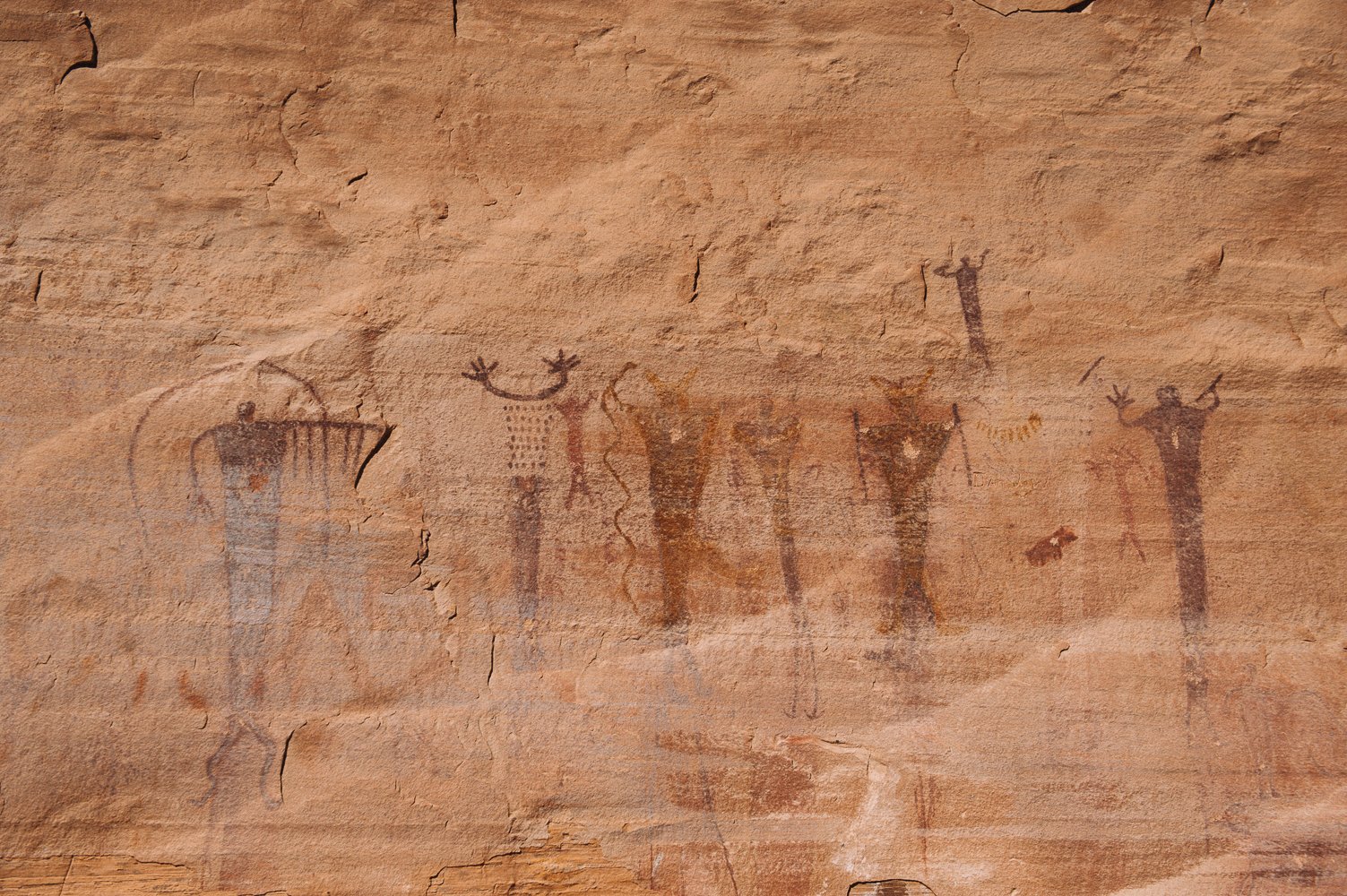
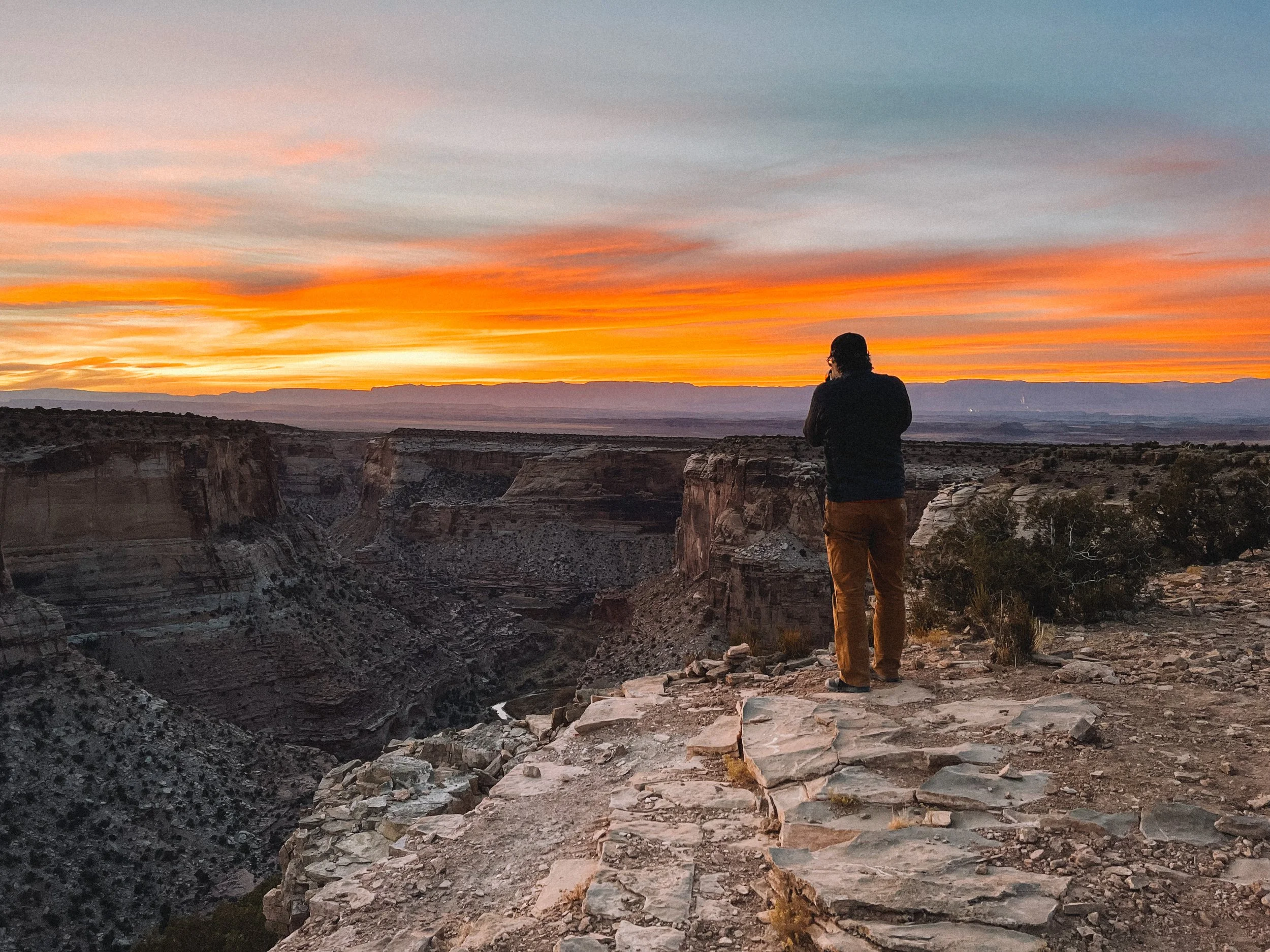
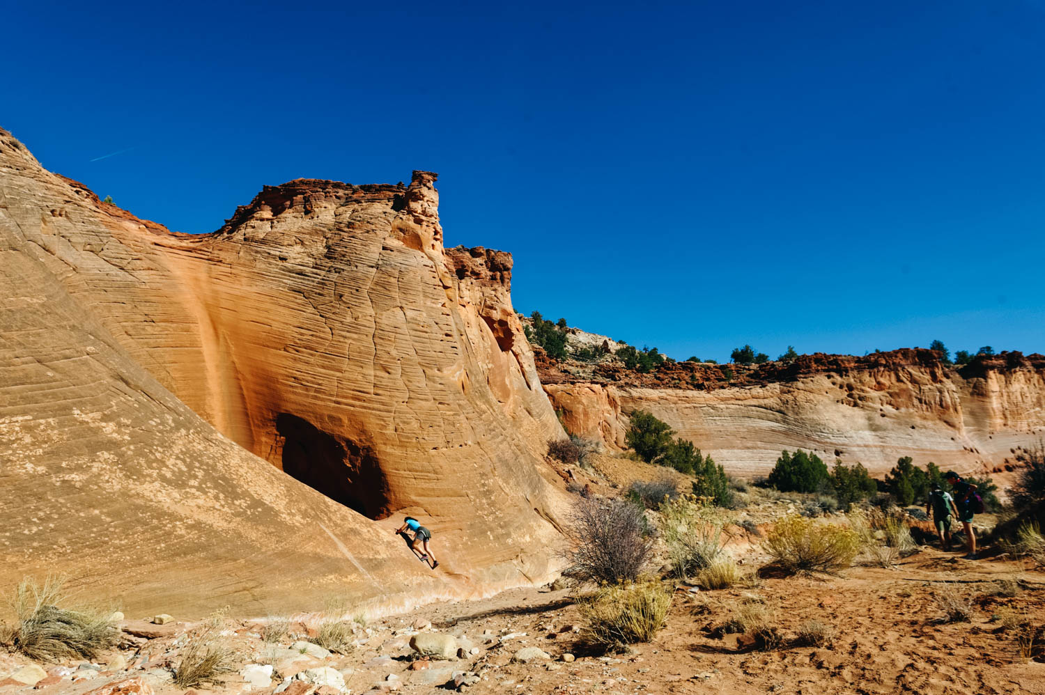
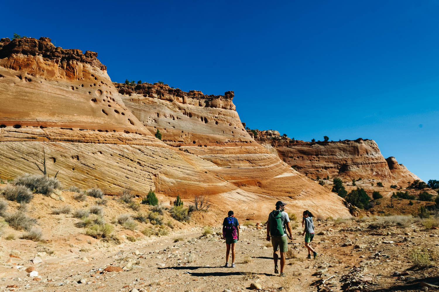
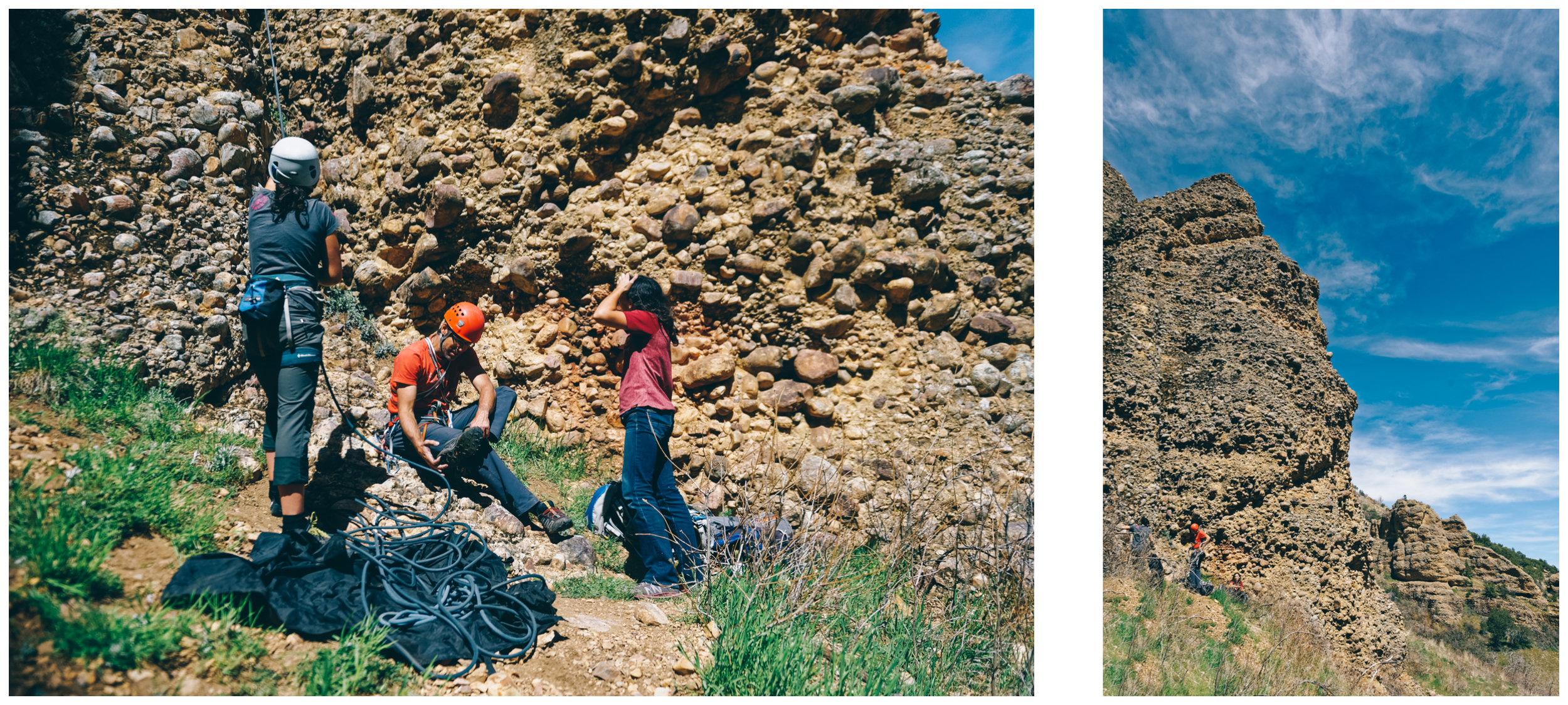
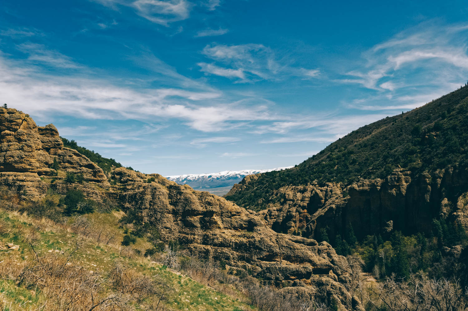
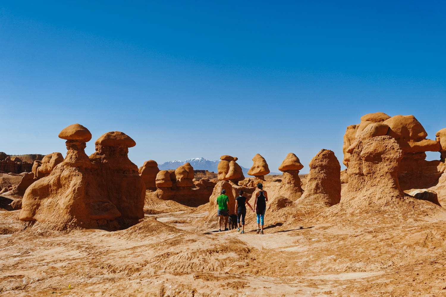
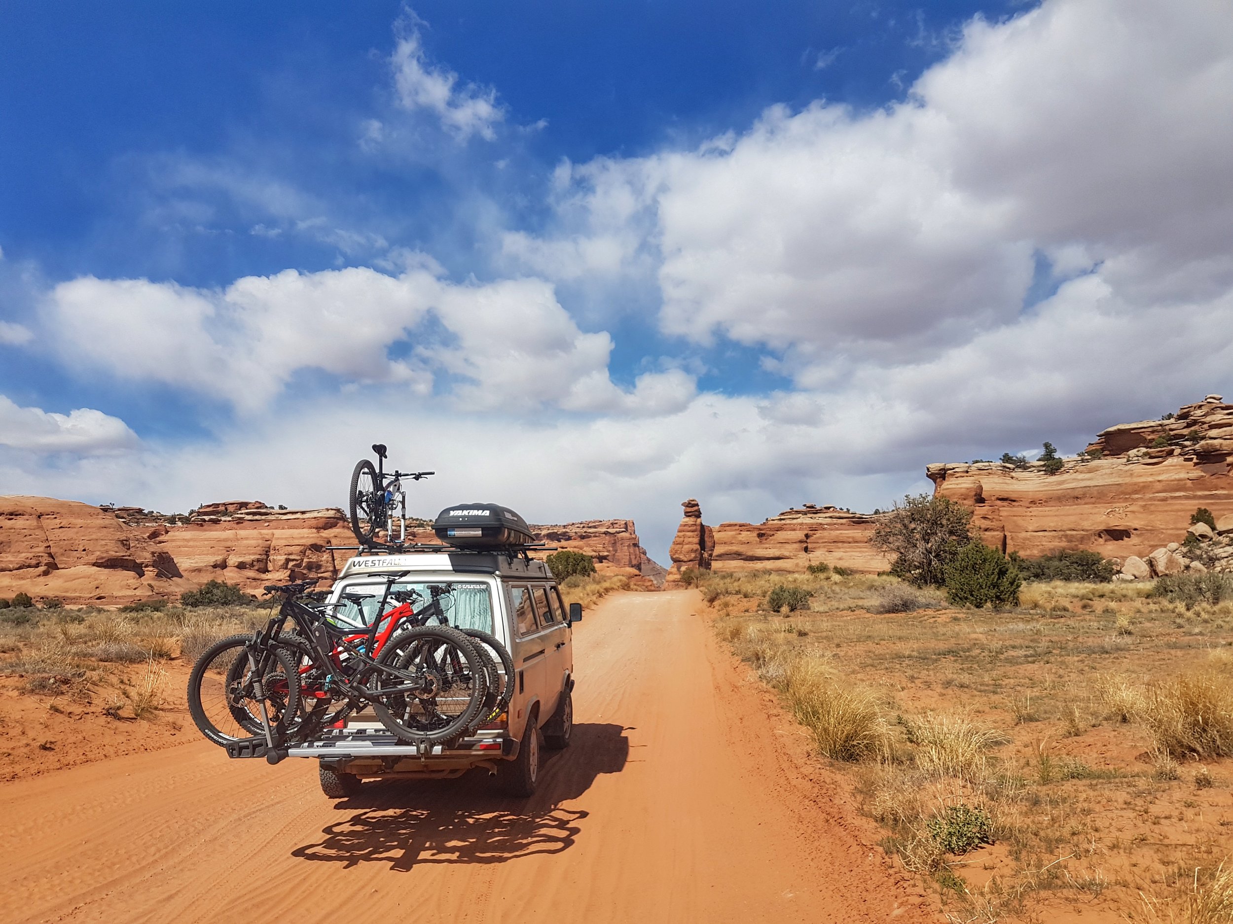
When you tell people that you are going to Moab to ride, almost all of them will talk to you about The Whole Enchilada (28 miles with 7000 feet of downhill, it is an epic whole day adventure for strong, skilled riders only - with a shuttle - and the top part is only open in the summer, the last part is the famous Porcupine Rim that can also be ridden separately). Or they talk about Slickrock (10.6 miles of pure slickrock goodness, black, pretty steep and very physical). Of course, these trails are epic in their own ways, but there is so much more in Moab! First, install the Trailforks app on your phone (MTB project is missing a part of the Klonzo trail system), it will come in very handy to navigate your way through all the trail systems around town. Then, come find a spot on Willow Spring Road to camp (14 day BLM, free) and enjoy the view! There are tons of pull-outs (some close to the roads, others further away (we suggest you find a far away one since there is quite a bit of trafic on that dirt road (especially on Fri-Sat-Sun) and it can get pretty dusty (and loud since half the crowd is here to do some four-wheeling on some other trails). 

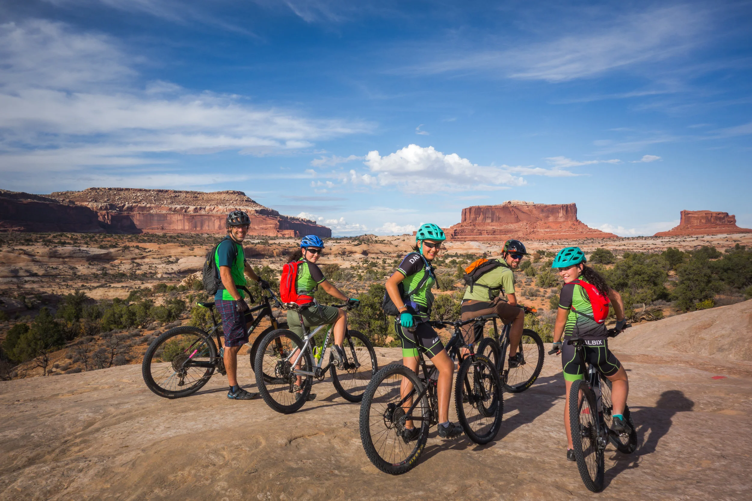
After 3 times visiting Moab for a few weeks, here's what we can tell you about our favorite trails (by trail systems):

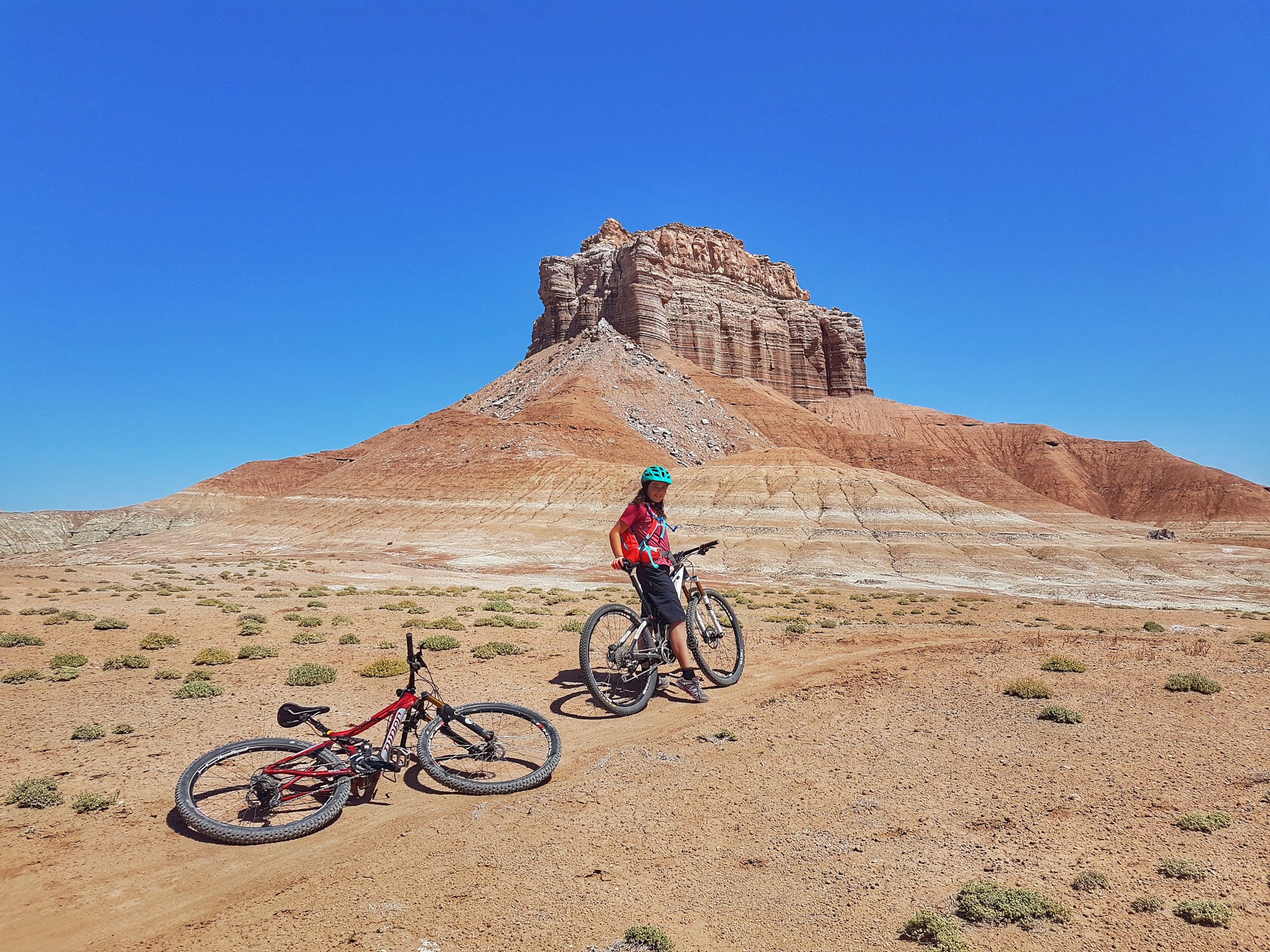
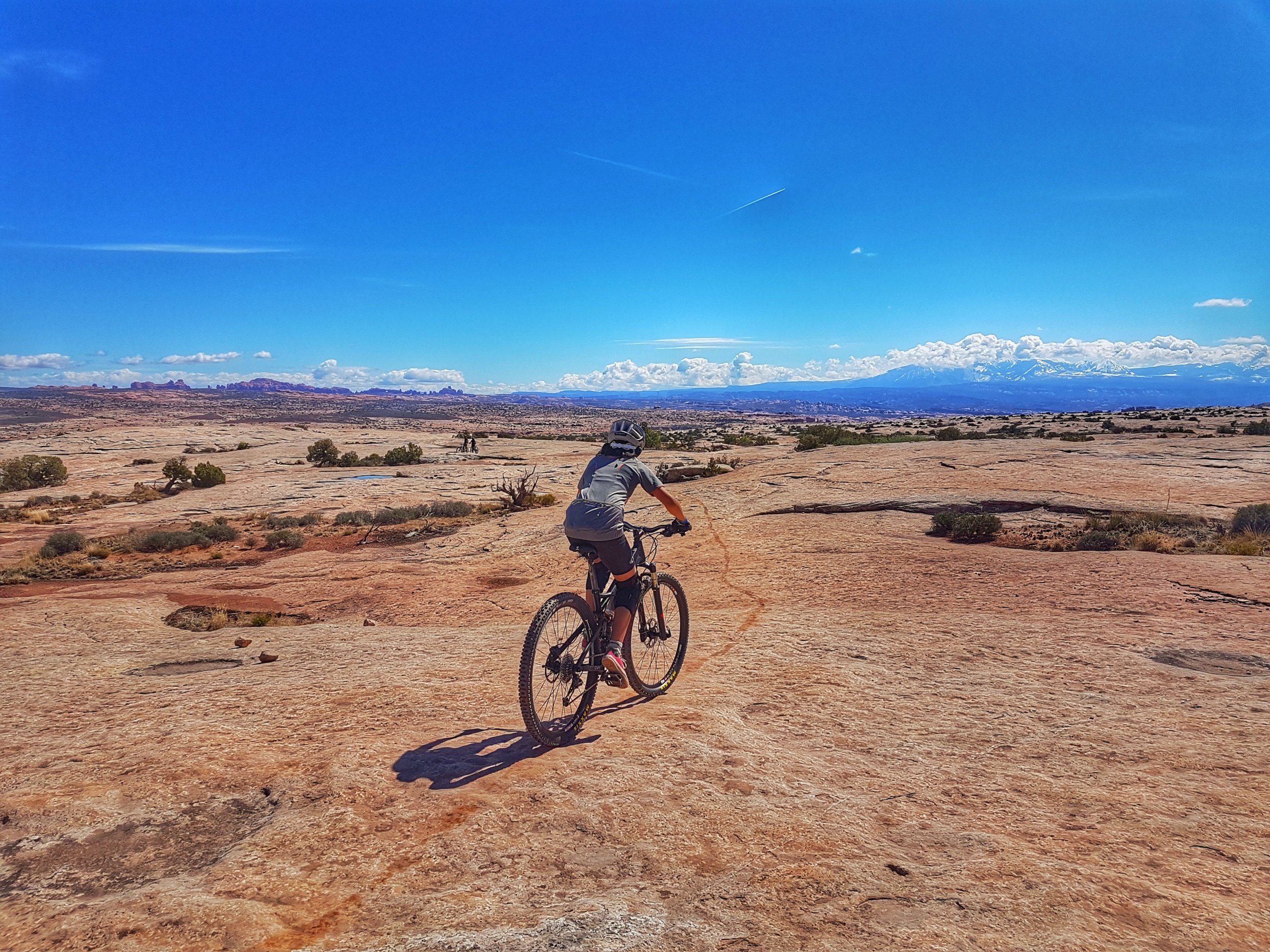
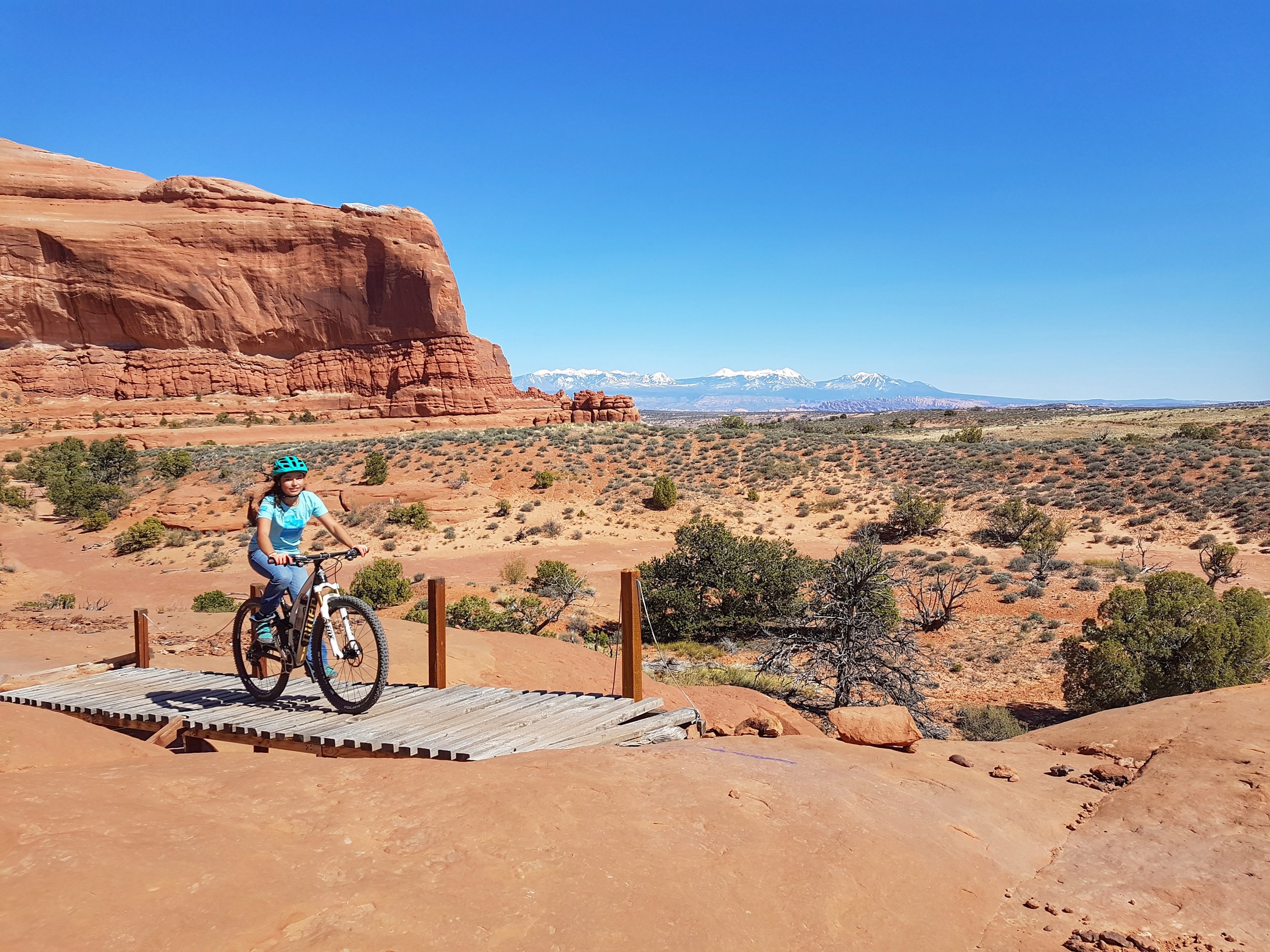
Klonzo (sometimes included in the Sovereign network) : This is a newish trail system with some great trails.
Klonzo North: Start with Dunestone (super fun combo of slickrock and dirt) and up Secret Passage, Vertigo (some black sections), Wahoo and down Borderline (all blue except for parts of Vertigo. We heard Gravitron is a fun black, but didn't get to do it. 

Klonzo South: Lots of easy fun ones for beginners (Hot Dog + Midway and the whole Carousel area for some slickrock introduction), as well as some good blue ones (Roller Coaster, The Edge, Zoltar) and a great black one (Houdini) that is mostly slickrock with not much elevation.

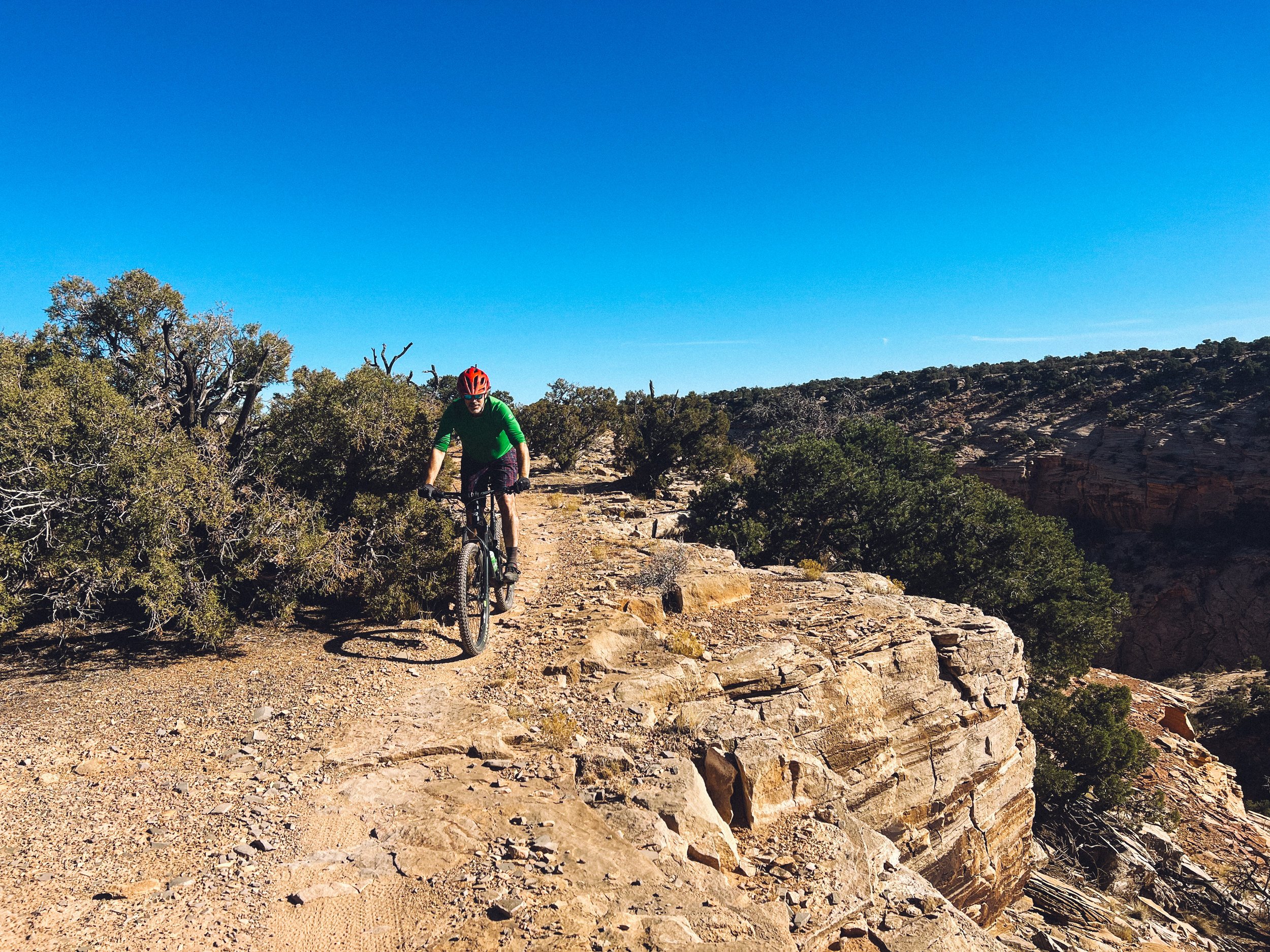
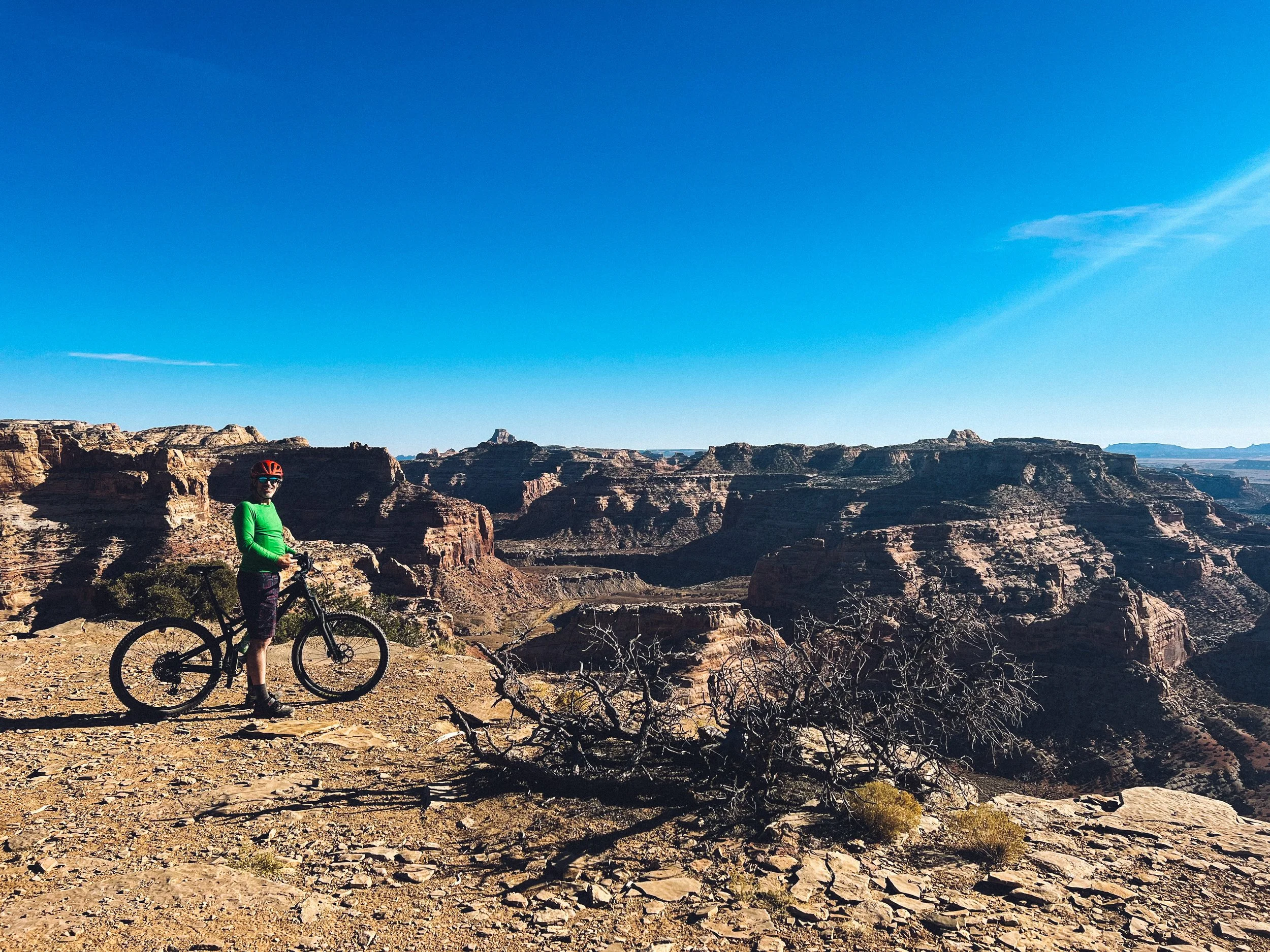
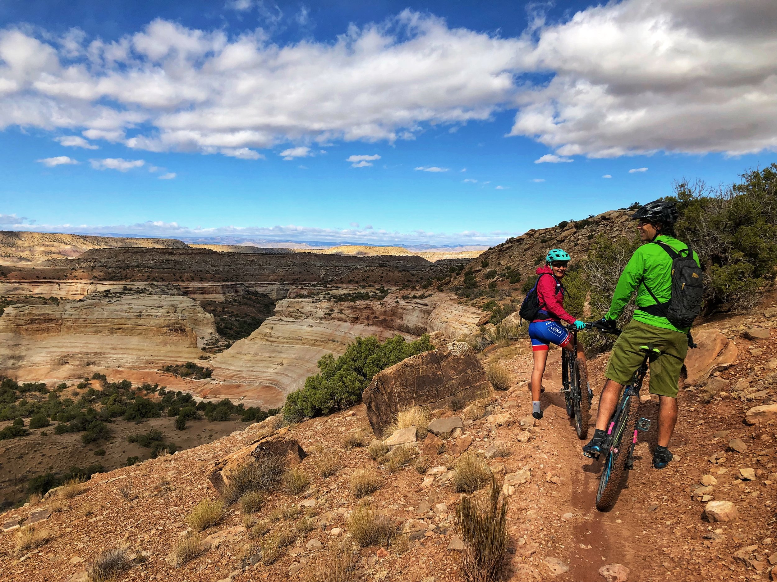
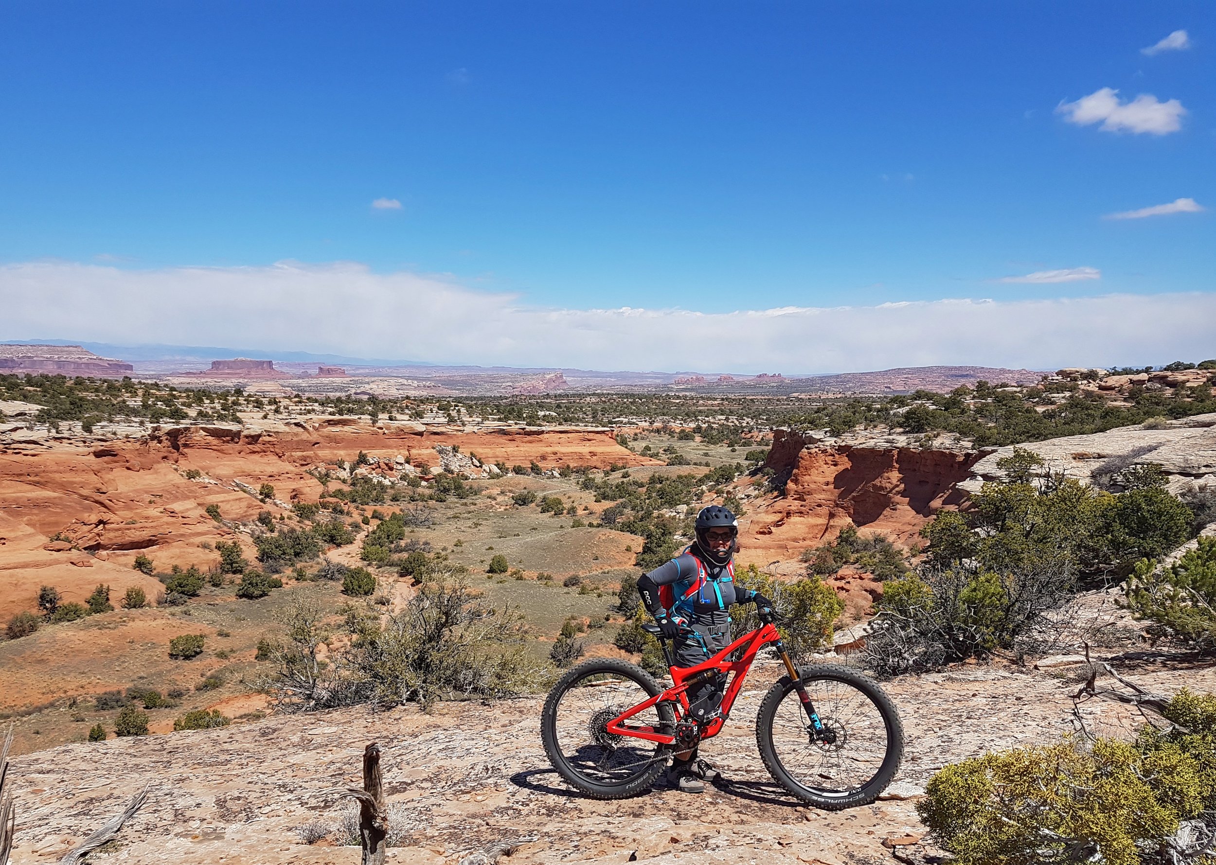
Horsethief: This is a new sector (also sometimes included or confused with Navajo Rocks). Combine the Mustang Loop (blue) with Wildcat (blue), Hildalgo (blue) and Whirlwind (optional) for a super fun ride. Just know that you go down for a while first and you have to climb back up... Make sure to do Getaway (blue) and Bull Run (black and blue sections, some sections near cliff edges) which is the beginning of Mag 7, a single-track composed of 7 trails that link the upper and lower ends of Gemini Bridges Road and that can be ridden as a point-to-point with a shuttle.

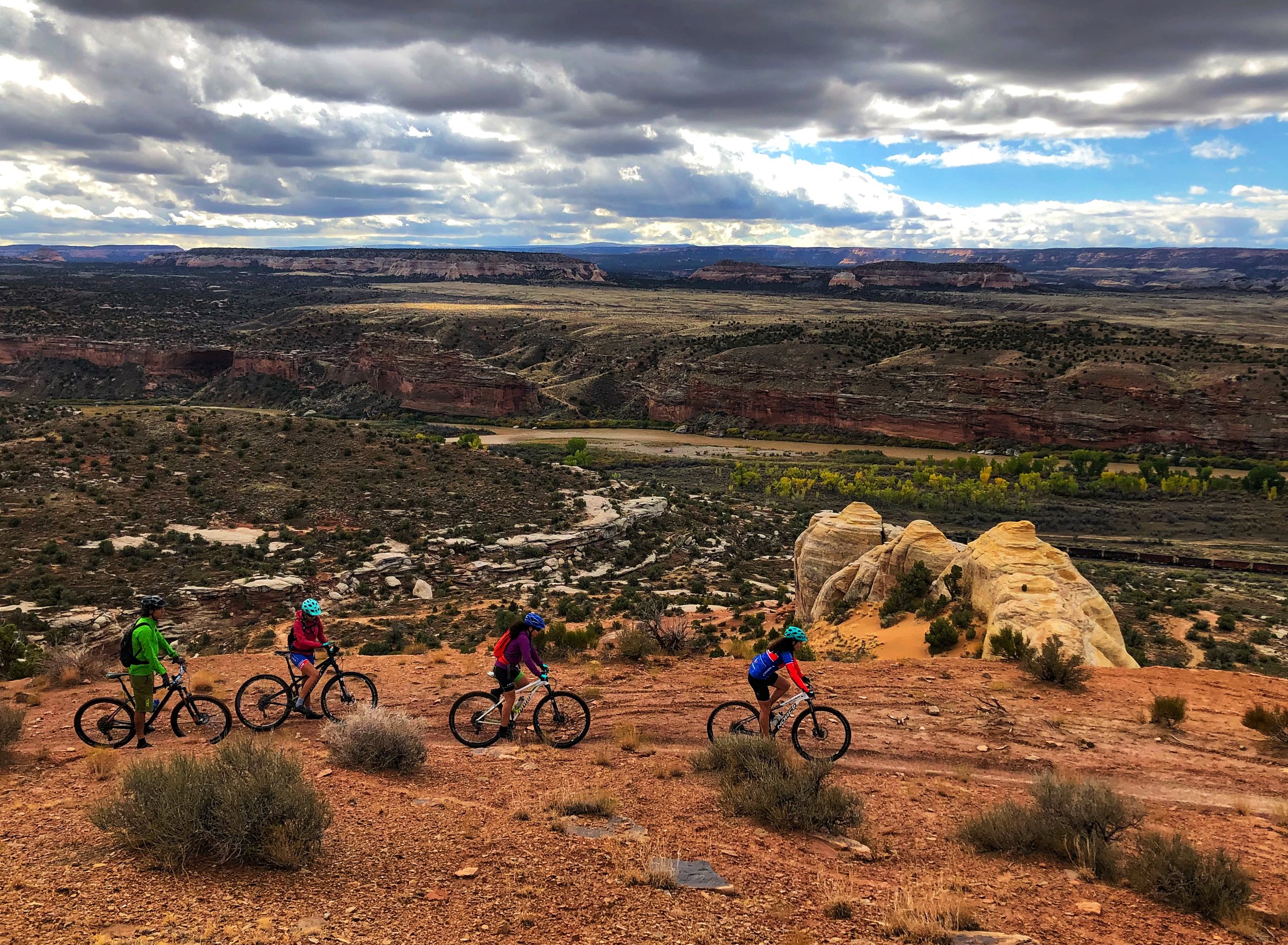
Navajo Rocks: Only fun trails! Do the big blue loop or only half of it (Ramblin and Rocky Tops) and come back for the other half (Big Mesa/Big Lonely)!

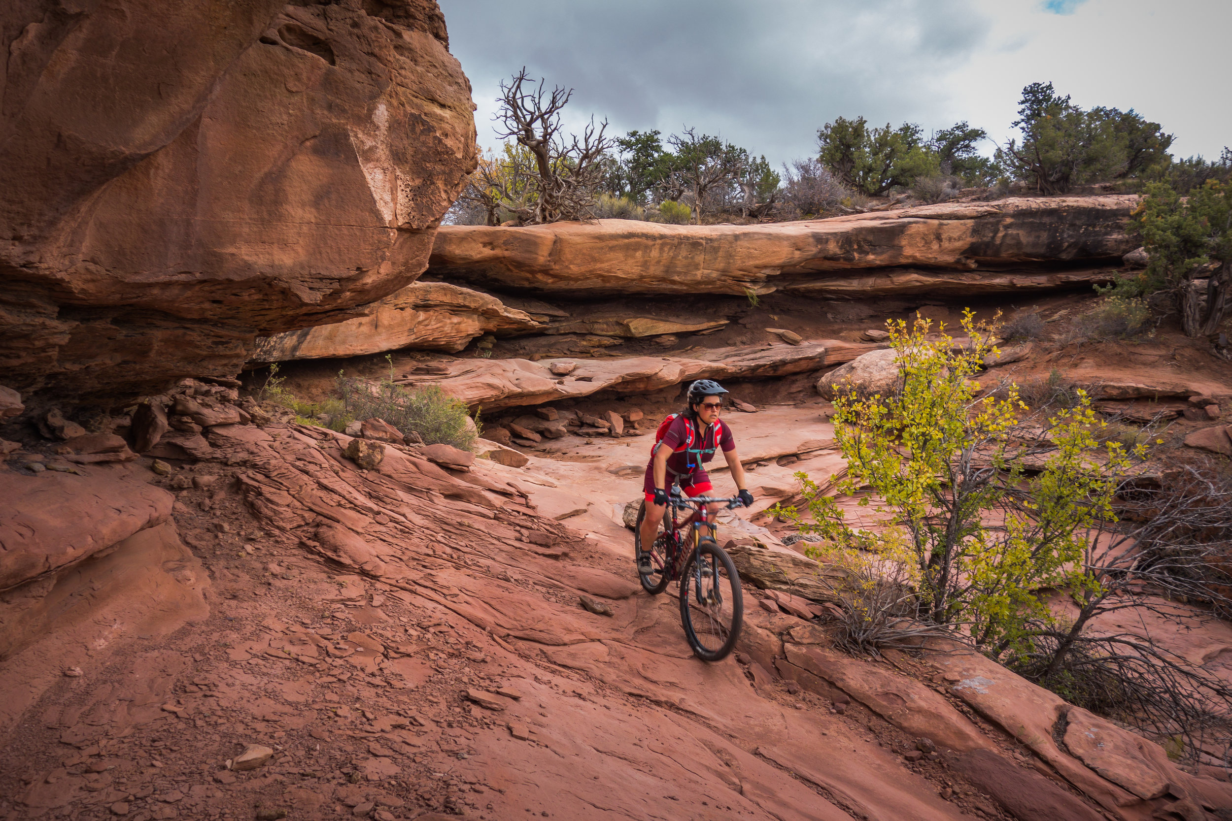
Moab Brands (aka Bar M): Warm  up on EZ and Lazy (super fun greens) and go do North 40 (blue), it's our favorite trail there. Circle-O is supposedly a fun black that we didn't have time to ride. Deadman's Ridge is a much more technical (rocky and bumpy) black that you can skip...

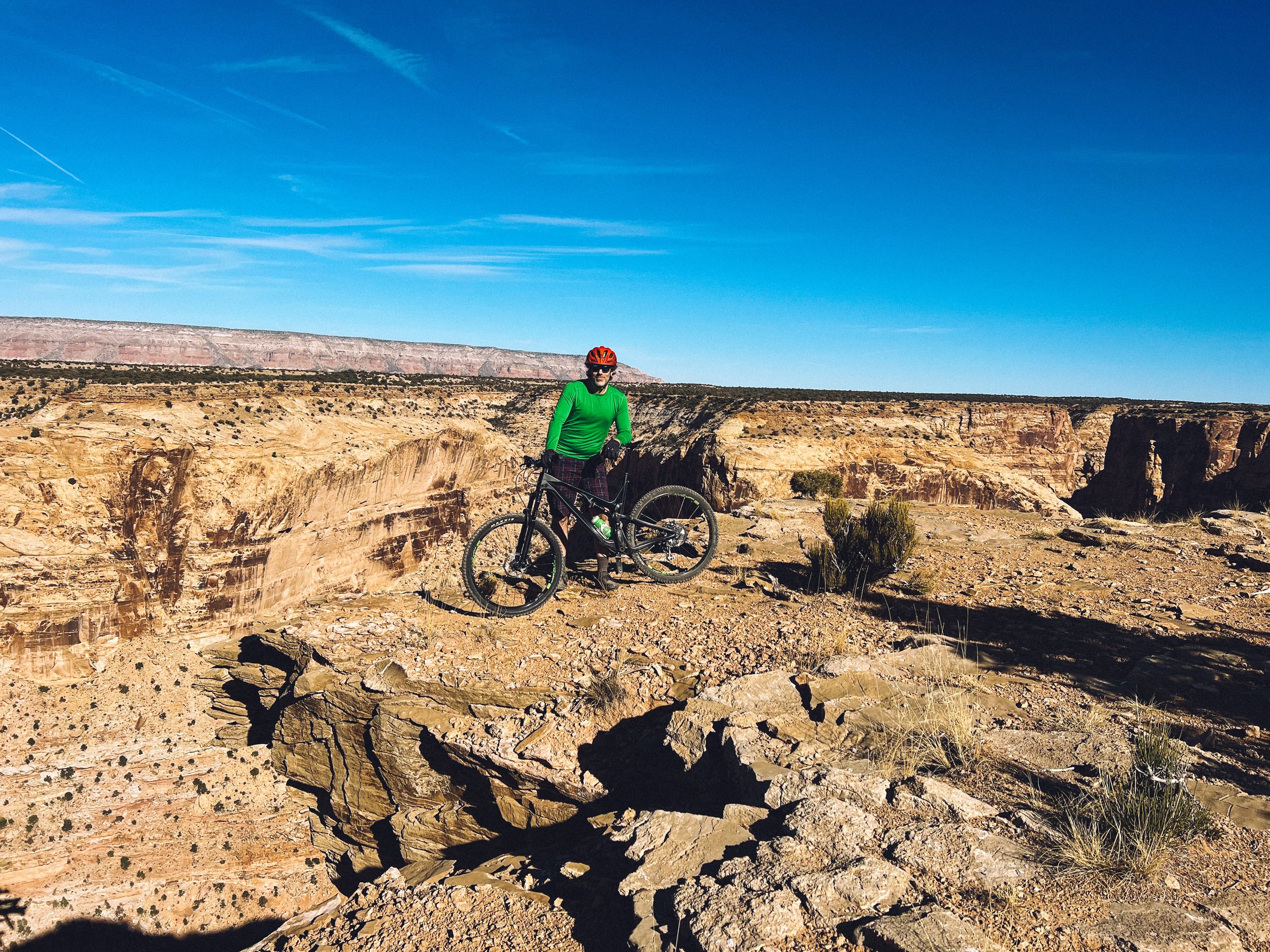
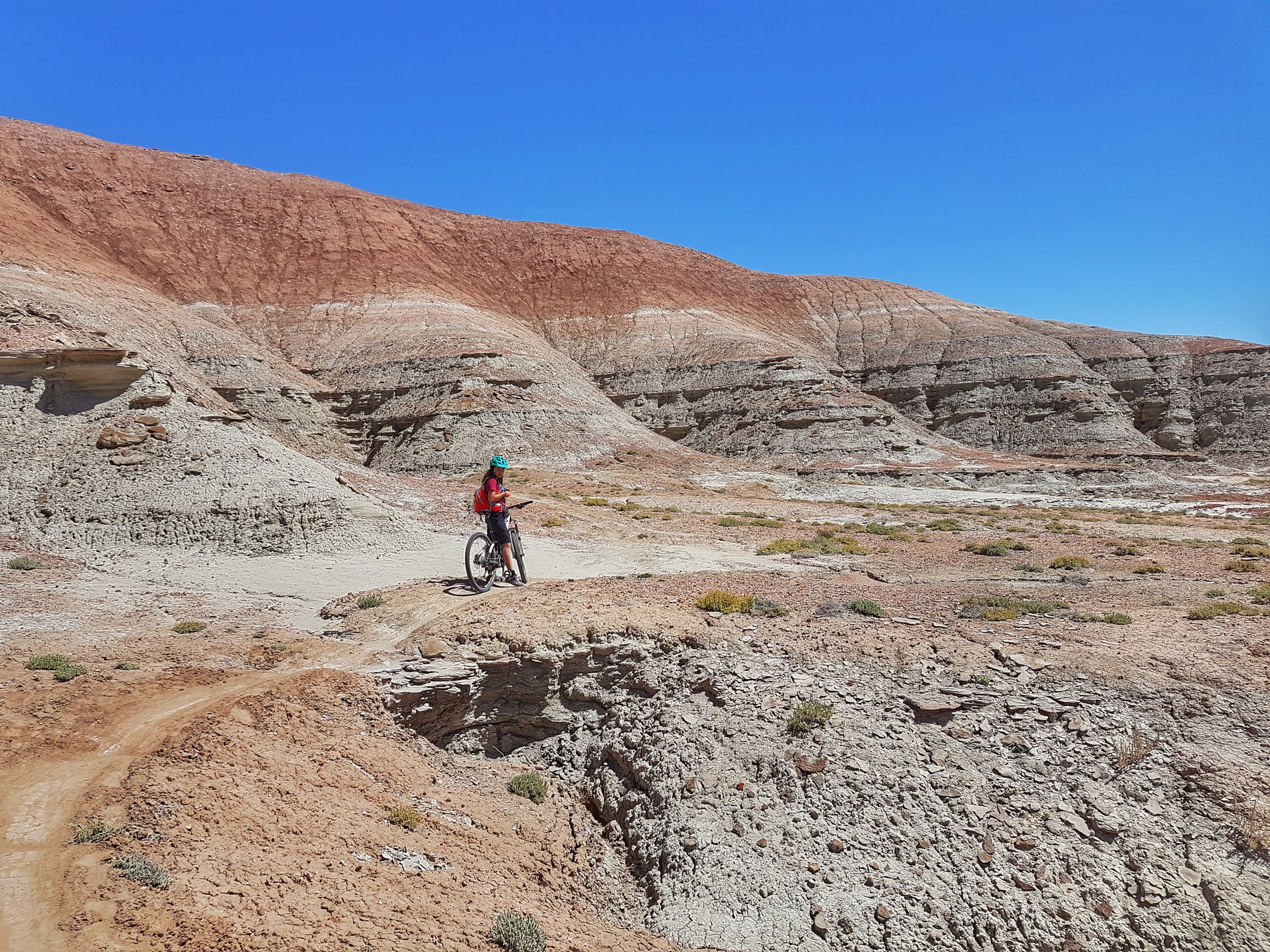
Klondike Bluffs: Don't miss Dino Flow (blue) and Alaska (if you are up for a climb, the view is totally worth it). For Dino Flow, you might want to consider doing a shuttle (leave a car at the Klondike South parking lot and start at the Dino Tracks parking lot). If you're up for a climb and do not want to do a shuttle, you can park at the Dino Tracks parking lot (don't park at the first parking lot by the highway, you'll have to ride a boring 5 miles on a dirt road to reach the trailhead), go up Homer and Alaska (blue) and down Mega steps (black). You'll even find dinosaur tracks along the way! You can then take Dino flow back to the parking lot. If you want to do Dino Flow all the way without a shuttle, park at the Dino Tracks parking lot, ride Dino Flow all the way down and come back up Jurassic, Jasper East and Midline (all green) for an easy uptrack, or take Baby Steps (blue) if you still have some juice left.

This comment about this sector made me giggle: The Klondike Bluffs Trail is perfect for your teenage son who fancies himself a racer, if you are worried he might kill himself on the Moab Slickrock Trail, which is certainly possible (from here).
And a good reminder: On a sad note, the dinosaur tracks in the Klondike Bluffs area are being destroyed by people who, with no skill or education, are trying to make molds of the prints to take home. We have seen everything from plaster of paris to spray foam. Needless to say, if people do not know how to make molds safely (using a plastic wrap to protect the track), then they probably should be shot on site before they mess this area up for the true amateur paleontologists. Leaving plaster or plastic stuck to the inside of a track is only one small step away from trying to crack the tracks out of the sandstone. Please do not stand on or mar the tracks in any way.

Amasa Back: For the very strong/expert riders only, sounds like Captain Ahab is not to be missed!

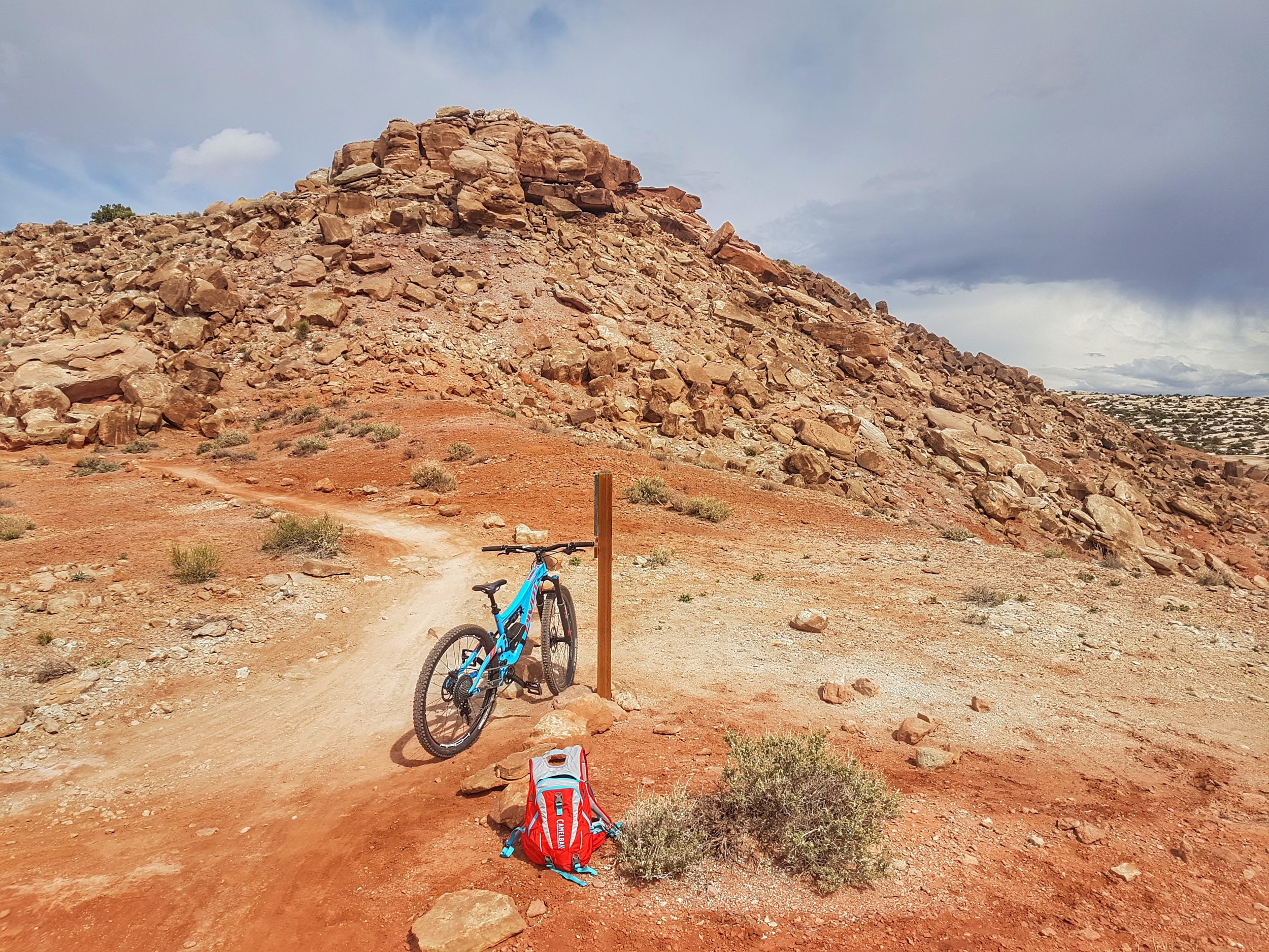
For a fun challenge, try Pipe Dream (black trail) located in town and try to do it without setting a foot down!

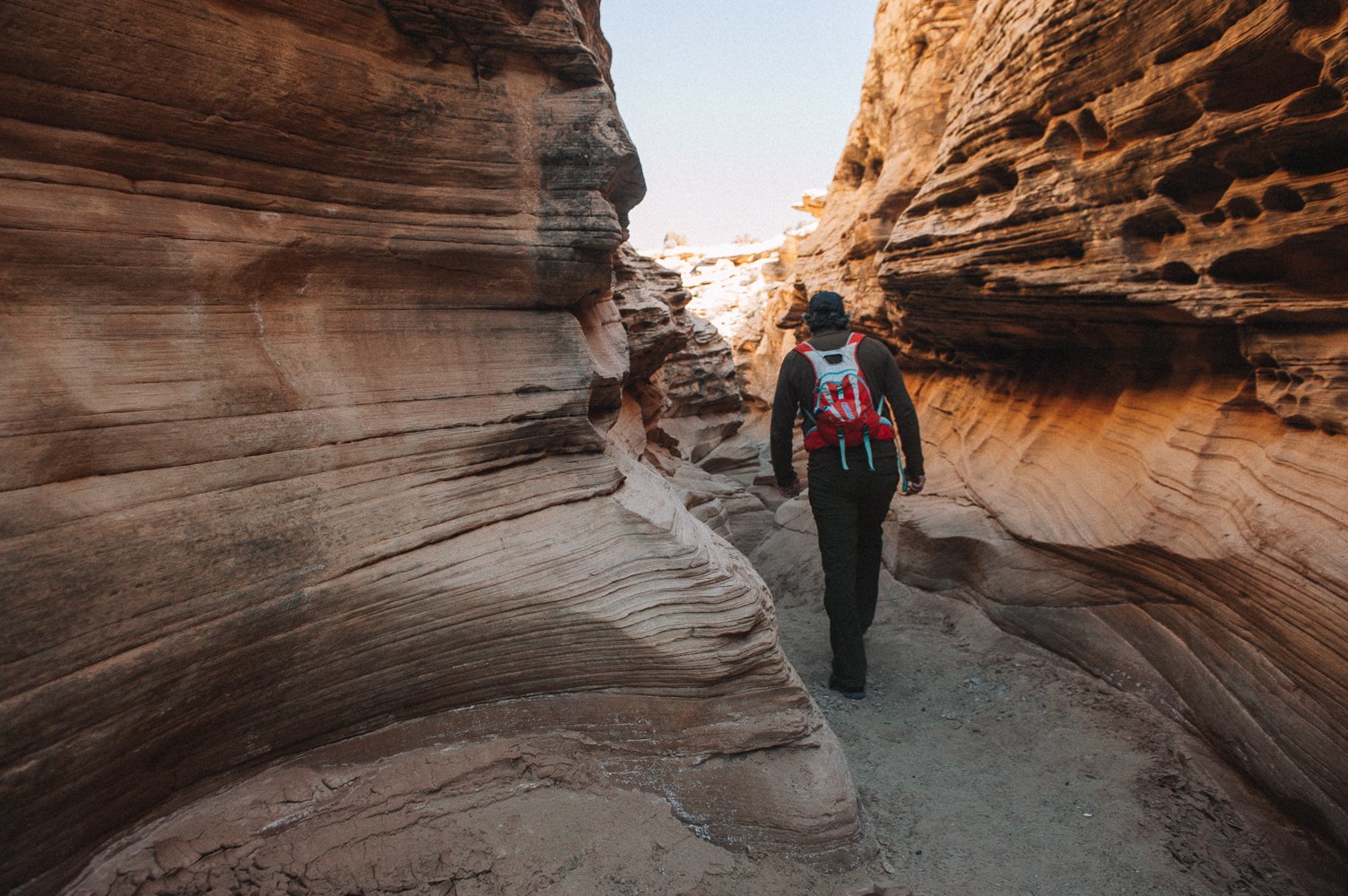
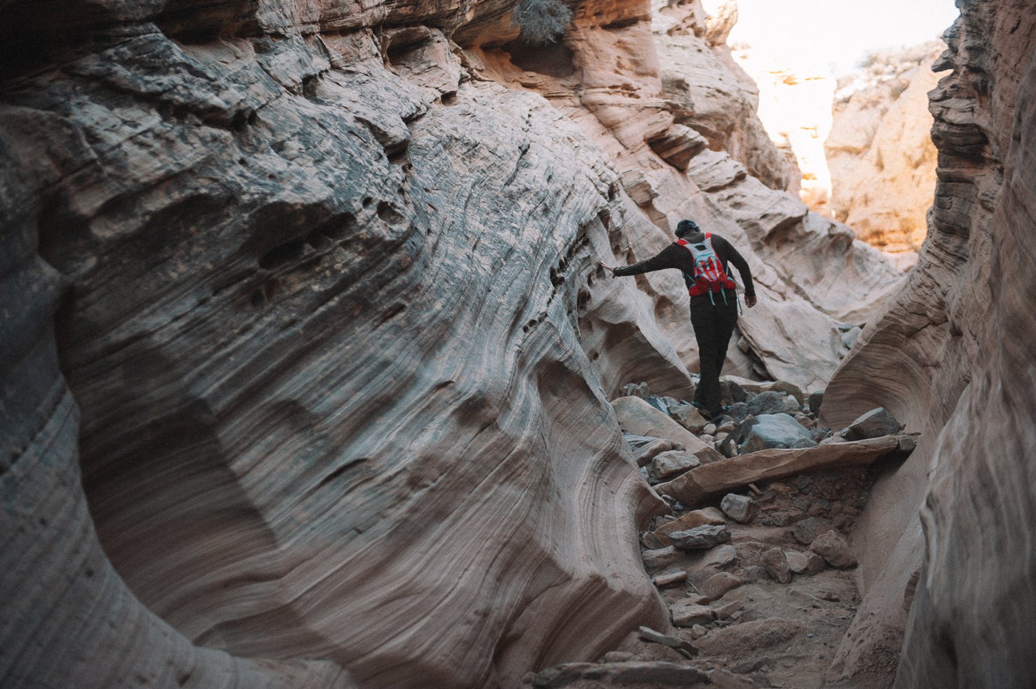
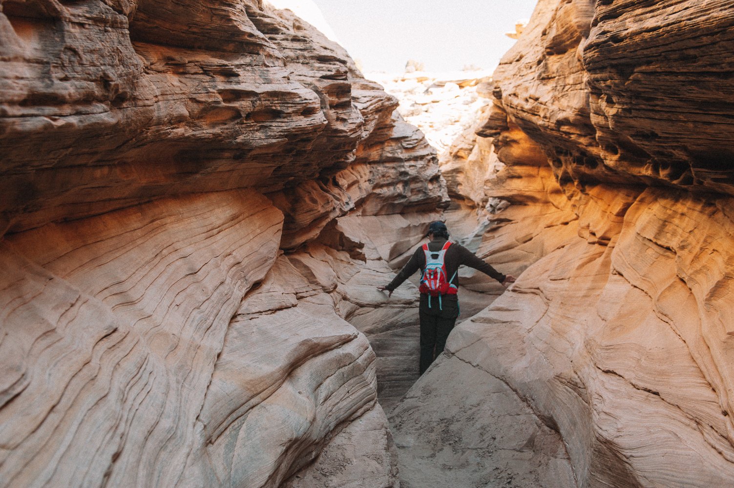
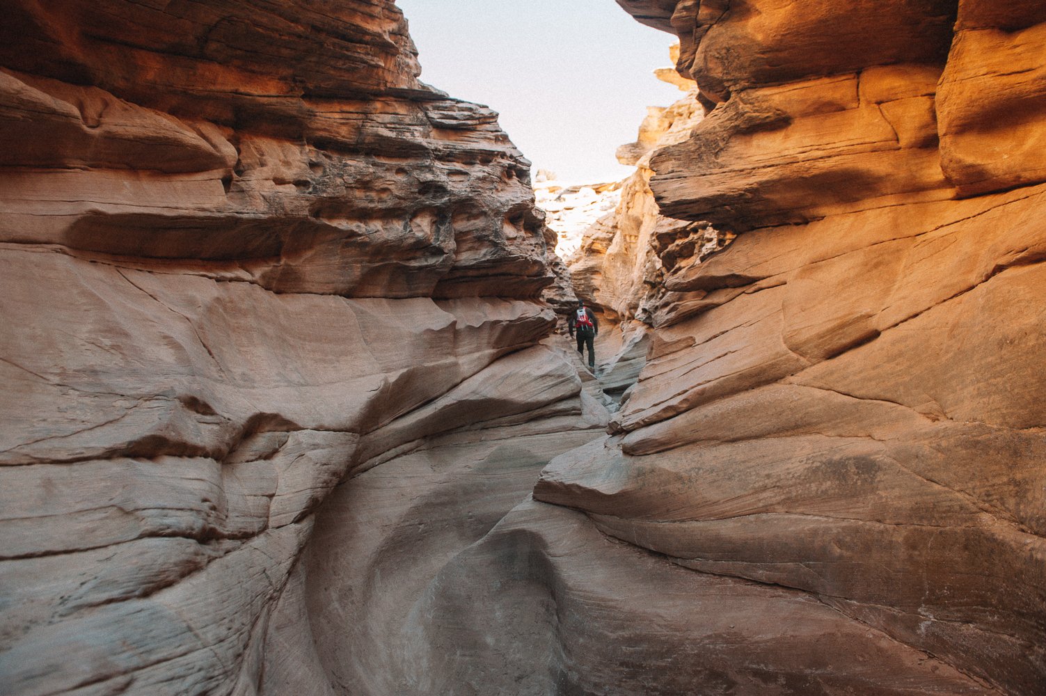
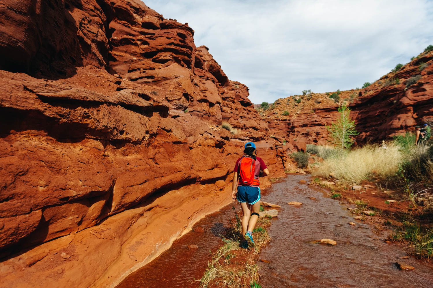
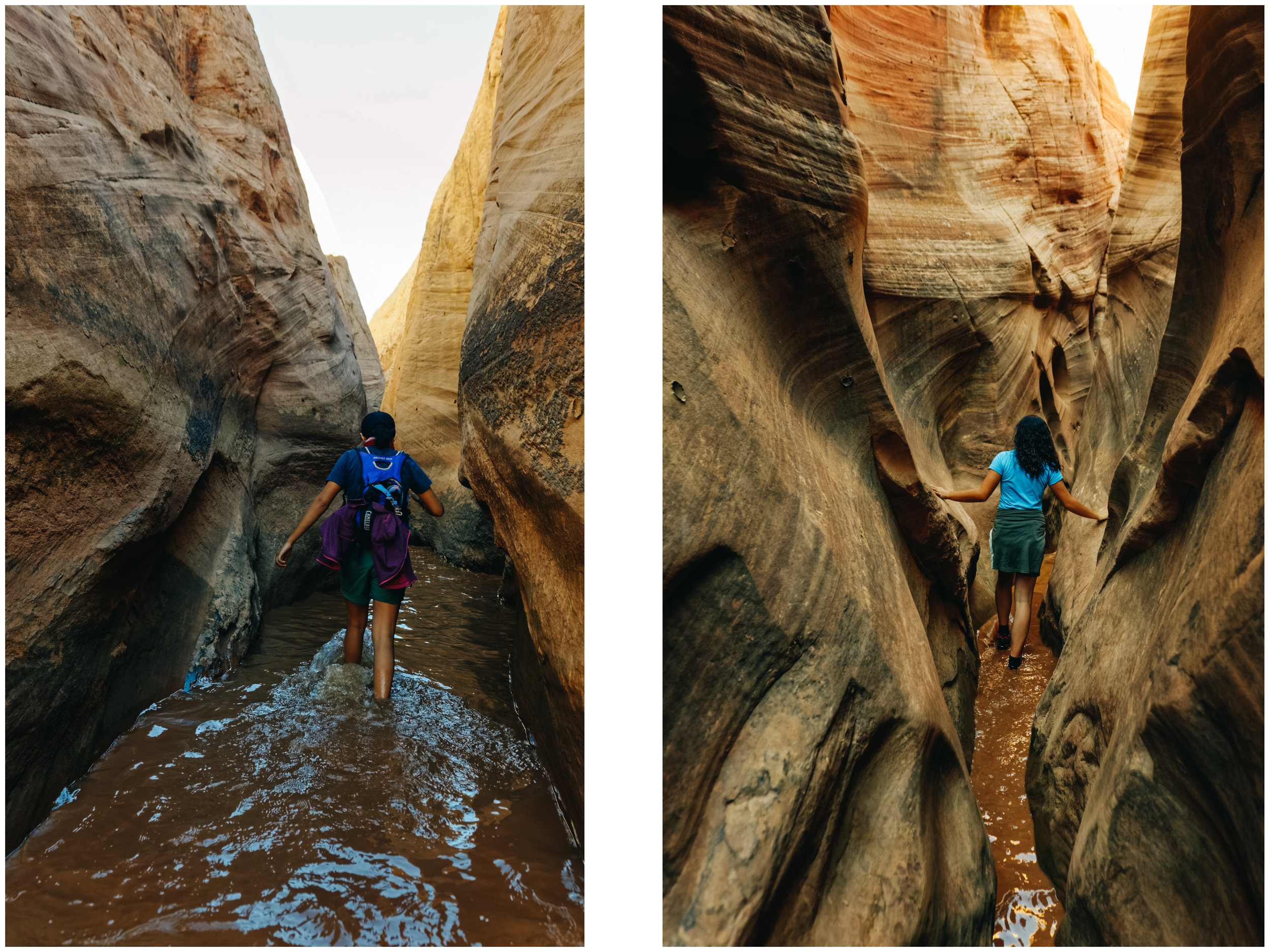
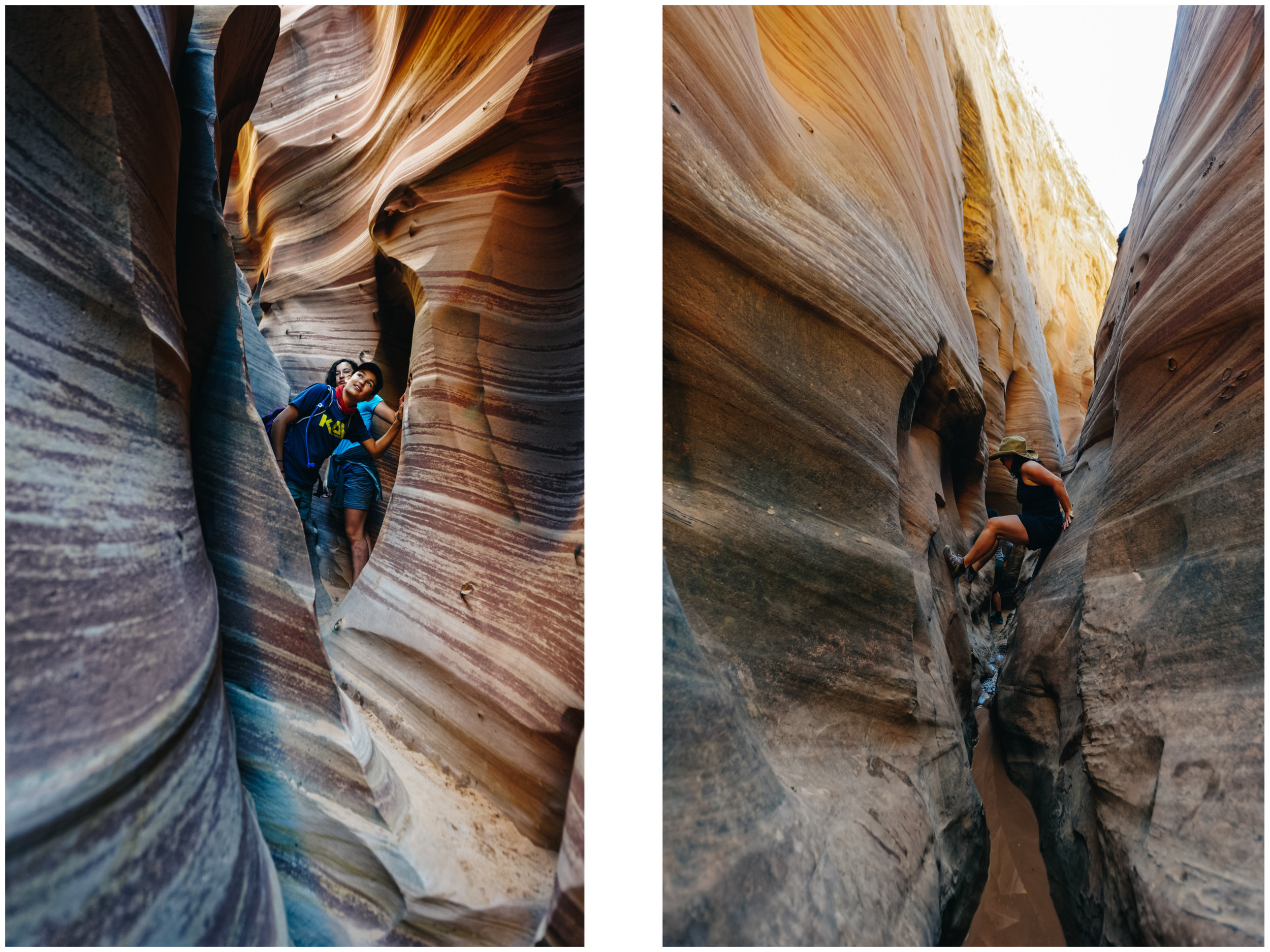
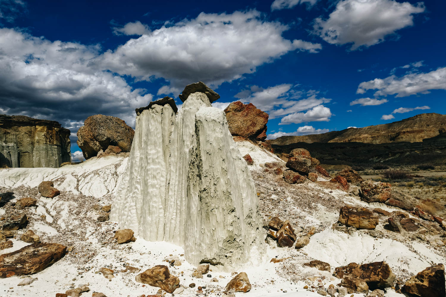
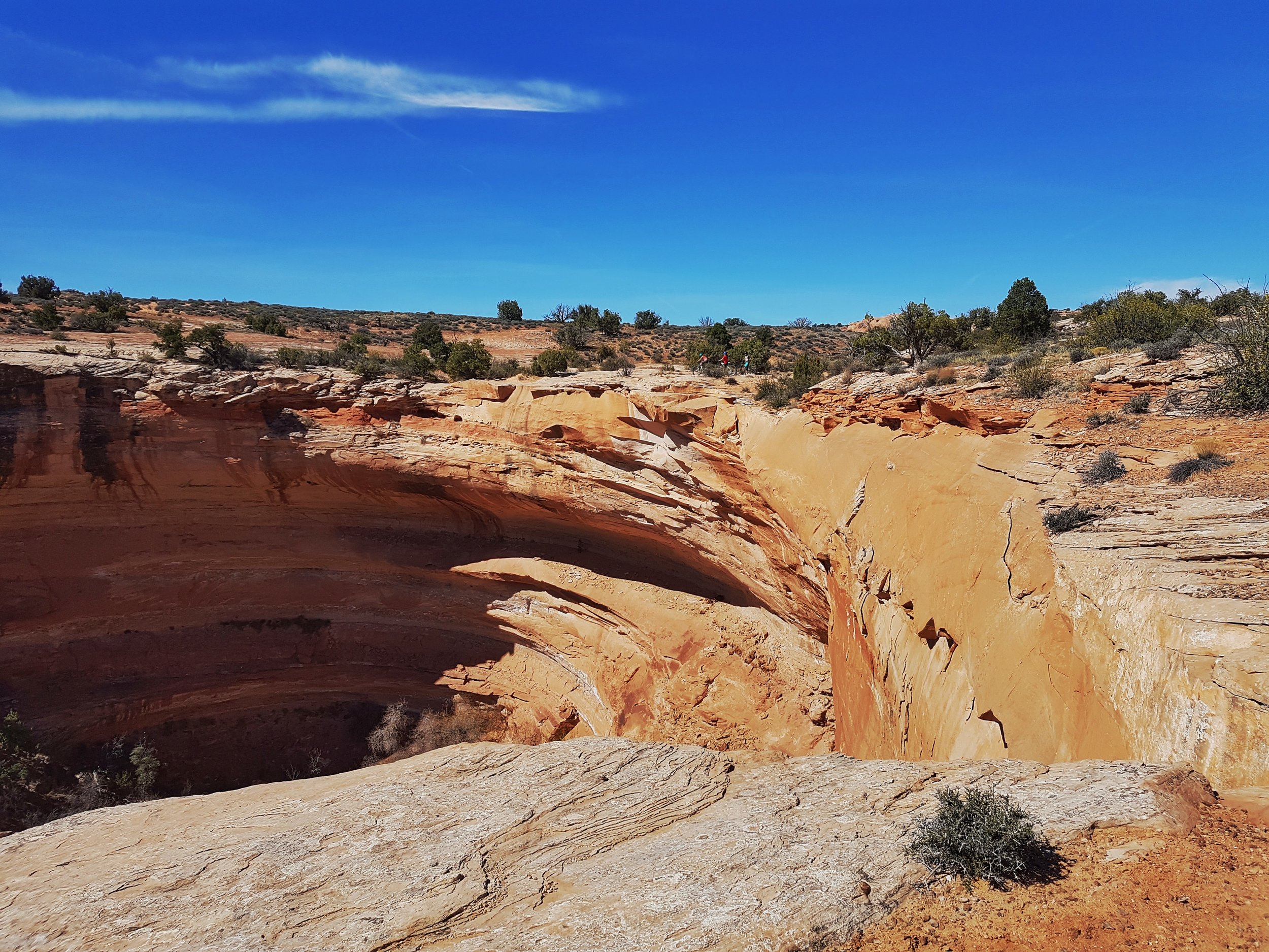
The Bartlett Wash (aka The Bartlett Bowl) seems like a pretty unique slickrock feature! Check out "The Toilet Bowl" here.

Here's a great site that list all the trails in the area.

Moab is a pretty cute little town that is pretty busy during high season (April to October, but busier during Spring and Fall, summers are hot!). You'll never see so many awesome bikes in such a high concentration! There are lots of bike shops in Moab, but we recommend Chili Pepper and The Moab Cyclery

Just know that everything is a little more pricey in Moab. There are lots of rental bikes on sale at the end of the season (November), but most of the regular sizes are so beaten up you really want to get such bikes. Four years ago, I got a really good deal on a XS bike that barely got out during the season. So, unless you are an XS or an XL, I would pass on the rental bike sales. If you need to rent a bike while in Moab, do a weekly rental (around $300/$350), which is much cheaper than daily ($80/$90).

As for food, you best one spot shop is the City Market (where most people shop with muddy legs and bike protections on). We really like the little health food coop called Moonflower. They sell delicious local greens and produce at decent prices. The rest is quite pricey.

Milt's Stop and Eat is an institution in Moab and every night of the week (except Monday when it's closed), you can expect to wait a good 30 min to get your burger, fries and shake, sitting outside among other bleeding and dirty riders. We make a point of eating here at least once when in Moab, but we have to say that it seems to have lost some of its quality. Our friend Karl had to bring back his large fries because there truly was only a handful of fries in there. They apologized and gave him a new order for free. Our fries were quite pale and undercooked and the avocado melt... didn't contain any avocado. The burgers were good, but not as juicy as they used to. Our chocolate-vanilla malt was as good as usual though.

Four our girls' night out, we went to the Spoke and liked their food (gluten-free bun option for their great burgers), good drinks, homemade ice cream and one of the nicest ambiance in town.

The boys went to the Atomic Loung/Moab Burger and found the food really good (great fries, homemade bacon, delicious burgers), but the atmosphere kind of so-so.

Our friends hit the Moab Brewery and didn't think much of it. The food is average and the beer is well, Utah beer. So if you like 4% beer, go for it, otherwise, forget it.

Grab and go: Try the Quesadilla Mobila. You can't miss this yellow truck. A bit pricey (like everything else in Moab), but it hits the spot.

Coffee. Try the Eklecticafé, nice ambiance, good coffee, vegan and gluten-free options. For a grab and go delicious coffee (or beans $13/lb), hit Moab Coffee Roaster, by the post office and almost in front of the health food coop Moonflower.

As for camping, there's plenty of options. There are a few big and crowded RV park in town, but the largest and most common place to camp is up at Sand Flats Recreation Area, a 10-minute drive up above town. Sand Flats road is the home of the Slickrock trail, and Porcupine Rim trail. There are over 120 campsites up and down the dirt road that runs through the recreation area. Campsites have pit toilets but no water. There's a fee to use the recreation area, and you pay at an entrance gate as you drive into the area. The Internet cell connexion is not great there.

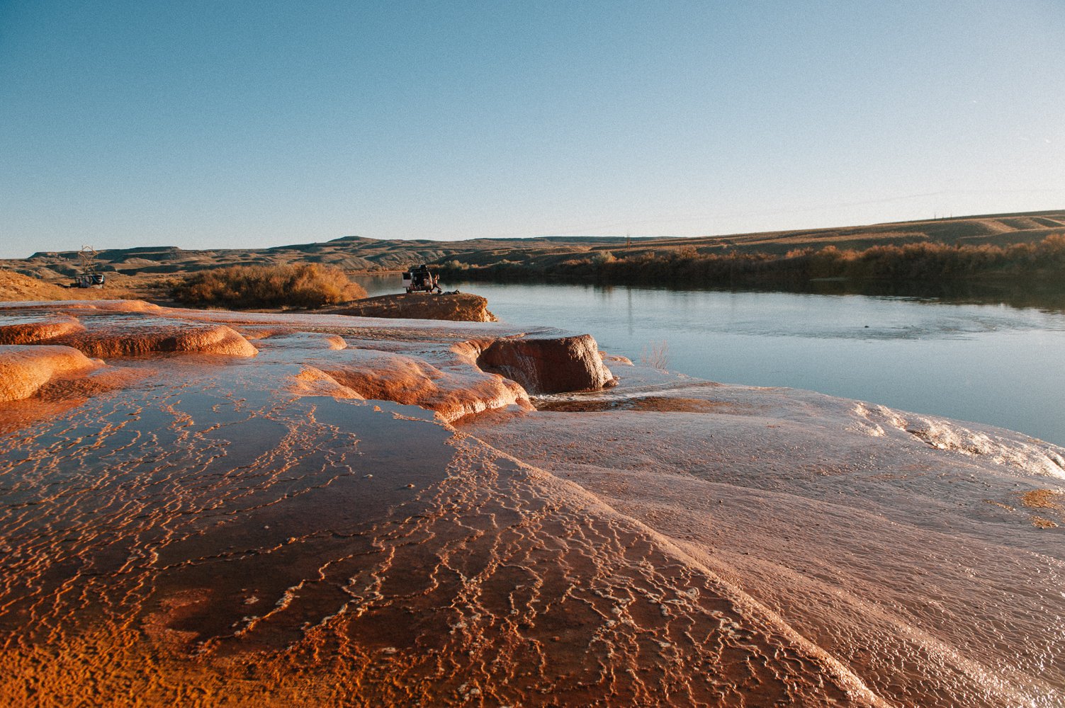
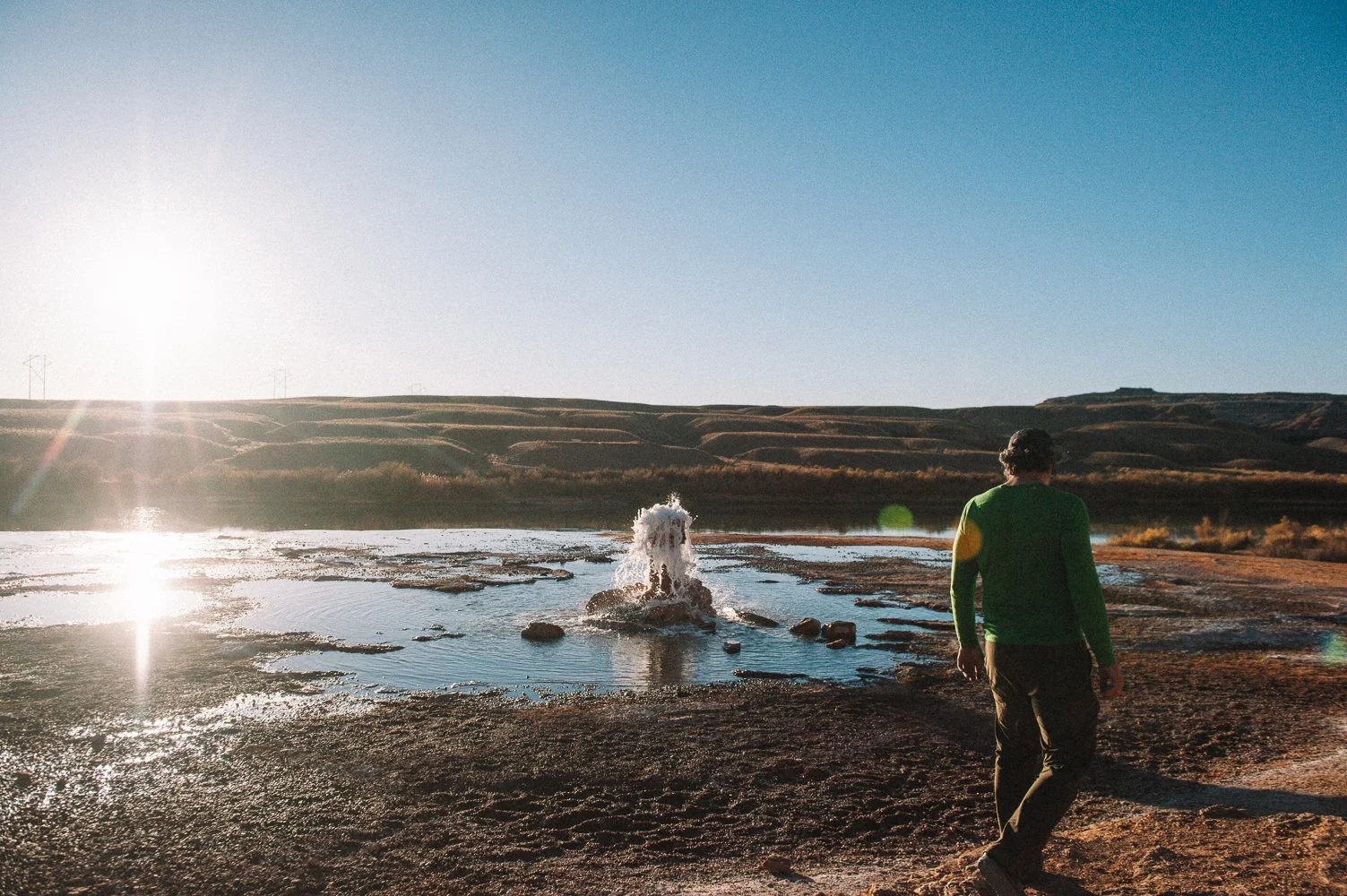
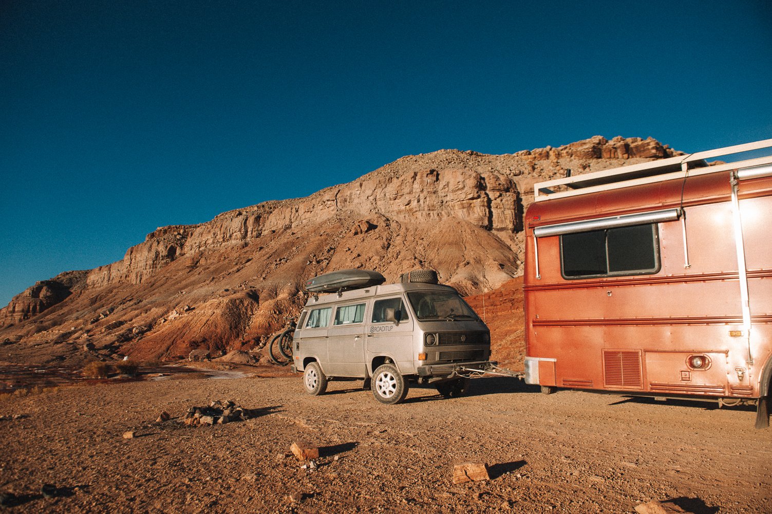
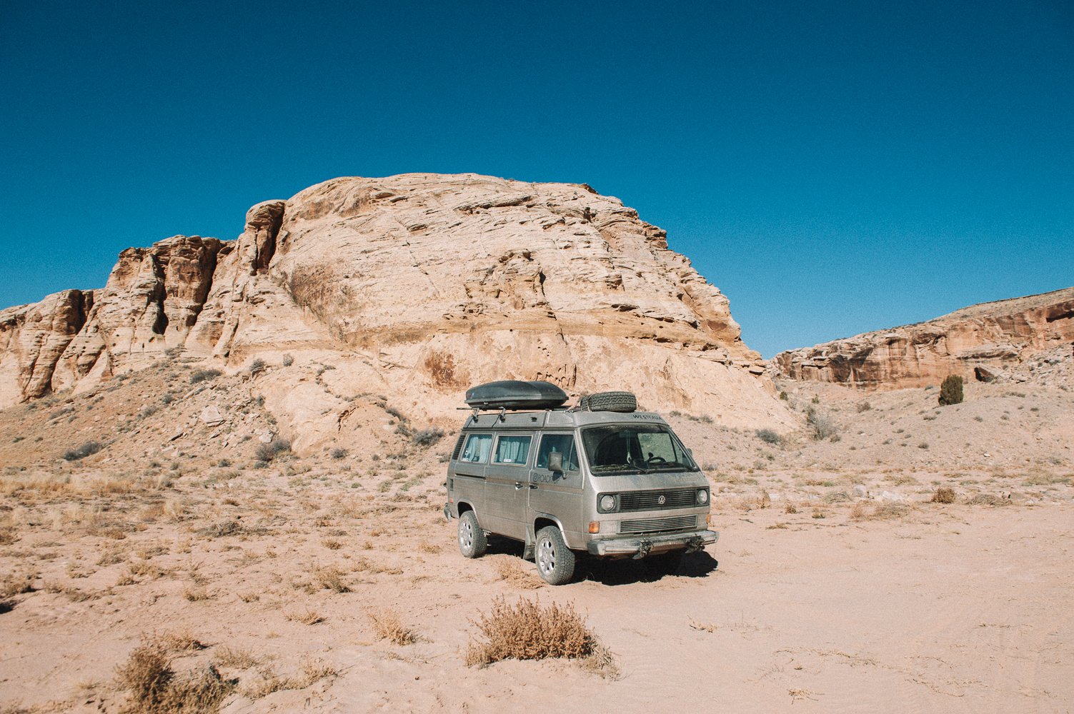
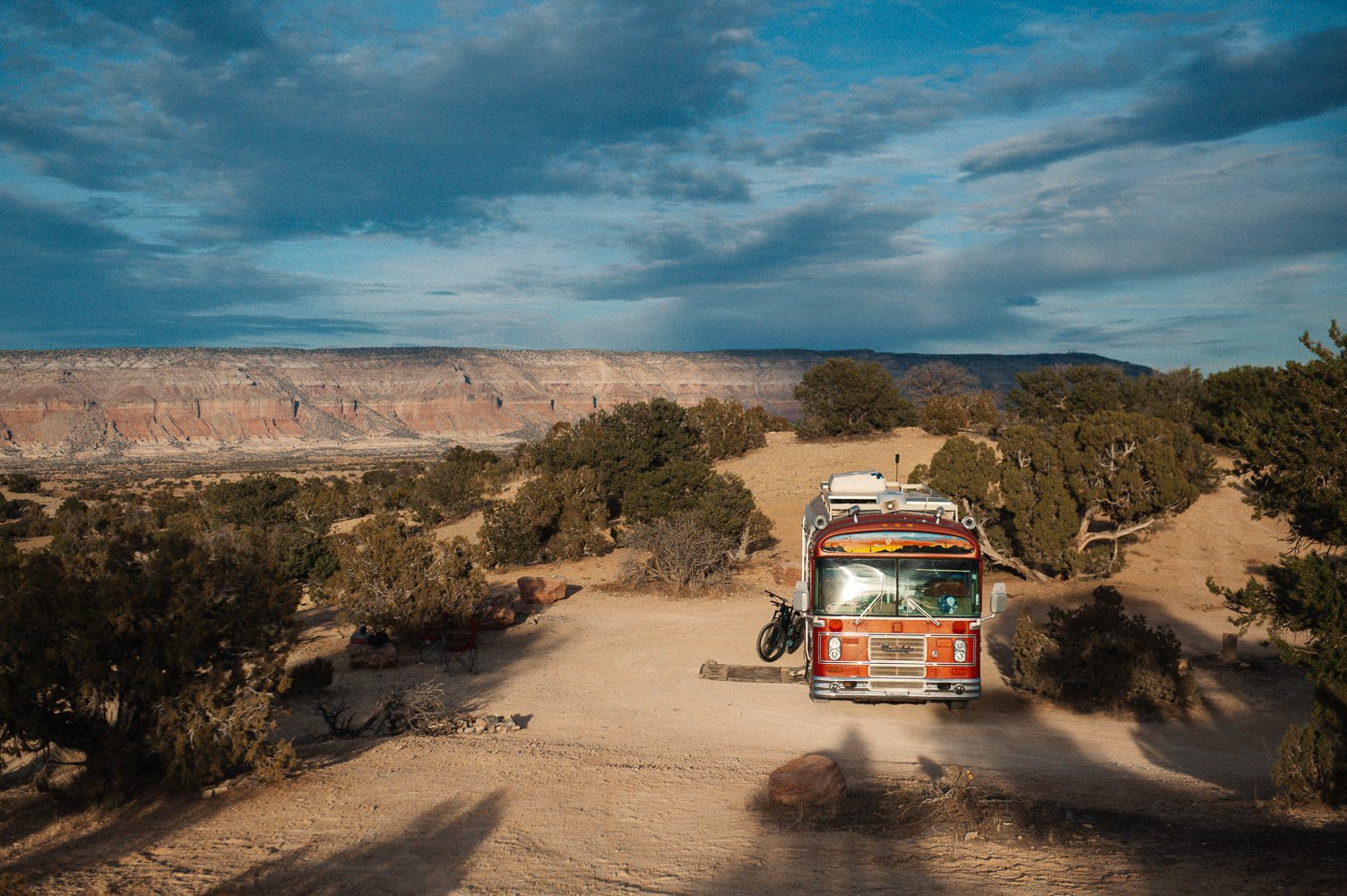
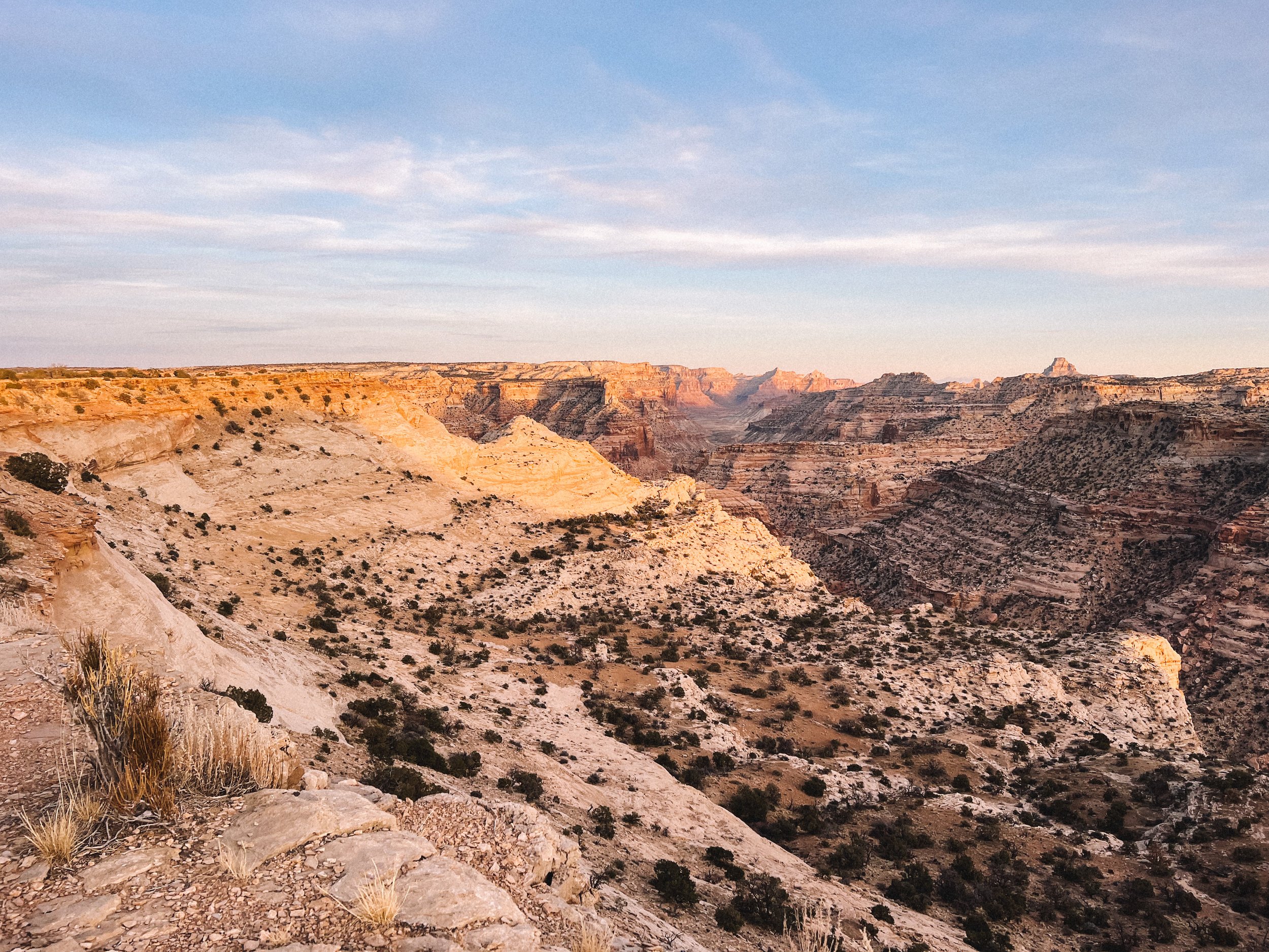
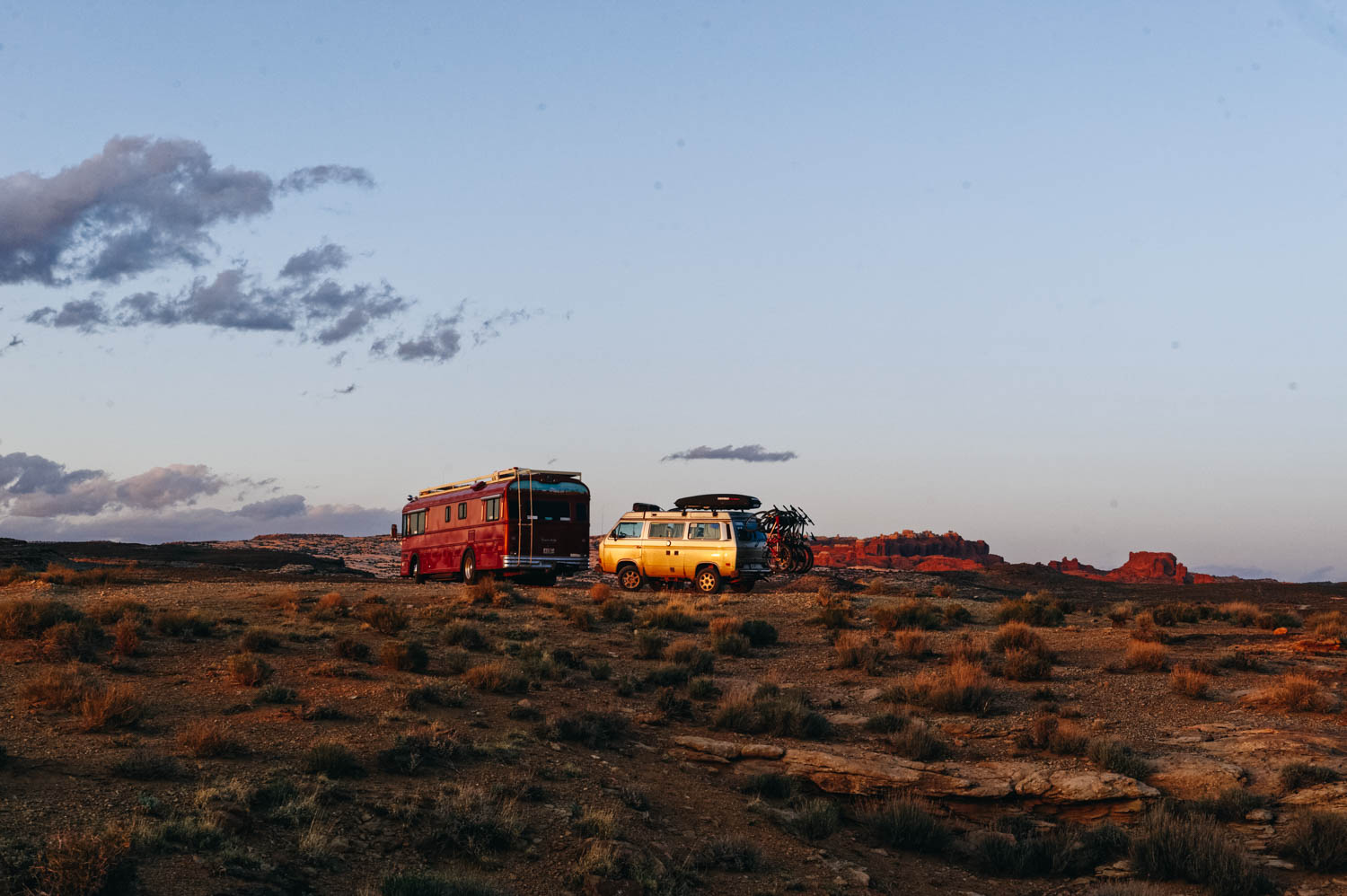
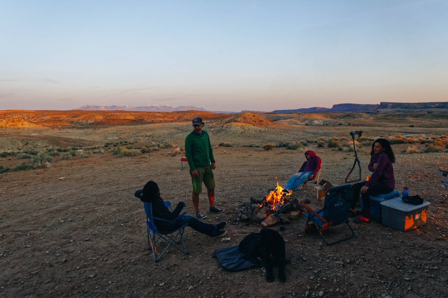
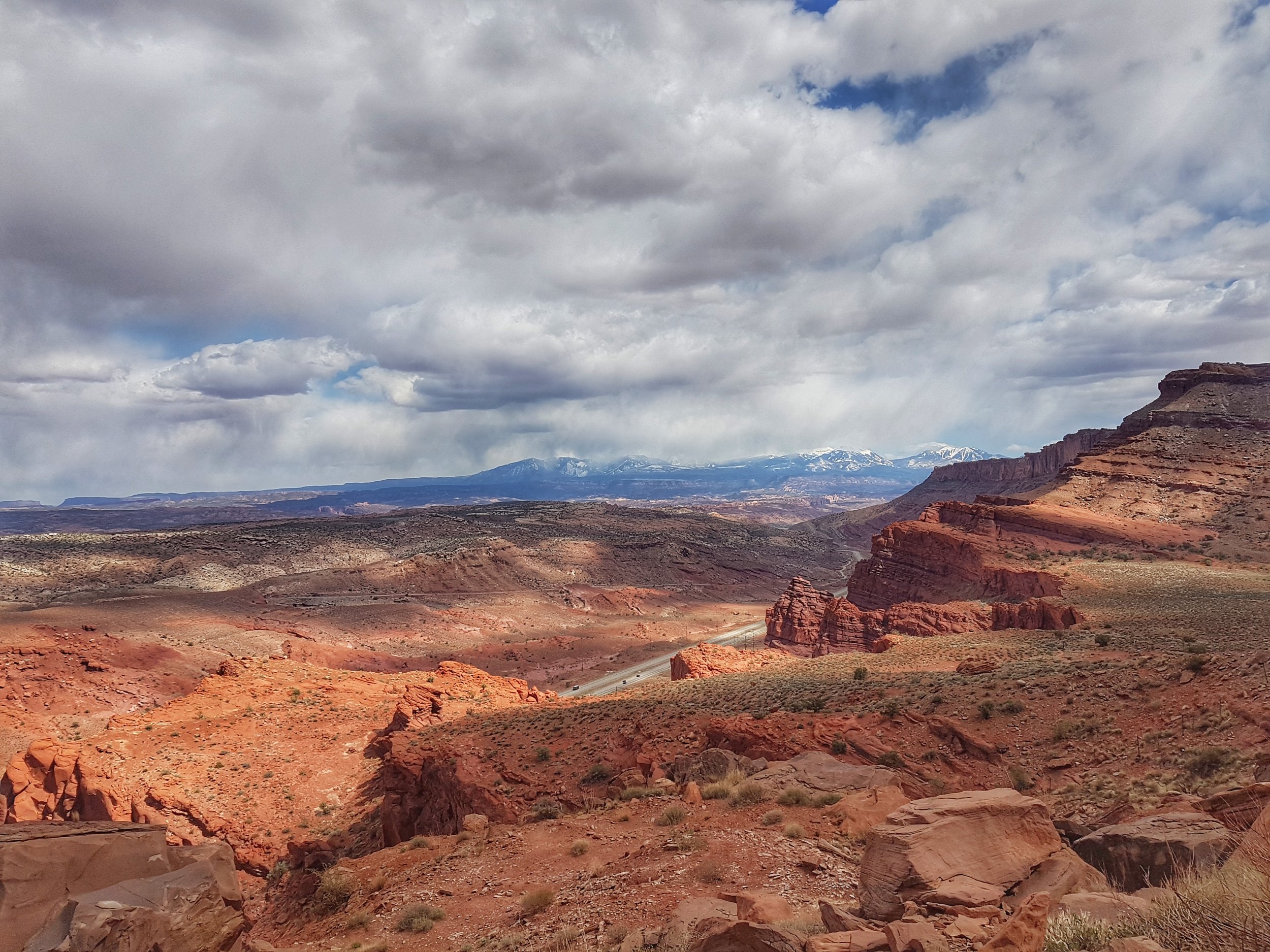
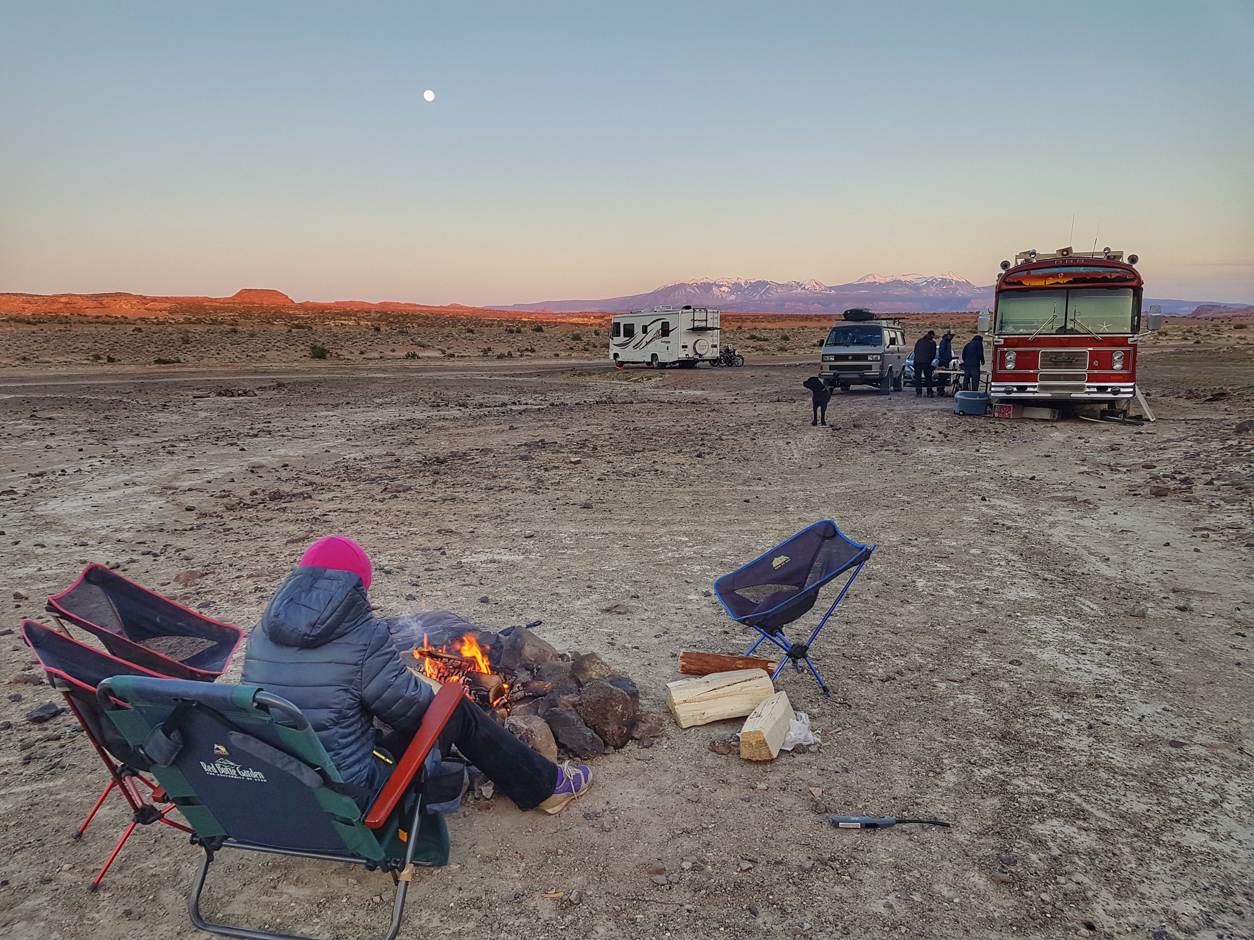
We much prefer boondocking for free on the BLM land on Willow Springs Road, 12 miles North of town. It's closer to most of the trail systems we like, the view is amazing (view of the La Sal Mountains and Arches National Park from our bedroom!), but it's a bit of a longer drive to town (20 min), but the connexion is better here. Still, you might need a booster to get good 4G.

For laundry, you can choose between the gringo laudromat (uber clean and more expensive), conveniently located beside the City Market and the Moab Cyclery, so you can shop while you laundry dries and the locals' laundromat (Moab Speedqueen Laundromat, no website, of course), located in the same strip mall as the Chili Pepper bike shop and another smaller and more expensive grocery store (Village Market). No wifi on the premises, but go sit in the grass outside in the La Quinta Hotel and get their signal. There are a few more that I didn't check (Wet Spot, close to Main and Center).

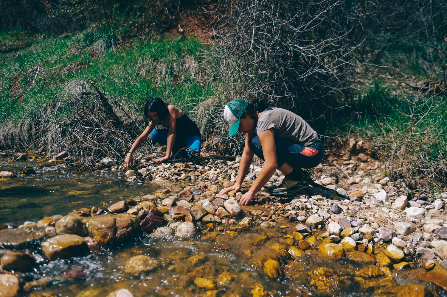
You can go fill your jugs of water with delicious spring water for free inside the Gearheads outdoor store (by the gringo laundromat and the City Market).

Recycling: Moab has probably the most recycling per square miles of any town. There is recycling for everything and a garbage container in the Information Center Parking Lot. There is also some recycling at the Moab Cyclery (no tin). Cardboard recycling between Gearheads and the laundromat. Arches National park has plastic and tin, but not glass.

Showers and pool. You can shower at the Moab Cyclery for $5 or at the Youth Hostel for $3 (Lazy Lizard), and at most campground for $4 to $6. We think that the best deal is the Aquatic Center ($20 per family) where you can enjoy the nice warm pool with a super fun waterslides and diving boards (and clean warm showers that do not run out of warm water!).

Receiving packages : UPS can be shipped to the UPS Customer Center at 1030 Bowling Alley Ln Ste 2, Moab, UT 84532. Pickup times vary so call ahead 435-259-5593
Shipping from any carrier at Canyonland Copy Center (375 S Main St Moab, UT 84532 435-259-8432) There is a fee of $5 per package

Dump and Fill: at the Maverick on the South side of town (free, no purchase required). You can also go to the Slickrock Campground (north side of town, so closer to the BLM) and dump and fill for $5.

Wifi: Library, Information Center, Moab Coffee Roaster, Love Muffin, Eddie McStiff


Dead Horse Point State Park, Moab, UT

There are so many awesome trail systems in Moab that you could pretty much ride every day for a month and never do the same trail again... I'll talk more about all of them in a next post, but for this one, I will focus on Dead Horse Point State Park, for no other reason than Isa took lots of good iPhone pictures and that the view is incredible. 

This trail network is probably one of the easiest in the area, but it still offers some fun technical sections and an amazingly rewarding view. Actually, the view is so amazing that it's almost dangerous because you cannot help but look at it while riding! None of the trails is close enough to the rim that it feels scary (no exposure). 

This is one of the only trail network that requires you to pay an entrance fee (since it is in a State Park). It's $10 for a 3 day access. After the ride, drive or ride to the view point at the end of the road, it's 2,000 feet above a gooseneck in the Colorado River. The State Park is right on the edge of Canyonlands National Park. You can also hike the Rim Trail (an hour or two before sunset is the best time!).

If you are planning to go, here are some information about the trails. All the trails start at the end of the Visitor Center Parking Lot (the Visitor Center is at one end, the trails start at the other end). Ride Intrepid to Great Pyramid and the the whole Big Chief loop (stop to eat lunch at the point of Big Chief, then take Crossroads (green). If you still have some energy left, do Whiptail (blue), Twisted Tree (black) and Prickly Pair (blue with black sections) back to the Visitor Center. If not, just come down Prickly Pair. Don't take Raven Roll down (unless you are very tired after Big Chief), it's a very boring green. 

Salt Wash View Area, UT

We stopped there for the night on our way to Moab and pulled in in the dark. When I opened the curtains in the morning, my jaw dropped. We made coffee and went outside on the rocks to admire the incredible view. The Salt Wash View Area is located on the north side of Interstate Highway 70 about 52 miles west of Green River, Utah. This Roadside Look-Out has spectacular views of the San Rafael Swell and the stupendous rock formations. This View Area is on the lonely stretch of Interstate between Green River and Salina where there are no town or services along the highway for 110 miles (closest town is Emery). There are about 25 parking spots and there is good 4G Verizon. You can spend the night there (there are no no camping signs).

Riding Thunder Mountain, in Panguitch, UT

                                                                               Oops! Road block!

Thunder Mountain Trail is just outside Bryce Canyon National Park. The first section has more climbing than we expected after consulting the MTB project website and less scenic, but the descent among the Red Canyon's hoodoos is a blast as we ride along knife ridges and switchbacks back to the trailhead The last mile is a super fun let-the-brake-go flowy downhill.  The trail is mostly smooth hard pack but has short serious sections of loose, steep, switchbackery madness (probably the reason why it is rated as a black trail, because most of it is truly blue). There aren't much in the way of steps or drops, the technical sections are short and walk-able with the climbing mostly moderate. What makes it harder is that you are riding at over 8000 feet of altitude and you sometimes wish you had an oxygen mask on while climbing.

If possible, ride this trail from the upper trailhead to the lower trailhead, with a car shuttle back. Several sections of the trail are virtually unrideable in the uphill direction.

However, riding the trail as a loop is possible if you ride back up the bike path for 8-9 miles.

Exploring Bryce Canyon National Park

It was our second time visiting Bryce Canyon - the first time was in late October 2012 - and it was as stunning as the first time. There is something completely magical about this place. You feel transported to a different planet. These unique hoodoos (those tall bulbous columns) are created by erosion of course, but unlike many places, it is snow that is mainly responsible for it. As it melts, water seeps into the fractures and as it re-freezes, it expands and cracks the rock around it.

Because of its high elevation and lack of light pollution, Bryce is one of the darkest place on earth. Unfortunately, the two nights we were there were a bit cloudy, so we couldn't really see more stars than usual, but it was still incredibly dark.