Exploring Utah's Canyons part 2: Hole-in-the-Rock Road

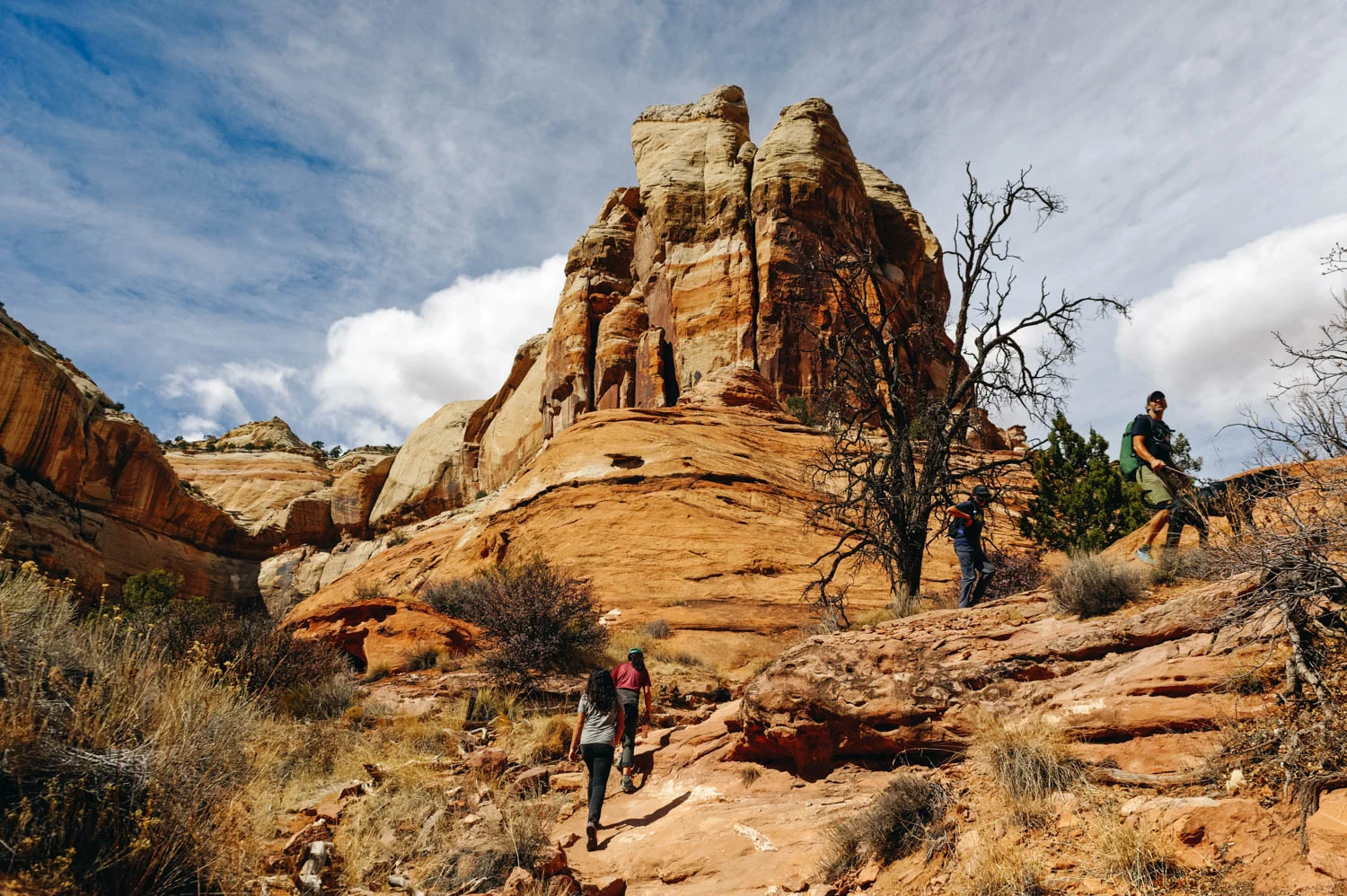
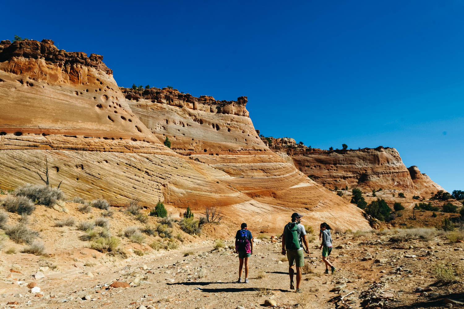
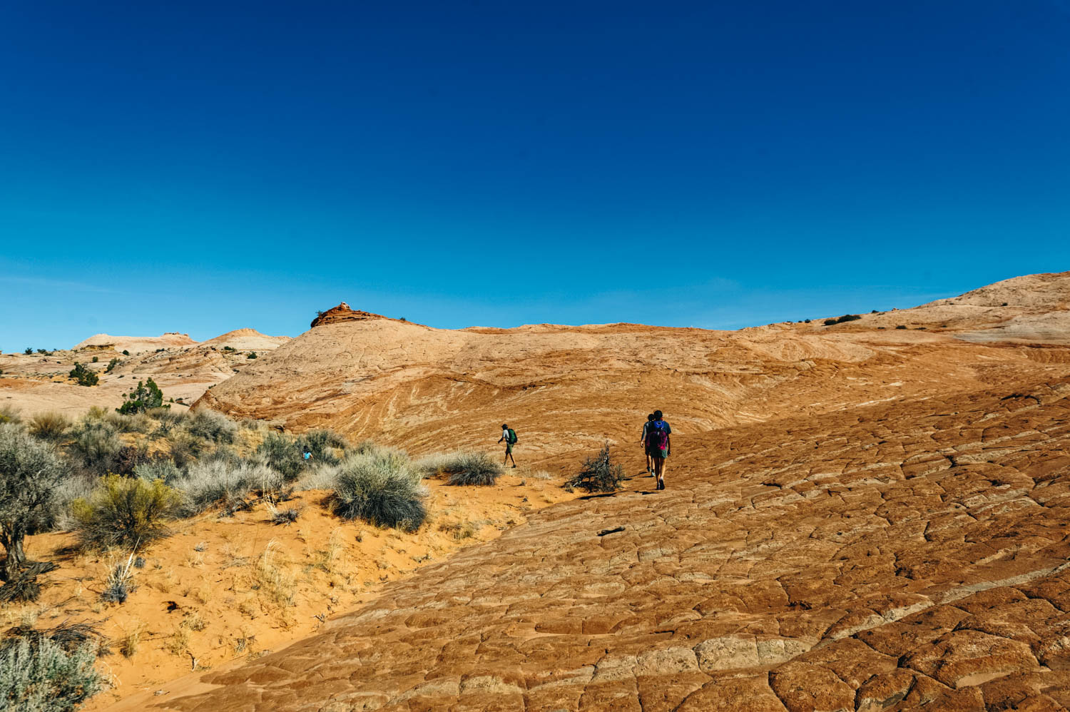
Approach hike to Big Horn Canyon
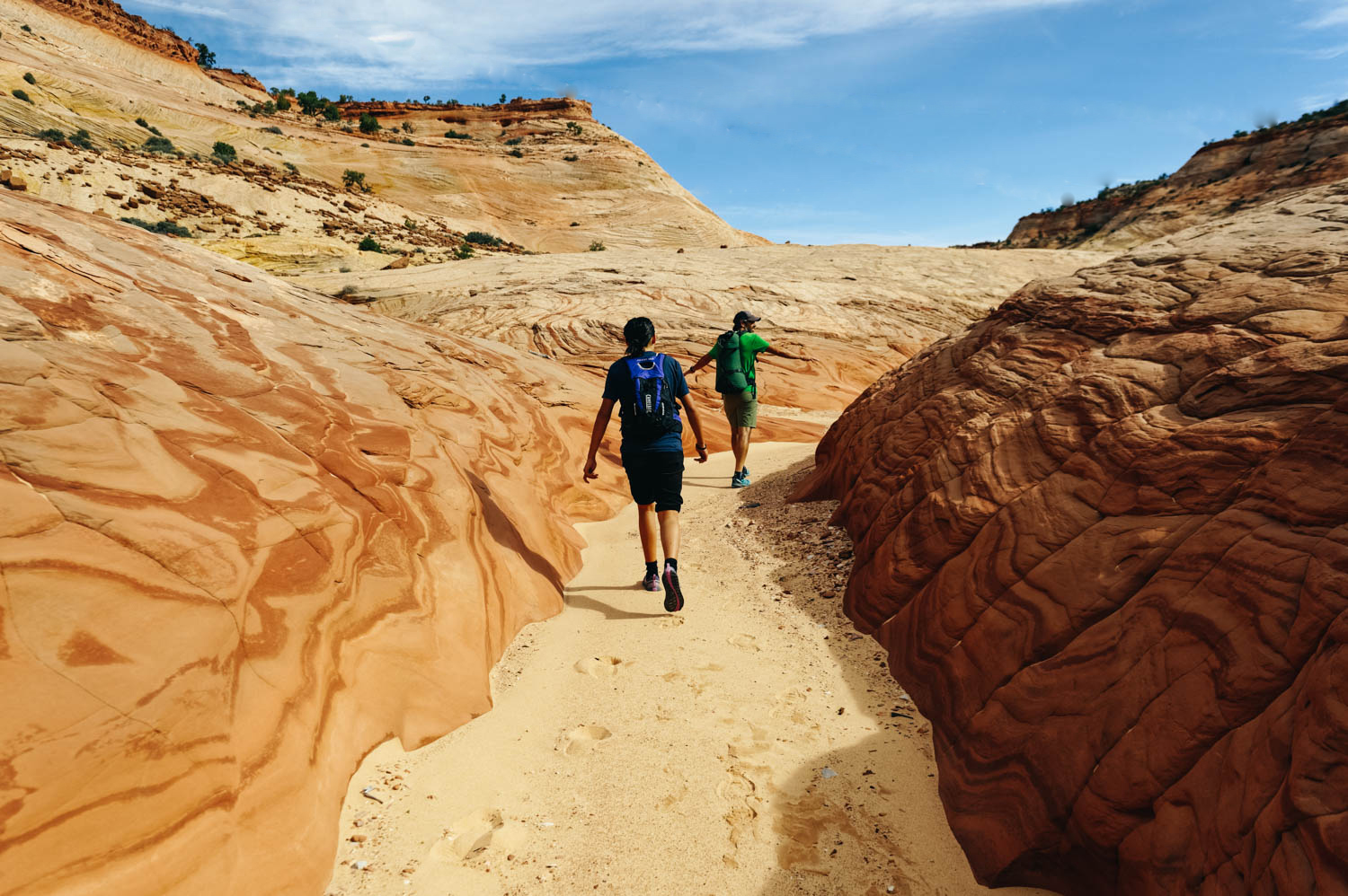
The incredible colors and texture in Big Horn Canyon.

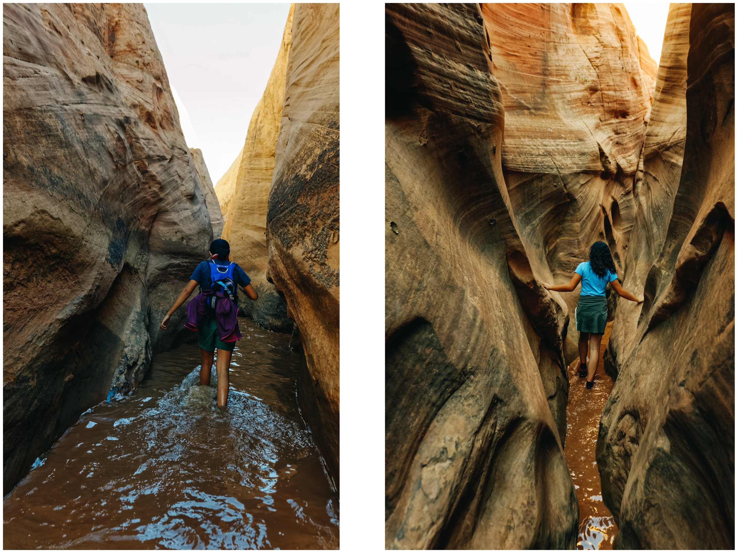
Feeling like we are in another world, alone in Big Horn Canyon.

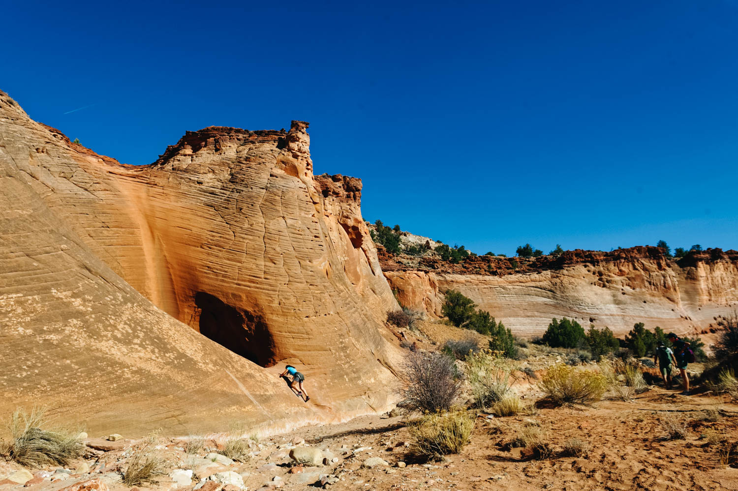
Playing in a shallow section of Big Horn Canyon.
Hole-in-the-Rock Road has the biggest concentration of slot canyons in Utah. It is 57 miles one-way and 4 x 4 is strongly recommended for the last 7 miles. There was LOTS of wash board on this route when we were there and driving it in our van wasn't fun. We decided NOT to drive the 50 something mile required to get to some of the canyons we wanted to explore and stuck to the canyons located on the first 15 miles of the road for that reason.
There are no route markers on most canyon trails (sometimes a cairn here and there). You need a map and some navigation skills.
As the Copelands put it in their book: Hiking, particularly when routefinding rather than heedlessly following a trail, reboots our connection with nature. It requires us to engage directly. And canyon country is the ideal place to venture into trail-less terrain.
These places invite exploration, but if you want to veer off the path, you should stay on the cattle trails to avoid destroying the fragile desert crust. Do not add cairns, do not write with mud on the canyon walls, keep your voice down (and teach this to your kids). Enthusiasm is beautiful, but this is not an amusement park. Be respectful of others who are likely to look for a more contemplative experience.
Big Horn canyon (5 miles round trip, easy, dog-friendly, moderate traffic): Big Horn Canyon is an interesting tributary of Harris Wash in a rarely explored part of the Grand Staircase-Escalante National Monument. It was our best *discovery*. The wide range of colors, textures and formations took our breath away. The canyon deepens quickly, eventually reaching a depth of 400 feet, and forms slot-like channels of varying narrowness mixed with wider, flat sections. It has two forks and all could be seen in five hours though adjacent parts of Harris Wash, and especially some of its nearby side canyons, are also worth visiting.

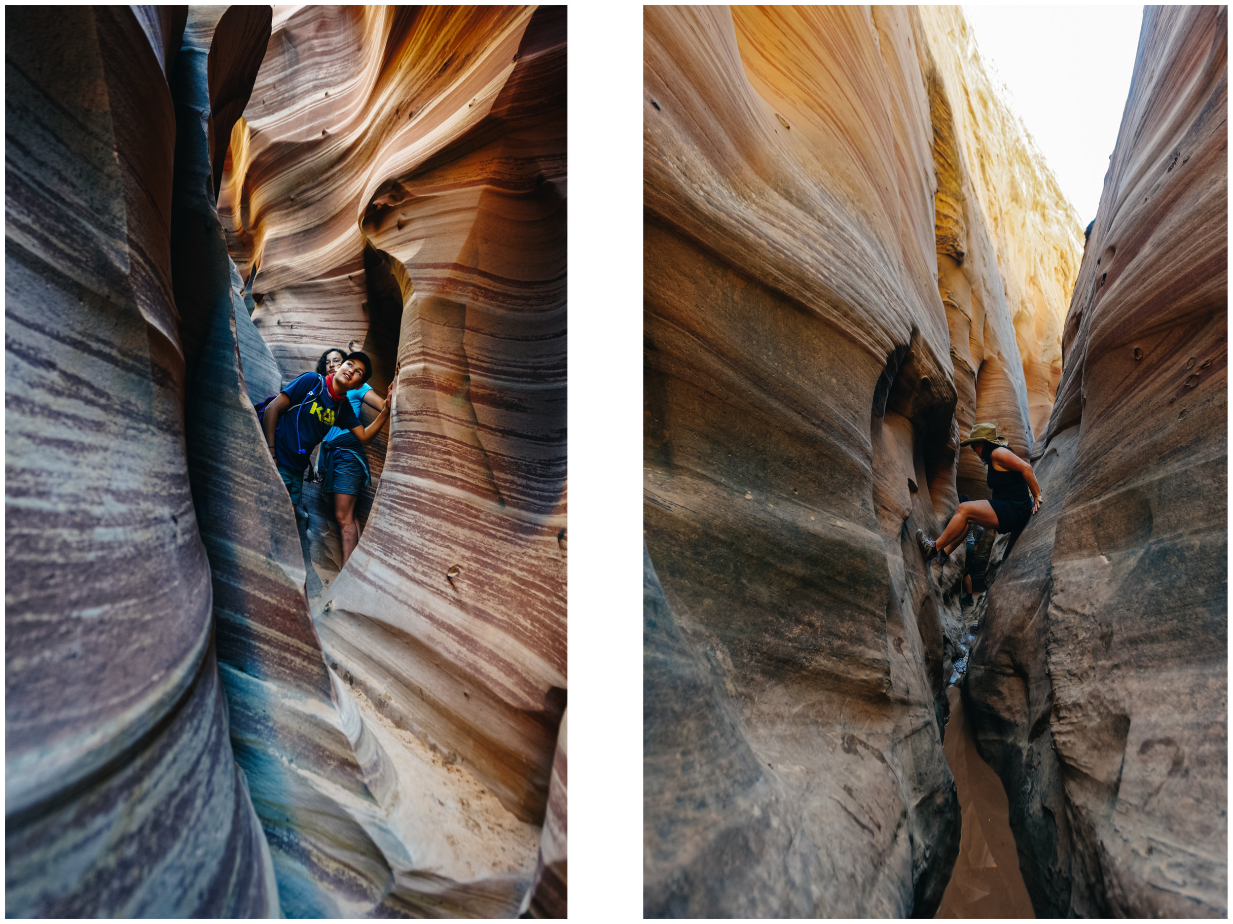
Squeezing through an unnamed side canyon we discovered while hiking in Big Horn Canyon. It led to a beautiful cathedral-like area.
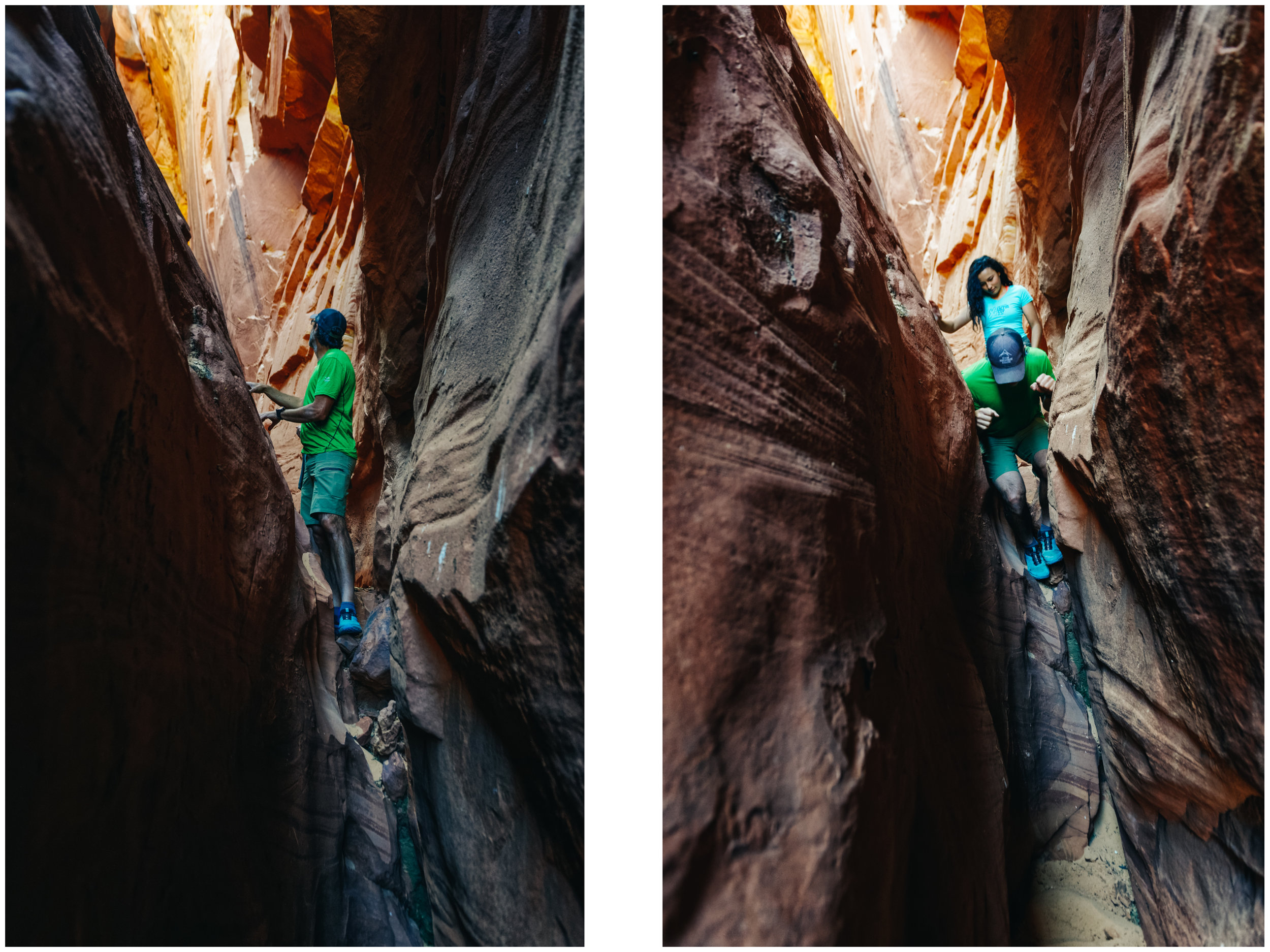
JF using his elbows to slowly get down this steep section of the side canyon.
We have a tradition to pick a birthday hike (or ride). I had picked Little Death Hollow, but it was closed since a cow was stuck in it and someone else had been charged by an aggressive cow… So back to the drawing board we went and decided to check out Zebra Canyon.
Zebra slot canyon (5 miles round trip, easy to get there/moderate, some stemming required in the canyon, canyon is not dog-friendly, high to moderate traffic): This is a very short slot canyon (200 m) that require some wiggling and stemming to get through. It often contains water and quicksand. When we did it, there was two 50 feet-long sections of mid-calf freezing cold water. The slot canyon is reached after a 2 miles beautiful approach walk down to Harris Wash. There are not route markers here and it can be confusing for many. Make sure you have a map.

The birthday hike crew
Canyons invite exploration
Walking in the wash to get to Zebra Canyon.
Getting closer.
There was two 50 feet-long sections of mid-calf freezing cold water. I got feet cramps that were so bad I could not stand for a minute.

Mara-give-me-a-challenge Roldan

Being tall is not always a good thing when exploring slot canyons.

Left: int the narrowest and most beautiful part of Zebra Canyon. Right: JF helps Mara down a steep section.
Right: looking at a bird's nest in an alcove. Right: me, stemming to avoid a section of freezing water.

In many of these canyons, you will see Moqui Marbles. They are sandstone balls cemented by a hard shell of iron oxide minerals. They tumble from the pale, cream-colored navajo sandstone beds, when wind and water wash away the softer rock. The children of the Indian tribe who lived there were known to play with these stones, particularly the smaller stones, and used them like children today use marbles, hence the name Moqui Marbles.
The curious rocks have inspired fantastical tales of fairies, meteorites and dinosaur eggs, but their origin is fairly mundane. Water flowing through sedimentary rock leaves behind minerals that glue together masses of sand, mud or other particles.
Collecting them is prohibited. Please be respectful.
In my research online, I actually discovered that some people are selling them on eBay as shaman stones having special powers. I’m pretty sure this is bad Karma...
To also check in the same area:
Devil’s Garden Hoodoos (stroll around, up to a few miles, perfect natural playground for kids, a few arches and funky hoodoos, 12 miles from Highway 12 on Hole-in-the-Rock road).

Devil's Garden Hoodoos (on Hole-in-the-Rock Road, not to be confused with Arches NP Devil's Garden).
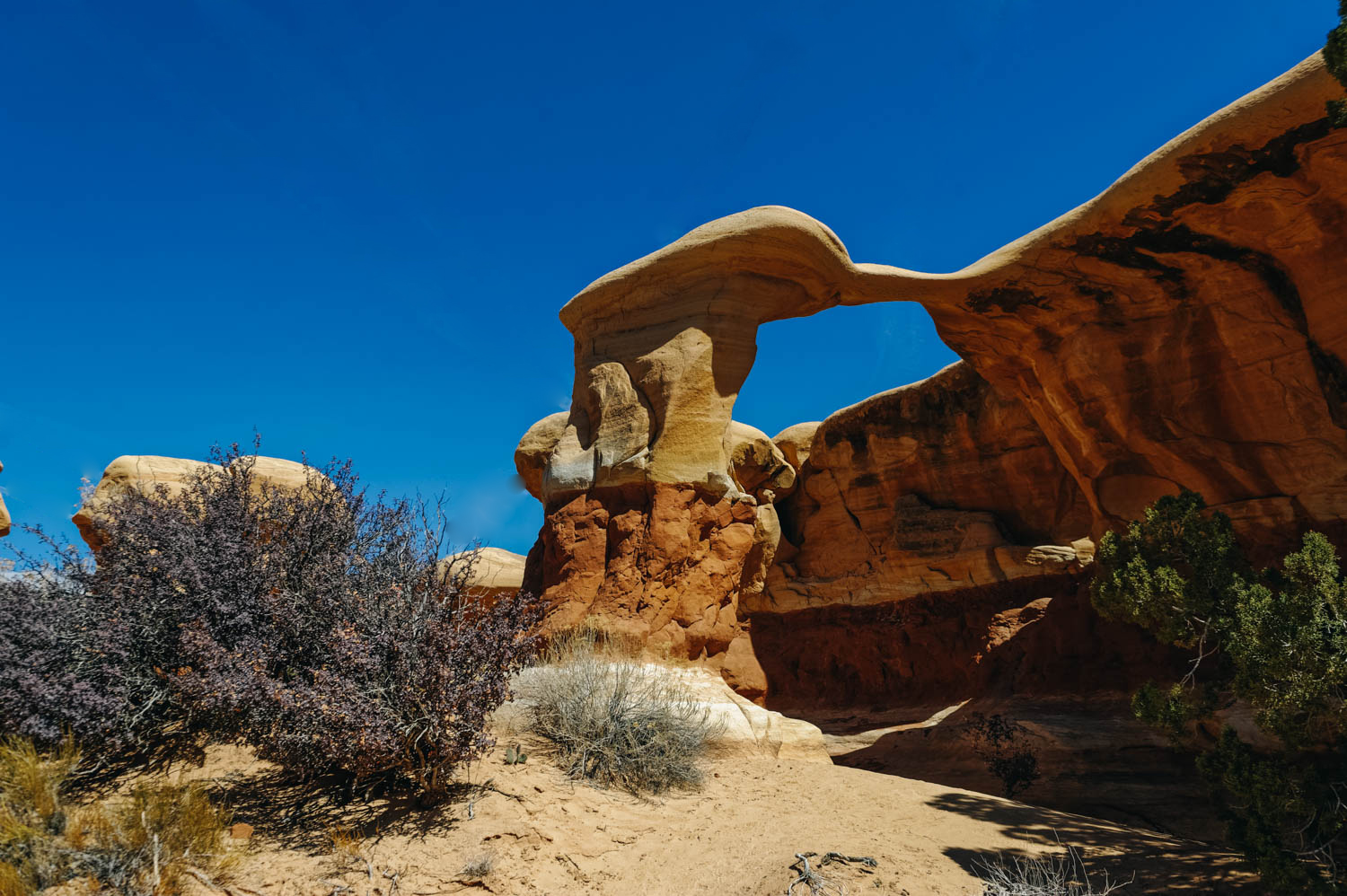
Metate Arch at Devil's Garden Hoodoos.

Mara standing on an arch at Devil's Garden. This is an amazing natural playground. You have to stop there if you have kids.
Peekaboo and Spooky Canyons (4.8 miles round trip, moderate, not dog-friendly, heavy traffic): These are undeniably the most visited canyons on Hole-in-the-Rock Road and for good reasons. The approach is short and the experience is unique. However, you might have to wait in line to enter through Peekaboo… it’s that crazy busy. People usually hike up Peekaboo and down Spooky (DO NOT ATTEMPT THIS HIKE IF YOU ARE IN ANY WAY OVERWEIGHT, these canyons are so narrow that people got stuck). Spooky will force even the most slender lanky types to carry their packs over their heads, turn sideways and wiggle through. There are a few chokestones and short drops. If you are #ho shapeshifter, you can also attempt Brimstone Canyon located at the same trailhead (darker and more obstacles, great to check you immunity to claustrophobia). We hiked these almost six years ago with the girls and it was quite the adventure (read the whole story here!)
Neon Canyon and the Golden Cathedral (9.2 miles round trip), moderate, dog-friendly, moderate traffic)
Note that there are many more very interesting canyons to explore on Hole-in-the-Rock Road (Davis Gulch, Llewelyn Gulch, Reflexion Canyon, Willow Gulch, Fortymile Gulch, Egypt 3, Spencer), but many require a 50 mile drive on that often very wash boardy road (it was in very rough shape when we were there).
We camped at this BLM while exploring this area.
Recommended books:
Map (note that there is no cell signal in most of these places, so you'll likely need a paper map) : Canyons of the Escalante