Crystal Geyser


The Crystal Geyser is located just south of Green River, Utah, along the east bank of the Green River. The geyser as it appears today was created by an oil exploration well drilled in 1935. 

Crystal Geyser is different from most geysers like those in Yellowstone National Park since it is not created by geothermal activity but rather by carbon dioxide. 

The water that comes out of the hole is cool to the touch since there isn't any geothermal activity involved.

This geyser erupts due to the same process that causes soda pop to shoot out of the can when you hold your finger over the lid and shake it. Although technically not a true geyser, the cold-water eruptions look so much like hot-water geysers that they are referred to as “soda pop geysers”.

When the geyser erupts the water cascades down a terrace of colorful orange travertine limestone, that varies in hues of white to almost brown, and into the river. 

When it first formed, the geyser would shoot 80 feet into the air in 15-minute intervals and 150 feet into the air every nine hours. Over the years, however, the eruptions have decreased in height and frequency.

These days, the Crystal Geyser eruptions times are a little more unpredictable and only reach heights ranging anywhere from 2 to 10 feet, due to the blockage in the well. The reason why it’s erupting now after years of dormancy is believed to be the result of Utah’s historically cold winter in 2022.

We lucked out as the geyser was active as we pulled in at sunset.

The geyser is said to erupt at least once every day but there isn't a pattern or timeline to go by. Eruptions have lasted from a few minutes to 45+ minutes. 

You will likely question your choice of this campsite as you drive through the desolate, lunar like landscape on a washboard road. But at the end you find this nice area along the green river with a geyser. It’s really scenic among the red rock.

We were surprised to find 3 more rigs there on a Sunday night in November, but the fact that this type of geyser is very rare will make it enough to attract visitors.


Furniture Draw Canyon and Buckhorn Draw road


This short, flat trail leads you through tall canyon washes. It is not technical at all and includes a few narrow sections. It’s great for all ability levels and shows the area’s beauty in less than four miles.

This canyon is totally kid and pet-friendly. Much of the wash is pretty wide and full of scree. Unlike many other canyons, it’s easy to find and easy to navigate. If you’re used to more  technical slotting, this will be rather underwhelming, but it’s still a beautiful canyon.

The rock formation is very similar to Little Wild Horse Canyon since they are both part of the San Rafael Swell. Furniture Draw is shorter and much less popular (although less stunning).

The whole area totally blew our minds. The Buckhorn Draw road reminded us a bit of the Burr Trail. It is stunningly scenic.

5 km down the road from Furniture Draw, you can see some really well-maintained pictographs and petroglyphs. There are also dinosaur tracks nearby.

The Buckhorn Draw Pictograph panel.

There are tons of gorgeous campsites along the canyon walls of Buckhorn Draw road, but they are $15 per night and the signal is not as good as at The Wedge.


The Wedge and Good Water Rim trail


The Wedge, also called The Little Grand Canyon, is located in Eastern Utah and despite its amazing beauty is relatively unknown. It is on BLM land, 20 miles east of Castle Dale and about three hours from Salt Lake City. 

It’s so special to camp (for free!) right on the rim of this spectacular canyon. We were afraid it was going to be crowded but there was almost no one there. The area is so large that we could not see any other campers from our spot. 

The Good Water Rim bike trail starts and ends here.
It’s a 21,5 mile loop.

This unique trail is a singletrack that parallels the contours of ‘The Wedge’ in the San Rafael Swell. If you do only choose to do a portion of the Good Water Rim Trail, I recommend to ride the west side where the views are more impressive.

The trail hugs the rim most of the way. The views are simply incredible.

Note that the wedge campgrounds are divided into two separate areas. Sites 1-7 fork left as you drive in (we picked site 7B which was huge). These sites generally do not have access to the stunning rim views that most people are after. 
Even though you are not really on the "Little Grand Canyon", Site 1 is gorgeous and remote. It's at the end of the road and has a nice view since it is "perched" on a little outcropping.

View from the East trailhead Overlook. We were completely alone for miles.

I’m sure it gets busier during the shoulder season when the weather is perfect, but I wouldn’t want to be here in the summer as there is no shade. It was pretty cold at night in November, but the days were perfect (for us northerners, at least) to hike and bike. Hey, there’s a reason it’s called the off-season and we had the place to ourselves!

Little Grand Canyon Overlook with the San Rafael River a the bottom.

What we discovered is that the most amazing sites right on the rim are directly AFTER site 9. These are not official BLM spots, but as long as you stay in the boundaries and camp on a designated site that has a fire ring, it is OK.

People with small children or pets might not want to camp on the ledge as there is obviously no fencing whatsoever.

One of the many amazing campsites along the canyon. If you sleepwalk, don’t camp here!

Many spots have been closed off and there is lots of cryptobiotic soil, so stay off and watch your step.

There is no water and no garbage cans, but there are very clean pit toilets at the trailheads and overlooks.

The dirt road is well graded all the way to the campsites. You won’t need a high clearance vehicle to get to them.

It’s pretty high (6,200 feet), so the nights are cold.


Longer hikes in the Bruce Peninsula, Ontario


The beautiful beach at Halfway Log Dump.

Indian Head Cove, near the Grotto

The Bruce Peninsula National Park is another place where you have to reserve months in advance to snatch a campsite. The campsites might only be $23 per night, but don’t be fooled, you have to pay extra for the entry fees and extra for a tow vehicle. It’s pricey for an unserviced campsite. The big plus is that you don’t need to reserve and pay for a parking spot (and be limited to 4 hour slots only) to hike to the Grotto (the most popular attraction everybody wants to see).

Indian Head Cove near the Grotto

Rocky Shore Beach. Day 1 hike (see below).

Overhanging Point (a viewpoint on Day 1 hike).

 Our goal was to hike everywhere from the campsite. Since we had wanted to visit the area for a long time, we reserved 4 nights during the week at the beginning of June and the campground was almost empty. Needless to say, the place is a zoo in the high season. Expect to see stupid behaviors and natural selection in action at the Grotto - 15-20 minutes will likely be plenty and you will desperately want to leave.

Halfway Rocky Point (at the beginning of Day 2 hike)

Unfortunately, there isn’t much info on longer hike options, so we created our own. That’s mostly why I’m sharing this post. If, like us, you don’t like to sit around much, 3 nights will be plenty.

Very badly handdrawn indications of the hikes we did, but since they do not exist, I figured it’s better than nothing. Day 1 on the left and Day 2 on the right.

Day 1: Hike to the Grotto and continue to the left along the coast on the Bruce Trail all the way to Rocky Point (Loon Lake). It’s a beautiful 10 km round-trip and we were by ourselves as soon as we left Boulder Beach. On the way back, take the Marr Lake Trail from Boulder Beach.

Day 2: Hike to the Grotto and take the other side (right) of the Bruce Trail all the way to Stormhaven backcountry campsites. On the way back, take Horse Lake trail to the campground.

Perfect lunch spot by the water at Stormhaven backcountry campground (Day 2 hike)

Day 3: Go explore Halfway Log Dump. You have to drive there from the campground (20 min) and hike less than 1 km to the beach. From there, explore the coast. We went left (upper peninsula) and found a cool bouldering area. If you want to go for a longer hike, you could go right on the Bruce Trail (lower peninsula) and hike to High Dump backcountry campsite.

Halfway Dump Beach

Day 4: get out of there before the weekend crowd gets here.

P.S.: All those hikes require walking on cobble beaches and rocky (slippery) terrain.


Overnight hike to Watersprite Lake, Squamish, BC


Watersprite Lake near Squamish is a crystal clear, turquoise lake framed by dramatic peaks and it is one of the most awe-inspiring hikes around. It was a hidden gem for years. Unknown to most and tucked away down a long, bumpy forest service road. But the word is out and it’s ‘hidden gem’ status has changed.

Whilst the hike is long, it’s a fairly gentle incline as BC hikes go and only the last portion has any serious climbing in terms of elevation. About 6 km in, you will come to a rock slide. This is the beginning of the more demanding section of the trail. The route is visible and there is flagging to keep you on track. 

Then, you enter a forested section and get to a boulder field. The final ascent is slow and steep, but you’re almost there and the view that awaits you will reward your effort!

While this last stretch is the most difficult hiking, the good news is you are nearly at Watersprite Lake. If you are staying overnight, you need to cross another boulder field along the lake to get to the other side where the tent platforms are located. 

As of summer 2022, Watersprite Lake area and the surrounding peaks are now a designated Provincial Recreation Site and you will need a camping reservation for tent camping (different to reserving the hut). This will cost $20. You can reserve here.

There are 10 platforms and 10 tent spots (we recommend platform 1 or 2 if one is taken). There are bear caches and a composting toilet on site. There is a very clear stream that runs behind camp to get water from (and a few streams along the trail too).

The only drawback to this hike is that it requires a 4×4 or AWD vehicle with good clearance to reach the trailhead. Please note, the road gets significantly worse for the final stretch to the trailhead and it is getting worse every year (not fixing it probably also helps weed out people).

There is a cabin at the lake which was built by BCMC. The cabin can be rented all-year round (the only option in the winter since the platforms are under many feet of snow) for 300$ per night (one party of 8 people max).

There are a few bridge crossing involved and the trail is very well-built and marked.

Make sure to reserve your tent platform ahead of time. This will cost $20. You can reserve here. We recommend platform 1 or 2.

Because the trail is open, make sure to bring plenty of water and sun protection in summer.


Hiking Ruby Mountain and Monarch Trail, Atlin, BC


Atlin, BC, is a small gold rush town that is only accessible through the Yukon. It’s a 2-hour drive from Whitehorse. 

Atlin Lake and the surrounding mountains are stunning and the historic gold rush village complete its charm. I’m not sure why we waited 15 years to come back here, but we are are glad we came on this perfect weekend.

We did two different hikes. The first one (and our favourite) was Ruby Mountain in the Atlin Volcanic Field. You have to drive about 30 min from town to get to the trailhead. If you have a high clearance 4x4 vehicle, you can even drive the first part that is on a mining road (all the info for directions and route finding are well explained here. Make sure to screenshot everything since there is no cell signal in Atlin). The hike starts already in the alpine and there are very few trail markers, so you’ll find having this info on hand useful as you ascend. It’s a short hike to a stunning 360 view with mountains all around as far as the eye can see. We were alone the whole time and even saw Dall sheep! That hike is easily in our top 5.

The trail starts here if you can drive up the mining road (high clearance 4 x 4 needed)

The Summit

The second day, we did the classic Monarch Trail. The trailhead is only 1 km from the Pine Creek campground. As soon as you start climbing, you get open views of the Atlin Lake and surrounding peaks. You can decide to turn around after about 1.5 km at the second bench before the climb in the forest begins or decide to plow through that steep section without view to get into the alpine for the last 700 meters. The view is beautiful but not as different as you go up. You’ll find the driving directions and trail info here (please note that the name of the road where the trailhead is located is Warm Bay Road NOT Warm Spring Road as indicated).

The camping options are pretty limited, especially with a big bus, but we lucked out on one of of the few sites that are big enough at Pine Creek campground.

There are beautiful walk-in sites in the lower section of the Pine Creek campground.

Note that there is no cell signal anywhere in town. There are limited groceries, but you can get some good BC beer at the Trading Post.

For those who do not follow us on Instagram, Stout passed away on August 2nd. He had a Valley Fever relapsed and even with the medication, his body gave up the fight and he died peacefully in his sleep in the bus. He was six years old. We miss him dearly every day.


Hiking around Summit Lake, Stone Mountain Provincial Park


Summit Lake campground in Stone Mountain Provincial Park is the highest point on the Alaska Highway (at about km 600 - Historic Mile 373) at 1,300 meters (4,250 feet of elevation). It is located about 140 km West of Fort Nelson and is a must stop on your way North. I recommend you spend the night in Fort Nelson and head to Summit Lake campground early to get a spot (the 28 campsites are only available on a first-come first-serve basis for $20 - some are really not that great - campground is open from May 12 to September 25). There is no electricity, but there’s a pit toilet and a water well, but it is recommended to boil it (wood bundles are a whooping $15). It is right by the Highway, so there is some road noise during the day, but the surroundings are well-worth it, especially if you can get one of the few spots by the lake.

The most popular hike here is Summit Peak trail (that should really be called Mount St. Paul via Summit Peak trail, an 8.5 km round-trip with 750 meters of elevation, the summit is not the end of the trail and you could keep going on the ridge all the way to a few other peaks). The information available at the campsite and online for these hikes are pretty inaccurate and misleading (except for the link I posted above). That’s why I decided to write that post.

The hike starts just across the road from the campground. Make sure to follow the trail that cross the creek after about 400 meters off the road and that starts climbing up on the RIGHT side of the river.

Some of the many blue pools you will see along the way, perfect for a post-hike dip!

You will soon get out of the tree line and start steadily climbing up the stone-faced ridge of Mount St. Paul.

The view makes the effort well worth it! We found hiking poles to be useful, especially on the descent since there is some loose scree and a few slightly exposed sections. Hiking boots would have been preferable to hiking shoes. Also, even if we were sweating at 9 am in the first km of the hike, it got cold and very windy as soon as we got onto the ridge. Be prepared for all kind of weather conditions.

Note that the ridge is the only place where you can get decent LTE signal (and it requires a fair amount of climbing)! We had spotty 3G and 1 bar LTE at the campground WITH our booster and the antenna placed just right, but I wouldn’t count on it, most people didn’t have anything.

You can see the campground behing JF’s shoulder and in the background, an alpine lake (Flower Springs Lake) where we also hiked (more info on that hike below).

It is easy to forget about how intense the descent can be on the legs in that kind of terrain, so make sure to save some energy and muscle strength for that!

Once you reenter the tree line, there is a trail that cuts down to the beautiful blue pools you saw on your way up (they might be dry later on in the season). Make sure to go explore and take a dip if you dare! It is pure paradise. There was NOBODY there.

From behind site 20, there is a bridge that leads to a trail. Turn right and follow along the shore of Summit Lake. It is a bit marshy and buggy in places, but you can see lots of wildflowers along the way (this area is known for its rare flora). After about 2 km, the trail veers left up into the trees and you can follow it all the way to a 4 x 4 road that will take you to the beginning of Flower Springs Lake trail.

There is another quicker alternative that we will use next time: just before you get to the campground on the Alaska highway, you will see an entrance to the 4x4 road to a microwave tower closed by a red gate. The gate is unlocked (make sure you close it behind you). The Flower Springs trail officially starts 2 km up that road. You can either drive up 2 km (it can be driven without a 4x4 up to that point - at least when we were there), bike (and stash the bikes in a bush at the beginning of the hike - there is nobody here) or walk up it (but is it quite boring). If you decide to walk (it is quicker that our first option by the lakeshore), simply turn left after the bridge instead of right and you will quickly get to the 4x4 road. Just start walking up until you see the picnic table and trail info board.

As soon as you begin walking, you cannot help but feel awed.

From the road, Flower Springs Lake is about 3 km (so from the campground, it is is a 10 km round-trip with the section on the 4 x 4 road), but the elevation gain is very minimal (230 m). If you do the upper Lakes, it is a 15 km hike round-trip with 430 m of elevation gain

You can keep hiking on the right side of the lake and get to two more alpine lakes, but we decided to turn around since we had already done 7 km by then and our 4 legged pup had done enough for the day. I would recommend getting a map of the area and go explore that beautiful backcountry.

There is another hike 2 km up the campground called Baba Canyon that is supposed to be really nice too. We’ll make sure to check it out next time. If you’re up for a more challenging adventure, check out this hike.


A winter of camping in Squamish + tips to avoid humidity issues in your RV

 
The beautiful foggy Coastal Forest near Brohm Lake.

The beautiful foggy Coastal Forest near Brohm Lake.

The big perk of our campsite: this private covered area that increases our living space so much. It’s not fully waterproof, but we use it a lot. We have now closed that open side with a tarp.

The big perk of our campsite: this private covered area that increases our living space so much. It’s not fully waterproof, but we use it a lot. We have now closed that open side with a tarp.

The girls use it a lot for stretching and strength training, Zwifting and Zoom spin classes.

The girls use it a lot for stretching and strength training, Zwifting and Zoom spin classes.

Hiking the Four Lakes trail after the first snow in November in Alice Lake Provincial Park.

Hiking the Four Lakes trail after the first snow in November in Alice Lake Provincial Park.

A rare bonfire outside on a dry night.

A rare bonfire outside on a dry night.

Jurassic-park like forest on the White Rabbit trail.

Jurassic-park like forest on the White Rabbit trail.

Mara learning to ski at the Whistler Olympic Park

Mara learning to ski at the Whistler Olympic Park

We’ve added a couch, a propane fire ring, a TV and a Christmas tree to our shelter to make it extra cozy.

We’ve added a couch, a propane fire ring, a TV and a Christmas tree to our shelter to make it extra cozy.

On the cliff right by our site, a 3 minute climb!

On the cliff right by our site, a 3 minute climb!

Our campsite in the snow.

Our campsite in the snow.

Watching the sunset behind the mountains at 3:30 pm near Solstice.

Watching the sunset behind the mountains at 3:30 pm near Solstice.

For the last 7 years, we’ve spelled winter A-R-I-Z-O-N-A…This is our first winter in Canada in the bus and we decided to spend it on the «Wet Coast» during a La Nina year (more rain and colder than usual). When at least a few seasoned outdoorsy Westcoasters told us it was quite extreme to attempt to live in the bus in Squamish for the winter, I got a bit worried. I had an idea of what we were getting ourselves into, but I had never experienced a West coast winter, not even in a house. It is not a badge of honour for us to do it. It is simply a means to an end. If we had found a rental that accepted dogs and did not require a year-long lease at a price we could afford - while also paying for storage for the bus in a heated or at least dry place nearby - we would have jumped on it, but Squamish is all but affordable.

Luckily, we found this great campsite with a covered area and storage in town, so the girls are right on the trails and the grocery store is 5 minutes away. It is still ridiculously expensive for a campsite, but it was the only financially sound option for us. Our campsite is gorgeous and very private, but it’s oh so dark between a cliff and mountains, under the tree canopy (no sun comes to our site on the rare occasions that it’s out) and the rain forces us inside much more than usual. It’s tough on all of us. However, there is a covered area with storage on our site where we can sit and enjoy some outdoor time even when it rains (we’ve outfitted it with free couches (thanks FB Marketplace!), a propane fire ring, a Christmas tree and a TV and training area for Zoom spin classes!). It’s not fully waterproof, but we’re super grateful for that extra space (and storage!) it provides.

We try to go outside everyday to stretch our legs but the amount of laundry (and mud, and dirty floors) this creates is insane. One of the most amazing things about living here is that you can ski and bike (not in the snow!) on the same day by driving only 40 minutes. The girls are lucky to have teammates and a coach that are competent skiers and they have been able to try skate skiing (something they had never done given our lifestyle).

We are so thankful for our friends who figured out how to best solve the humidity issue (we thought we had a water infiltration issue, but it turns out it was just an insane amount of condensation despite already having 1 dehumidifier running!) We have found that the key to make it comfortable in the bus (and to avoid mold issues) is to have 2 large dehumidifiers running all the time, as well as a fantastic fan. We always turn on the kitchen fan everytime we cook and the shower fan during and after a shower. We also have put desiccant salt containers in every closed cupboard to avoid moisture build-up. We never have condensation in the windows or anywhere anymore, a priority to keep the mold at bay and everyone healthy and comfortable.

The weather has dipped below zero in the last week and we need to use the heaters a bit more to make the bus comfortable, but so far, it is very manageable. It takes a little more will power to get out of the bus at night and into the shelter to watch a movie by the fire bundled up in our sleeping bags, but unless the wind is howling, it is pretty cozy in there and we never regret doing it.


The Canadian Rockies

 
Wilcox Pass

Wilcox Pass

View of the Athabaska Glacier from Wilcox Pass.

View of the Athabaska Glacier from Wilcox Pass.

Wilcox Pass

Wilcox Pass

View of the Athabaska Glacier from Wilcox Pass.

View of the Athabaska Glacier from Wilcox Pass.

Looking at the Columbia Icefield

Looking at the Columbia Icefield

Beautiful boondocking spot along Abraham Lake

Beautiful boondocking spot along Abraham Lake

Bow Lake

Bow Lake

Mistaya Canyon

Mistaya Canyon

Moraine Lake

Moraine Lake

Lake Louise

Lake Louise

Jura Canyon

Jura Canyon


Johnston Canyon

Johnston Canyon

Johnston Canyon Lower Falls

Johnston Canyon Lower Falls

Tent Ridge

Tent Ridge

Snow on Tent ridge

Snow on Tent ridge

Snow on Tent ridge

Snow on Tent ridge

On the Moonraker Trails in Golden, BC

On the Moonraker Trails in Golden, BC

Cedar Lake Rec site, Golden, BC

Cedar Lake Rec site, Golden, BC

Radium Hot Springs

Radium Hot Springs

Full disclaimer: I was never wowed by the Rockies. We had camped in Banff and Jasper 18 years ago on our way to the Yukon with our old Westfalia and driven through the park a few times since then, but it was always so busy that I never could truly get a feel this beautiful place. This time, I really did. And I understand why people come from all over the world to see this place.

With the fall colors in full force and very few tourists because of the pandemic, it was the chance of a lifetime. So we drove from Squamish and back for a short 3 week road trip before settling down for the winter. And we’re so glad we did!

There are so many hikes to do in the area that I won’t even try to give you an exhaustive list, but I will gladly share our favorite. Some are short, some are long and involved, I’ll let you do your research depending on what you want. Interestingly enough, most hikes allow dogs on leash!

In the Spray Lake area, our favorite was Tent Ridge (a horseshoe loop on a stunning ridge, be warned that this is not a beginner hike, there is some exposure and some mandatory scrambling). A good shorter one south of Canmore is Little Lougheed (steep but offering rewarding view).

There are lots of hikes around Canmore; Ha-ling Peak is a popular one. We did West Wind last year and found it very rewarding.

In the Park, between Banff and Lake Louise, Stanley Glacier and Arnica Lake are both beautiful hikes, especially in the fall. While you are in the area, go check out Marble Canyon (a short 1,4 km hike).

Near Lake Louise, Paget Peak is beautiful and Iceline Trail looks like a fun challenge. Cirque Peak Trail is also on our list for next time.

By the way, if you have to beat the crowds to see either Lake Louise or Moraine Lake, pick Moraine! It is bluer and more beautiful. Go during the week (pick a day when the shuttles don’t run if that’s an option) and go after 4 pm. Or go super early. And since you got up that early, you might as well hike the Larch Valley Trail, especially in the fall when the larches are yellow!

On your way up toward Jasper, you can stop to stretch your leg and see beautiful Mistaya Canyon (1 km). Keep going North onto the Icefields Parkway and stop to hike Parker Ridge and Wilcox Ridge (so gorgeous in the fall!).

Also know that it is usually possible to camp in the Columbia Icefields parking lot for $15 AND to have cell service (a really good deal in that area). However, it was closed this year because of COVID. I won’t publicly share our all our camping spots, but will gladly share them with you if you write to me personally and are planning to go. If you are willing to drive a bit, there are tons of beautiful camping spots along Abraham Lake (but there is only cell signal at this spot toward the end of the lake, at the trailhead for Allstones Lake Trail, toward the town of Nordegg).

On our way back, we spent two nights in Golden at the beautiful Cedar Lake Rec site right on the Moonraker mountain bike trails. I highly recommend it!

From there, if you are heading toward Revelstoke to mountain bike, you can stop and hike the Hermit Trail.

On our way down toward Rossland, we stopped in Radium for a quick evening soak in the Hot Springs and spent the night at Redstreak campground, 6 km away.

P.S. You will notice that I didn’t mention Johnston Canyon in my post. (but posted pictures of it). It is one of the most popular hikes in Banff and we were lucky that the road that leads to the trailhead was closed this time around because of COVID to limit the amount of people, so we biked 6 km in to get to the trailhead. Even with that caveat, we found the hike to be quite busy, so I cannot imagine how crazy it must be when the road is open!


The Great Confinement

 
_CFO4571.jpg
coquillages.jpg
My office-bedroom view for the last 6 weeks… with the fog horn blaring in the distance.

My office-bedroom view for the last 6 weeks… with the fog horn blaring in the distance.

If you follow us on Instagram, you know that there has been A LOT of baking in our life lately, now that we are connected to the grid while we shelter in place (and own a crappy toaster oven).

If you follow us on Instagram, you know that there has been A LOT of baking in our life lately, now that we are connected to the grid while we shelter in place (and own a crappy toaster oven).

Our beautiful green, lush and mossy backyard.

Our beautiful green, lush and mossy backyard.

duo Mahtilde.jpg
NAT_8283.jpg
duo 3.jpg

Historians have already said that this period in history will later be referred to as The Great Confinement.

You would have told me a few months ago that I would not leave our campground for over a month and it would have felt like a major hardship. But here we are. I’ve done it. Granted, there are beautiful trails around, the view from our site is wonderful and my amazing partner has been doing the necessary errands, but it still feels like an accomplishment that is very out of character for me. And yet, I feel good. 

Part of it is luck (and privilege, yes).

I could tell you how going through dark times of depression and debilitating anxiety has helped me prepare for tough times. How I know to check with myself daily to assess how I’m feeling, what my needs are and all this... But that would be (mostly) bullshit.

Right now, if I didn’t have a somewhat meaningful (paid) job to do, a wonderful partner and teenagers that are self-motivated and just all-around great to be around (and who were already doing all their classes online), I would very likely go batshit crazy.

But life has been very good. Quiet and peaceful for a change. And honestly, there is nothing like translating dog food bags to make you feel like the world keeps on turning (and yes, that is not exactly literary translation, but I really like my job).


The roadtrip from hell

 
First beautiful sunny morning of the trip. We had no idea what this roadtrip had in store for us.

First beautiful sunny morning of the trip. We had no idea what this roadtrip had in store for us.

Our beautiful campsite at Clear Springs Park (an Army Corps park), near Texarkana.

Our beautiful campsite at Clear Springs Park (an Army Corps park), near Texarkana.

The following night we arrived in this campsite after dark and realized the next morning that the night ended up costing us 53 US$… We had forgotten that Texas State Parks charge a daily fee per person, even for kids in the same family… And we had c…

The following night we arrived in this campsite after dark and realized the next morning that the night ended up costing us 53 US$… We had forgotten that Texas State Parks charge a daily fee per person, even for kids in the same family… And we had came here especially to ride at Réveille Ranch… which we found out just after waking up that it was closed for the week because of hunting…

Riding the Northshore Trail system, near Dallas.

Riding the Northshore Trail system, near Dallas.

Really cool techy red slickrock sections (Northshore Trail number 6, Murrel Park, TX).

Really cool techy red slickrock sections (Northshore Trail number 6, Murrel Park, TX).

Beautiful campsite with water and electricity right by great bike trails for 20$ in Pace Bend State Park, near Austin, TX.

Beautiful campsite with water and electricity right by great bike trails for 20$ in Pace Bend State Park, near Austin, TX.

Proudly cooking on our 20+ year old Primus stove.

Proudly cooking on our 20+ year old Primus stove.

It was literally raining acorns when we were there. Good thing they are cute, because they hurt when they hit your head.

It was literally raining acorns when we were there. Good thing they are cute, because they hurt when they hit your head.

We didn’t get to explore the trails much because Mara fell and got a light concussion, but the Rock Garden of Greatness was a fun challenge!

We didn’t get to explore the trails much because Mara fell and got a light concussion, but the Rock Garden of Greatness was a fun challenge!

The one thing that struck me the most was how much more time we spent outside when traveling in the Westy.

The one thing that struck me the most was how much more time we spent outside when traveling in the Westy.

And how much we were pretty much the only ones outside in the campgrounds most nights… Granted, it was cold, but it made for some magical starry sky nights.

And how much we were pretty much the only ones outside in the campgrounds most nights… Granted, it was cold, but it made for some magical starry sky nights.

Then, the Westy started losing power and lots of oil in the middle of nowhere. After spending the night behind a gas station, we got towed to Alpine, TX, to a small country garage where the mechanics had never worked on a VW Vanagon.

Then, the Westy started losing power and lots of oil in the middle of nowhere. After spending the night behind a gas station, we got towed to Alpine, TX, to a small country garage where the mechanics had never worked on a VW Vanagon.

Obviously, they couldn’t solve our problem, so the day after, we got towed from Alpine to Van Horn, TX. To make things even better, the tow truck broke down on its way to us. The driver - who conveniently is also a mechanic and was towing us to his …

Obviously, they couldn’t solve our problem, so the day after, we got towed from Alpine to Van Horn, TX. To make things even better, the tow truck broke down on its way to us. The driver - who conveniently is also a mechanic and was towing us to his garage - fixed his truck and showed up to pick us up 6 hours after the call was placed.

He towed us to his Oasis (his RV Park -by his garage and the highway and train tracks). Quite the Oasis indeed.

He towed us to his Oasis (his RV Park -by his garage and the highway and train tracks). Quite the Oasis indeed.

It is quite the funky junk yard.

It is quite the funky junk yard.

There is also a motel, a taxi company and a church on the premises where he is the preacher and offers poolside church service on Saturday nights.That’s the inside of the church/laudromat/gym/used clothing store. We tried to work in there, but the J…

There is also a motel, a taxi company and a church on the premises where he is the preacher and offers poolside church service on Saturday nights.

That’s the inside of the church/laudromat/gym/used clothing store. We tried to work in there, but the Jesus music was too loud and there was a sign that read: “Anyone caught touching the sound system will get a broken arm.”

So we didn't dare trigger the wrath of God...

Total East Jesus meet Bombay Beach feel. There are even a few abandoned half finished cabins on the property…

Total East Jesus meet Bombay Beach feel. There are even a few abandoned half finished cabins on the property…

But hey, Lyle found a simple temporary solution that allowed us to drive the Westy to Tucson and didn’t charge us a dime (the tow ride was paid by our roadside assistance company).

But hey, Lyle found a simple temporary solution that allowed us to drive the Westy to Tucson and didn’t charge us a dime (the tow ride was paid by our roadside assistance company).

Beautiful night at Rockhound State Park, near Deming, in New Mexico. We were exhilarated to be able to drive and leave the Oasis!

Beautiful night at Rockhound State Park, near Deming, in New Mexico. We were exhilarated to be able to drive and leave the Oasis!

It felt so amazing to be back in the wild (and to get to a spot at Indian Bread Rocks where we cannot go with the bus) after many days of parking lots night.You know, even in the thick of it, not once did I think: if only we had a house and live a m…

It felt so amazing to be back in the wild (and to get to a spot at Indian Bread Rocks where we cannot go with the bus) after many days of parking lots night.

You know, even in the thick of it, not once did I think: if only we had a house and live a more normal life… Nope. I guess this is the ultimate nomad test. We might have found ourselves wishing we had more mechanical skills though…

On our way to Tucson, we rode a beautiful section of the Arizona Trail.

On our way to Tucson, we rode a beautiful section of the Arizona Trail.

Stout is the only cactus casualty so far.

Stout is the only cactus casualty so far.

I’m usually pretty good at staying positive in the face of (road) adversity. That with choosing this lifestyle in the first place and being lucky to travel and all that… But the other day when someone reminded me to look for the silver lining - because there is always one - I thought: Is there? I mean, we were finally crawling back out of debts and now this? Back-to-back-to-back unplanned expenses. And everybody falling apart because it’s simply ridiculous to live in a Westfalia with a large dog, 2 full-time working adults and 3 teenagers doing online school many hours a day. 

As I tried to fall asleep to the live country music of the saloon next door where we were stranded, I scratched my head to find that silver lining. How much can you stretch yourself before it comes flying back in your face? 

That's when I thought about the people. The volunteer at a campground who wished us Merry Christmas and waved the camping fee for us when we came to pay the next morning after a late night arrival, the garage owner’s dad that looked to be at least 80 yo and told us stories of his childhood while we waited in the crummy break room, of how he used to ride his horse buggy for 3 days with his dad to get supplies in town and meet indians in skin loins. And there was Allan, our first tow truck driver, who told us amazing stories of the 10 years he worked on fishing boats in Alaska. With stars in his eyes, he told us of the seal that helped him harvest sea cucumbers and of the 94 lbs King salmon he caught, of his dream to save enough money working his towing to buy a dive boat and a piece of land near Homer. He hasn’t been back there in over 20 years, but his heart is still there. 

Of course, it’s all about the people. Even if sometimes the last thing I feel like is to strike a conversation in the stuffy overheated back seat of a tow truck. Even if at 7 am, I rush into a gas station for a morning pee hoping to be incognito, and a cowboy - a real one - throws himself in front of me to gallantly open the door, removes his hat, bows his head and calls me Ma’am with a beautiful smile and a thick Texas accent.

These last few weeks reminded me that by stretching ourselves, we are learning to feel comfortable being uncomfortable. And that's an important life lesson for us and for our girls. And a pretty good silver lining.

And well, this week provided us with quite a collection of good stories to tell by the bonfire.


Güdrun Mountain Biking Festival, Hot Springs, Arkansas

 
Bonfire at sunset on Saturday night after the Slow roll, Mini enduro and Jump Jam.

Bonfire at sunset on Saturday night after the Slow roll, Mini enduro and Jump Jam.

The Festival was held at Cedar Glades Park, a venue with a 360 view that is part of the Hot Springs National Park.

The Festival was held at Cedar Glades Park, a venue with a 360 view that is part of the Hot Springs National Park.

_CFO3170.jpg
I never had my 3 girls stand on the same podium before! Hey, there's a first for everything! Also: first time I saw an Elvis cat with a viking crown.

I never had my 3 girls stand on the same podium before! Hey, there's a first for everything! Also: first time I saw an Elvis cat with a viking crown.

The local microbrewery, Superior Bathhouse brewery (that uses hot springs water to make its beers ), even created a special beer for the event. It was a delicious Norwegian Farmhouse Kornol (never heard of that type of beer before? Me neither!) brew…

The local microbrewery, Superior Bathhouse brewery (that uses hot springs water to make its beers ), even created a special beer for the event. It was a delicious Norwegian Farmhouse Kornol (never heard of that type of beer before? Me neither!) brewed with voss yeast and local red cedar. You could really taste the cedar and we really enjoyed it.

Vikings racing!

Vikings racing!

Mathilde at the start.

Mathilde at the start.

Mathilde pushed hard.

Mathilde pushed hard.

… and finished first in her category!

… and finished first in her category!

She was so proud!

She was so proud!

Stout rolling in the grass and soaking up the sun during the festival.

Stout rolling in the grass and soaking up the sun during the festival.

Aïsha leading the Cat 1 ladies at the start!

Aïsha leading the Cat 1 ladies at the start!

Mara showing great form on a flat turn.

Mara showing great form on a flat turn.

Aïsha coming down fast!

Aïsha coming down fast!

That last hill (that they had to do twice!) was a dozer after 25 km of racing.

That last hill (that they had to do twice!) was a dozer after 25 km of racing.

The girls got to race with a pro from Colorado who was incredibly nice and kept encouraging them. I just love the mountain biking community!

The girls got to race with a pro from Colorado who was incredibly nice and kept encouraging them. I just love the mountain biking community!

My adorable little vikings shared the podium (they were the only ones in the Cat 1 15-29 category).

My adorable little vikings shared the podium (they were the only ones in the Cat 1 15-29 category).

The Güdrun Northwoods Mountain Bike Festival celebrated the one-year anniversary of the opening of Hot Springs’ new Northwoods Trail System and combined a mountain bike expo, a group ride through downtown Hot Springs, a mini enduro, a Jump Jam and the annual Attila the Hun Mountain Bike Race.

Güdrun is a Germanic heroic legend. A woman warrior Viking! She was the wife to Attila the Hun and later defeater of the Huns. We were sold!

As you might know from our social media, we barely made it to Hot Springs National Park** in a cloud of white smoke before the bus engine died on us. Replacing it is an expensive and long process, so we are figuring out the best options. The Festival was a great diversion and allowed us to focus on something else for a bit and let solutions emerge (isn’t it often the best way to go at it?).

We thought we would at least enjoy the hot springs while we are stuck here, but soaking in the springs is only allowed in the bathhouses in town (the cheapest one is 20$ per person, so 100$ for a soak for our family… yeah, no).

Whereas most national parks cover thousands of acres, are far from city streets, and keep natural resources away from commercial users, it is not the case with Hot Springs National Park. This smallest of national parks borders a city that has made an industry out of tapping and dispensing the park's major resource: mineral-rich waters of hot springs.

A National Park inside a city? Well, almost. The city of Hot Springs, Arkansas was founded right up against Hot Springs National Park (which happens to be the smallest National Park in America) to capitalize on the tourists coming to the area for a dip in the healing hot spring waters.The city’s main street (called Bathhouse row) is actually part of the National Park.

Here’s a little back story that won’t surprise anyone:

Following 8,000 years of use by indigenous peoples, European Americans discovered and appropriated the springs. Then, the government decided that bathing in spring water would only be available in approved facilities at a cost (and they diverted the spring water from the mountains to the bathhouses only). The entire Bathhouse Row area is designated as a National Historic Landmark District and contains the grandest collection of bathhouses of its kind in North America. Comprised of eight bathhouses, these stately structures owned by the National Park Service were constructed between the years of 1892 and 1923. The historic Fordyce Bathhouse, located on famous Bathhouse Row, serves as the park's visitor center.

So, there you have it. It’s one interesting way for a National Park to say that they are “protecting the ressources”... 

It’s no biggie. The people we have met here are really nice, the town is just quirky enough for our liking and the trails are pretty sweet! We’ll be OK for a bit.

** Hot Springs National Park is a first-come, first-served campground with full hook-up for 30$ per night, only 10 minutes from the Northwoods mountain biking trails and 5 minutes from Bathhouse Row (downtown Hot Springs).


Mountain biking in Northern Georgia

 
Super fun trails at Blankets Creek. Fun fact: trail direction changes daily in Georgia!

Super fun trails at Blankets Creek. Fun fact: trail direction changes daily in Georgia!

That red clay is gorgeous and fun to ride… when dry!

That red clay is gorgeous and fun to ride… when dry!

So many giant berms here!

So many giant berms here!

Beautiful campground on Lake Allatoona (McKinney Campground).

Beautiful campground on Lake Allatoona (McKinney Campground).

With our own private beach!

With our own private beach!

Paynes Creek trails (during the Payne Cave 6 hour race).

Paynes Creek trails (during the Payne Cave 6 hour race).

Our beautiful campsite at Paynes Creek Campground (and our 3 medalists).

Our beautiful campsite at Paynes Creek Campground (and our 3 medalists).

Even if Georgia is not yet a mountain biking destination, we were quite surprised to find some really fun rides only a few hours from Atlanta.

Our favorite were the trails at Blankets Creek in Holly Creek - some of the top-rated in the Atlanta area. At most networks we visited, the direction of travel on the trail loops changes daily (kudos to the trail builders for making trails that are fun to ride in both directions). Hikers and trail runners have to travel in the opposite direction to bikes and foot traffic is meant to yield to bikes here. The trails were very well-marked with lots of emergency exits. The rating is easy, so a black here is much tamer than elsewhere. If you ride here, make sure to ride the Van Michael trail (huge berms and lots of flow) and don’t miss Quehl Holler, a short purpose-built gravity trail full of berms, wooden features and rollers! The Dwelling Loop is a good fast warm up, but is more a green than a blue trail.

The other sector not to miss are the Bull/Jake Mountain trails, near Dalhonega. With over 30+ miles of trails in this network, you can rack up more than 2000 feet of climbing through lush Georgia forests, an unforgettable experience that will take you hours. The Walmart in Dalhonega is a good base camp.

Allatoona Creek – Nearly 20 miles of trail, ranging from beginner to expert. Unfortunately, a big portion of the trails were closed for hunting season and we ended up having to ride the TurtleBack Loop (a very mellow green) for 5 km before being able to hit an interesting trail and it was getting late, so we didn’t get to ride the more interesting Mason’s Bridge and Bluff, Hocus Pocus and Voodoo.

The Pinhoti Trail is an epic mountain bike route that goes from Alabama west to the start of the Appalachian trail. All but one section is open to bikes, though currently about 40 miles of the 140 mile route are on paved roads.

Some sections can be ridden and some of those require a shuttle. Look up P1, P2 and P3.

The girls did a 6 hour race (3 hour for Mathilde who was doing it solo) at Paynes Creek Campground. The trails were fun (think fast, twisty flowy green), but not a destination IMO.

Also check out: 

Chicopee Woods Intermediate Loop (don’t miss the Flying Squirrel and Copperhead gap trails for a fun challenge)

Know of any other fun trail in Georgia that I miss? Leave it in the comments!


Mountain biking, eating and tasting beer in Asheville, NC

 
It’s the perfect time of year to ride in the Pisgah National Forest!

It’s the perfect time of year to ride in the Pisgah National Forest!

Working and doing online classes at Odd’s Café in West Asheville. Good coffee at a very decent price and great atmosphere. Dogs everywhere! We loved it.

Working and doing online classes at Odd’s Café in West Asheville. Good coffee at a very decent price and great atmosphere. Dogs everywhere! We loved it.

FOOD!! Hole donuts (made fresh in front on you!), Asheville sandwich company’s shoestring fries and Chai Pani (Indian street food).

FOOD!! Hole donuts (made fresh in front on you!), Asheville sandwich company’s shoestring fries and Chai Pani (Indian street food).

West Asheville art and delicious ice cream at The Hop.

West Asheville art and delicious ice cream at The Hop.

The Oysterhouse (West Asheville): dusted and fried oyster with blue cheese and lemon zest; Fish and chips.

The Oysterhouse (West Asheville): dusted and fried oyster with blue cheese and lemon zest; Fish and chips.

Wicked Weed Brewery and beer tasting at the Funkatorium.

Wicked Weed Brewery and beer tasting at the Funkatorium.

Avery Trail in Pisgah.

Avery Trail in Pisgah.

Just like Bend, OR, and Boulder, CO, Asheville, NC, is among the top cities where everybody wants to move. And for good reasons. It is surrounded by world-class hiking and mountain biking trails, and has a definite liberal vibe with a big LGBTQ+ community, a strong local movement, a big artistic and musical scene, over 30 microbreweries (in a town of a little over 90,000 people! That’s a lot of beer drinkers per capita!) and amazing restaurants with tons of vegan/food intolerance options. Oh, and it’s super dog-friendly (coffee shops, restaurants, trails, etc.).

Needless to say, the city is bursting at the seams. Obviously, we were here during one of the busiest times of the year (fall colors), but I heard locals say that the traffic has gotten simply insane in the last few years. 

Even if the cost of living is not cheap and there is definitely a housing crunch in Asheville, it is still about half of the cost of places like New York City and the Bay Area. However, the economy is mostly service-based and poverty and homelessness are rampant. We saw lots of people sleeping in their cars in parking lots at night and lots of squatting spots around town.

It’s easy to forget that we are in the South, but stepping out of town reminds you quickly that you are indeed not in California. 

Downtown Asheville is very cute, but parking is no fun. Get there early or be ready to be patient! West Asheville is really a fun laid back neighborhood that can be a good option on busy nights to avoid downtown.
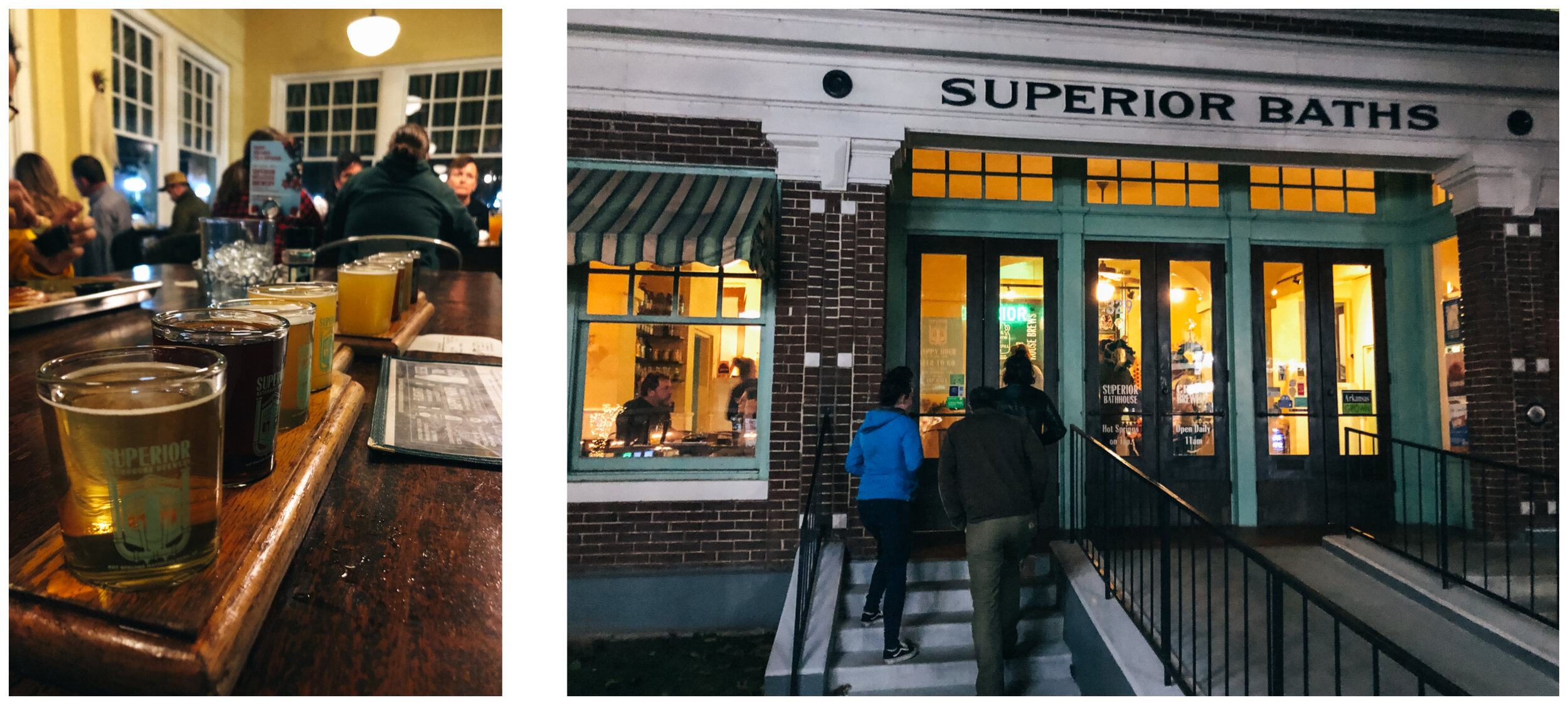
FOOD AND BEERS

Here are a few of the places we loved:

The Oysterhouse - Good beer and delicious and affordable food in West Asheville. The girls ordered fish and chips and they had 3 pieces + fries for $12!!

Hole Doughnuts - Simply the best donuts ever. Made fresh right in front of you. They have 4 flavors per day and drip coffee. That’s it. When you do something well, there’s no need to expand your offering. It’s a very cute little spot, but you might leave smelling of donut grease!

The Funkatorium - It’s an off shoot of Wicked Weed Brewery, where they serve their sour and funky beers, along with some tasty food. Try their fried sweet potato burger and their arancini as an appetizer.

The Hop - Great ice cream, not too sweet, lots of vegan and sugar-free options. There are 3-4 locations across town. If they have their Bees Knees flavor, try it!

Odd’s Café - in West Asheville, very good coffee at a reasonable price, beautiful place where to work. The Asheville Sandwich Company is just next door for a quick meal (they are known for their Banh Mi and shoestring fries)

 Goodwill outlet in West Asheville 


For next time (or for you if you go!):

-The Wedge Brewery

-Thirsty Monk Brewery

-Chai Pani - Indian Street Food (they don’t take reservation and there’s often a long wait, so plan accordingly). Things to order there: Sev Potato Dahi Puri, Pani puri, Bhel puri, Butter Chicken Thali and their Mango lassi.

-White Duck Taco (River Arts District Location)

-French Broad Chocolate Lounge - They offer 30 min tours for $6 per person (including a chocolate tasting). We wanted to try their liquid truffles as per our friend recommendation.

And more breweries recommended by our friends from Live Small Ride Free:

Highland Brewery, Green Man Brewery, Hi-Wire, Burial, One World, Asheville Brewing Company, Sierra Nevada (in Mills River), and Oskar Blues (in Brevard).
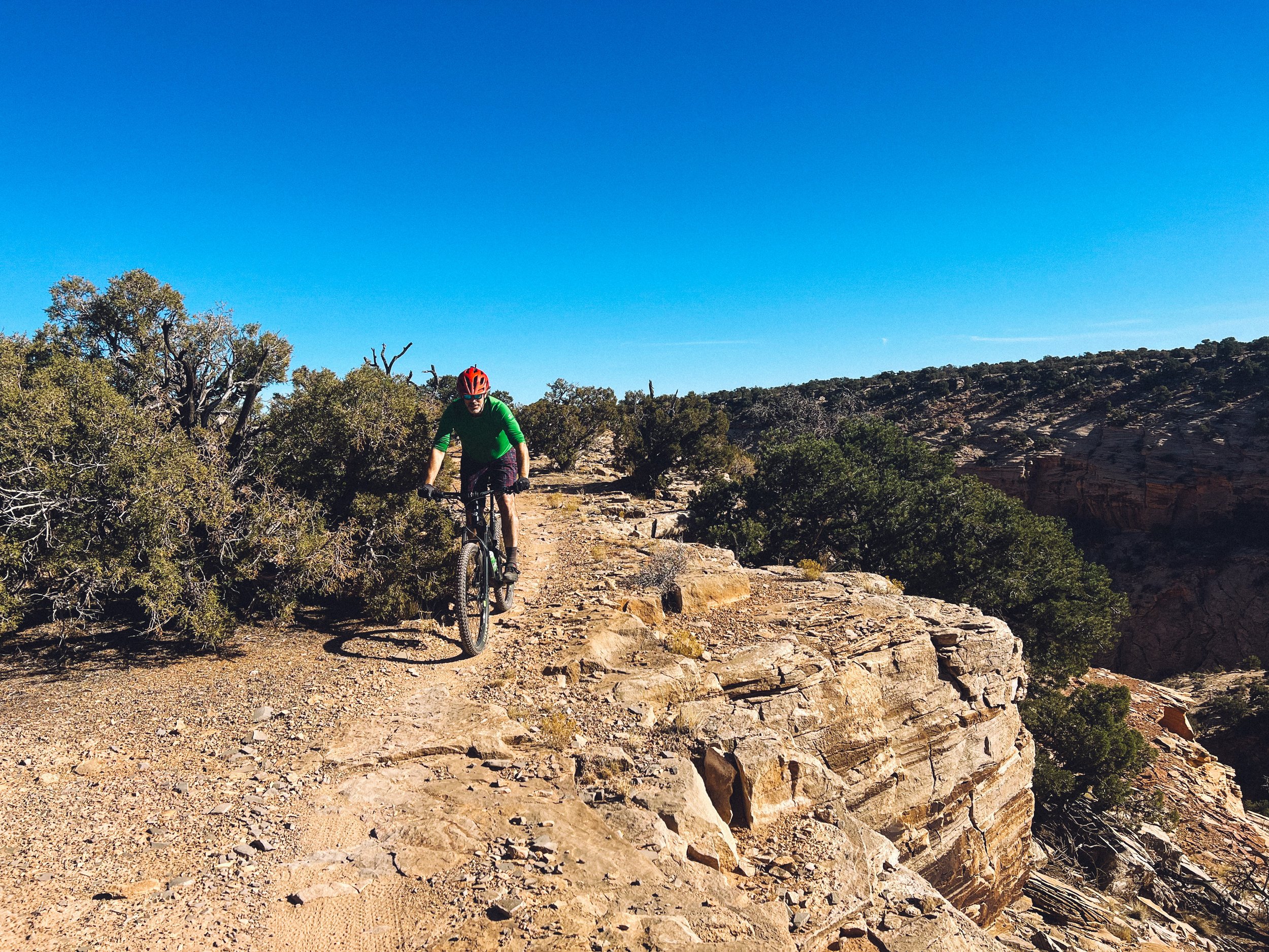
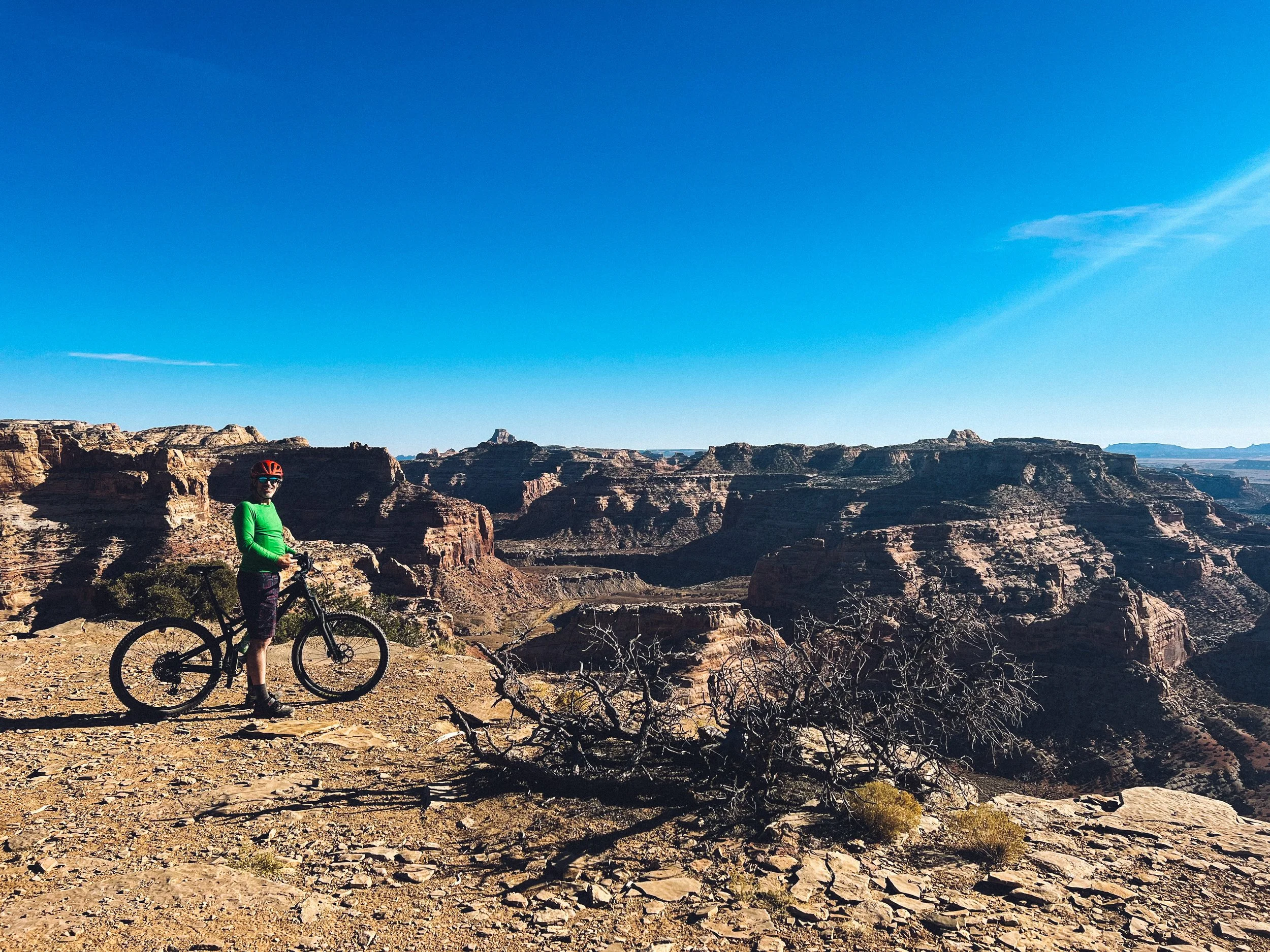
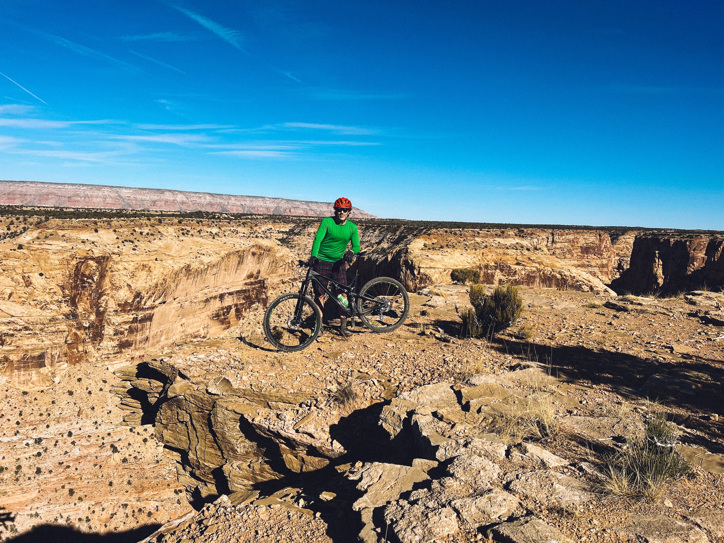
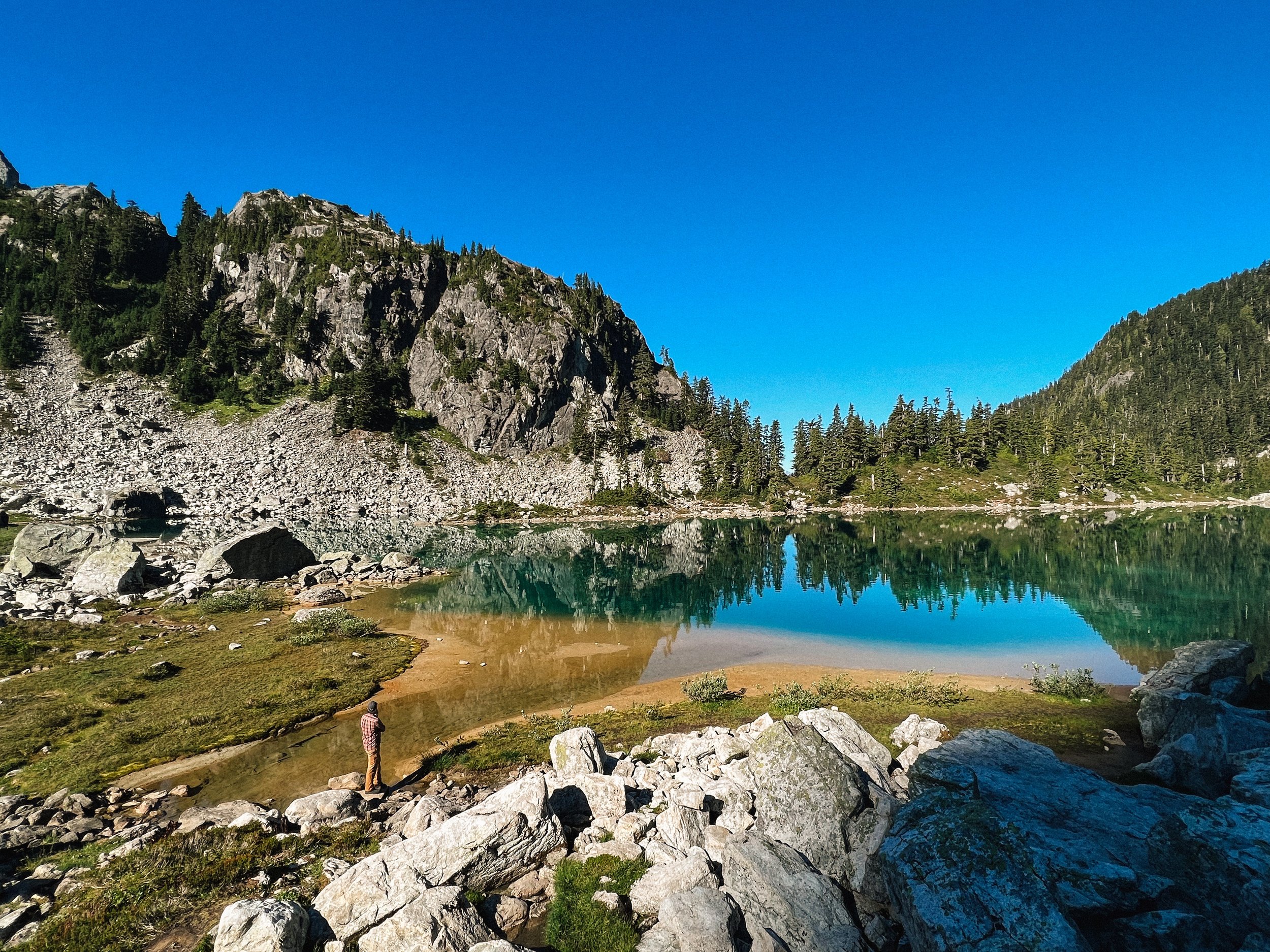
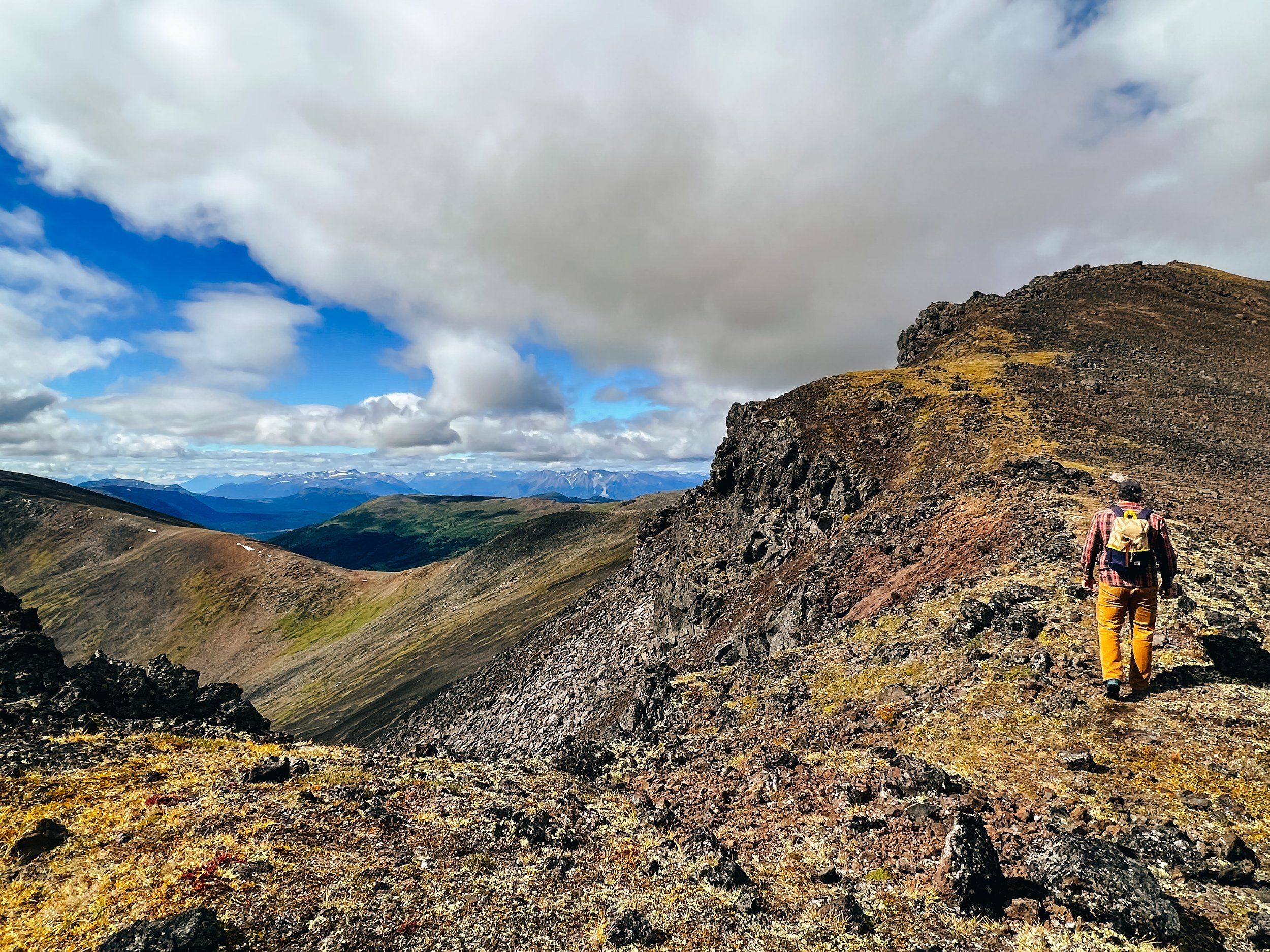
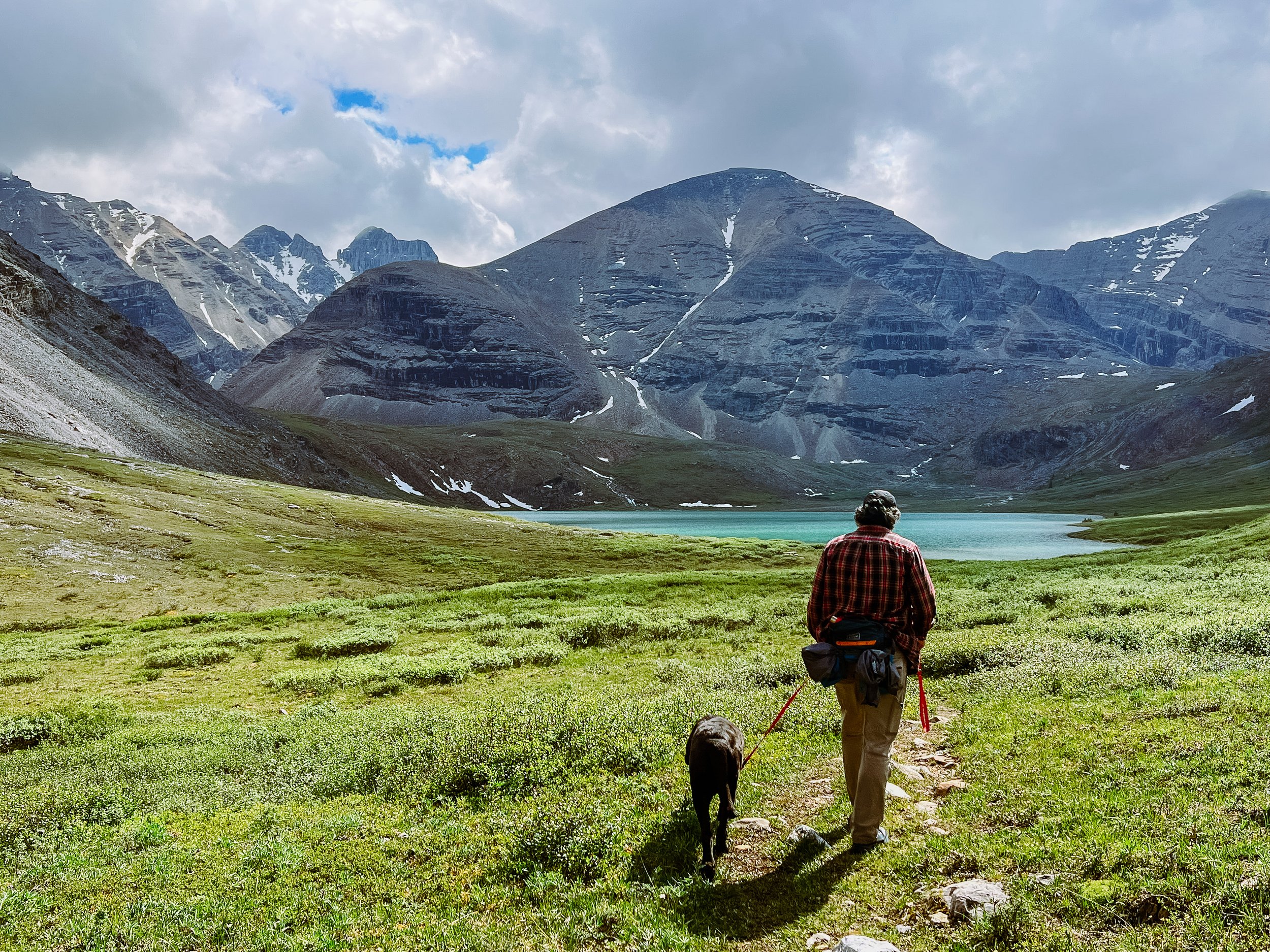
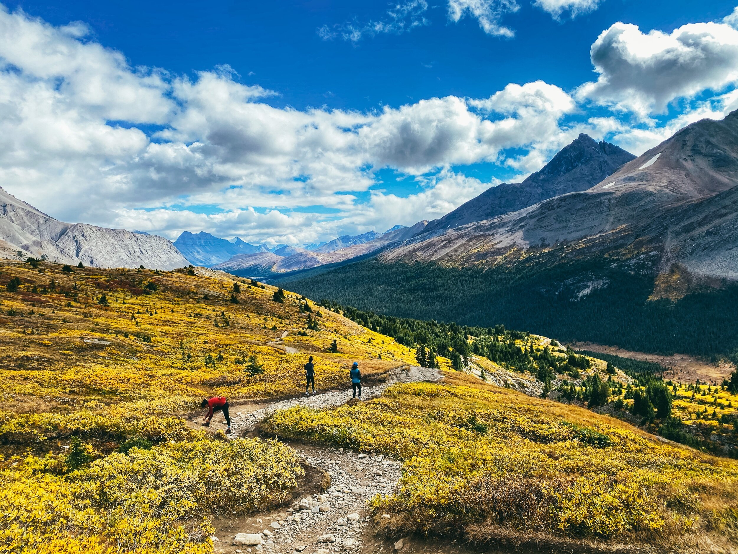
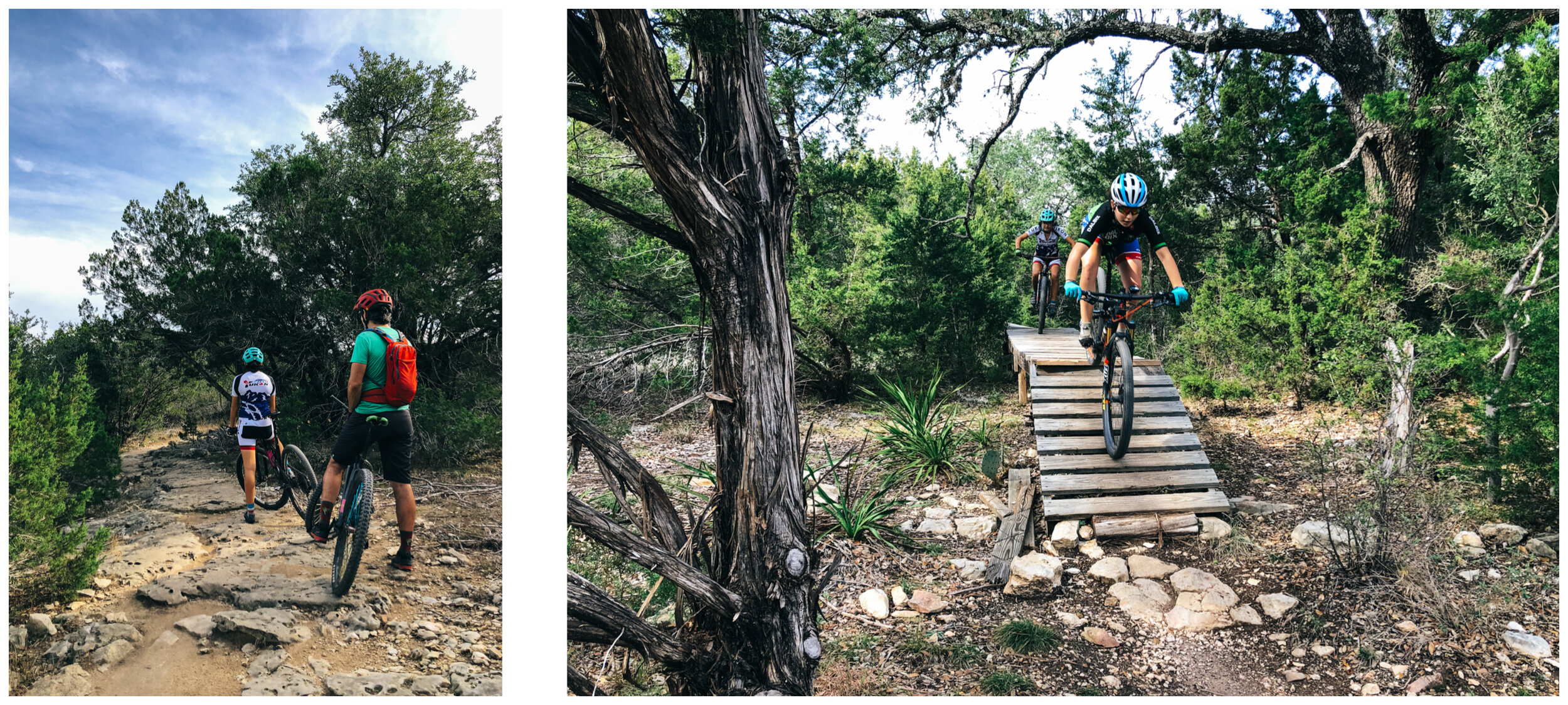
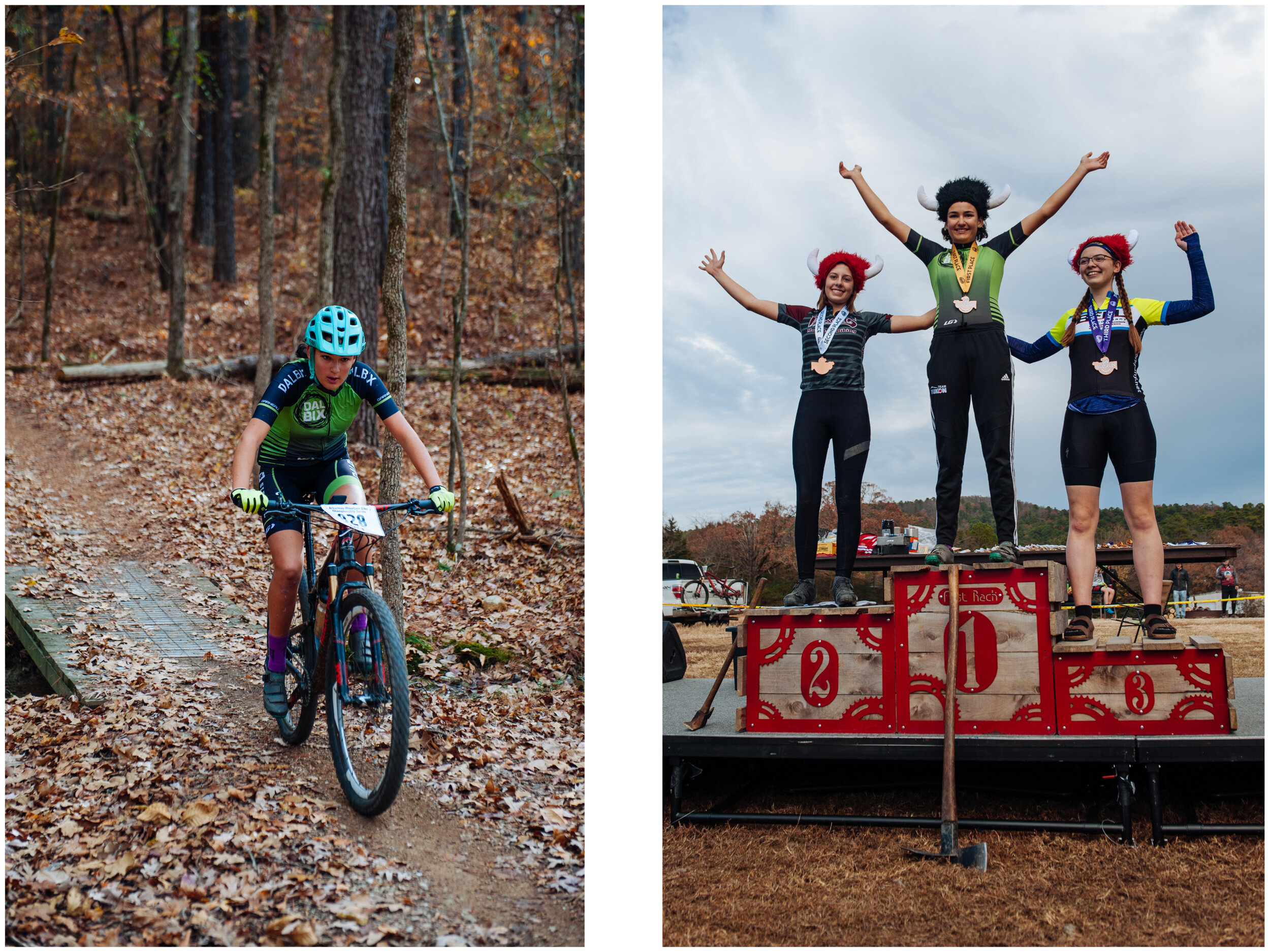
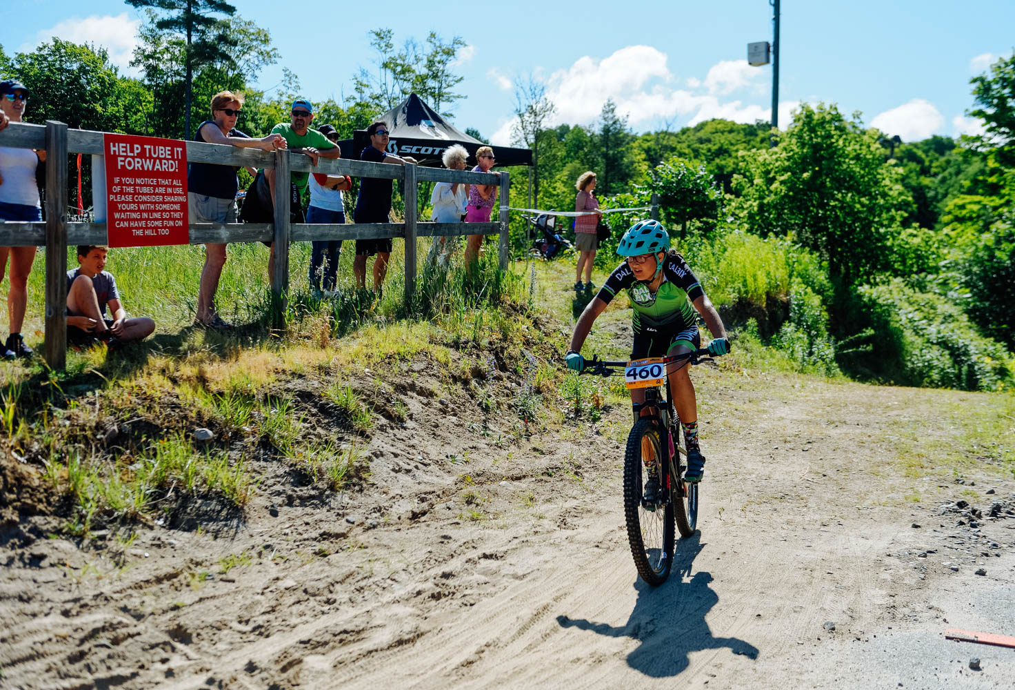
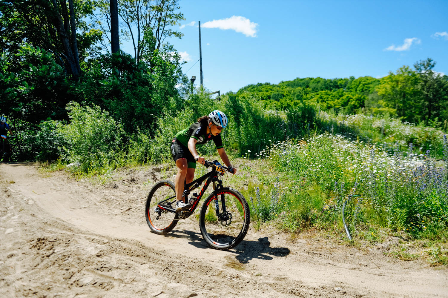
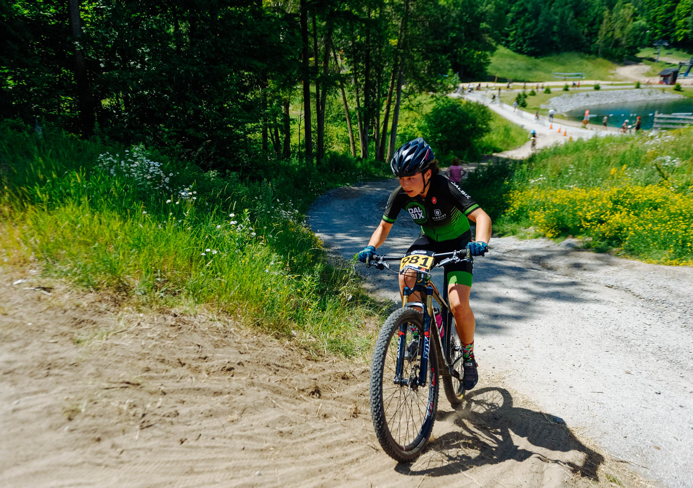
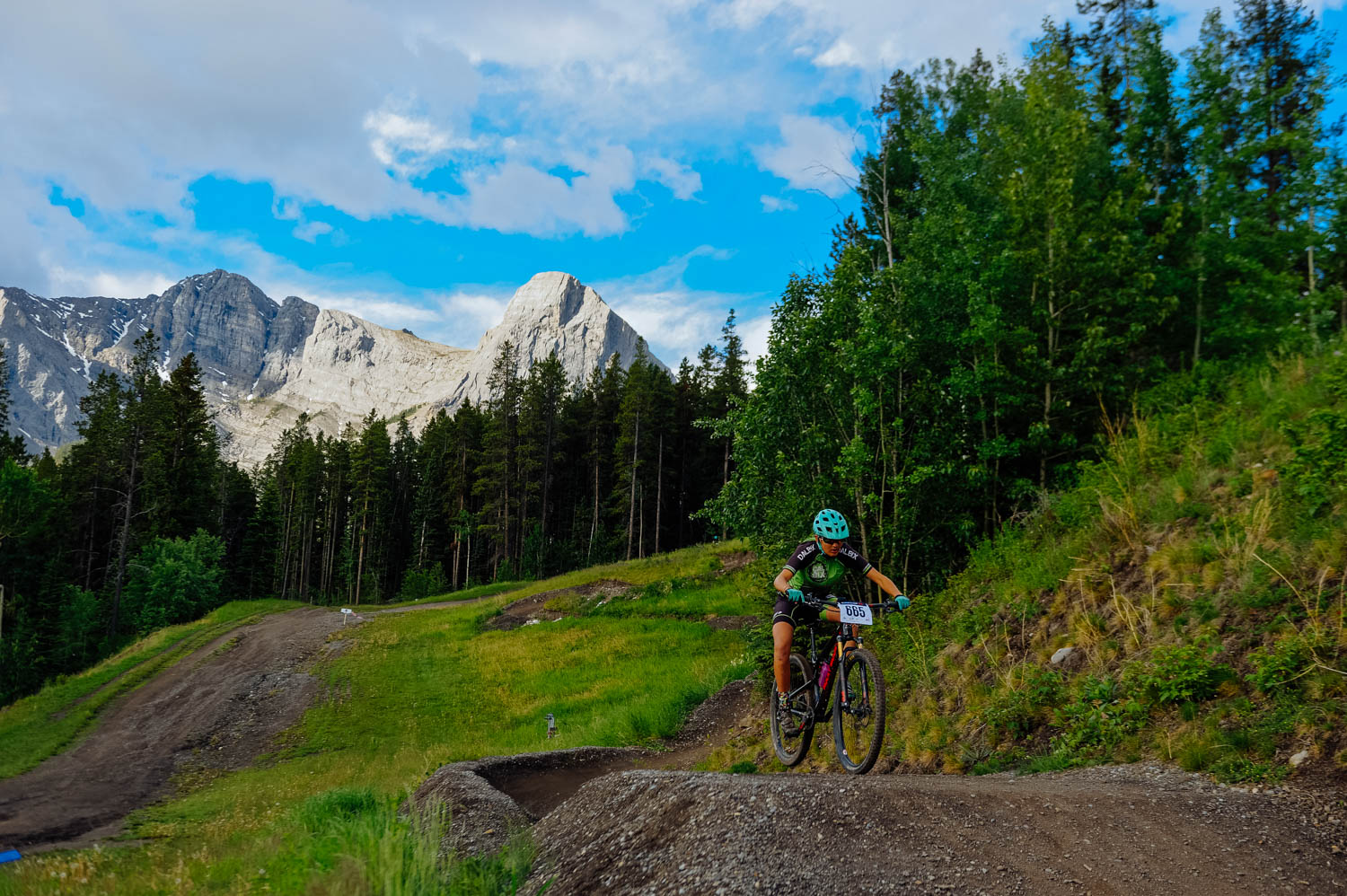
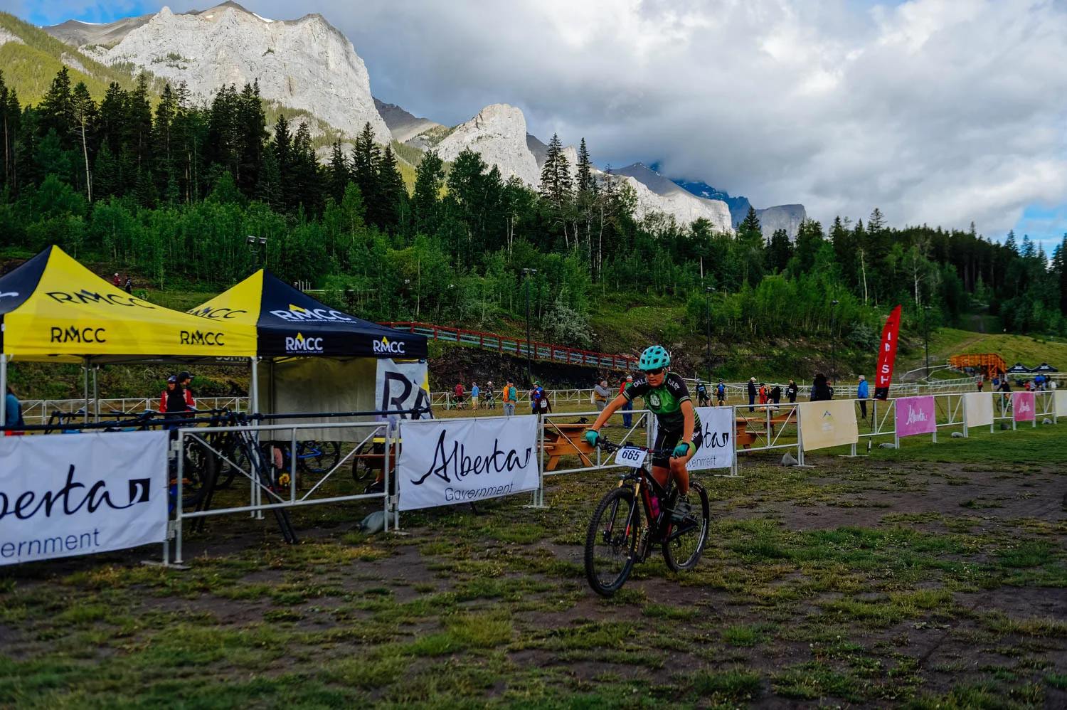
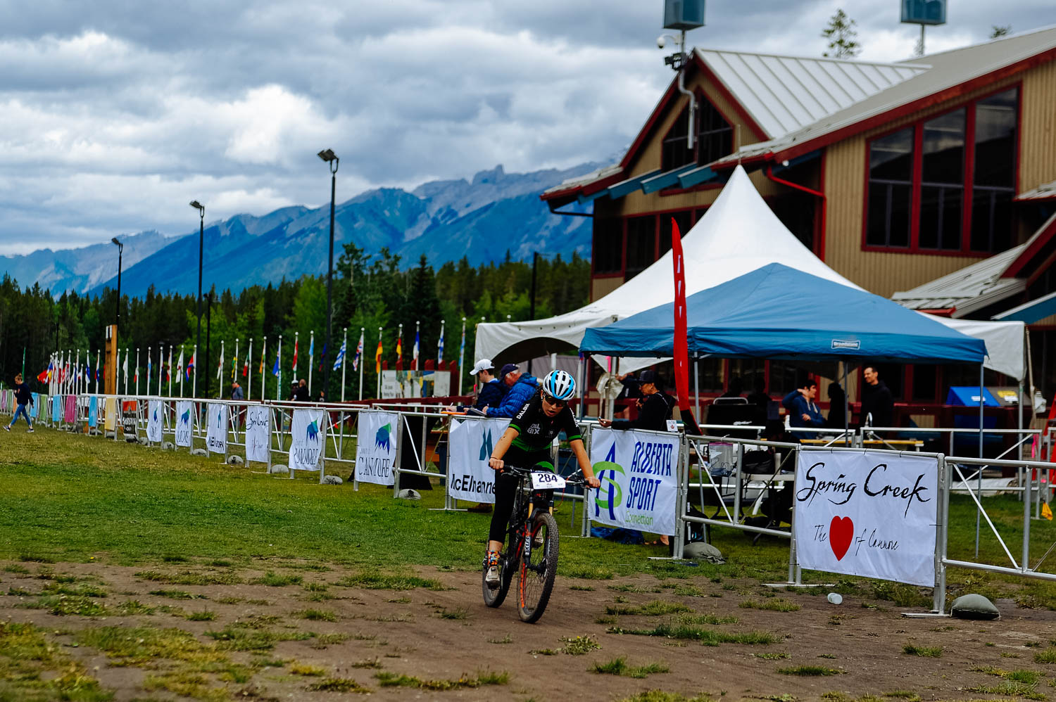
MOUNTAIN BIKING

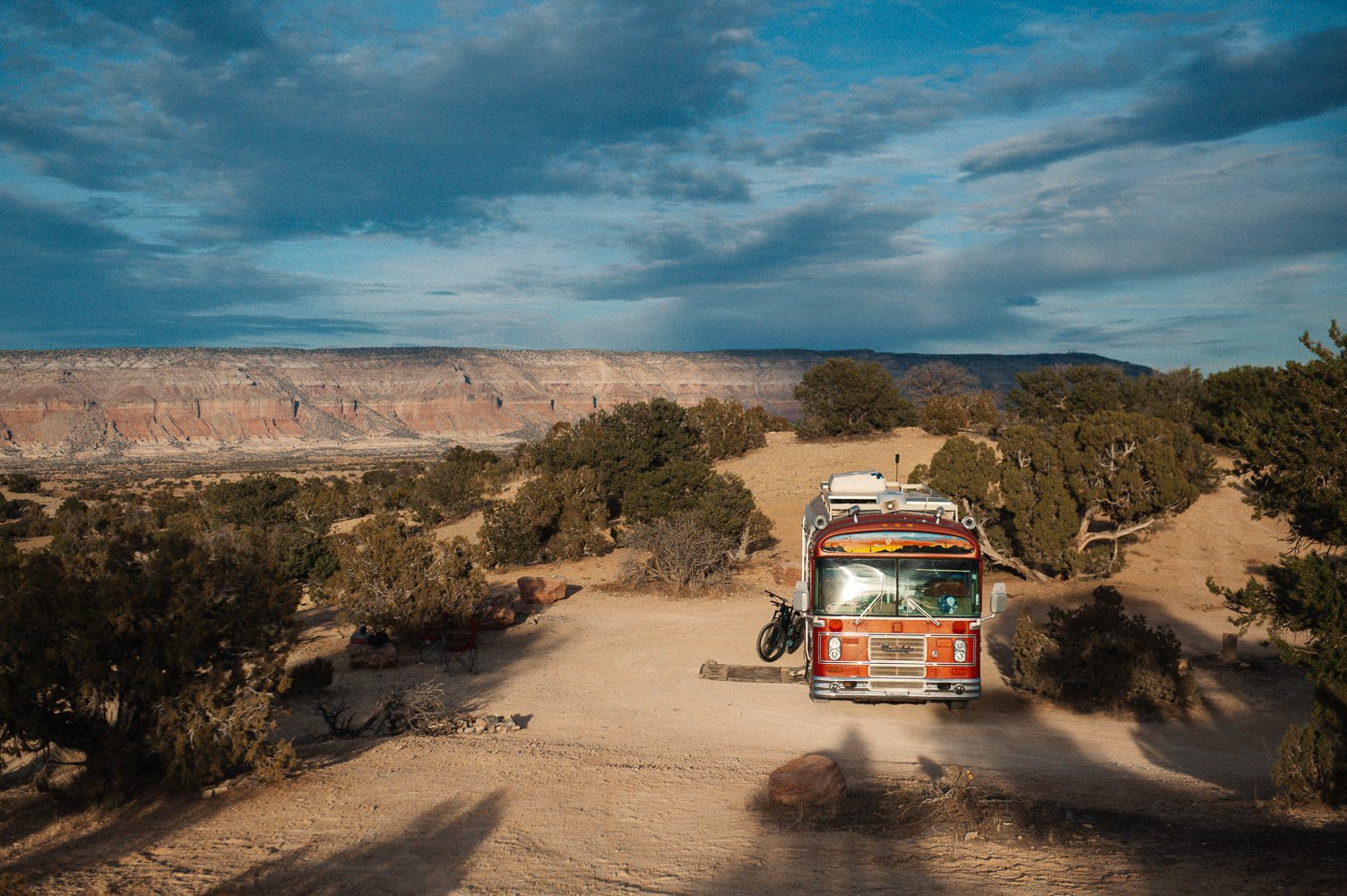
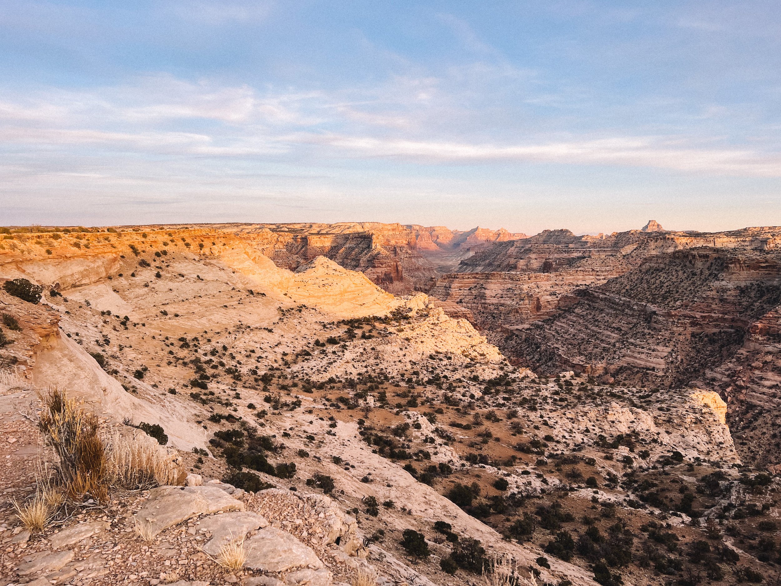
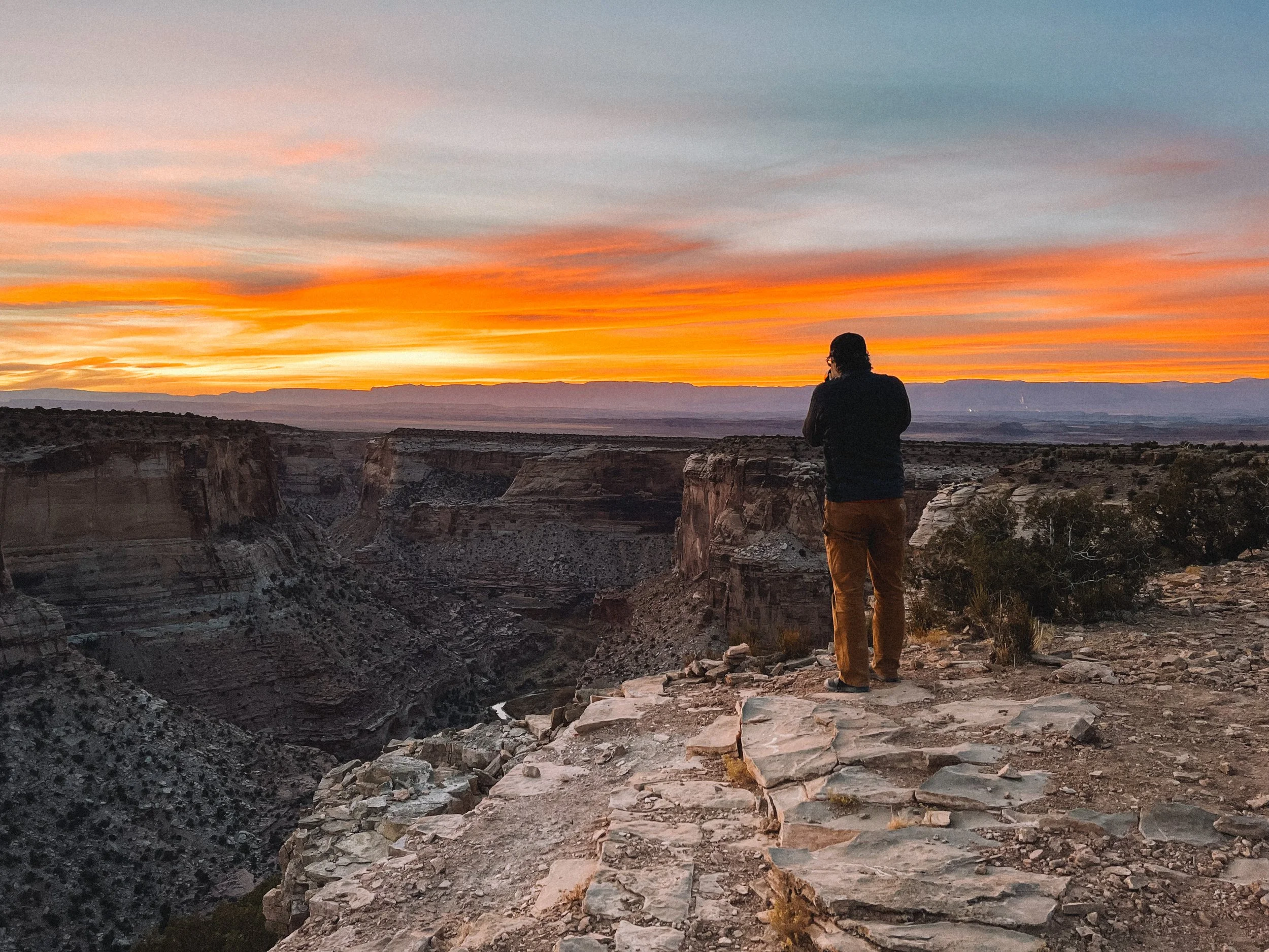
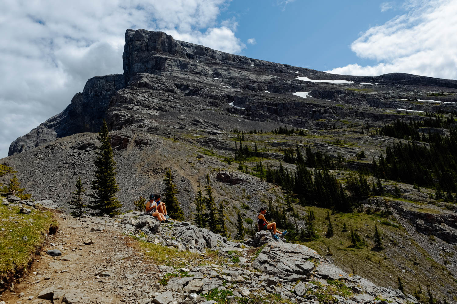
 There is so much riding in the Pisgah National Forest! There are tons of ways to connect trails and it is possible to do very long rides. One thing that might surprise some is that a lot of the up tracks are gravel roads. All the good riding is South of town.
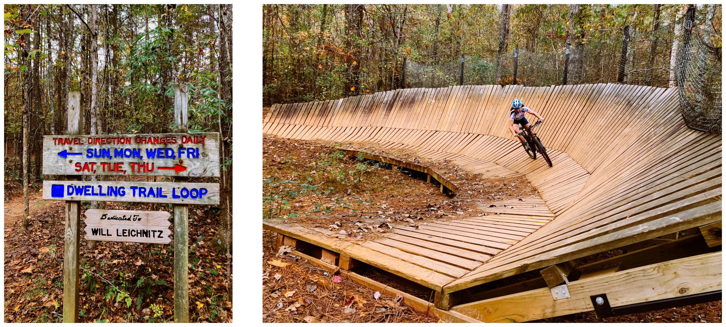
Bent Creek area

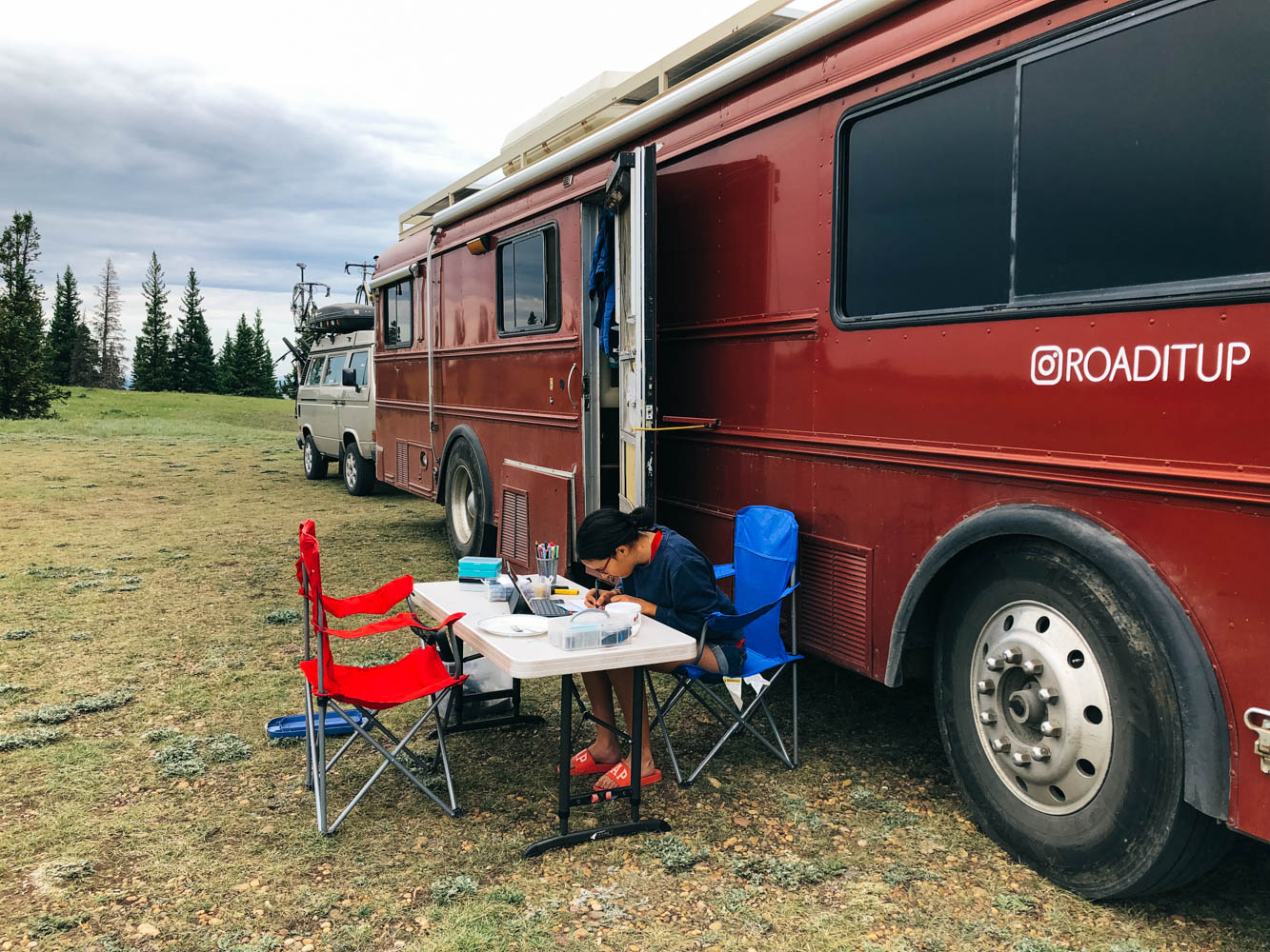
The biggest issue with Asheville is that there is no cell signal at the trailheads. We are used to park the bus at a trailhead and take turns riding while part of our group works or do school. Being on the East Coast is much trickier schedule-wise for us. The closest trail network from town is Bent Creek and is therefore always busy. We were quite surprised to find the parking lot full on a Wednesday morning. It really reminded me of Boulder, where it seems like nobody works and just hang and have fun.

A few of the trails/rides not to miss at Bent Creek:

Green’s Lick (fast flowy downhill)

Ingles Field Gap Loop (in MTB project)

For an easy exploration ride, check out Pisgah Area SORBA Beginner’s Loop (in MTB project)

For a longer ride, check out Bent Creek Epicito route (in MTB project)

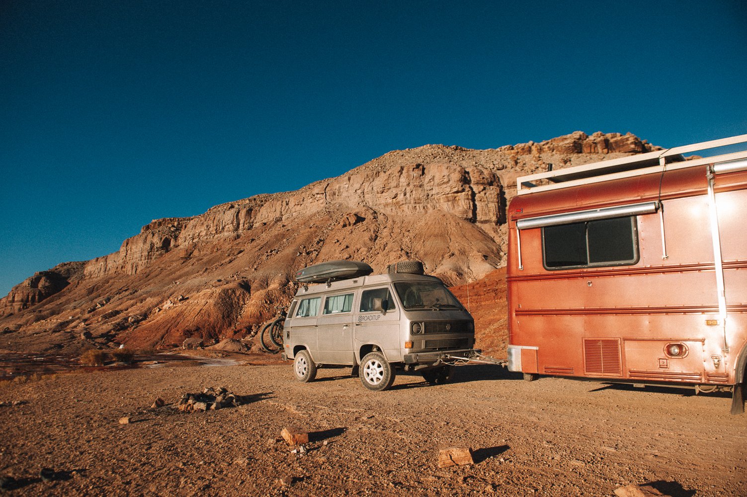
Where to sleep in Bent Creek/West Asheville :

Lake Powhatan Recreation Area is right in the middle of the trails, but the signal is spotty. We were able to work from the Big John Loop (1 to 2 bars 4 G LTE).

Another (free) option is the Cracker Barrel in West Asheville on Crowell Road. The nights were pretty quiet even if the lot is not exactly leveled. 

Brevard/Pisgah area

We found one great spot right by the Brevard trails and the Hub bike shop where we could park the bus and ride right from our door. It is a huge parking lot (look up Walmart Brevard on Google Maps), but it is forbidden to spend the night there.

From there, it’s easy to ride the Black Mountain Trail and the Thrift Cove/Sycamore Cove Trails.

For longer, more challenging rides, this is the place. Here are a few trails that shouldn’t be missed:

Squirrel Gap Trail

Laurel Mountain/Pilot Rock trail

Avery Creek Trail

Trace Ridge Trail 


Where to sleep in Brevard/Pisgah:

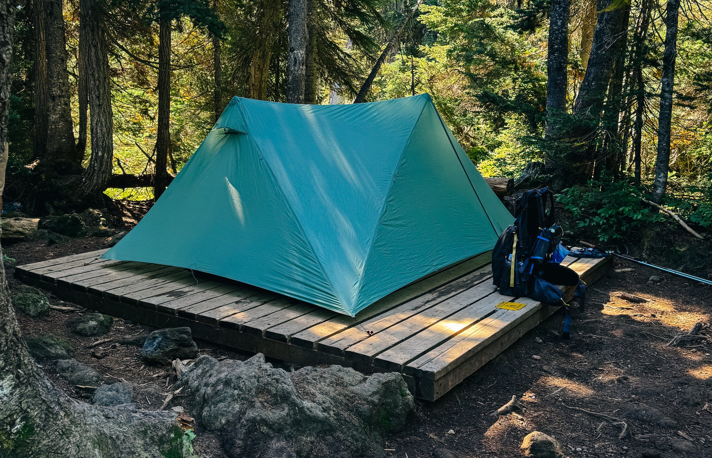
Davidson River campground (in the Pisgah National Forest): signal is spotty, but we found out that sites 1 to 11 had good enough signal for work.

Dispersed camping in the Pisgah National Forest: free, no signal, right down the road from the Davidson River Campgrounds (check iOverlander for exact coordinates). First come, first serve basis, 14 nights maximum. Right off the road, but have a fire pit and some with picnic tables. The road is pretty quiet at night. There are some beautiful spots by the creek for smaller rigs and you can ride right from your site.

Walmart Hendersonville: that a good 20 minute’s drive away and is pretty noisy (a street runs through the parking lot and people love to drive fast there!), but it’s free and there is good signal.
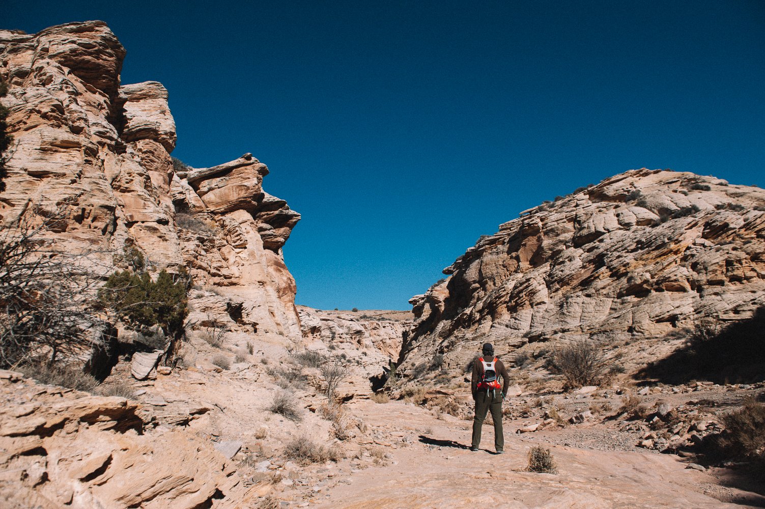
 

Dupont State Forest

Then, there is Dupont State Forest, where the trails are more beginner-intermediate friendly. We loved Ridgeline and Hickory Mountain Loop, but there are many more to ride in that area. We wanted to ride Cedar Rock (the only slickrock in the area) and Reasonover Creek Trail.

This is by no mean an exhaustive list of all the trail areas in Asheville, just some of them that we rode in the most visited areas.

The other sector we didn't get to ride is Mill Creek. It is located between Bent Creek and Brevard. Our friend recommended riding the Fletcher/Spencer Trails there, but we didn’t have time.

 A lot of this great information comes from our friends at Live Small Ride Free. We are always incredibly thankful to get recommendations from local, but Ching’s super exhaustive list made our time in Asheville really incredible.


Assateague Island National Seashore

 
_CFO2905-2.jpg
_CFO2886-2.jpg
_CFO2892-2.jpg
_CFO2899-2.jpg
_CFO2877-3.jpg

I know I might be a hopeless romantic, but when I hear « camping on an island where wild horses roam free », I have images of the white Camargue horses galloping free in harmony on the beach… Maybe that’s why I was surprised to see pissed off horses stealing bags of chips from campsites and being aggressive with dogs and people. They reminded me more of giant raccoons than the Camargue horses of the animal channel of my youth… 

Of course they behave like this because people feed them to take pictures with them or try to pet them. One died last year after being fed commercial dog food… Many get hit by cars because they associate vehicles with food. It’s a pretty sad reality.

Like bears, if the horses get used to humans feeding them, they will tear into the tents to get food, raid picnic tables, and even push people out of the way to get to the food sources. Unfortunately, people are not scared of horses like they are of bears, so they just leave food outside unattended even if this is a very clear rule.

Horses have been on Assateague Island for over 300 years. Though nobody knows for sure how they got there, it is certain that they were not originally wild. Domesticated horses could have swam ashore from sinking ships or could have been thrown off of ships that had run aground in an attempt to lighten and refloat the ship. Another theory is that during colonial times, residents on the mainland brought horses to graze on the island to avoid taxation on animals living on the mainland. Regardless, today the horses are wild and, for the most part, left to fend for themselves. (excerpt from here).

And it has to stay that way. But of course this is too much to ask.

So, even if the beach is beautiful and wild (and not littered! I could not find one piece of trash on it!!), we won’t be back. These horses may be corralled and no longer be able to freely roam the island if visitors continue to violate the well-posted park rules. I feel very torn about places like these. I know I don’t want to be part of this. I’d love to hear your thoughts.

If you consider coming here, make sure to reserve ahead and know that the mosquitoes are pretty bad in the summer months (July and August are the worst; there were none while we were there mid-October). Keep all your food inside your vehicles at all times unless it is in a plate or bowl in front of you. Dogs are accepted in a few loops and adjacent beaches (and please keep them on a leash at all times). Horses will come on your campsite and smell your dog, so if you have a dog that is likely to react to that, either keep him in your rig when a horse approaches or do not come to the island. Expect that people will walk into your campsite if there are horses on it. Also know that there are no campsites with ocean view since there are dunes that separate the campground from the ocean (that is not clear on the map). The campsites closest to the boardwalk that leads to the sea are NOT a good choice since people will walk on your site to get to the ocean. The campsites that are away from the beach offer a little more protection against the elements. Most campsites are sand (with a paved area for rigs). It gets pretty windy and miserable when it rains here, so plan accordingly.

There are miles of dedicated (road) bike trails along the island and there are a handful of places within the park to trap your own crabs or forage your own mussels (trapping supplied cost about $20 and can be found at any of the local tackle shops). Both AT&T and Verizon signal was spotty. This is dry camping, but the shower buildings are amazing. However, some people will run their generators all day (allowed from 7 am to 10 pm), so it can be pretty annoying in such a peaceful place.

While you are there, make sure you check out the cute little town of Berlin, 20 minutes away (skip Ocean City!) and go have delicious craft beer at the Burley Oak Brewery.


Border crossing: from Canada to the US

 
_CFO2725.jpg
_CFO2755.jpg
_CFO2771.jpg
_CFO2821.jpg
_CFO2824.jpg

After a tough border crossing, we had to zoom down to pick up packages in the New York area before they got shipped back (we left Quebec 3 weeks later than planned because of some mechanical issues that needed to be taken care of). There are a few reasons why we don’t do the East Coast (or even the East part of the States). First, there is no Public Land and free camping, and with a big RV, this mostly means sleeping in parking lot (the ones that allow it)… We like to take chances and check out trailheads and more remote spots on maps, but more often than not it ends up being extremely frustrating in this part of the country. We had an epic night of driving up steep hills and narrow roads (man the roads are narrow and the turns tight in New England: another reason we don’t come often!) to scout out a few spots to find them all with No overnight signs… So we stuck to Cracker Barrels and Walmart parking lots and paid for campsites in a few places that were worth it. One that was worth it in our opinion was Turkey Swamp County Park in New Jersey. It’s still $40 a night, which is a big expense for us, but very reasonable for the area and it includes a parking pass to the beautiful Seven President Oceanfront Park (35 minutes drive from the campground). Also, if you are in the area, do not miss Antoinette Boulangerie (a great stop after the beach) for amazing croissants and pâtisserie (get their raspberry chocolate mousse).

Also know that there are Parkway regulations in NY and NJ that prevent RVs to travel on some sections. We got stopped by a police officer who told us we could not be on that specific Parkway (even if this is a touristy area, there were no signs to that regard). We asked if we could take the next exit 2 miles further and he said he would have to give us a ticket if we did that… So we had to drive in reverse to take the exit!

The roads are narrow, the corners are sharp and the bridges and tunnels are low. This all makes for some stress driving.

So about the border crossing… As I posted on Instagram and Facebook, it was our toughest border crossing in 7 years. I can't tell you if it's truly because they are starting to be stricter or because we got a zealous border agent. What I can tell you, is that during the hour we all sat inside the building and the agent literally yelled at JF, I was already making plans for a winter in Canada.
Everything started as usual with the agent at the window. The usual questions; we made sure not to have any food that was problematic (no tropical fruits, especially). He then asked us to park and come inside. Nothing unusual there, we’re used to being searched at customs. However, when we stepped inside, JF was called by an older and much sterner officer who started drilling him with questions, not letting him finish a sentence and not taking our story for an answer.

He kept asking JF why we truly were coming into the States and JF kept saying : to visit, to mountain bike and to enjoy the outdoors, but the agent kept cutting him, saying: “You’re not being forthcoming with me! This is ridiculous!” And he was laughing in JF’s face…

JF went to grab his computer, showed him that we truly had jobs in Canada that we were doing online and that our girls were really studying online with a Yukon program. He searched their schooling website, JF’s job and mine and after a long while came back and told us that we were all set…
The main red flag in our case is that we don’t own a property in Canada. If we hadn’t had the girls registered in school and a job that we could both prove, they would very likely not have let us in this time.
So if you sell everything and go, make sure you have something to prove that you still have ties to Canada because it is possible that you will not be allowed in the US. Have the address of a campground where you will spend the first few nights (they don't like hearing that you don’t really know where you’ll sleep tonight...) and don’t forget that our lifestyle seems totally farfetched for many people. “You’ve been living in this thing for more than 5 years with teenagers?! That’s too funny…” is not what you want the border agent to tell you…

Something else that seems to trigger agents is when you try to give context to your answers. Simply answer by “yes” or “no” if no details are asked for, stay calm, even when the agent is trying to make you lose your cool (I’m so thankful JF is so naturally calm and not easily intimidated) and be patient and in no rush.

This one person has your plans for the upcoming years in their hands. It's not a good feeling, but to keep stating the same  facts while being courteous and honest is the best thing you can do.


Ontario

 
_CFO1074_DxO.jpg
Cooking dinner in a rest stop is a great way to save money on campings on long drives. We stop in a (free) beautiful spot to stretch our legs and cook dinner and keep driving. After that, it doesn’t matter much where we spend the night.

Cooking dinner in a rest stop is a great way to save money on campings on long drives. We stop in a (free) beautiful spot to stretch our legs and cook dinner and keep driving. After that, it doesn’t matter much where we spend the night.

Beautiful stop along Lake Superior.

Beautiful stop along Lake Superior.

Exploring a beautiful free campsite just outside of Lake Superior Provincial Park

Exploring a beautiful free campsite just outside of Lake Superior Provincial Park

Look at that water!

Look at that water!

Very cool Cheetos powder lichen.

Very cool Cheetos powder lichen.

Eating dinner by Lake Superior

Eating dinner by Lake Superior

Mathilde at the Horseshoe Canada Cup

Mathilde at the Horseshoe Canada Cup

The start of the Cadet expert girls at Horseshoe. Mara got stuck at the very back…

The start of the Cadet expert girls at Horseshoe. Mara got stuck at the very back…

Aïsha at the Horseshoe Canada Cup

Aïsha at the Horseshoe Canada Cup

Mara at the Horseshoe Canada Cup

Mara at the Horseshoe Canada Cup

So, how do we deal with the heat when relying mostly on solar? Even with 750 Watts of panels, we can’t run the AC in the bus. We could pay for a 55$+ campsite, but we try to find public beaches where we can spend the day and sleep in free spots. We haven’t paid for a campsite since we left the Yukon. Actually, we very rarely pay for campsites anymore since it is so easy to find free camping spots, and since at this time of year you need to make reservations in advance to have a good campsite (and in our book, if you pay for a campsite, it better be a good one). 

When we cover a lot of ground like we are doing this summer, our go-to strategy is to stop during the day (and often for dinner) at beautiful spots along the way, stretch our legs, bike, swim, and keep driving afterwards. By then, it’s dark and it doesn’t matter much where we spend the night as long as it’s not too noisy. It allows us to save money (since we are spending a lot on gas during this time) and not worry about making reservations in advance.


In Canada, iOverlander is the best app to use to find free camping spots. Be aware that most users are in vans or 4 x 4 vehicles, so scout out the recommended spots in advance if there is no information about vehicle length in the comments to avoid bad surprises.


_CFO1304_DxO.jpg
_CFO1305_DxO.jpg

The XCO Mountain Biking National Championship was a bit of a bust. Aïsha crashed during her first preride and got a concussion, so there was no racing for her. She is still healing and focusing on the Western Summer Canada Games at the beginning of August. Mara felt strong and ready, but the crazy hot weather at 42 C with humidex was really rough for a Yukon kid. She battled hard, but crashed near the finish and lost 3 positions, finishing 14th over 21 strong girls. It was not the results she was hoping for and she was quite disappointed.

Mathilde is still too young to compete at National level, but took part in the Ontario Cup the next day. The weather was a bit cooler, but there was A LOT of traffic on the course. She’s still quite happy with her race.

The girls are now on Instagram and they will share their own race reviews (and lots more) there. Give them a follow if you want:
@aisha.roldan
@mathilde.roldan
@mara.roldan.mtb


Cypress Hills Interprovincial Park, AB and SK

 
Sunrise over the Conglomerate Cliffs. The positive side of getting here in the dark was to wake up to this amazing view.

Sunrise over the Conglomerate Cliffs. The positive side of getting here in the dark was to wake up to this amazing view.

FREEdom!

FREEdom!

Mathilde is working on a jewelry order (you can visit her Etsy shop here: https://www.etsy.com/shop/RideItUpJewelry

Mathilde is working on a jewelry order (you can visit her Etsy shop here: https://www.etsy.com/shop/RideItUpJewelry

Riding Last Grizzly, a fun dowhill trail in the Albertan side of the park, near Elkwater Lake.

Riding Last Grizzly, a fun dowhill trail in the Albertan side of the park, near Elkwater Lake.

Cypress Hills.jpg
Riding by Elkwater Lake.

Riding by Elkwater Lake.

Following Julien’s suggestions (in the book Vie de Van, of course!), we headed to the Conglomerate Cliffs for a sweet boondocking site. However, since we were already in the Albertan side of the Cypress Hills Interprovincial Park for biking, we decided to cross through dirt roads. We didn’t expect them to be that steep and were too low in diesel for that inclination (and the pump could not pick up the fuel…) Sooo… We got stuck on a hill and had a bit of a moment trying to back up with the Westy attached (we have to be careful backing up with a tow bar and couldn’t unhook the Westy), but made it with the help of a local. JF drove 45 min to the nearest gas station and came back in the dark. As we stayed behind in the middle of nowhere, many herds of cows came to sniff and check the bus. One young bull stuck around for a while and Mathilde turned a stressful situation into a good laugh, saying: Mom! He must be one of Roaditup’s followers! He wants a selfie with the bus! 

We were only 10 minutes from the boondocking site, but driving in the dark on those roads proved dangerous since cows charged the Westy (that I was driving). There are LOTS of free ranging cows here, so driving during the day is strongly advised. The roads also become a mud fest when it rains, so stay away if it is in the forecast of if there had been rain in the last few days.


Hike to West Wind Pass and the Canmore Canada Cup

 
Grassi Lake, Canmore

Grassi Lake, Canmore

Spray Lake

Spray Lake

The view after 5 minutes on the West Wind Trail!

The view after 5 minutes on the West Wind Trail!

Getting to the Pass.

Getting to the Pass.

Wow!

Wow!

A well deserved break to enjoy the view.

A well deserved break to enjoy the view.

2,5 km to that awesome view? Hell, yeah!

2,5 km to that awesome view? Hell, yeah!

We get spoiled so much in BC and in the Yukon! On this hike, there are a few trails options and not must signage so it can get confusing. Stick to the trails on the right and you’ll get there. Consider taking poles if you struggle with steep descent. It’s a pretty tame hike by Rockies standard (it’s considered moderate), but the climbing is pretty steep and constant, so just plan accordingly if you need breaks. We got to the pass in one hour and back in 30 minutes. After taking a break at the pass and admiring the view, you can keep hiking all the way up to the Wind Tower. 

Mathilde at the start of her race.

Mathilde at the start of her race.

_CFO0720_DxO.jpg
Math Canmore.jpg
Mathilde finishing.

Mathilde finishing.

Mara at the start line

Mara at the start line

Mara at the start

Mara at the start

Aïsha getting down the aptly named Organ Donor trail.

Aïsha getting down the aptly named Organ Donor trail.

Aïsha getting some air!

Aïsha getting some air!

_CFO0815_DxO.jpg

Well, Canmore was not what I was hoping for. This was for sure not my weekend. I crashed on Thursday during my preride and then crashed again on race morning, bending my front wheel and derailleur 2 hours before my start. We pretty much took a bunch of different parts from other bikes and put them on my bike. When I was finally able to do my race, I didn’t even get 10 minutes into the race and got a flat on my rear wheel. There was lots of experience and learning throughout these few days spent in Canmore, but I’m wishing to get all problems fixed in time for the Horseshoe Canada Cup. What happened to me today was simply bad luck, crashing and flatting are things that are part of cycling and it is for sure not the last time that this will happen to me. Awesome job to everyone who raced today and thank you very much to all the people for helping and supporting me throughout this rough couple of days. What a fun event though, I wish to come back next year and have an even better time riding these amazing trails!

Jura Creek.jpg

Even after 5 years on the road, we sometimes forget how fragile the balance of our daily life is. Of course, sometimes we just need to get somewhere and drive a lot, but that also means making sure to get outside and be active for an hour or so a day at least. We are pretty good about keeping our regular (healthy) meals schedules and to keeping a work and school morning routine. However, since we left the Yukon, we haven’t slept in a campsite once and parking lot life does take its toll on all of us. Yes, our bus is big, but throw 5 adult-size person + a giant size dog and it feels very small. Especially after 2 weeks. 

Since there isn’t much external framework when you live on the road, you have to constantly check in with yourself to figure out why you feel the way you feel. It’s one of the reasons people say traveling is a fast track to self-improvement. And a fast track to divorce!!

So, yes, even after all this time, we’re still learning how much of a balancing act this is. After two days in nature, I feel like myself again, ready to cross the Prairies and hit the hot humid and buggy weather of Ontario. Just kidding, I’m so not ready for that. But hey, soon we’ll be in Quebec and spending time with our loved ones and I sure am ready for that!!

Finding free QUIET camping spots in Whistler and Canmore is not an easy task (and paid campgrounds are often full or very expensive). Even the usual trail head spots often have NO Overnight camping signs. We lucked out that our friends found a new trailhead that didn’t have a sign up yet, so we could spend two quiet nights here after the chaos of the Visitor Center (there are huge signs saying NO overnight camping there, but they tolerate it if you leave by 8 am).


Down the Cassiar, Westy troubles and Whistler Canada Cup

 
Boya Lake Provincial Park.

Boya Lake Provincial Park.

Boya Lake Provincial Park, Northern BC.

Boya Lake Provincial Park, Northern BC.

Full moon rising over the Stewart-Cassiar Highway.

Full moon rising over the Stewart-Cassiar Highway.

Aïsha keeping us entertained on long drives with her ukulele songs.

Aïsha keeping us entertained on long drives with her ukulele songs.

Leaving Burns Lake pulling our broken Westy on a U-Haul platform, still unsure where we will be able to get it fixed and even less when…

Leaving Burns Lake pulling our broken Westy on a U-Haul platform, still unsure where we will be able to get it fixed and even less when…

Mathilde showing great form on a steep line during the Whistler Canada Cup.

Mathilde showing great form on a steep line during the Whistler Canada Cup.

Mathilde, proud to finish that tough race!

Mathilde, proud to finish that tough race!

Aïsha at the beginning of the race.

Aïsha at the beginning of the race.

Mara feeling tired.

Mara feeling tired.

Mara on the left and Aïsha on the right.

Mara on the left and Aïsha on the right.

Mara

Mara

Mara dug deep to finish that race.

Mara dug deep to finish that race.

Teammate Zachary Brunelle taking one of the technical A line on the course.

Teammate Zachary Brunelle taking one of the technical A line on the course.

Mathilde in 3rd place!

Mathilde in 3rd place!

The Whistler Canada Cup course was the most technical race the girls had ever done. On top of that, there was 240 m of climbing PER lap. Some sections of the course were only a few days old and very loose. The whole course was incredibly dusty. Aïsha crashed during the preride; she was in pain during the race and had lost her confidence, so she decided to opt out after one lap to avoid another crash and save herself for next weekend Canada Cup in Canmore. Mathilde coughed all night (and kept everybody awake) and was feeling miserable on the morning of the race (we all brought back a nasty virus from Whitehorse). She freaked out a bit after the first big climb when she stopped and felt like she was choking, but thankfully, coach Dan Sams @terraridersyukon was right there and talked her through it and she kept on going. She finished her race and grabbed the 3rd place. She was super proud to have finished such a tough course in her physical condition. After a sleepless night, too much preriding the day before and still healing from her nasty crash at Baie St-Paul, Mara was able to hang on to 4th place. Quite a feat in her condition! The field of Expert Women U17 was very strong with a few BC riders who are super strong technically. It was a good experience and the girls know what they need to work on for next year!

We were super proud of the girls’ Yukon teammates from U Kon Echelon who came all the way down here to race, not expecting such a tough course, but did it nonetheless! Way to go, friends!

And the girls now have Instagram accounts: @aisha.roldan, @mara.roldan.mtb @mathilde.roldan
Go give them a follow if you want!